Proposed Submission Development and Site Allocations (DaSA) Local Plan
(1) Part B: Site Allocation Policies
(1) 8. Overview
Development targets
8.1 The adopted Core Strategy's targets for the numbers of additional homes and business floor space over the plan period (2011-2028) are set out in its respective polices for each locality and summarised in Figure 15, which is reproduced below.
(1) Figure 15: Development targets
|
|
Approximate development levels 2011-2028 |
|
|
Housing |
Employment |
|
|
Bexhill |
3,100 dwellings |
At least 60,000sqm. |
|
Hastings Fringes |
100-250 dwellings |
At least 3,000sqm. |
|
Battle |
475-500 dwellings |
At least 10,000sqm.* |
|
Rye |
355-400 dwellings |
At least 10,000-20,000sqm. |
|
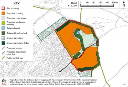
Villages |
1,670 dwellings |
At least 10,000sqm. |
|
Total |
At least 5,700 dwellings |
At least 93,000 - 103,000sqm. |
*includes sites on Marley Lane
8.2 The distribution of dwellings between villages in the rural areas is set out in the Core Strategy at Policy RA1 and Figure 12. This identifies the number of dwellings that are anticipated from new sites, taking account of completions between 2011 and 2013, outstanding planning permissions and allocations in the earlier 2006 Local Plan that did not have planning permission at that time.
8.3 In line with national policy guidance, existing sites allocations that have not been carried forward by a planning permission are reviewed as part of the review of options to meet the residual requirement.
8.4 Figure 16 below identifies an updated residual requirement for additional homes on new sites of 6+ dwellings in each of the towns as at 1st April 2018.
(1) Figure 16: Residual requirements to meet Core Strategy targets as at 1 April 2018
|
Area |
Target |
Completions (01/04/11 - 31/03/18) |
Small site permissions (01/04/18) |
Large site permissions (01/04/18) |
Small site windfalls (01/04/23 - 31/03/28) |
Residual req. |
|
Bexhill |
3,100 |
533 |
107 |
1,665 |
75 |
720 |
|
Battle |
475 |
30 |
22 |
113 |
15 |
295 |
|
Rye |
355 |
227 |
25 |
6 |
16 |
81 |
|
Hastings Fringes |
100 |
59 |
1 |
26 |
1 |
13 |
(1) 8.5 Figure 17 below indicates the residual housing requirements from larger sites (of 6+ dwellings) in the villages; villages shown inbolditalics are covered by this Local Plan, the others being covered by Neighbourhood Plans. Numbers relate to larger sites as there being a separate small sites allowance for the whole Rural Area.
(2) Figure 17: Residual requirements for individual villages as at 1 April 2018
|
Settlement |
Core Strategy Large Site Requirement |
Large Site Completions (04/13 - 03/18) |
Large Site Permissions (01/04/18) |
Residual requirements |
|
Beckley Four Oaks |
26 |
6 |
0 |
20 |
|
Broad Oak |
50 |
0 |
0 |
50 |
|
Burwash |
52 |
0 |
30 |
22 |
|
Camber |
40 |
20 |
0 |
20 |
|
Catsfield |
53 |
0 |
15 |
38 |
|
Crowhurst |
20 |
0 |
0 |
20 |
|
Etchingham |
51 |
21 |
10 |
20 |
|
Fairlight Cove |
37 |
0 |
16 |
21 |
|
Flimwell |
43 |
9 |
25 |
9 |
|
Hurst Green |
75 |
0 |
0 |
75 |
|
Iden |
12 |
0 |
0 |
12 |
|
Netherfield |
48 |
0 |
25 |
23 |
|
Northiam |
123 |
65 |
58 |
6[54] |
|
Peasmarsh |
50 |
0 |
11 |
39 |
|
Robertsbridge |
147 |
0 |
17 |
0[55] |
|
Rye Harbour |
40 |
0 |
0 |
40 |
|
Sedlescombe |
49 |
8 |
22 |
0[56] |
|
Staplecross |
25 |
0 |
26 |
0 |
|
Ticehurst |
87 |
21 |
70 |
0 |
|
Westfield |
89 |
0 |
39 |
50 |
|
Total (All villages) |
1,117 |
150 |
251 |
465 |
(1) 8.6 It can be seen from Figures 16 and 17 that, as at 1 April 2018 (the base date for this Plan), having taken into account completions to date, outstanding planning permissions and allowances for small sites and exception sites provided for by the Core Strategy, there is a need to identify further sites for at least 1,574 net additional dwellings through the DaSA Local Plan and Neighbourhood Plans, of which this Plan should identify at least 1,029 dwellings. Bexhill has the largest residual requirement, although this has been much reduced following the recent granting of planning permission for over 1,000 dwellings at Worsham in Bexhill.
(1) Meeting the housing targets
8.7 The April 2018 Housing Land Supply statement shows that 1,324 dwellings of the requirement for 5,700 dwellings have been built to date, with nearly, 2,500 having planning permission (2,185 on larger sites and 284 on small ones). Also, trends confirm expectations for further "windfall" sites (of 225 dwellings) and rural exception sites (of 45 dwellings).
8.8 That over a half of the residual housing requirement already has planning permission illustrates progress towards continuing development while development plans have been in preparation.
8.9 As well as the preparation of this Plan, a number of Neighbourhood Plans have come forward since the Core Strategy was adopted, all of which embrace site allocations required to meet the housing targets for the settlements that fall within those 'neighbourhood areas'.
8.10 At the present time, Neighbourhood Plans have been 'made' (or adopted) for the Parishes of Sedlescombe and Salehurst & Robertsbridge. Draft Neighbourhood Plans for Rye, Ticehurst (which also covers the village of Flimwell) and Crowhurst have been consulted upon and submission is expected this year (2018). Neighbourhood Plans are also in preparation for Battle (which also covers Netherfield), Burwash, Etchingham and Hurst Green.
8.11 Policies to meet the housing requirements for Bexhill and other villages, as shown in bold italics in Figure 17 above are set out in the following chapters.
8.12 The total number of dwellings on allocated sites in Bexhill, the Hastings Fringes and the villages covered by this Plan is 1,562 dwellings. This is somewhat higher than the minimum requirement for these settlements in combination, notably with more supply at Bexhill.
8.13 However, it should be noted that some 246 of these dwellings are also included in the figures for existing commitments, as they are on sites that either have planning permission or a resolution to approve subject to a legal agreement. These are at Preston Hall Farm, Sidley, Bexhill; Former Market Garden, Lower Waites Lane, Fairlight Cove; South of The Paddock/Goddens Gill, Northiam; and Land at Westfield Down, Westfield. However, in these instances, allocations are made because either a formal planning permission is not actually in place at the 1st April 2018 base date of the Plan or there are doubts about its implementation. Hence, the net capacity of "new" sites is 1,381 homes.
8.14 For all settlements, the allocations are regarded as in line with the overall settlement strategy. The proposed allocations in Camber and Catsfield are a few dwellings less than the Core Strategy target, but they properly reflect the outcome of detailed site assessments. The allocations in other settlements achieve their housing targets, while the total allocations across Bexhill, the Hastings Fringes and the relevant villages also meet their combined housing target. There is also a degree of a contingency.
8.15 A summary of all housing allocations within this Plan is presented in Figure 18 below.
Figure 18: Summary of housing allocations in this Plan
|
Settlement |
Policy |
Site |
Proposed Dwellings |
|
Bexhill |
BEX2 |
Land at Preston Hall Farm, Sidley, Bexhill |
139 |
|
BEX3a |
Land at North Bexhill |
250 |
|
|
BEX3b |
Land at North Bexhill |
130 |
|
|
BEX3c |
Land at North Bexhill |
150 |
|
|
BEX4 |
Land at Former High School Site and Drill Hall, Down Road, Bexhill |
35 |
|
|
BEX5 |
Land at Gullivers Bowls Club, Knole Road, Bexhill |
39 |
|
|
BEX6 |
Land adjacent to Cemetery Lodge /276 Turkey Road, Bexhill |
30 |
|
|
BEX7 |
Land at Moleynes Mead, Fryatts Way, Bexhill |
24 |
|
|
BEX8 |
Land south of Terminus Road, Bexhill |
10 |
|
|
BEX9 |
Land off Spindlewood Drive, Bexhill |
160 |
|
|
BEX10 |
Land at Northeye, Bexhill |
140 |
|
|
Hastings Fringes |
HAS1 |
Land at Michael Tyler Furniture, Woodlands Way, Hastings |
40 |
|
Beckley / Four Oaks |
BEC1 |
Land east of Hobbs Lane, Beckley Four Oaks |
14 |
|
BEC2 |
Land south of Buddens Green, Beckley Four Oaks |
6 |
|
|
Broad Oak |
BRO1 |
Land west of A28, Northiam Road, Broad Oak |
40 |
|
BRO2 |
Land south of the Rainbow Trout Pub, Broad Oak |
20 |
|
|
Camber |
CAM1 |
Land at the Former Putting Green Site, Camber |
10 |
|
Catsfield |
CAT1 |
Land to the rear of The White Hart, Catsfield |
35 |
|
Fairlight Cove |
FAC1 |
Former Market Garden, Lower Waites Lane, Fairlight Cove |
16 |
|
FAC2 |
Land east of Waites Lane, Fairlight Cove |
30 |
|
|
Iden |
IDE1 |
Land south of Elmsmead, Iden |
12 |
|
Northiam |
NOR1 |
Land south of Northiam Church of England Primary School, Northiam |
6 |
|
NOR2 |
Land south of The Paddock/Goddens Gill, Northiam |
52 |
|
|
Peasmarsh |
PEA1 |
Land south of Main Street, Peasmarsh |
45 |
|
Rye Harbour |
RHA1 |
Land at the Stoneworks Cottages, Rye Harbour |
40 |
|
Westfield |
WES1 |
Land at Westfield Down, Westfield |
39 |
|
WES2 |
Land at the former Moorhurst Care Home, Westfield |
40 |
|
|
WES3 |
Land south-east of Goulds Drive, Westfield |
10 |
|
|
Total |
1,562 |
||
8.16 Paragraph 68a of the
2018 NPPF requires local planning authorities to identify,
through their development plan and brownfield register,
land to accommodate at least 10% of their housing
requirement on sites no larger than one hectare. Of these
1,562 dwellings allocated in the DaSA, some 15.2% (237) are
on sites of less than one hectare. This percentage is
expected to rise further as Neighbourhood Plan allocations
come forward, as these sites tend to be smaller. Indeed,
100% of allocations within the adopted Sedlescombe
Neighbourhood Plan are on sites of one hectare or less.
Sites on the Brownfield Register would also increase this,
as would small sites coming forward within identified
development boundaries.
8.17 In view of the fact that the annualised housing requirement has not been achieved to date and that housing delivery is likely to not "catch up" on present projections, it is considered appropriate to not only have a margin of over-provision, particularly in Bexhill where there is a high reliance on a strategic site, but also to avoid unduly deferring the identification of suitable sites and to ensure that planning permissions continue to come forward in a timely manner.
8.18 The following policy is therefore put forward to make clear the Council's commitment to increase supply and, as far as it is able, to achieve the actual delivery of homes within the plan period of the Core Strategy.
(8) Policy OVE1: Housing supply and delivery pending plans
Housing sites sufficient to meet the Core Strategy requirement of at least 5,700 net additional homes over the period to 2028 will be met by allocations and other provisions in this Plan and Neighbourhood Plans.
No phasing restrictions will be imposed on development allocations, other than for site-specific, normally infrastructure, reasons.
Until such time as a Neighbourhood Plan for the relevant settlement with an outstanding Core Strategy housing requirement is in force, planning applications will be favourably considered for development proposals in those settlements where:
- they contribute to meeting the housing target for that settlement and accord with the relevant spatial strategy; and
- the site and development proposals are otherwise suitable having regard to other relevant policies of the Core Strategy, including the considerations in OSS2 and OSS3, and of this Plan.
Business land needs
8.19 Several business allocations supplement sites with existing planning permissions, as well as the existing stock, to meet the Core Strategy's minimum quantitative requirements. The relevant policies/allocations are:
- Policy BEX1 - Land at Levetts Wood and Oaktree Farm, Sidley, Bexhill
- Policy HAS2 - Land north of A265, Ivyhouse Lane, Hastings
- Policy RHA2 - Harbour Road Employment Area
- Policy MAR1 - Land at Felon's Field, Marley Lane
8.20 The first allocation (Policy BEX1), to the north-east of Bexhill adjacent to the newly constructed North Bexhill Access Road, is strategically significant, being the larger part of a longstanding commitment to provide for employment growth on sites close to Combe Valley Way, which affords good access to the wider area.
8.21 Policy RHA2 provides a policy framework for the effective use of the Harbour Road estate near Rye, being the largest concentration of businesses in the east of the District.
8.22 Perhaps as importantly, Policy DEC3 sets a clear framework for retaining and securing effective use of existing business land and premises across the District. This policy approach, together with the allocations and already permitted sites, should both meet the quantitative business floor space targets and provide for a range of business activities.
(3) 9. Bexhill
Context
9.1 Bexhill is by far the largest settlement in Rother district, with a population of some 44,395 people (ESCC 2016), equivalent to some 48% of that of the district as a whole. It is primarily residential in character with an established employment, shopping and service centre role.
9.2 The underlying environmental quality of the town is high. Key assets are the seafront, the internationally acclaimed De la Warr Pavilion, the well-preserved and mixed-use town centre and a variety of pleasant residential areas interspersed with substantial areas of parkland and open space.
9.3 The countryside setting of the town, although not part of the High Weald Area of Outstanding Natural Beauty, is also undulating and attractive. The area is rich in wildlife habitats. Parts of High Woods and the Combe Haven are Sites of Special Scientific Interest, the latter being integral to the Combe Valley Countryside Park which is covered in the Hastings Fringes chapter. Beyond the western fringe are the Pevensey Levels, which are of international nature conservation importance.
(1) 9.4 The town centre maintains its vital shopping and service centre role for the town, even though a significant proportion of retail expenditure is "lost" to Ravenside Retail Park, Hastings and Eastbourne. Competition from other centres allied with the physical constraints on development in the town centre, as well as the increase in online shopping, have combined to limit retail investment in recent years.
9.5 The amount of business accommodation is relatively low for the size of the town, with only Beeching Road and, to a lesser extent, Brett Drive and Elva Way forming recognised industrial estates, although this is changing with the major new "Bexhill Enterprise Park" off Combe Valley Way becoming established.
(3)
Development
Provisions and Development Boundary
9.6 In view of its relative size, range of services and location outside any national landscape or nature conservation designations, the Core Strategy identifies Bexhill as the focus for development within the District. It sets a requirement of 3,100 dwellings to be built over period 2011 to 2028, as well as at least 60,000sqm of new business floorspace within Bexhill. In terms of housing, 533 dwellings have been constructed to date (2011-2018) and a further 1,772 dwellings have planning permission – a large majority of which are at 'North East Bexhill' – see below. This leaves a remaining requirement of 795 dwellings to 2028.
9.7 Allocations both within and on the edges of the town are identified to ensure that sufficient housing is built in the plan period. Most notable is the identification of three linked sites to the north of the town, together providing some 530 new homes, as well as associated infrastructure.
9.8 There has been significant progress in bringing business land forward since the construction of the Link Road, with completions and planning permissions already accounting for some 27,814sqm of floorspace. The further large allocation for a business area off the new North Bexhill Access Road, as set out at Policy BEX1 below, (which has very recently been granted planning permission), essentially meets the residual minimum quantitative requirement.
9.9 A large part of the development for Bexhill over the next 10 years will take place through a major urban extension to the town at North East Bexhill, which was planned in the earlier Rother District Local Plan adopted in 2006. This involves both residential and business areas either side of Combe Valley Way as it enters Bexhill.
9.10 To the immediate east of Combe Valley Way, off Mount View Street, is the Bexhill Enterprise Park. The first building was completed in December 2015, whilst other buildings are currently under construction. Beyond this, will be the new community of 'Worsham'. The building of 108 dwellings off Pebsham Lane is now substantially completed while, in March 2016, outline planning permission was granted for a residential-led mixed use development providing 1,050 dwellings and associated facilities including a primary school, based on Worsham Farm (RR/2015/1760/P). Much of the guidance in the earlier North East Bexhill SPD is still relevant as this major new development area takes shape.
9.11 The developments to the west of Combe Valley Way that were also the subject of policies in the Rother District Local Plan 2006 but have not yet gained planning permission are reallocated below.
9.12 The Core Strategy (policy BX2) identifies the potential for an additional 2,000sqm convenience goods floorspace and 4,000sqm for comparison goods, primarily through edge of centre development north of the railway, as well as effective use of town centre units. The Council's Updated Retail Capacity Study[57] confirms that this further convenience goods floorspace is still justified and that 'Land South-East of Beeching Road' is the most appropriate location for this, as set out below.
(1) 9.13 The Council's Playing Pitch Strategy (PPS) assesses existing pitch provision and identifies where new provision is needed and how future provision of playing pitches should be secured. It highlights specific deficits in both football and rugby pitches and the need for two artificial grass pitches across the district. The PPS indicates that the deficit of football pitches is particularly acute in Bexhill, particularly due to a number of Bexhill-based clubs who require enclosed pitches to progress through the football league structure. In addition, it highlights the need to enable Sidley Cricket Club, which was displaced outside of the district when its home ground closed, to return locally.
(2) 9.14 As such, it is imperative that existing facilities are safeguarded, in line with Core Strategy Policy CO3, but also new sites are found/previously used sites are brought back into use. However, opportunities for new playing pitches within Bexhill are limited due to the availability of land and the topography of the town. Therefore, proposals are set out below to bring back the former Sidley Sports and Social Club site for playing pitch provision and associated community use. In addition, Policy BEX10 for Northeye provides an opportunity to provide new playing field provision alongside redevelopment.
9.15 The development boundary is drawn tightly around the built-up area of Bexhill, which prevents encroachment into the countryside, aside from taking into account the allocation sites set out in this Chapter, as well as some limited small scale development opportunities.
9.16 Further growth of the town is severely limited to the east, as it is a priority to retain the open countryside gap between the town and Hastings and to further establish the Combe Valley Countryside Park in the area, which includes the relatively tranquil and ecologically sensitive SSSI.
9.17 To the north, the development boundary envelops the approved developments south of the Worsham ridge at North East Bexhill and, further west, the allocated sites contained in this Plan. The North Bexhill Access Road (NBAR) provides a clear edge between the urban area and the countryside to the north, while important open areas to the south of NBAR are also excluded, notably ecologically important amenity land south-west of the junction with Combe Valley Way, fields to the west of Watermill Lane and proposed open space/playing fields to serve new development.
9.18 West of the A269, development beyond the exiting built-up area would detrimentally and unnecessarily erode the countryside setting of that part of the town and is resisted while, further west, the pattern of fields, defined by trees and hedgerows as well as blocks of woodland, relates much more to the surrounding countryside. This runs into the heavily wooded ridge of High Woods and Whydown, which feels relatively remote from the town. Hence, the development boundary follows the existing urban edge in this direction.
9.19 Towards the western end of the town, the surrounding countryside is less wooded, but a pastoral landscape which runs into the exposed and open landscape of the Barnhorn and Hooe Levels. Development is clearly resisted on the Levels and on the sloping land overlooking it. An exception to this at Northeye, where the redevelopment of this redundant site, formerly in institutional/educational use, is provided for. At the same time, as it is well beyond the built-up area of Bexhill, it is still outside the development boundary.
9.20 The Development Boundary and site allocations are detailed on the Policies Map Inset Map at the end of this section.
Site Allocation:
Land at Levetts Wood and Oaktree Farm, Sidley,
Bexhill
9.21 The site is located to the north of Bexhill with its northern boundary being defined by the recently constructed North Bexhill Access Road. It comprises three distinct fields with tall hedgerows and tree belts. Levetts Wood, to the south, is an Ancient Woodland providing a buffer to existing housing at Sidley. The grazed fields create an impression of woodland clearings. The land slopes gently down to the north, towards the Combe Haven. The sunken Buckholt Lane, with its species rich hedges and fringing trees, cuts through the area. The only buildings are those at Oaktree Farm to the south east corner.
9.22 This land was earmarked in the earlier, 2006, Local Plan as well as being identified in the Core Strategy as an important employment site to meet business floorspace needs of the area. It offers easy access via the North Bexhill Access Road (NBAR) to Combe Valley Way. The design of NBAR provides one access off a roundabout at Buckholt Lane to serve the three discrete land parcels that comprise the site. Internal road connections should involve minimal intervention to the tree belts.
9.23 A comprehensive approach is required to ensure integrated provision of employment floorspace, high quality urban design, green infrastructure and mitigation and/or compensation for any biodiversity losses. The degree of self-containment allows different design approaches for each development area.
9.24 Buildings should be set within a strong landscape structure, both through the site and around the perimeter to minimise its visual impact. Development should be well set back from the NBAR and open spaces incorporated within the site to retain the 'woodland clearing' character, with the creation of water features to both "soften" development and, together with ponds, provide a sustainable drainage system.
9.25 Flexible building design is encouraged, to suit a variety of possible business requirements. Office and light industrial uses are expected, being most compatible with the strategic importance of the site and the business land requirements of the area. The layout should take full account of existing site features in scheme design, the existing tree belts should be strengthened to provide informal amenity space, new green links should be incorporated to form a series of connected spaces and corridors accommodating attractive cycle/footpath links, whilst also preserving generous areas for the movement of wildlife through the site. These areas will also act as a screen to soften the visual impact of commercial buildings and act as physical separation between the three development parcels and NBAR.
9.26 The gently sloping ground may accommodate a range of building sizes, but larger buildings should be cut into the slope to minimise their height and associated visual impact. Linkages with facilities and services in Sidley are vital and will be achieved by improving Buckholt Lane as the main footpath, cycleway and bridleway route from Sidley, creating an attractive pedestrian/cycle route to the proposed residential allocation to the west (Policy BEX2) and connecting to the linear 'greenway' and new housing of Policy BEX3 (North Bexhill), which should extend along the northern edge of the site, along the route of NBAR.
9.27 Additional drainage capacity required to serve the development and therefore, the developer will need to work with Southern Water to ensure appropriate sewerage infrastructure is provided to serve the development prior to its occupation.
9.28 The hydrological impact of development in terms of drainage, surface water run-off, ground water and pollutants entering the ditch network which feeds into the Combe Haven Site of Special Scientific Interest (SSSI) needs detailed consideration in terms of the potential to harm the botanical, invertebrate and bird interest of the SSSI. As such, proposals should set out appropriate mitigation measures.
9.29 The site has an outline planning permission (reference RR/2017/2181/P) for up to 33,500sq.m (net internal area) of employment floor space (within Use Classes B1 and B2) with roads and ancillary infrastructure and services, subject to conditions, which was granted in May 2018 (beyond the base date of the DaSA, hence its inclusion within the Plan).
(4) Policy BEX1: Land at Levetts Wood and Oaktree Farm, Sidley, Bexhill
Land at Levetts Wood and Oaktree Farm, Bexhill, as shown on the Policies
Map, is allocated for a comprehensive business development. Proposals will be permitted where:
- proposals conform to a masterplan covering the entire area;
- up to 33,500sqm of business floorspace is provided, to be predominantly light manufacturing and offices, falling within Class B1 of the Use Classes Order;
- vehicle, cycle and pedestrian access is provided from the North Bexhill Access Road's (NBAR) Buckholt Lane roundabout;
- cycle and pedestrian access runs through the site to the adjacent residential allocation (Policy BEX2), to the urban extension envisaged by Policy BEX3 and to the footpath on the western boundary;
- existing landscaped boundaries around and within the site are maintained and reinforced, including along the NBAR frontage, and proposals for structural open spaces, landscape and woodland belts and buffers are developed and implemented as an integral part of the proposals, as indicated on the Detail Map;
- contributes to the provision of an overarching foul drainage strategy for North Bexhill, in conjunction with Southern Water; and
- the hydrological impact of the scheme, including the provision of a Sustainable Drainage System (SuDS), does not result in negative impacts on the ditch network and the associated Combe Haven Site of Special Scientific Interest (SSSI), taking into account any proposed mitigation measures.
9.30 The Detail Map below provides an indicative general layout of the development site.
Figure19: Policy BEX1 Detail Map
Site Allocation:
Land at Preston Hall Farm, Sidley, Bexhill
9.31 This is a greenfield site located to the north east of Sidley. The site is bounded by existing residential properties to the west, Redgrove Wood, which is designated as Ancient Woodland to the south with further ancient woodland to the north. A private lane (also a public footpath in part) to the Grade II Listed Preston Hall and Preston Hall Cottage bounds the site to the north-east and a strong hedgerow to the east. The land slopes generally down from the north and south to a ditch that bisects the site, naturally dividing it into two parts. A small pond occupies a central position just west of Preston Hall Farm.
9.32 This land was previously allocated in the earlier, 2006, Local Plan as part of the North East Bexhill allocations comprising of housing and employment floorspace. These proposals were dependent on the construction of the Bexhill-Hastings Link Road (now known as Combe Valley Way) which was completed in 2015.
9.33 The site is the subject of the grant of a full planning permission (reference RR/2017/2441/P – granted in August 2018[58]) for 139 dwellings, subject to conditions and a Section 106 agreement relating to: affordable housing; open space, buffer zones, landscape and play area provision and future maintenance; ecology mitigation and biodiversity improvements; travel plan; public transport enhancements; road management; footway/cycle route provision and connection; and contributions to primary school places.
9.34 The site has an area of 5.21ha, with a developable area of around 3.8ha and is to provide a comprehensive scheme to include 139 dwellings, of which 30% are affordable, in accordance with Policy DHG1. In addition, a central greenspace incorporating the pond with a childrens play space should be provided for, as well as landscaping through out the site, including the provision of buffer zones to the ancient woodland in the north and south and ecological mitigation will also be required.
9.35 The site visually relates to the adjacent housing off Watermill Lane and an access is to be created via Watergate. A cycle and pedestrian route should traverse through the site to connect with the public footpaths and proposed cycle/pedestrian link through the employment site to the east (Policy BEX1). The site access through will require the removal of a number of on-street parking spaces which should be re-provided elsewhere in Watergate.
9.36 Additional reinforcement of the sewerage network may be required to serve the development and therefore, the developer will need to work with Southern Water to ensure an appropriate connection to the sewerage infrastructure is provided to serve the development prior to its occupation.
9.37 The hydrological impact of the development in terms of Sustainable Drainage, ground water and surface water run-off and pollutants entering the ditch network which feeds into the Combe Haven Site of Special Scientific Interest (SSSI) needs specific consideration. Particularly in terms of the potential to harm the botanical, invertebrate and bird interest of the SSSI, as such development should set out appropriate mitigation as part of any proposals.
(2) Policy BEX2: Land at Preston Hall Farm, Sidley
Land at Preston Hall Farm, as shown on the Policies Map, is allocated for a comprehensive scheme comprising residential development and amenity open space. Proposals will be permitted where:
- some 139 dwellings are provided, of which 30% are affordable;
- the development provides an amenity open space centred on the existing pond. The layout of the site will be such that the green will be afforded passive surveillance from adjacent residential properties;
- a new vehicle, cycle and pedestrian access is achieved off Watergate, together with cycle and pedestrian access through the site to the adjacent employment allocation (Policy BEX1); connection with the footpath to Watermill Lane on the eastern boundary, as indicated on the Detail Map;
- existing landscaped boundaries around the site, as indicated on the Detail Map, are maintained and reinforced, including the provision of ancient woodland buffers;
- care is taken to respect the setting of the adjoining listed buildings on the eastern boundary, and the amenities of the adjoining residential properties on the western boundary;
- development contributions towards public transport enhancements and towards primary school education provision at Worsham in North East Bexhill;
- provision is made for an acceptable connection to the local sewerage system in agreement with the service provider; and
- the hydrological impact of the scheme, including the provision of Sustainable Drainage System (SuDS), do not result in negative impacts on the ditch network and the associated Combe Haven Site of Special Scientific Interest (SSSI), taking into account any proposed mitigation measures.
9.38 The Detail Map below
provides an indicative general layout of the development
site.
Figure 20: Policy BEX2 Detail Map
(1) Site Allocation: Land at North Bexhill
9.39 The Local Plan Core Strategy identifies North Bexhill as a broad location for future development at Bexhill, contingent upon the now constructed North Bexhill Access Road (NBAR). This road provides access to the previously allocated large business site to the east (see Policy BEX1), as well as providing a strategic connection between the link road to Hastings, the A2690, Combe Valley Way, and the A269.
9.40 From the A2690/Mount View Street roundabout, the newly constructed NBAR wraps around the allocated business site before crossing the Combe Haven stream and rising up its south-facing slope to the south of Cole Wood, crossing Watermill Lane (which is severed on the town side), continuing westwards past the southern edge of Kiteye Wood to sweep down to join the A269, Ninfield Road.
9.41 The new road, intended to carry through traffic, is regarded as an effective, defensible limit to further development in this locality, with the pastoral and wooded landscape to the north offering a valuable, attractive rural setting to the town itself. At its western end, it also maintains a valuable countryside gap between the town and The Thorne/Lunsford Cross.
9.42 It is not appropriate to develop all the land enclosed by the NBAR. Landscape and ecological assessments highlight that established woodlands, many ancient, should be retained, while the small fields west of Watermill Lane include ecologically more valuable grassland habitat and collectively provide a more rural character to the upper part of the severed Watermill Lane.
9.43 Significant development in this area generates a need for new infrastructure, notably a major upgrade to the foul drainage system. There is also a requirement for a range of open space provision, including playing field(s), to serve now residential areas. The valley bottom of the Combe Haven stream is of ecological value, as well as having the potential to form a broad "green corridor" for both walking and cycling and as amenity green space integral to the setting of new development. It may also be suitable for local play provision and for mitigation of any biodiversity losses.
9.44 Addressing the cumulative impacts of additional movements on the existing highway network and implementing associated traffic management and/or mitigation measures, as well as access arrangements for adjacent sites, also require a comprehensive and integrated approach to the provision of housing and infrastructure.
9.45 Accessibility to local services requires careful attention. While the Ninfield Road benefits from regular bus services, and NBAR is also expected to be a bus route in the future, the nearest focus of local services is in Sidley 'District Centre'. In fact, housing that is well connected to Sidley offers the opportunity to support the vitality of the District Centre. This is not to discount the provision of more local facilities to purely serve the new housing.
9.46 Good connectivity for pedestrians and cyclists is important for both existing and new residents in the locality. The developments should provide new and enhanced routes from the built-up area to main destinations, notably Sidley, the new business developments, larger recreational areas, the Countryside Park further to the east and the wider countryside. The green corridor along the valley bottom will be the main artery for sustainable travel, with playing pitches, natural amenity spaces and play areas accessible from it. Other specific new/improved links will be:
- A connection between Footpaths 16b and 56
- A new north-south route from footpath 56 crossing NBAR to footpath 61
- A diversion of a short section of footpath 56 to the north of Jim's Place
- A new route from Mayo Rise through new development to Watermill Lane
- A connection from the new east-west Combe Haven brook corridor to the planned footpath/cycleway from footpath 16b into and along the NBAR frontage of the new Enterprise Park (see BEX1), and hence to the Combe Valley Countryside Park
- Connections across NBAR near the Watermill Lane junction to provide connectivity to footpaths 35a and 42a just to the north of NBAR
9.47 Within the frame of NBAR, existing woodlands, retained fields, the open valley corridor and the existing built-up area, three development areas are identified.
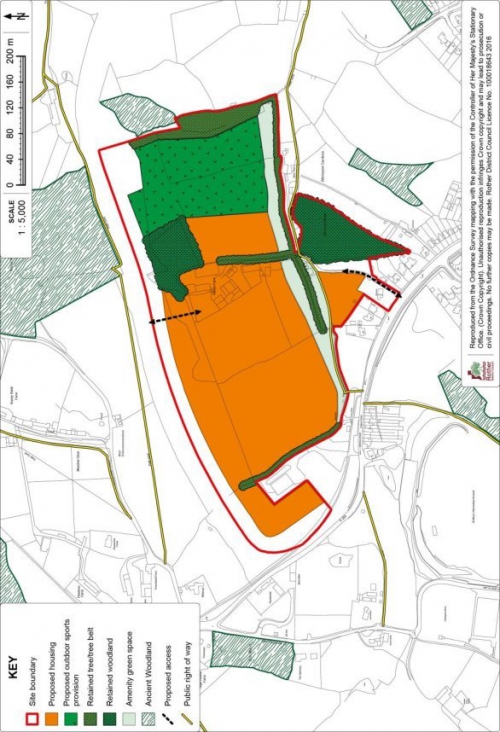
9.48 To the west, between the Ninfield Road and NBAR, is an area focused on Kiteye Farm. The agricultural holding has been severed by the new road. The fields are relatively open, with only boundary trees, aside from Birchen Shaw. There are no significant buildings within the site, while the modern farmhouse fronting Ninfield Road may be demolished to provide access, although access to the bulk of the site north of the stream course may alternatively be gained directly from NBAR. Access directly off the roundabout, or close to it, is not viable. Access to this area should also serve playing fields to meet the needs of all the development areas, the location of which should be as indicated on Figure 21: Policy BEX3a Detail Map.
9.49 This area is identified for residential development, with an estimated capacity of some 250 dwellings.
(3) 9.50 Towards Sidley, between the Ninfield Road and Watermill Lane, three grazed fields situated between properties on the west side of Mayo Lane and the Allotment Gardens, are well related to the existing built-up area and suitable for development. The estimated capacity is 130 dwellings.
(1) 9.51 Vehicular access needs to be off Watermill Lane, with the use of Mayo Rise restricted to cycle and pedestrian use, which should be facilitated through the development to Watermill Lane. As with other development sites, it should help create the linear green space corridor along the adjacent length of the valley. It is recognised that Watermill Lane has no footway beyond its junction with Mayo Lane, necessitating works as far as Preston Lodge to ensure safe pedestrian movement.
9.52 The third area of development potential is east of Watermill Lane between NBAR and the valley. A particular issue is access. While this may be possible directly off NBAR, this would produce a relatively isolated development, especially in terms of access to local services. Therefore, preference is for access to be off Watermill Lane, although this will need to be assessed in more detail as part of a planning application, notwithstanding that the removal of through movements has substantially reduced flows from previous levels. A small plot of land accessed from the end of the southern section of Watermill Lane would provide a discreet site for up to 5 pitches for the permanent homes of Gypsies and travellers.
9.53 For all development areas, housing should be of a high quality, befitting a sustainable urban extension on a key approach to the town, with a high proportion of family homes and a modest net density, which should also take account of the local topography and existing landscape features, including trees and hedges.
(5) Policy BEX3: Land at North Bexhill - Infrastructure
The development of sites which are the subject of policies BEX3a, BEX3b and BEX3c shall contribute to shared infrastructure by:
- the provision of an overarching foul drainage strategy, in conjunction with Southern Water;
- the design and provision of complementary sustainable surface water drainage schemes in accordance with Policy DEN5;
- having regard to the transport requirements and impacts of the combined allocations and make proportionate financial contributions to off-site highway and cycleway/footpath improvements;
- as part of (iii) above, all developments off Watermill Lane should provide an integrated approach to ensuring safe and convenient movement for pedestrians and cyclists, as well as vehicles;
- ensuring an integrated approach to establishing a multi-functional 'green corridor' along the Combe Haven stream, extending from the A269 to the planned Enterprise Park (and beyond);
- as part of (v) above, all developments will contribute to the provision of playing fields within site BEX3a, either directly or through proportionate (to the respective quantum of residential development) financial contributions;
- investigation of a common approach to securing superfast broadband.
The above shared infrastructure requirements shall be implemented by a combination of direct provision and legal (s106) agreements attached to the respective development proposals.
(2) Policy BEX3a: Kiteye Farm and adjoining land
Land with Kiteye Farm and adjoining land, as shown on the Policies Map, is allocated for housing and open space, including playing fields. Proposals will be permitted where:
- some 250 dwellings will be provided within the residential area as indicated on the Detail Map, of which 30% should be affordable;
- an open space to include provision for playing fields of at least 2.64 hectares is set aside and laid out in the area indicated on the Detail Map;
-
access arrangements will be subject to a
findings of a Transport Assessment, with the
expectation that vehicular is provided either:
- from the North Bexhill Access Road (NBAR), with the small development area south of the stream being separately accessed from Ninfield Road, or
- from Ninfield Road (by the demolition of Folly House);
- the lower part of the valley is kept open and laid out as part of a green corridor, incorporating an enhanced footpath/cycleway, which should include a diversion to the north of Jim's Place;
- there is a generous setback of development from the NBAR, with avenue tree planting along the edge of the site and intermediate landscaping;
-
development adjacent to (and well set back
from) the A269/NBAR junction has principal elevations
towards the roundabout;
a woodland management scheme is prepared and implemented for Birchen Shaw;
- the playing fields are laid out at the same time as housing development, in accordance with a phasing plan to be agreed with the local planning authority;
- the infrastructure requirements set out in Policy BEX3 are met.
Figure 21: Policy BEX3a
Detail Map
(6) Policy BEX3b: Land west of Watermill Lane
Land west of Watermill Lane, as shown on the Policies Map, is allocated for housing and open space. Proposals will be permitted where:
- some 130 dwellings will be provided within the residential area as indicated on the Detail Map, of which 30% should be affordable;
- the northern part of the site towards the stream course is kept open and laid out as part of a green corridor, incorporating an enhanced footpath/cycleway, which should extend to the planned playing fields (see Policy BEX3a);
-
access is from Watermill Lane, the details of
which will be subject to a findings of a Transport
Assessment, with the expectation that:
- A single access will be provided where appropriate sight lines can be achieved;
- Provision is made for a new footway/cycleway along most of the length of the Lane from the Mayo Lane junction to the stream (to dovetail with requirements under Policy BEX3c);
- The development will incorporate a convenient route for pedestrians and cyclists to Ninfield Road, via Mayo Rise;
- trees on the western boundary are retained and safeguarded;
- due regard is paid to the amenities of adjacent properties in terms of height and proximity of dwellings;
- the infrastructure requirements set out in Policy BEX3 are met.
Figure 22: Policy BEX3b
Detail Map
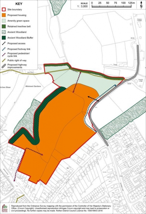
(25) Policy BEX3c: Land east of Watermill Lane
Land east of Watermill Lane, as shown on the Policies Map, is allocated for housing and open space. Proposals will be permitted where:
- Some 150 dwellings will be provided within the residential area as indicated on the Detail Map, of which 30% should be affordable;
- the southern part of the site towards the stream course is kept open and laid out as part of a green corridor, incorporating an enhanced footpath/cycleway, which should extend from Watermill Lane to the planned Enterprise Park (see Policy BEX1);
-
Access should be from Watermill Lane, the
details of which will be subject to findings of a
Transport Assessment, with the expectation
that:
- a single access will be provided along the line of the existing farm track;
- traffic management measures are introduced on Watermill Lane to calm traffic, with specific regard to the short section north of Mayo Lane and to ensure the safe movement of pedestrians and cyclists between the site and Sidley in association with the provision of a new footway/cycleway in line with the requirements of Policy BEX3b;
- A small site of up to five pitches for the permanent residential use by Gypsies and travellers is retained, as indicated on the Detail Map;
- the infrastructure requirements set out in Policy BEX3 are met.
(1)
Figure 23: Policy BEX3c
Detail Map
Site Allocation:
Land at Former High School Site and Drill Hall, Down Road,
Bexhill
9.54 This brownfield site is located north of the Town Centre at the junction of Combe Valley Way and the A259. The existing leisure centre is situated to the south of the site along with the Ministry of Defence (MoD) Drill Hall, with King Offa primary school beyond, to the west. Combe Valley Way forms the eastern boundary. The northern part of the site is currently vacant, formerly occupied by the High School.
9.55 The Council aspires for a combined wet and dry sports and leisure facility in the town and this centrally located site allows the opportunity to create a "landmark" destination for leisure and complementary facilities. It is envisaged that this would be on the frontage of the site as, potentially, may be complementary restaurant space and a hotel, also taking advantage of the prominent roadside position.
9.56 There is also scope for residential elements in the central and northern parts of the site. This may take one of two forms; either as a total of some 35 houses or a combination of circa 18 houses and 36 flats, totalling 54 dwellings.
9.57 There is a need for a comprehensive consideration of the site to ensure a high quality public realm on this highly prominent site. Access should be from Down Road and any scheme should provide for continued vehicular access to the adjacent King Offa primary school and the Skills Centre, along with associated car parking to serve the development, as well as a car/coach parking and drop-off area for King Offa School. Electric vehicle charging points are also envisaged to serve the commercial elements of the allocation.
9.58 There is an existing Drill Hall located on the development site which may be demolished to make way for the proposals. A level 4 Standing Building Assessment[59] has been undertaken[60] which details the historical and evidential value of the Drill Hall and has concluded that in addition to the detailed recording undertaken as part of that assessment, a further recording should be completed in terms of internal and exterior scaled drawings of the Drill Hall. Once completed, it should be archived for public dissemination along with the existing Standing Building Assessment prior to demolition. Therefore, should the Drill Hall be required to be redeveloped as part of proposals, the organisations which presently use the Drill Hall would require relocation.
9.59 Development of the north part of the site would need to have regard to the relationship with the existing housing to the north in Bancroft Road, notably in terms of building heights.
9.60 A culvert runs through the south east of site which means that no buildings can be constructed within an 8m easement line of the culvert. The electricity sub-station which is located on the site should, if practicable, be relocated in order to create a better public realm and pedestrian access from the south of the site.
9.61 The development should focus on an accessible, sustainable and high quality leisure hub facility, through the creation of high quality buildings and public realm on this highly prominent gateway site into the town.
(4) Policy BEX4: Land at Former High School Site and Drill Hall, Down Road, Bexhill
Land at Former High School Site and Drill Hall, Down Road, Bexhill, as shown on the Policies Map, is allocated for mixed use development creating a leisure destination, comprising of a wet/dry leisure facility, housing, hotel, restaurant space, and associated car parking.
Development should focus on an accessible, sustainable and high quality leisure hub facility, creating a landmark leisure destination through high quality buildings and public realm on this highly prominent gateway site into the town. Proposals will be permitted where:
- a wet and dry sports and leisure facility of up to 6,500sqm is provided;
-
Either:
- some 35 houses are provided; or
- some 36 flats and 18 houses are provided.
In both cases, 30% of the dwelling units shall be affordable.
- complementary commercial development, including up to a 100 bed hotel, plus up to 4 units of restaurant space totalling around 400sqm is provided;
- a quality public realm incorporating adequate car-parking, including electric charging points to serve the development, along with associated car/coach drop-off area for the adjacent school;
- a transport assessment is provided, considering the proposed vehicular access and linkages to the wider transport infrastructure that supports local accessibility for both cyclist and pedestrians are incorporated as indicated on the Detail Map;
- a further archaeological record of the Drill Hall is undertaken and archived for public dissemination prior to any demolition;
- if required, the current users of the Drill Hall have been provided for at an alternative location; and
- provision is made for the retention and enhancement of boundary planting on the northern boundary.
Development of the site should be through a comprehensive masterplan.
9.62 The Detail Map below provides an indicative general layout of the development site.
Figure 24: Policy BEX4 Detail Map
Site Allocation:
Land at Gullivers Bowls Club, Knole Road,
Bexhill
(1) 9.63 The site comprises about 0.7 hectares of land on the northern side of Knole Road and is roughly rectangular in shape. The site is surrounded on three sides by properties in Middlesex Road, Brassey Road and Cantelupe Road whilst there is a substantial Grade II listed terrace of late-Victorian dwellings in De la Warr Parade on the south side of Knole Road. The site is just to the east of the Bexhill Town Centre Conservation Area and visually forms part of the setting of the listed terrace to the south known as De La Warr Parade.
(1) 9.64 The site is currently used as an outdoor bowls facility consisting of two 2 outdoor greens (one is disused) with an additional indoor rink, along with other associated facilities. The existing bowls club buildings run along the length of the western boundary and are in poor condition.
9.65 The site is well related to the town centre and other associated services such as doctors. There are also nearby bus services connecting to the town and wider transport network within walking distance. The train station is also within a reasonable walking distance.
9.66 The site has a medium potential to contain prehistoric, Roman and medieval remains. An archaeological assessment would be a planning application requirement.
(1) 9.67 Development of the site offers the opportunity to upgrade the long established bowls club while allowing frontage development to Knole Road for sheltered housing. Any planning application should present a comprehensive scheme, meeting the requirements for sustainable drainage, taking account of the listed terrace to the south and providing an integral landscaping scheme particularly addressing the northern, eastern and western boundaries.
(1) 9.68 The principal of developing the site was accepted in a planning appeal decision[61] in 2013. However, the appeal failed for design reasons. The Council subsequently granted a revised scheme in 2014 (although following a successful Judicial Review the decision was remitted to the Council: to date no further decision has been made).
9.69 In the event that
delivering the replacement bowls facility raises issues of
viability in relation to the full affordable housing
requirement, the replacement bowls facility shall take
priority, subject to the robust evidence being provided and
agreed.
(3) Policy BEX5: Land at Gullivers Bowls Club, Knole Road, Bexhill
Land at Gullivers Bowls Club, Knole Road, Bexhill, as shown on the Policies Map, is allocated for mixed use development comprising of housing and a replacement bowls facility. Proposals will be permitted where:
- some 39 sheltered dwellings are provided, of which 30% are affordable;
- an improved bowls facility comprising of an outdoor bowls green, an indoor rink and associated clubhouse and maintenance facilities is provided;
- development at the rear of the site is single storey only;
- separate access points are provided for the residential and bowls facility part of the scheme;
- the design of the scheme does not adversely affect the character of the area or the setting of the listed terrace to the south;
- sustainable drainage (SuDS) is provided in accordance with Policy DEN5; and
- provision is made for the retention and enhancement of boundary planting, particularly on the western, northern and eastern boundaries, as indicated on the Detail Map.
9.70 The Detail Map below provides an indicative general layout of the development site.
Figure 25: Policy BEX5 Detail Map
Site Allocation: Land adjacent to 276 Turkey Road, Bexhill
9.71 This is an undeveloped greenfield site. There are three residential properties at the south-eastern corner of the site, with a further residential property along the western boundary. Bexhill Cemetery lies to the east and north of the site.
9.72 The site is partially contained from wider views by the boundary trees but there are more localised views into the site. There is an existing Tree Preservation Order (TPO 312) along the western and southern boundaries. Development of the site would require the protection of existing trees and hedgerows, including suitable buffers and provide for additional landscaping. Regard should be made to the potential future redevelopment of the Cemetery Lodge site, to the east of the allocation, in development layout plans.
9.73 The site is relatively well located in terms of access to some services, notably schools and is close to existing bus routes. There is no footpath on the north side of Turkey Road but the site can be linked to footpaths on the opposite side of the road. The most likely access point is at the south-west corner of the site onto Turkey Road. Highway improvements are likely to be required to make the development acceptable.
9.74 The site has a medium potential to contain prehistoric, Roman and medieval remains. An archaeological assessment would be a planning application requirement.
9.75 Additional reinforcement of the sewerage network will be required to serve the development and therefore, the developer will need to work with Southern Water to ensure appropriate sewerage infrastructure is provided to serve the development prior to its occupation.
9.76 The site is located within the Pevensey Levels Hydrological Catchment, with implications for SuDS treatments which will need to be fully addressed through any planning application.
(3) Policy BEX6: Land adjacent to 276 Turkey Road, Bexhill
Land adjacent to 276 Turkey Road, Bexhill, as shown on the Policies Map, is allocated for residential development. Proposals will be permitted where:
- some 30 dwellings are provided, of which 30% are affordable;
- an appropriate access is provided onto Turkey Road, including any necessary off-site highway works necessary to make the development acceptable;
- provision is made for the retention and enhancement of boundary planting, particularly in relation to the existing Tree Preservation Order on the site as indicated on the Detail Map;
- provision is made for an acceptable connection to the local sewerage system in agreement with the service provider; and
- at least two forms of appropriate Sustainable Drainage' are incorporated in accordance with Policy DEN5 'Sustainable Drainage'.
9.77 The Detail Map below
provides an indicative general layout of the development
site.
Figure 26: Policy BEX6 Detail Map
Site Allocation:
Land at Moleynes Mead, Fryatts Way, Bexhill
9.78 The site is located in the north-western part of Bexhill, within the Development Boundary. The site is surrounded by existing housing on all four sides and is relatively well-screened from the wider countryside to the west by the existing residential development in Fryatts Way (although there are some gaps to the west).
9.79 The site is in an established residential area and there is a bus route within walking distance of the site. The inclusion of a footpath link from the site to Ellerslie Lane would provide a more direct walking route in the interests of promoting sustainable travel choices.
9.80 The site is occupied by an existing dwelling (Moleynes Mead) which, although not listed, is considered to be an undesignated heritage asset and should be retained as part of any development proposal.
9.81 The site is located within the Pevensey Levels Hydrological Catchment, with implications for Sustainable Drainage (SuDs), as set out in the Environment chapter of this Local Plan.
9.82 The site contains a number of mature trees close to its eastern and southern boundaries which contribute positively to the character of the area and which are protected by Tree Preservation Orders. These will need to be retained and protected, and enhanced with additional planting as appropriate. The southern part of the site is separated from the wider site area by a line of protected trees and it is therefore not appropriate to include it as part of the developable area, although it may be suitable to accommodate SuDS. This southern section of the site should be retained and managed as a wildlife area to offer a biodiversity enhancement and accommodate any protected species using the site.
9.83 The site is 1.6 hectares in size, but given the areas that need to be retained for biodiversity, additional buffer planting and SuDs, the developable area is 0.9 hectares and it is anticipated that 24 dwellings will be provided.
9.84 Access would be delivered off Fryatts Way to the west. The existing dwelling, Moleynes Mead, will continue to be served by an existing access from Ellerslie Lane.
9.85 The site is subject to an outline planning application (reference RR/2017/2452/P) for 24 dwellings, which has delegated approval subject to conditions and the completion of a Section 106 agreement relating to the requirement for 30% affordable housing; the management of a wildlife area; and SuDS. However, as planning permission is not in place at the base date of this Local Plan, the allocation is considered necessary.
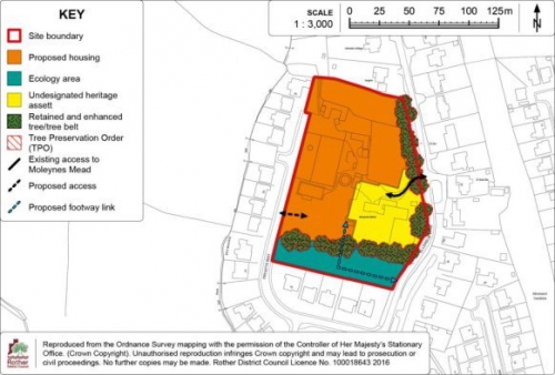
(1) Policy BEX7: Land at Moleynes Mead, Fryatts Way, Bexhill
Land at Moleynes Mead, Fryatts Way, Bexhill, as shown on the Policies Map, is allocated for residential development. Proposals will be permitted where:
- some 24 dwellings are provided, of which 30% are affordable;
- the existing dwelling, Moleynes Mead, is retained;
- provision is made for the retention and enhancement of existing boundary planting, particularly in relation to the existing Tree Preservation Orders on the site;
- an ecological design strategy makes provision for any protected species found to be using the site, and where necessary, includes appropriate mitigation and/or compensation for any loss of habitat. The strategy shall include the retention and management of the southern section of the site as an ecology area, as indicated on the Detail Map;
- a footpath link is provided through to Ellerslie Lane;
- a new access is achieved of Fryatts Way, with the existing access from Ellerslie Lane retained to serve the dwelling, Moleynes Mead; and
- in accordance with Policy DEN5 'Sustainable Drainage', at least two forms of appropriate SuDS are incorporated.
9.86 The Detail Map below provides an indicative general layout of the development site
Figure 27: Policy BEX7 Detail Map
Site Allocation:
Land south of Terminus Road, Bexhill
9.87 This is a site within Bexhill that is occupied by car sales and car wash businesses. The site is bounded by the railway line to the south, residential to the west and further offices to the east, with the Beeching Road industrial estate on the opposite side of the road to the north. The site is an edge of the town centre location and is extremely well located in terms of its access to services.
9.88 Recent appeal decisions[62] on the site have challenged the retention of the existing car sales business on the site. The Inspector considered the car sales business not to be an employment use and accepted that a solely residential scheme could be provided on the site without having an unacceptable impact on the Council's employment land supply. However, these appeals were dismissed due to the siting and scale of the proposed buildings. The appeal decisions indicated that the site may only be suitable for a three storey block of flats, given the characteristics of the locality.
9.89 There is an underground surface water culvert and a separate main river culvert which runs along the western side of the site. Advice from the Environment Agency's indicates that there should be a minimum of an 8 metre exclusion zone for development. Therefore it is expected that built development on the site will be restricted to the eastern part of the site.
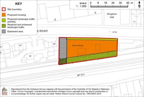
(2) Policy BEX8: Land south of Terminus Road, Bexhill
Land south of Terminus Road, as shown on the Policies Map, is allocated for residential development. Proposals will be permitted where:
- some 10 flats are provided;
- appropriate boundary landscaping is provided as indicated on the Detail Map; and
- built development is restricted to the eastern part of the site resulting in an 8 metre built development exclusion zone from the main river culvert which passes along the western boundary as show on the Detail Map.
9.90 The Detail Map below
provides an indicative general layout of the development
site.
Figure 28: Policy BEX8 Detail Map
(1)
Site Allocation:
Land off Spindlewood Drive, Bexhill
9.91 The site is south of Barnhorn Road and west of Spindlewood Drive, Little Common and is located relatively close to bus services on Barnhorn Road and Cooden Sea Road and to local shops and services at Little Common district centre. The total site area is 7.3ha with a net developable area of 4.8ha. It is anticipated that 160 dwellings will be provided, of which 30% are affordable.
9.92 The site is relatively well contained from wider views by the adjacent block of woodland (Cooden Wood) and trees and hedges to the west. Site levels are higher towards the existing residential development along Barnhorn Road and the impact on wider views of any development will have to be considered by any detailed proposal.
(3) 9.93 There are viable access points to the site from both Spindlewood Drive and from Barnhorn Road via the existing entrance to Barnhorn Manor Farm and Caravan Park. Utilising both access points, the highway authorities are satisfied that a development of this scale can be satisfactorily accommodated by the local and strategic highway network subject to some local highway improvements and detailed on-site measures relating to the internal layout of the site to discourage 'rat running' and to discourage the use of the Maple Walk estate private roads through the use of directional signage.
9.94 Improvements to pedestrian routes including a direct pedestrian route from the site to Barnhorn Road and footway works at the Spindlewood Drive access will be required to reinforce connectivity to shops and services. Development will also be expected to contribute to improved bus stop infrastructure and services including the relocation of the existing bus stop close to the farm entrance on Barnhorn Road, real time information signs at the closest stops on Cooden Sea Road and financial contributions towards extending the evening service Monday – Saturday provided by route Wave 99 between Hastings and Eastbourne. A green travel plan drawing on the above improvements will be required to promote sustainable travel options as an alternative to private cars.
(2) 9.95 The site is located within the Pevensey Levels SAC/Ramsar Hydrological Catchment where, in accordance with Habitats Reguations Assessment (HRA) work undertaken to inform the Core Strategy and DaSA, a minimum of two types/stages of Sustainable Drainage (SuDS) treatment will be required in order to address the possible negative effects from surface run-off and hydrological pathways on the water quality in the Levels. The SuDS design should also be designed to meet multiple benefits in terms of not only maintaining water quality but also promoting opportunities for ecological and recreational enhancement and reinforcing local landscape character and the design of the development. While the Council has undertaken a full Appropriate Assessment under the HRA, which confirms as the need for effective SuDS, Natural England has sought a site specific Appropriate Assessment to be certain that the requires SuDS mitigation can be achieved and any adverse impact on the integrity of the Levels can be avoided.
9.96 There is a gap with wider views to the Pevensey Levels from the south western field that should be protected from any built development that would represent an unacceptable visual intrusion into the wider countryside. It is therefore expected that this area forms the area for SuDS to retain the open character.
9.97 A connection from the site to the nearest point of the foul sewerage network with adequate capacity will need to be made in consultation with the service provider and the detailed layout of development should take account of the nearby wastewater pumping station at Spindlewood Drive to minimise land use conflict.
9.98 There are two bands of trees that run through the site linking a wooded area to the north with Ancient Woodland to the south. This is an important landscape feature within the site and acts as a wildlife corridor between the two areas of woodland that should be retained for ecological and recreational open space. Part of the area may be suitable for children's play space. It is recognised that the existing track bisecting the corridor (or an alternative to it) will need to be made up as part of the internal vehicular movement network. Appropriate mitigation measures to enable the safe movement of wildlife through the corridor will need to be incorporated in the detailed design. There is also a pond in this area which should be retained and enhanced for ecological purposes only and not as part of the SuDS. The pond lies adjacent to the Ancient Woodland and provides existing habitat for protected species. It would therefore be appropriate to include this area within an enhanced buffer zone to the woodland and to restrict public access to it.
9.99 Elsewhere, a minimum 15m buffer between development and the Ancient Woodland should be maintained and other appropriate wildlife mitigation measures informed by a full evaluation of the site's ecological value and potential will be required.
9.100 The north west part of the site adjacent to the historic medieval farm complex is identified as an Archaeological Notification Area and a geophysical survey of the site has identified the potential for archaeological remains to be present throughout this whole field. It will be necessary to clarify the significant of these features through trial trench testing prior to the detailed layout of development on the site being designed so that any important remains can be retained in situ.
9.101 This site is the
subject of a current outline planning application (RR/2017/1705/P) for a residential
development for circa 160 dwellings with all matters other
than access reserved which is yet to be determined.
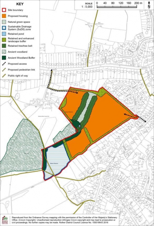
(59) Policy BEX9: Land off Spindlewood Drive, Bexhill
Land off Spindlewood Drive, Bexhill as shown on the Policies Map, is allocated for residential development. Proposals will be permitted where:
- some 160 dwellings are provided, of which 30% are affordable;
- highway access is provided from Spindlewood Drive and Barnhorn Road, alongside offsite highway works to make the development acceptable in highway terms;
- a pedestrian footpath link is provided to Barnhorn Road and footpath improvements are made at the Spindlewood Drive access;
- improvements are made to existing local bus stop infrastructure and a financial contribution towards improving local bus services;
- provision is made for the retention and enhancement of existing boundary planting, particularly in relation to the existing Tree Preservation Orders on adjacent sites and the north and north-eastern boundaries of the site as indicated on the Detail Map;
- suitable provision is made for children's play space in the form of both a Locally Equipped Area for Play (LEAP) and a Local Area for Play (LAP);
- a green corridor is provided through the centre of the site between two areas of existing adjacent woodland areas for ecological and public recreational use, as indicated on the Detail Map. The corridor will include the retention and enhancement of the existing pond only for ecological value and not as part of the SuDS system, which should form part of an enhanced buffer to the adjacent Ancient Woodland;
- elsewhere, a woodland buffer to protect the Ancient Woodland to the south west of the site of at least 15m depth will be required;
- provision is made for any significant archaeological artefacts identified through a trial trench investigation to be preserved in situ on the site;
- a connection is provided to the local sewerage system at the nearest point of adequate capacity, in collaboration with the service provider.
- in accordance with policy DEN5 'Sustainable Drainage', at least two forms of appropriate SuDS are incorporated and an Appropriate Assessment under the Habitats Regulations demonstrates beyond reasonable scientific doubt that these can be delivered on the site without harming the integrity of the Pevensey Levels Special Area of Conservation/RAMSAR site;
- provision is made for any protected species found to be using the site, and where necessary, includes appropriate mitigation and / or compensation for any loss of habitat, including retaining physical linkages through the central wildlife corridor as indicated on the Detail Map; and
- care is taken in respect of the amenity of adjoining residential properties to the north, north east and south east and to the existing character of the countryside and farm complex to the south west and west.
(1) 9.102 The Detail Map below provides an indicative general layout of the development site.
(1)
Figure 29: Policy BEX9
Detail Map
(1)
Site Allocation:
Land at Northeye (Former UAE Technical Training Project),
Bexhill
9.103 This large, part brownfield/part greenfield site lies on a north-facing slope extending down to the edge of the Pevensey Levels on the north side of the A259, a little beyond the western extent of Bexhill. Access is provided by Wartling Drive, served off Coneyburrow Lane, a short distance from its junction with the A259.
9.104 The site was a training centre for the United Arab Emirates, but ceased some years ago and the site is presently mothballed. There is no intention to bring the site back into training use for its purposes. Hence, the site is available for redevelopment.
9.105 Of note, its somewhat exposed countryside location reflects the fact that the site was originally established as a RAF base in 1944 and then developed as a prison, which existed until 1992 before being taken over by the United Arab Emirates.
9.106 The total site area is approximately 15ha, with a variety of accommodation, education and operational buildings covering about 9ha. The remainder is open and undeveloped, the northern part previously providing recreation fields for the Centre. The central area alongside the stream which runs through the site is in Flood Zone 3. A small residential estate sits alongside the approach to the site off Wartling Drive. Otherwise, the setting is very rural in character.
9.107 It is evident that this is a very sensitive site, most notably due to its position adjacent to an internationally-designated ecological site of the Pevensey Levels, its largely rural setting and associated visual exposure, as well as being somewhat isolated from the main built-up area of Bexhill.
9.108 New development in such a situation would normally be resisted, but given the brownfield nature of a large part of the site, redevelopment of that area (excluding land that falls in Flood Zone 3) should be proactively planned for.
9.109 A Landscape Study[63] has been undertaken to inform this allocation. This concludes that redevelopment of the site would provide an opportunity to plan for a high quality development within an appropriate landscape setting. This would enhance the character of this part of the urban fringe and the transition from the town to the open and sensitive Levels. The removal of the austere boundary fence would also enhance local views. The existing open areas of Northeye (open space to the east of Wartling Drive and the recreational area east of the stream) contribute positively to local landscape character and blend in to the wider, sensitive area of the Levels.
9.110 The Study concludes that the brownfield part of the site could be suitable for housing, employment, tourism or a mix of those uses. However, there appears to be limited commercial interest for tourism or employment uses. The greenfield part of the site, east of the stream, should remain open and undeveloped.
9.111 The brownfield part of the site (outwith of the area located in Flood Zone 3) is considered suitable for residential development, the area east of the stream to remain open and set aside for playing pitches, to contribute to meeting the strategic need identified through the Playing Pitch Strategy.
9.112 To the south-east, Ticehurst Avenue runs through the existing housing area into 'Principal Close' and the area of administrative buildings. This could be extended into this part of the site, developed with a small area of houses of a similar layout, scale and relatively high density to the existing estate (as shown on the Detail Map below), also being well contained in views from the wider countryside. A terrace of houses could be provided on the site of the existing Northeye car park off Wartling Drive. This would mirror the residential housing on the opposite side of the road.
9.113 The central part of the site, west of the stream, which is currently enclosed by the former prison security fence, would continue to be accessed off Wartling Drive. The sloping nature of the site and the sensitivity of the surrounding views influence the scale of potential buildings on this part of the site. Housing here would need to be of a lower density to the surrounding Wartling Drive estate and with larger gardens than the existing (as shown on the Detail Map as the low density area), with a variety of roofscapes and green space, as outlined below.
9.114 Proposed housing development on the site would need to be of a high quality design and layout. The layout of access roads should follow the contours of the site, so that proposed development steps down the slope minimising the need for retaining structures. Materials should be in keeping with the local vernacular, using local stock bricks and clay tiles or ideally green roofs.
9.115 The open space and associated boundary trees already provide a buffer between the built development on the site and the wider countryside to the north. The existing wooded area to the north of this space should be managed and the planting enhanced to create a buffer to views from the surrounding countryside. A landscape buffer of locally characteristic native tree and shrub planting should be introduced around the western and northern boundaries. This would help to integrate future development with the wider countryside. The existing Lombardy Poplars on the western and northern boundaries could be gradually replaced with more characteristic native woodland planting, which would require adequate space for tree planting on the boundaries.
9.116 The stream valley which runs through the site forms a distinct boundary to the built up part (brownfield area) of the site. This should be retained and managed as the boundary to built development on the eastern side of the site area.
9.117 The area located within Flood Area 3 should be kept free from development. This would also allow for a wider landscape buffer to the countryside on this boundary. This area may provide an opportunity to provide sustainable drainage (SuDs) for the development site.
9.118 The site is located within the Pevensey Levels SAC/RAMSAR Hydrological Catchment where, in accordance with the Plan's Habitats Reguations Assessment (HRA), a minimum of two types/stages of Sustainable Drainage (SuDS) treatment will be required in order to address the possible negative effects from surface run-off and hydrological pathways on the water quality in the Levels. The SuDS should also be designed to provide multiple benefits in terms of not only maintaining water quality but also promoting opportunities for ecological and recreational enhancement and reinforcing local landscape character and the design of the development. Any proposal to develop the site must be accompanied by a Habitats Regulations Assessment to determine beyond reasonable scientific doubt that the requisite SuDS mitigation is achievable and that any adverse impact on the integrity of the Levels can be avoided.
9.119 Given the previous use of the site and its on-going management, it is not anticipated that any part of the site is functional habitat for bird species associated with the RAMSAR site designation. However, a detailed survey will need to be undertaken review this. If proposals are likely to have a significant effect then an Appropriate Assessment would be required and mitigation measures implemented.
9.120 There is an outstanding need for additional playing pitches within Bexhill as identified within the Playing Pitch Strategy, particularly for football in terms of the needs for enclosed ground. The open space area of former recreational area/playing fields, which lies to the north-east of the stream, would need to be kept open. While built development would be intrusive in this area, a playing fields use would be acceptable in principle. Careful consideration would need to be given to the impact of structures and floodlighting, use of the latter being for restricted hours and fully cut off to avoid adverse night time impacts. It would be reasonable to accommodate a single storey pavilion/changing rooms to replace the existing building on the eastern side of the stream. A small area of well-designed and screened parking to serve should also be provided to the east of the stream using the existing bridge access to minimise the impact on existing trees.
9.121 A landscape-led masterplan would ensure that development is successfully integrated into the landscape and provides enhancements to the landscape and visual amenity of the area, with the built form broken up by vegetation and open spaces.
9.122 The original public footpath which crossed the site before the development of the site as a prison should be reinstated to give enhanced access to the countryside and the Levels to the north. This would provide an alternative to the poorly used path 59a. This would also provide better access to footpath 12b which links Coneyburrow Lane to Little Common.
9.123 A connection from the
site to the nearest point of the foul sewerage network with
adequate capacity will need to be made in consultation with
the service provider and the detailed layout of development
should take account of the nearby wastewater pumping
station to minimise land use conflict.
(4) Policy BEX10: Land at Northeye (Former UAE Technical Training Project), Bexhill
Land at Northeye (Former UAE Technical Training Project), Bexhill as shown on the Policies Map, is allocated for residential development and playing pitches. Proposals will be permitted where:
- some 140 dwellings are provided on the southern part of the site as indicated on the Detail Map, 30% of which should be provided as affordable housing;
- a full size adult football pitch and/or a senior cricket pitch is provided on the northern part of the site as indicated on the Detail Map, alongside associated ancillary changing and parking facilities to serve the playing pitch;
- highway access is provided from Wartling Drive and Principal Close, via Coneyburrow Lane, alongside offsite highway works to made the development acceptable in highway terms;
- in accordance with policy DEN5 'Sustainable Drainage' at least two forms of appropriate SuDS are incorporated and an Appropriate Assessment under the Habitat Regulations demonstrates beyond reasonable scientific doubt that these can be delivered on the site and that the development can otherwise proceed, with mitigation if necessary, without harming the integrity of the Pevensey Levels Special Area of Conservation/Ramsar site;
- suitable provision is made for children's play space in the form of both a Locally Equipped Area for Play (LEAP) and a Local Area for Play (LAP);
- the Public Right of Way (PROW) is reinstated through the middle of the site, following the stream corridor together with a financial contribution towards improvements to the existing PROW network in the locality;
- improvements are made to existing local bus stop infrastructure and a financial contribution towards improving local bus services;
- provision is made for the retention and enhancement of existing landscape buffers with locally characteristic native tree and shrub planting, particularly on the western and northern boundaries; and
- a connection is provided to the local sewerage system at the nearest point of adequate capacity, in collaboration with the service provider.
Development of the site should be through a Green Infrastructure framework and landscape led masterplan.
9.124 The Detail Map below provides an indicative general layout of the development.
Figure 30: Policy BEX10
Detail Map
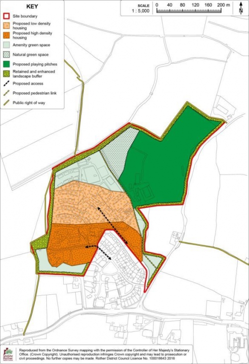
(1)
Site Allocation:
Land at Sidley Sport and Social Club, Bexhill
9.125 The site is located within the Sidley area of Bexhill and comprises a 2ha area of grassed, open space formerly used as a playing field accommodating a full size adult football pitch and a full size cricket pitch with an ancillary clubhouse building.
9.126 The site is within a predominantly residential area, being bordered by the rear gardens of houses on North Road on its western side, bungalows at Festival Gardens on its northern side and, on its southern side, are flats on Glovers Lane. Buckholt Lane, a public right of way, borders the eastern side of the site and there are houses on Ingrams Avenue on the opposite side of this Lane.
9.127 The site is located about 80metres from Sidley's main shopping area which is focused around Ninfield Road to the south-west of the site.
9.128 The southern part of the site is relatively level but the northern part slopes gently upwards towards its northern boundary. The site is otherwise largely covered by grass and there are some mature trees on its boundaries.
9.129 The site is designated an Asset of Community Value. This scheme is intended to assist communities to preserve buildings or land that they consider important to their social wellbeing.
(1) 9.130 The Council has undertaken a Feasibility Study[64] to establish the most appropriate use/s for the site and set out these options whilst establishing whether they are economically viable and sustainable over an extended period of time. The Study sets out three shortlisted options, based on the likely viability and overall benefit of the facility mix and future usage and also sets out options for a future management structure to oversee on-going delivery and development of the site. The Study indicates that the most viable option for sports use on the site is a full size 3G Artificial Grass Pitch (AGP) along with associated ancillary changing facilities and community hub space.
9.131 The site is therefore proposed for a full size 3G Artificial Grass Pitch (AGP) along with associated ancillary changing facilities, a community hub and associated open space.
9.132 In order to facilitate the use of the site for playing pitches the existing access from Glovers Lane will need to be improved as will walking and cycling connections. Adequate parking will need to be provided in accordance with the relevant standards.
9.133 The site boundaries should be enhanced to improve the relationship with neighbouring residential properties as well as an enhancement to local biodiversity. Any planning application will need to include provision for the protection and enhancement of biodiversity, including translocation of reptiles and appropriate protection or mitigation for light-sensitive species in accordance with a lighting design strategy and species activity surveys.
9.134 The 3G AGP will require an acoustic barrier around the perimeter of the playing pitch/spectator area to mitigate the impact of noise from the pitch. An application will need to be accompanied by a noise impact assessment.
9.135 Whilst it is expected that the facility will provide an enclosed ground for at least one football club in Bexhill, to ensure a safe, well managed and viable sports facility, it is expected that a Community Use Agreement will be secured with any planning permission to ensure community access to the facility, covering details of pricing policy, hours of use, access community users, management responsibilities and include a mechanism for review.
9.136 The use of the site as a 3G AGP will require the use of a floodlighting to allow year round use. The use of floodlighting will be controlled by planning condition for any subsequent planning permission.
9.137 The site has a high potential to contain prehistoric, Roman and medieval remains. An archaeological assessment would be a planning application requirement.
9.138 There are no existing
surface water sewers in the vicinity of the allocation site
and as such any proposal would need to make adequate
provision for SuDS drainage in accordance with Policy
DEN5.
(7) Policy BEX11: Land at Sidley Sport and Social Club, Bexhill
Sidley Sports and Social Club, Glovers Lane, as shown on the Policies Map, is allocated for playing pitches for formal sport and ancillary changing facilities, a community hub and associated open space. Proposals will be permitted where:
- one full size 3G Artificial Grass Pitch (AGP) for formal sport is provided, alongside associated ancillary changing facilities, community hub space and open space, as indicated on the Detail Map;
- an acoustic barrier is provided on the perimeter of the playing pitch/spectator area to mitigate noise impact on the surrounding residential properties;
- provision is made for the protection and enhancement of site's boundaries in order to enhance biodiversity and improve the relationship with neighbouring residential properties, as indicated on the Detail Map. Provision should include the translocation of reptiles and appropriate protection or mitigation for light-sensitive species in accordance with a lighting design strategy and species activity surveys;
- a Community Use Agreement accompanies the application to ensure community access to the facility. The Agreement shall include details of pricing policy, hours of use, access by non-school users, management responsibilities and include a mechanism for review;
- highway access is provided from Buckholt Lane, via Glovers Lane, alongside any offsite highway works to make the development acceptable in highway terms;
- linkages to the wider transport infrastructure that supports local accessibility for both cyclist and pedestrians are incorporated, including connections to the proposed Bexhill Cycle Network; and
- sustainable drainage (SuDS) is provided in accordance with Policy DEN5.
9.139 The Detail Map below provides an indicative general layout of the development site.
Figure 31: Policy BEX11
Detail Map
Bexhill Town Centre and Retail Needs
9.140 The Core Strategy highlights, at Policy BX2, the central role of Bexhill town centre as the commercial and cultural heart of the town, as well as its retail investment potential.
9.141 The Council is very supportive of ensuring a vibrant shopping environment, building on the town centre's considerable strengths in terms of the mix of land uses and strong architectural and historic character, as well as the close linkages between the seafront and the town centre.
9.142 Bexhill's many small independent shops help lend the town centre its special character. These small independent shops provide an important role in serving the day-to-day needs of local residents, workers and visitors and can provide consumer choice and local employment. The cafés and restaurants in the town play an increasing role in the vibrancy, and diversity, of the town centre.
9.143 In line with national planning policy and Core Strategy policies (see below), it is important that Bexhill town centre is the focus of both retail growth, particularly given its accessibility by all modes of transport and the complementary presence of a range of shops and services that are vital for the well-being of the local residents.
9.144 In line with Policy EC7 of the Core Strategy, to help the town centre maintain and strengthen its trading position, especially given the competition from nearby town centres, retail investment is directed firstly towards the existing designated centre, then if no opportunities exist to edge-of-centre locations to sites that are well connected to the town centre, to encourage linked trips to the centre.
9.145 The Core Strategy's strategy for Bexhill town centre (Policy BX2) seeks to 'provide for some 2,000sqm additional convenience goods and 4,000sqm comparison goods floorspace, primarily through 'edge of centre' retail expansion on the north side of the railway, as well as effective use of town centre accommodation.'
9.146 An allocation of land for a convenience goods-led retail development is set out below in line with this expectation, as further advised by a recent Retail Capacity Study. Other smaller sites may come forward for redevelopment or intensification within Bexhill Town Centre, including the identified Primary Shopping Area. Such sites and premises will be favourably considered for retail use in accordance with Policy EC7 in the Core Strategy.
9.147 This Retail Capacity Study (2018)[65] updates Core Strategy position in respect of comparison goods floorspace needs. It concludes that future expenditure growth on comparison goods should be met within existing comparison goods shops in the town centre rather than through new additional floorspace. Therefore, no further allocation for comparison goods floorspace is made within this Plan.
9.148 Meanwhile the designation of a 'Cultural Area' focuses the enhancement of the cultural facilities and activities "offer" and to improve patronage and evening economy around the seafront as a significant amenity asset to the town.
9.149 Policy is also set out below the identification of an area earmarked for enhancement between London Road and Sackville Road, where a focus for public realm and traffic movement improvements should be secured to enhance the appeal of these streets which form the approach to and part of the town centre.
9.150 The District centres of Little Common and Sidley also form an important function in fulfilling day-to-day shopping needs to local communities. Their function and physical extents are detailed further below.
(1) Bexhill Town Centre and Primary Shopping Area
9.151 The National Planning Policy Framework indicates that planning policies should define a hierarchy of town centres, whilst also defining the extent of town centres and primary shopping areas.
9.152 Bexhill's 'shopping centres' in the Core Strategy follow a hierarchy with Bexhill being the town centre, and District Centres being Little Common and Sidley. A variety of 'Town Centre' uses are directed to these centres, Policy BX2 in the Core Strategy sets out this approach.
9.153 The town centre is the most sustainable location for retail investment with good accessibility by a range of means of travel, with the 'primary shopping area' being the main concentration of retailing and associated high street uses. The purpose in identifying the primary shopping area is to support the primary retail function of the town centre. Increasingly cafes and restaurants are playing an increasing role in the function of the Town Centre.
9.154 Accessibility and public realm improvements will be key to strengthening the town centre's position, and a town centre traffic management strategy is envisaged. This strategy will be prepared in conjunction with East Sussex County Council and will articulate a cohesive approach to town centre traffic movement, connectivity and the public realm, including the management thereof, recognising the relationship between traffic management, connectivity and the public realm with the wider vitality and viability of the Town Centre. The strategy will be expected to encompass sustainable transport initiatives, accessibility of the town for cars, pedestrians, cyclists and public transport, traffic management within the town centre, including car-parking provision and location, and the potential for 20mph zones, pedestrian and social zones particularly along Devonshire Road and Western Road and public realm design, management and maintenance. The introduction of Civil Parking Enforcement is seen as a key element of improving accessibility within the Town Centre.
9.155 The Bexhill Town Centre and Primary Shopping Area boundaries are defined on the Policies Map with respective policies set out below.
(1) Policy BEX12: Bexhill Town Centre
Bexhill Town Centre, as defined on the Policies Map, will be the focus for retail and other town centre uses.
Within the Town Centre, the loss of significant town centre uses will be resisted.
Traffic management improvements for cyclists, public transport users, and particularly pedestrians to provide better access within the town centre will be supported. Public realm improvements to enhance the environmental quality and appearance of the town centre are encouraged.
Policy BEX13: Bexhill Town Centre Primary Shopping Area
The Bexhill Town Centre Primary Shopping Area, as defined on the Policies Map, gives priority to retail and associated services (A1 and A2 uses) and seeks to protect the predominant shopping role and character of the area by controlling the loss of such units.
Planning permission will be granted for the introduction of new shops and the expansion or refurbishment of existing premises, subject to compatibility with other Plan policies.
In schemes for the redevelopment and change of use of sites within this area, regard will be made to the following factors:
- whether there is harm to the shopping character, diversity and vitality of the area;
- the size and type of unit, with support for the provision of new and retention of larger retail units;
- the type and characteristics of other uses in proximity to the application site; and
- the need to avoid an over-concentration or clustering of non-retail uses.
Where appropriate, Consideration should also be made to Policy DEC1 shopfronts.
Figure 32: Policy BEX12 and BEX13 Detail Map
Site Allocation: Land south-east of Beeching Road, Bexhill
9.156 Given the historic character, mix of ownership and already intensive use within the town centre, there is little opportunity for a large scale redevelopment to accommodate the level of convenience goods floorspace identified within the Core Strategy for Bexhill within the town centre boundary. Therefore, the Council must apply the sequential test in the consideration of sites to accommodate the floorspace, by firstly looking at edge-of-centre sites (i.e. within 300 metres of the town centre boundary) and, if necessary, out-of-centre sites with good links to the town centre.
9.157 Work undertaken for the Council by GL Hearn in 2013 and GVA in 2018 considered a number of sites in terms of suitability to accommodate convenience goods retail floorspace and their location in proximity to the town centre. The only edge of centre site which can be considered available and suitable for retail redevelopment is 'Land South-East of Beeching Road'. The centre of site is within the 300m threshold to be considered edge of centre. The route from the edge of the town centre is relatively flat and there are no obstacles which would hinder the scope for linked trips with the town centre. Even so, to achieve linked trips to the town centre, direct, attractive and safe pedestrian links from the site and along Terminus Road towards the town centre are vital.
9.158 Maximising the potential for linked trips – and hence the benefit for the town centre - also requires clear visibility between a store and Terminus Road. Hence, it would involve some loss of business units at least at the south-eastern section of the Beeching Park complex. Also, the location of the store car park is likely to be a key factor in promoting linked trips with the town centre; hence, it would be best located towards the Terminus Road end of the site.
9.159 The site proposed for (convenience) retail-led redevelopment located on the south-eastern side of Beeching Road is shown on the Policies Map. It is approximately 2.7 hectares, which has the capability to contain approximately 2,000sqm convenience goods floorspace.
9.160 The site presently comprises of a mix of uses, predominantly employment uses, but with some large vacancies, a mixture of large format warehouse buildings and smaller terraces of start-up type units. There is an existing public car park, scout hut, veterinary surgery and coach/lorry park within the area. There is also a Police Station adjacent to the site and predominantly two-storey residential properties along the eastern boundary (Reginald Road).
9.161 The site is largely in a single freehold ownership but there are multiple leases and sub-leases, although there has been some consolidation of leasehold ownerships in recent years.
9.162 There are significant level differences across the site, falling from Beeching Road in the west towards the eastern boundary. There is a culvert which runs through the site which would have a bearing on the siting of new buildings, requiring an 8 metre easement from the culvert. A large proportion of the site suffers from surface water flooding and therefore Sustainable Drainage (SuDS) would need to be incorporated in a redevelopment scheme.
9.163 There is an existing footpath along the eastern boundary of the site joining Terminus Road with Wainwright Road, but it is narrow, unmade and uninviting. There are further footpaths crossing the site joining the Beeching Road estate eastwards to join with Reginald Road/Victoria Road and a further path westwards joining back to Beeching Road. There is no existing pedestrian crossing across Terminus Road between Beeching Road and Sackville Road/Buckhurst Place.
9.164 Redevelopment proposals for retail floorspace will only be considered acceptable where at least the minimum frontage to Terminus Road indicated on the Detail Map is achieved, to provide direct, high quality and attractive pedestrian links between the store, its car park and the town centre. This will include off-site highway works to secure environmental improvements to the pedestrian route along Terminus Road and the northern end of Sackville Road.
9.165 It is expected that any displacement of existing businesses would be re-provided elsewhere within the Estate, possibly in the area set aside for employment redevelopment to the north of the retail allocation, shown on the Detail Map below.
9.166 There is further scope for the redevelopment to include the provision of new office space in this area which would complement provision elsewhere in the town. There is an opportunity to re-site the scout hut within the locality in association with a redevelopment, but this would need to be compliant with Policy DCO1.
9.167 It is also expected that a contribution to off-site highways works will be required to improve the junction of Beeching Road and London Road as part of the wider traffic management improvements referred in Policy BEX12.
9.168 There is an existing public car park located on the site and it is expected that an agreement is made for the store's car park to be made available for use by the public. Consideration will need to be given to relocating the existing coach and lorry park within the site as part of proposals and provide for an equivalent quantum of spaces, in liaison with the District Council.
9.169 Any future planning application must be accompanied with a retail impact assessment, in line with Policy EC7. Planning permission will only be granted where the proposed retail floorspace does not harm the viability of Bexhill town centre and makes a clear, positive contribution to the town centre via linked trips.
9.170 The need for additional comparison goods floorspace is expected to be provided within the town centre as set out above. Therefore, non-food sales should be restricted, meaning that they should account for a small and ancillary part of the store and not provided in a separate unit(s).
9.171 The site has a medium potential to contain prehistoric, Roman and medieval remains. An archaeological assessment would be a planning application requirement.
9.172 A connection from the site to the nearest point of the foul sewerage network with adequate capacity will need to be made in consultation with the service provider and the detailed layout of development should take account of the nearby wastewater pumping station to minimise land use conflict.
(2) Policy BEX14: Land south-east of Beeching Road, Bexhill
Land south-east of Beeching Road, as shown on the Policies Map, is allocated for convenience retail development. Proposals will be permitted where the scheme:
- provides 2,000sqm of convenience floorspace and provides only food ancillary retail sales, and excludes a pharmacy and any other form of service outlet which might undermine the vitality and viability of the town centre;
- includes provision for the development of office units, if practicable;
- is accompanied by a Retail Impact Assessment in line with the requirements of Policy EC7;
- provides at least the minimum direct frontage onto Terminus Road, as indicated on the Detail Map, to make a positive contribution to linked trips and create a visual connection with the Town Centre;
- brings forward direct and attractive pedestrian links between the store, its car park and the town centre, including the environmental improvement of pedestrian links across Terminus Road and the northern end of Sackville Road;
- provides consequential offsite highway works to improve the junction of Beeching Road and London Road, alongside financial contributions towards the improvement of public transport to serve the development;
- locates the store's car park on the southern part of the site and agreement is made for the car park to be made available for use by the public;
- an assessment of the options to re-provide the existing coach and lorry park is undertaken, in liaison with the District Council, and suitable alternative provision made;
- existing occupiers of premises located within the site are re-provided north of the retail allocation in the area set aside for employment redevelopment, shown in the Detail Map. If required, an alternative scout hut premises should also be provided for elsewhere in the locality in line with Policy CO1;
- a connection is provided to the local sewerage system at the nearest point of adequate capacity, in collaboration with the service provider;
- an 8 metre built development exclusion zone from the main river culvert which passes through the site, is achieved to allow access to the existing outfall;
- in accordance with Policy DEN5 'Sustainable Drainage', appropriate SuDS are incorporated within the development; and
- demonstrates that the access arrangements and the service yard are located in a position that protects the residential amenity of adjacent properties.
The masterplanning of the site should take account of nearby wastewater pumping stations to minimise land use conflict.
9.173 The Detail Map below provides an indicative general layout of the development site.
Figure 33: Policy BEX14
Detail Map
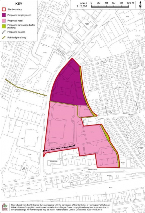
Bexhill Cultural Area
9.174 The arts and cultural offer in Bexhill is centred around the De La Warr Pavilion – a Grade I listed building which is internationally renowned for art installations and venue for live music and the arts. To the south lies the restored Grade II listed Colonnade, and the Bexhill Rowing Club, to the east the Grade II listed terrace of residential properties Marina Court Avenue, then Marina Arcade which comprises of a mixture of commercial and residential uses, and lastly Bexhill Sailing Club and the war memorial. Meanwhile the West Parade leads away from the Pavilion to Bexhill Museum to the west. The De La Warr Pavilion and its surrounding area is seen as a significant asset and hub for cultural and social activity within the town being the focal point for events such as the 'Bexhill Festival of the Sea' and 'Bexhill Motofest' and being critical in not only providing local amenity but also attracting visitors from further afield.
9.175 The designation of a 'cultural area' affords the opportunity to focus the enhancement of the activity and facilities offer to improve patronage and evening economy around the seafront as a significant amenity asset to the town.
9.176 The cultural area boundaries area shown in Figure 34 below.
(1) Policy BEX15: Bexhill Cultural Area
Bexhill Cultural Area is defined on the Policies Map and will be the primary focus for arts, culture and tourism activities within the town. Within the cultural area, as defined on the Policies Map, the loss of significant existing arts, culture and tourism uses will be resisted.
Improvements to the quality of the public realm to complement the arts, culture and tourism offer, to improve the quality of the promenade experience, to strengthen connections between the beach and the town, and create a sense of place in keeping with the destination role of the seafront will be supported.
Façade restoration to reinstate the original architectural features at Marina Arcade will be supported, subject to compatibility with other Local Plan policies.
Additional infrastructure, including high quality visitor accommodation, to support cultural activity and facility offer in close proximity to the Cultural Area will be encouraged, subject to compatibility with other Local Plan policies.
Figure 34: Policy BEX15 Detail Map
London Road – Sackville Road Enhancement Area
9.177 Travelling into Bexhill on the A259, A269 or Combe Valley Way (A2690), the Town Centre is approached via the southern section of London Road, Buckhurst Place and Sackville Road, the latter running to the seafront and the De La Warr Pavilion. However, this route does not appear as an obvious or easy "gateway" to the Town Centre either on foot or by car and, furthermore, presents a poor initial impression.
9.178 Large advertising hoardings adjacent to the A259 junction do not set a high quality tone on entering London Road. Traffic flows, particularly on the northern section between Chepbourne Road and the A259, are regularly impeded by cars illegally parked on yellow-lined sections on both sides of the road, in some cases mounting the kerb, which adds to the general poor appearance of the street and limits the footway width on both sides. Traffic queues regularly form in London Road from the traffic lights at the A259, while the lack of a right-hand turn lane into Beeching Road can also cause queuing at the junction with the A259. Whilst there are private car parks for a few businesses, there is no readily accessible public off-street parking to support the wide range of shops along London Road.
9.179 Shops variously serve either the local catchment or seek to take advantage of the through-route location. However, not untypical of fringe retail areas in a constrained environment, the presentation of shopfronts and advertising can be poor and lacking continuity appearance, often also reflected in the upper parts of the buildings. Vacant units occur regularly and can become an eyesore. The condition and mix of materials on footways and several private forecourts is variable.
9.180 Buckhurst Place (also referred to as "Town Hall Square") benefits from its central Green, with flower beds and Cherry trees, but any "sense of place" is not helped by long flank brick wall of Sainsbury's. In addition, dominating traffic flows, on-street parking and the prominent taxi rank around the gyratory create confusion for some users and pedestrian crossing difficulties, particularly on the western side across the square.
9.181 Sackville Road contains Edwardian terraces worthy of the Conservation Area status. However, entering it from the north is inauspicious, the junction with Buckhurst Place and Terminus Road having an awkward road layout, slow-moving traffic and hoardings dominating the railway arch, along with narrow pedestrian footways through the arch. The condition of buildings is generally good and there is a mix of activities, including retail, food and drink (which are also present on London Road) and residential (although predominantly on the upper floors). However, there is a marginal "feel" to commercial activities, which may not be helped by constantly occupied on-street parking spaces.
9.182 The significance of these streets to the appeal of, an approach to, the Town Centre is considered to warrant positive plans for their enhancement. Priorities include improvements to traffic flow, parking, pedestrian safety and public realm enhancements and supporting commercial activities, including promoting cultural uses close to the De La Warr Pavilion (see Cultural Area policy BEX15).
(1) Policy BEX16: London Road – Sackville Road Enhancement Area
The London Road – Sackville Road Enhancement Area, as shown on the Policies Map, is identified as a focus for townscape improvements to enhance this important gateway into Bexhill. Proposals will be supported where:
- clear enhancements to the public realm are achieved, resulting in a stronger sense of place;
- the commercial environment for business and visitors is improved;
- the living conditions and amenities of residents are improved;
- improvements in terms of the safe and convenient movement of pedestrians, cyclists, public transport and vehicles are secured.
The District Council will work with partners, including East Sussex County Council, to meet the objectives of this policy.
9.183 The area identified as the London Road – Sackville Road Enhancement Area is shown on Figure 35 below.
Figure 35: Policy BEX16
Detail Map
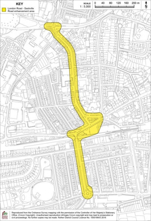
District shopping
centres of Little Common and Sidley
9.184 Access to shops and services, particularly those that meet day-to-day needs, is a vital aspect of sustainable development. These centres provide a focus for communities, are a source of jobs and help reduce the need to travel, especially by car. Government policy for sustainable communities gives emphasis to sustaining and enhancing the vitality and viability of these centres. In line with the Core Strategy, the hierarchy of shopping centres is identified and, in relation to Bexhill, 'district centres' are identified at Little Common and Sidley.
9.185 Little Common District Centre appears to be functioning well; there is a low vacancy rate within the centre and there is a good mix of retail and professional services such as banks and estate agents, although the former Co-op building remains vacant. There is a small supermarket within the centre. There are some pockets in the centre which experience high turnover of occupants but generally the traders have been in Little Common for a long time.
(2) 9.186 Sidley District Centre has experienced a challenging time in recent years. Although the vacancy rate is not high, there has been a high turnover of occupants within the centre and there is a very high proportion of takeaways. Sidley is one of the most deprived areas within the District and for this small geographical area, it represents an over-concentration of such uses which could negatively impact on the health and well-being of the local population. Local consultation highlights concerns by residents of the numbers of takeaways in Sidley and the impact on its function to perform as a shopping area in the daytime and the impact of external shutters on the shop facades.
(1) 9.187 Given the high concentration of takeaways (defined as Use Class A5 in the Use Classes Order) in Sidley District Centre and the known deprivation issues in the locality, it is considered that the further concentration of takeaways should be resisted.
Policy BEX17: Little Common and Sidley District Centres
Little Common and Sidley District Centres are defined on the Policies Map, and will be the primary focus for retail and other town centre uses.
Within these centres, as defined on the Policies Map, the loss of significant existing ground floor retail floorspace falling within Use Class A1 will be resisted. Planning permission will be granted for the introduction of new shops and the expansion or refurbishment of existing premises, subject to compatibility with other Local Plan policies.
Within Sidley District Centre, further concentration of takeaway uses (within Use Class A5) will be resisted.
Figure 36: Policy BEX17 Little Common District Centre
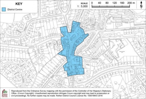
Figure 37: Policy BEX17 Sidley District Centre
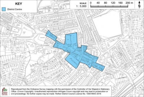
Policies Map Inset Map 1:
Bexhill
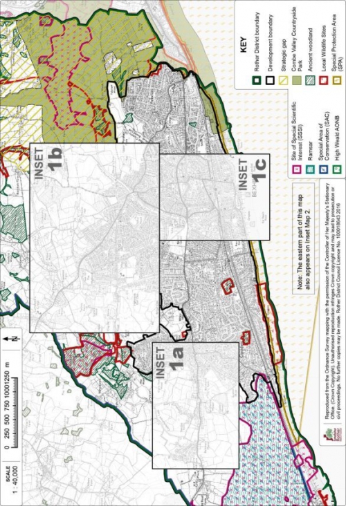
Policies Map Inset Map 1a:
Bexhill West
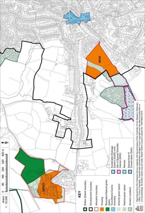
Policies Map Inset Map 1b:
Bexhill North
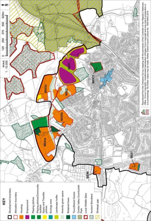
Policies Map Inset Map 1c:
Bexhill Central
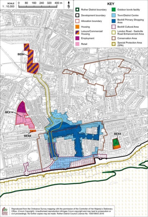
(1) 10. Hastings Fringes
Context
10.1 The built-up area of Hastings extends, for the most part, up to the administrative boundary, with a number of its peripheral areas extending over into Rother district. The 'Hastings Fringes' is defined in the Core Strategy as those areas within Rother district that are contiguous with the built up area of Hastings. This encompasses areas along Westfield Lane, Beaneys Lane, Woodlands Way, Parkwood Road, Sandhurst Gardens, Stonestile Lane, Chowns Hill, Ivyhouse Lane, Rock Lane and Batchelors Bump.
10.2 A large proportion of the Hastings Fringes are heavily constrained, principally by the High Weald Area of Outstanding Natural Beauty (AONB) designation and, although physically close to a large service centre (in Hastings Borough), many peripheral areas relate far more to their rural surroundings than to the town and are important to its setting. It is also considered important to retain effective countryside gaps between Hastings/St Leonards and Battle, Bexhill, Crowhurst and Fairlight, as set out in the Environment Chapter by Policy DEN3 – Strategic Gaps, to retain their distinct identities.
(1) 10.3 The Gap between Bexhill and Hastings/St Leonards is also seen as a valuable 'green lung' between the towns. Here, an area of approximately 600 hectares is promoted for leisure, relaxation, sport, ecology and education in the context of the Combe Valley Countryside Park. The Park will provide access to the countryside, whilst balancing the need to proactively manage wildlife habitats with the scope for a wide range of informal and formal leisure uses. Central to the Park is the restoration of the former land-raise operation for waste disposal. Although that operation has ceased, there is continued use of land within this locality for waste collection, in line with the waste planning authorities' Waste and Minerals Plan. It is important that such operations are contained and do not conflict with the aims and objectives of the Combe Valley Countryside Park.
10.4 Also in relation to green space, an area north of Hastings either side of the railway as it approaches The Ridge, with Rock Lane to the east and Ivyhouse Lane to the west, is identified for a joint "urban fringe management" approach. This area lies within the High Weald AONB, but its quality could be improved. Moreover, it could provide a valuable amenity for the surrounding areas, especially if access opportunities were increased.
10.5 Construction of the Queensway Gateway Road, which runs from Queensway (A2690) to Sedlescombe Road North (A21), which began in October 2016 and is due to open in winter 2018/2019, should improve highway capacity along The Ridge, particularly in the Baldslow area, and hence improve connectivity between the A21, St Leonards and Bexhill.
Development Provisions
10.6 The Core Strategy identifies a target of 100-250 dwellings up to 2028, as well as at least 3,000sqm of business floorspace, within the Hastings Fringes. As at 1st April 2018, there is a remaining minimum requirement of 13 dwellings to 2028, taking into account completions, planning permissions and windfall sites.
10.7 The areas which are considered suitable for further residential development along the Fringes are limited. A number of greenfield sites on the north-eastern part of the Fringes have been discounted, largely due to negative impacts on the High Weald AONB landscape. However, there is one opportunity that has been identified for residential development. This brownfield site is located on Woodlands Way and is an existing underused manufacturing building which is located in the development boundary. The older style format of the buildings has deterred other employment occupiers from utilising the site and it is acknowledged that the buildings would prove difficult to convert to alternative business users. As such, given its location and that it is surrounded on all four sides by existing housing, it is included for residential development as set out below. Its development would achieve the minimum housing requirement for Hastings Fringes.
10.8 In terms of employment floorspace, as at 1st April 2018, there is one site with outline planning permission at Burgess Road on the Ivyhouse Lane Industrial Estate for 4,601sqm of B1/B2/B8 employment floorspace alongside a new access road between Burgess Road and Haywood Way. The scheme also ensures the long-term management of the woodland to the north of the site, as well as a new public footpath to be provided from Haywood Way across the valley to Rock Lane, in accordance with the urban fringe management approach noted above and elaborated upon below in Policy HAS4. While the implementation of this permission would meet the minimum target of 3,000sqm of employment floorspace for Hastings Fringes, it is supplemented by a further, nearby site off Ivyhouse Lane that will link with an allocated employment site in Hastings Borough.
Development boundary
10.9 The development boundaries along the Fringes comprise of several areas which contain development along Westfield Lane, Woodlands Way, Parkwood Road, Ivyhouse Lane and Rock Lane. The development boundary is drawn around those built up areas that are well consolidated and relate to the main confines of Hastings. However, the open areas adjacent to the Fringes which visually relate to the open countryside rather than the urban areas of Hastings are excluded as their inclusion would harm the structure, form and character of the countryside. Also, these areas tend to have relatively poor accessibility to local services and relate more to the rural setting of Hastings, even though close to the urban edge.
10.10 The Development Boundary is detailed on the Policies Map Inset Map at the end of this section.
Site Allocation:
Combe Valley Countryside Park
10.11 The Countryside Park covers an area of 600ha within Rother District and Hastings Borough. The northern area comprises the Combe Haven valley Site of Special Scientific Interest (SSSI) and reed beds. The southern part adjoining Bulverhythe contains a landfill site, a waste transfer station, a household waste site and a waste water treatment works. It contains a significant amount of archaeological sites.
10.12 The Park was established jointly by Rother District Council, Hastings Borough Council and East Sussex County Council. In 2015, a Community Interest Company (CIC) with a board of directors including representatives of the three councils, local businesses, landowners and stakeholders, including the Friends of Combe Valley Foundation which was established by local residents. The Park was set up to facilitate the restoration of the landfill areas and to manage to the countryside between the towns.
10.13 The Countryside Park is a long term project which addresses the deficiency in green space for the towns of Hastings and Bexhill. The Park serves an immediate population of 22,500 people and an overall urban population of 130,000 persons. It provides an opportunity for active recreation, walking, cycling, equestrianism, bird watching, nature studies, etc. New and improved public access routes will enable the whole community to gain safe and controlled access to the Countryside Park. It is envisaged that these will help to generate new commercial opportunities for local landowners and businesses to enhance the local economy.
10.14 The newly established CIC oversees the strategic direction of the Park and is currently focusing on promoting the Park and encouraging and improving access. The CIC aims "to create and manage a high quality sustainable, attractive, accessible and multi-functional landscape rich in wildlife to serve the recreational, economic and health and well-being needs of residents and visitors[66]". Their first project has been the construction of a Discovery Centre at Bulverhythe to provide a café and information point for the Park.
10.15 The principle of the Countryside Park Project is enshrined in Core Strategy Policy HF1. This sets out the strategic importance of the Park in the context of an overall shared approach to future prosperity for Hastings and Bexhill, as well as having a key role in maintaining the open gap between Bexhill and Hastings and clearly a very significant role in providing a substantial leisure/amenity resource for the large urban population in the Hastings/Bexhill area.
10.16 As the Park becomes established, it is also expected to reduce the pressure on more sensitive leisure destinations in the area and will specifically help to manage the recreational pressure on more sensitive habitats, most notably the international Natura 2000 designations to the south-east and south-west of the District.
10.17 Core Strategy Policy HF1 defines the boundary of the Countryside Park in broad terms, which is refined in this Local Plan, as shown on the relevant Inset Maps. This largely reflects the boundary defined in the Rother District Local Plan (2006), alongside minor amendments to dovetail with the actual alignment of the new Combe Valley Way and the recently permitted development at North East Bexhill.
10.18 The main elements of the policy relate to the importance of the area as a recreational and amenity resource, including cycling and walking routes, for the residents of both Rother and Hastings, the conservation and management and enhancement of the national and local nature designations within the Park, including the Site of Special Scientific Interest (SSSI) and the Local Wildlife Site (LWS). The Countryside Park also forms part of the identified Strategic Gap between Bexhill and Hastings as set out in Policy DEN3 and, hence, the policy dovetails with that.
(5) Policy HAS1: Combe Valley Countryside Park
Land between Bexhill and St. Leonards, from Galley Hill in the south to Crowhurst to the north, as shown on the Policies Map, is allocated as the Combe Valley Countryside Park.
Within the Countryside Park area, proposals will only be acceptable where they:
- are consistent with the establishment and maintenance of the area as a key recreational and amenity resource for Bexhill and Hastings and their wider catchment;
- provide for the proper conservation and, where appropriate, management of the Site of Special Scientific Interest and the Local Wildlife Site within it and creates net gains to biodiversity within the Park, where practicable; and
- accord with the provisions set out in Policy DEN3 regarding Strategic Gaps.
10.19 The Detail Map below shows the area allocated as Combe Valley Countryside Park.
Figure 38: Policy HAS1
Detail Map
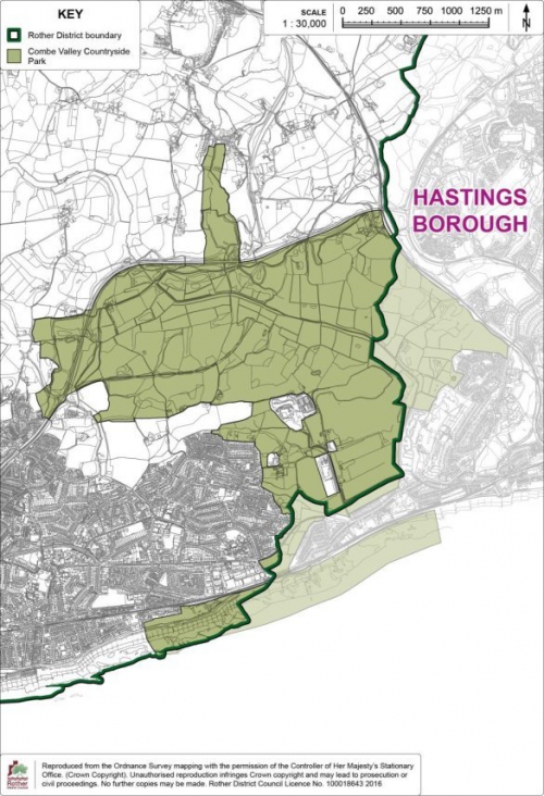
Site Allocation: Land at Michael Tyler Furniture, Woodlands Way, Hastings
10.20 This brownfield site is located within the development boundary on the northern side of The Ridge at Michael Tyler Furniture, Woodlands Way. There is relatively low density housing to the south, west and north of the site, with further residential development currently under construction to the east.
10.21 The site is an existing employment site and comprises of three existing industrial buildings which are only partly in use and have been for some years. The older style format of the buildings has deterred other employment occupiers from utilising the site for alternative business uses. The owners have marketed the site for a number of years to let out the vacant space but have received little interest. Policy DEC3 – 'Existing Employment Sites and Premises' allows for the change of use of employment sites where there is no prospect of their continued use.
10.22 The site is adjacent to the High Weald Area of Outstanding Natural Beauty (AONB). Residential dwellings to the north are few and set within large plots, thereby representing low density development and maintaining a rural context. Any development would need to be mindful of the AONB countryside to the north and appropriate landscape buffers would need to be incorporated within any potential scheme to respect wider views from the north. Care should also be taken to respect the relationship with residential properties on the periphery of the site.
10.23 The general topography falls somewhat to the north-west. To provide level areas for the existing buildings/parking there has been some cut-and-fill. There is a bank down to the adjacent bungalows to the north, and a bank and retaining wall down from the adjacent site to the east, around 2.0m high. Parts of the site are located within areas of surface water drainage issues. The site may contain Japanese Knotweed.
10.24 There have been incremental residential developments off Woodlands Way which, individually, have not provided children's play space. Additional residential development would assist in providing a play space for a large residential area where there is a present lack of provision.
10.25 Additional reinforcement of the sewerage network will be required to serve the development and therefore, the developer will need to work with Southern Water to ensure appropriate sewerage infrastructure is provided to serve the development prior to its occupation.
10.26 This site yields some 40 dwellings which, together with what has already been permitted, achieves, and exceeds, the outstanding requirement to meet the minimum target of 100 dwellings along the Fringes.
(2) Policy HAS2: Land at Michael Tyler Furniture, Woodlands Way, Hastings
Land at Michael Tyler Furniture, Woodlands Way, Hastings, as shown on the Policies Map, is allocated for housing purposes. Proposals will be permitted where:
- some 40 dwellings are provided, of which 30% are affordable;
- suitable provision is made for children's play space in the form of a Local Area for Play (LAP);
- development does not intrude into views from the Area of Outstanding Natural Beauty to the north;
- the tree belt on the west and north of the site is strengthened as indicated on the Detail Map; and
- provision is made for an acceptable connection to the local sewerage system in agreement with the service provider.
10.27 The Detail Map below provides an indicative general layout of the development site.
Figure 39: Policy HAS2 detail map
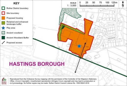
Site Allocation: Land north of A265, Ivyhouse Lane, Hastings
10.28 This north-east sloping and undulating area of vacant scrubland is located adjacent to the existing well-established and fully occupied Ivyhouse Lane industrial estate located within Hastings borough. The existing industrial estate presents a very "raw" edge to the openness of the adjacent High Weald AONB beyond.
10.29 This site is relatively sustainable in the sense that it is located adjacent to existing transport links and relatively close to services within Ore (Hastings). The area is used for informal recreation but has suffered from misuse and a lack of management in recent years. There are long views from Rye Road and Hastings Academy/North Seat on the ridge to the east over the wider valley area. However, this site itself is largely obscured due to topography and woodland cover.
10.30 Having regard to its location, as well as to the fact that Hastings Borough Council has allocated the land between it and Ivyhouse Lane for employment purposes (in Policy HOV11 of the Hastings Development Management Plan), it is considered suitable for future business development.
10.31 This area forms part of a larger open area astride the district/borough boundary with Hastings, with the area abutting the site to the east being identified as the Rock Lane Urban Fringe Management Area (see Policy HAS4).
10.32 Inclusion of a wider area for further modest employment use should provide additional scope to secure improvements to the visual appearance of the area, including the improved landscape management of the valley and create a more acceptable transition between the estate and the High Weald AONB beyond, whilst also providing managed public access across the valley.
10.33 Employment development here, along with recently permitted development of adjacent land across the valley (Land east of Burgess Road - RR/2015/1514/P) could also contribute to securing managed access to the adjacent area of countryside, and the wider area beyond, in accordance with Policy HAS4, notably in relation to the provision of wider footpath links. A financial contribution towards bridge works across the valley will be sought, to complement contributions from other, already permitted, developments in the locality.
10.34 The site has medium/high potential to contain archaeological remains from all periods. Appropriate archaeological assessment will need to be undertaken in support of a planning application for its future development. The findings of the assessment may need to inform the layout and design of the proposal.
10.35 The Public Sewer maps show the lines pass along the eastern boundary of the site, along the area proposed for the public footpath link to the north. Development of this site should not compromise underground infrastructure that passes along the eastern edge of the site (existing outfall). Easements would be required to allow access for future maintenance and upsizing.
10.36 It is estimated that the area in Rother District will accommodate some 1,800sqm of business floorspace, in addition to the 7,000sqm identified within the adjacent allocation within Hastings borough.
(3) Policy HAS3: Land north of A265, Ivyhouse Lane, Hastings
Land east of A265, Ivyhouse Lane, Hastings, as defined on the Policies Map, is allocated for employment purposes. Proposals will be permitted where:
- some 1,800sqm of business floorspace is provided;
- a comprehensive scheme is developed in conjunction with the adjoining employment allocation in Hastings Borough (Policy HOV11 in the Hastings Development Management Plan);
- access is provided off Ivyhouse Lane in Hastings Borough; development does not intrude into views from the Area of Outstanding Natural Beauty to the north; and
- provision is made for enhanced landscape planting, as indicated on the Detail Map, as part of wider landscape management of this part of the wider valley, including new and enhanced green infrastructure of the north of the employment site;
- provision is made for new footpaths across the site to join adjacent land to the east, with extant planning permission for business development[67], with land to the west in Hastings Borough (Policy HOV11 in the Hastings Development Management Plan) and extending northwards alongside the railway line for a potential future footpath link joining the 1066 Country Walk;
- an appropriate financial contribution, as agreed by East Sussex County Council Rights of Way Team, towards off-site bridge works across the valley is provided;
- it does not detract from the principles set out in Policy HAS4 relating to the adjacent Rock Lane Urban Fringe Management Area; and
- development would not compromise underground infrastructure that passes along the eastern edge of the site (existing outfall).
10.37 The Detail Map below provides an indicative general layout of the development site.
Figure 40: Policy HAS3 detail map
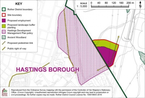
Site Allocation:
Rock Lane Urban Fringe Management Area
10.38 The area of land north of Hastings either side of the railway as it approaches The Ridge, with Rock Lane to the east and Ivyhouse Lane to the west, is identified within the Core Strategy as an area of potential for a joint urban fringe management approach. It lies within the High Weald AONB, but its quality could be improved. Moreover, it could provide a valuable amenity for the surrounding areas, especially if access opportunities were increased.
10.39 There is an opportunity in this location to facilitate the creation of an area of multifunctional green space as a buffer between town and countryside. The area has fallen into poor management, as it is not especially attractive for agricultural use and, due to this neglect, some areas are misused for anti-social behaviour. At the same time the area is well used as informal space, notably for dog walking, and this use could be formalised and greatly enhanced to be of greater benefit for the local population. Recently permitted development sites[68] in the locality have proved a catalyst to formalise access to this area through the creation of a new formal footpath network and the introduction of improved management of woodland and the wider countryside to protect existing nature and biodiversity. This Policy would provide an opportunity to secure the further future management of the area as green space for the local population.
10.40 Therefore, development in this locality, including that under Policy HAS3, should be viewed in the context of a wider area-based initiative to improve the landscape quality and formal access to the countryside to establish an appropriate transition area between the built-up area of Hastings and the High Weald AONB countryside.
(3) Policy HAS4: Rock Lane Urban Fringe Management Area
Land between Ivyhouse Lane and Rock Lane, as shown on the Policies Map, is allocated as the Rock Lane Urban Fringe Management Area.
Development that would harm the openness of this Urban Fringe Management Area or its significance and value to the local community will not be permitted.
Landscape management proposals which improve the landscape character, green infrastructure, biodiversity interest or formal access opportunities within this area will be supported, subject to compatibility with other policies of the Plan.
Development in the vicinity of the Urban Fringe Management Area should support the principles of its designation.
10.41 The Detail Map below provides an indicative general layout of the development site.
Figure 41: Policy HAS4
detail map
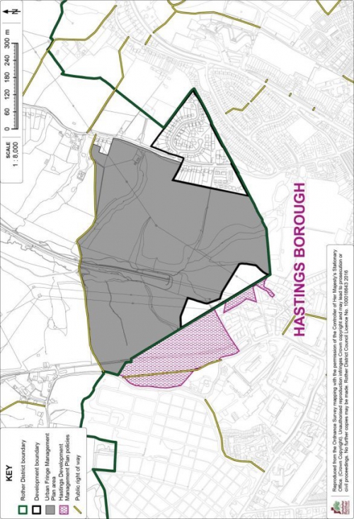
Policy Map Inset Map 2:
Combe Valley Countryside Park
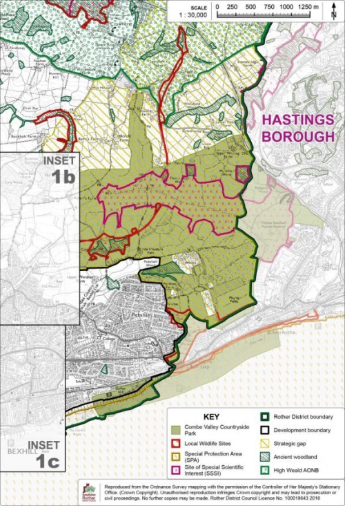
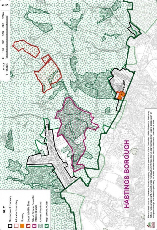
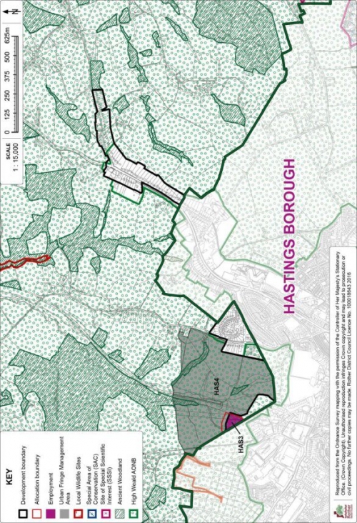
11. Villages with
site allocations
(1) Beckley Four Oaks
11.1 Beckley Four Oaks is linear in form, straddling the B2088 Main Street. The village is situated some 1.2 miles east of Northiam and 1.5 miles west of Peasmarsh, both offer a wider range of goods and services. It is characterised by surrounding pasture land, its weatherboard houses and ribbon development along a historic route way. Its development is unusual in that there are a number of undeveloped "gaps" along Main Street, in between clusters of houses. These gaps have the effect of allowing views of the countryside into the village, and are important in defining its character and setting within the High Weald AONB.
11.2 Beckley Four Oaks and the surrounding countryside lie within the High Weald AONB, in the Lower Rother Valley. It is a landscape of gently undulating, farmed countryside with large blocks of mixed woodland particularly to the south of the village, some of which are designated as ancient woodland. Large parts of the village are bordered to the north and south by the Rother, Brede and Tillingham Woods Biodiversity Opportunity Area, where opportunities for habitat management and restoration have been identified. While no parts of the core of the village are within Flood Zones 2 or 3, there are areas at risk of surface water flooding.
11.3 Archaeological Notification Areas identify the medieval and post-medieval hamlets of Beckley (at the western end of the village) and Four Oaks (at the eastern end of the village). There are also a number of listed buildings within the village.
11.4 The village is reasonably well served by local services with a primary school, recreation ground and village hall all actively used. The Open Space, Sport and Recreation Study suggests a shortfall in children's play space at the east of the village. There is a regular but limited bus service to Northiam, Rye and Hastings.
Development Provisions and Development Boundary
11.5 Having regard to the
environmental and historical constraints and the limited
range of services offered, the Local Plan Core Strategy has
set a target of 20 additional dwellings on new sites in the
village up to 2028. This remains the target.
11.6 In considering suitable areas for development, many sites on the edge of the village are discounted due to their landscape impact on the wider AONB countryside. Areas to the north of the B2088 are particularly exposed and less suited for development. The filling in of any of the open gaps along Main Street would cause harm to the character and setting of the village and would be resisted. The location of listed buildings, surface water flooding and impact on historic field boundaries are further constraints in a number of locations.
11.7 However, two opportunities have been identified for residential development. One makes use of a brownfield site and adjoining land at Hobbs Lane on the northern edge of the village and the other involves a small extension to an existing residential estate at Buddens Green.
11.8 The retention of a tightly drawn development boundary, which prevents encroachment into the countryside and protects the rural setting of the village, is necessary. The boundary largely follows the established built form of the village together with the two allocations, preventing further ribbon development and the extension of the village along the main roads of the B2088 and A268 to the west, north and south, and along other minor roads including Hobbs Lane to the north-east and Kings Bank Lane to the south. The development boundary also generally follows existing residential curtilages to prevent inappropriate encroachment into the rural landscape of fields and woodland that surround the village. The numerous open gaps along Main Street are also excluded from the development boundary.
11.9 The Development Boundary and site allocations are detailed on the Policies Map Inset Map at the end of this section.
Site Allocation: Land east of Hobbs Lane, Beckley Four Oaks
11.10 The site is on the northern edge of the village on the eastern side of Hobbs Lane. It comprises an existing brownfield site known as the Former Manroy Engineering Works and a smaller area of farmland which creates a more logical development area. The former employment site has been vacant for a number of years and it is accepted that its particular nature and location means that there is no reasonable prospect of its continued use for employment purposes. Development of the brownfield land offers the opportunity to significantly improve the appearance of the site, particularly where it is viewed from Hobbs Lane.
11.11 The developable area is some 0.67 hectares and it is anticipated that 14 dwellings will be accommodated, of which 40% will be affordable. A financial contribution towards off-site children's play provision is required, in lieu of on-site provision.
11.12 The site is bordered to the north and east by open countryside. To minimise visual intrusion and for the benefit of biodiversity, trees/ hedgerow of native species should be planted along the eastern boundary, and the existing tree belt on the northern boundary should be retained and enhanced with additional planting.
11.13 The pedestrian footway alongside Hobbs Lane currently extends only to Coombs Close, and in order to integrate the new development with the existing village and for highway safety reasons, a new footway will be required along Hobbs Lane to reach the northern boundary of the site. The Highway Authority has indicated that the width of the public highway is sufficient to accommodate a footway in this location.
11.14 The former industrial use of part of the site could have led to ground contamination, and appropriate surveys will need to be undertaken as part of the planning application process, with the need to employ appropriate measures to mitigate any such contamination.
11.15 The site is bordered to the south by residential development alongside Hobbs Lane and Coombs Close. Bungalows on the northern side of Coombs Close have a clear view across the site and the amenity of existing and future residents must be protected in designing an appropriate scheme. Regard must also be had to the relationship with the small cluster of commercial/ industrial uses on the opposite side of Hobbs Lane.
(1) Policy BEC1: Land east of Hobbs Lane, Beckley Four Oaks
Land east of Hobbs Lane, as shown on the Policies Map, is allocated for housing. Proposals will be permitted where:
- some 14dwellings are provided, of which 40% are affordable;
- access is from Hobbs Lane to the satisfaction of the Highway Authority;
- screen tree and hedgerow planting employing native species is provided on the eastern boundary of the site, and the tree belt on the northern boundary is retained and enhanced with additional planting;
- a new footway alongside Hobbs Lane is provided to link the new development to the existing Hobbs Lane footway as indicated on the Detail Map;
- care is taken to respect the amenity value of adjoining residential properties on the southern boundary; and
- developer's contributions are made towards open space, specifically play provision for children and young people, in lieu of on-site provision.
11.16 The Detail Map below provides an indicative general layout of the development site.
Figure 42: Policy BEC1
Detail Map
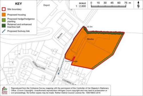
Site Allocation: Land south of Buddens Green, Beckley Four Oaks
(1) 11.17 The site is centrally located within the village and close to existing services. It comprises undeveloped land adjoining the existing Buddens Green estate, which slopes gently up from north to south.
(1) 11.18 The developable area is some 0.3 hectares and it is anticipated that 6 dwellings will be provided, of which 40% will be affordable. Access to the site will be via Buddens Green.
(1) 11.19 The site is largely enclosed by the existing residential estate to the north and a mature tree belt to the south and west, limiting the visual impact on the wider AONB landscape. The layout of the residential scheme will need to be carefully designed to take account of the shadowing effect of the adjacent trees.
(1) 11.20 A new hedgerow of native species will be required on the western boundary of the site for screening purposes and for the benefit of biodiversity.
(1) Policy BEC2: Land south of Buddens Green, Beckley Four Oaks
Land south of Buddens Green, as shown on the Policies Map, is allocated for housing. Proposals will be permitted where:
- some 6 dwellings are provided, of which 40% are affordable;
- access is provided via Buddens Green;
- existing trees on the southern and eastern boundaries are retained and a new hedgerow of native species is provided on the south-western boundary, as indicated on the Detail Map.
11.21 The Detail Map below provides an indicative general layout of the development site.
Figure 43: Policy BEC2
Detail Map
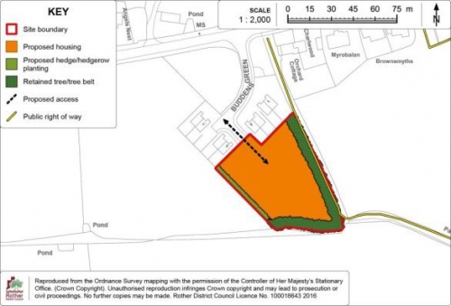
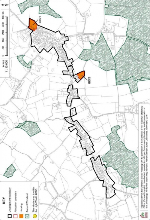
Broad Oak
11.22 Broad Oak is located within the High Weald Area of Outstanding Natural Beauty, approximately 8 miles north of Hastings and 4 miles south of Northiam. It is situated on an east to west running ridge, which rises up between the River Tillingham to the north and the River Brede to the south. The B2089 Battle to Rye road bisects the village east to west along the ridge, while the A28 runs north to south through the village.
11.23 Much of the village has developed over the last 50 years, largely north of the B2089 and away from the more exposed land to the south. The original form of the settlement comprised of frontage development along the roads that radiate out from the centre of the village, but over time, small estates have been developed.
11.24 Broad Oak is closely linked to the neighbouring villages of Cackle Street and Brede to the south, and the three of them form a relatively compact cluster of settlements along the A28.
11.25 Broad Oak has a good range of local services to meet the basic needs of the community including a primary school, shop, recreation ground and church. The community hall is located in nearby Cackle Street. There is a regular bus service to Hastings, Northiam and Tenterden. The Council's Open Space, Sport and Recreation Study identified a shortfall of allotment provision in the village.
Development Provisions and Development Boundary
11.26 Given the size of the village, the range of services available and consideration of the constraints in the locality, the Local Plan Core Strategy set a target of 50 dwellings on new sites in the village up to 2028. This remains the requirement.
11.27 In considering the scope for development, there are landscape constraints to further development south and east of the village, where there are outstanding views across the Brede river valley and out towards the open rolling countryside to the east. Immediately north of the village is extensive woodland, much of which is designated as ancient woodland, and part of which is also designated as a Local Wildlife Site. The village does not offer an abundance of infill or back land development opportunities and there are access constraints in a number of locations.
11.28 Two locations have been identified to meet the village's housing target; one site off the A28 in the north-west of the village and a second site to the south of Chitcombe Road. Both sites are well-related to the village core, providing good access to services, and are relatively well-contained within the landscape.
11.29 The larger site, land west of the A28, makes good use of land, utilising the residential curtilages of 3 properties together with adjoining land to the rear. It is of sufficient size to include new allotments and an area of retained woodland, together with 40 dwellings. It provides direct access to the public right of way network and an appropriate buffer to adjoining ancient woodland. The smaller site, land at the Rainbow Trout public house, would facilitate the use of part of the pub garden, together with vacant land to the rear, for the construction of some 20 dwellings, while also retaining the public house and necessary facilities including car parking and garden area. The retention and enhancement of existing boundary planting will protect historic field boundaries.
11.30 The two allocated sites for development will provide for some 60 dwellings, thereby meeting and slightly exceeding the Core Strategy housing target for the village.
11.31 The Development Boundary tightly encloses the built form of the village, excluding the long rear gardens of a number of properties to prevent inappropriate back land development. Two extensions have been made to reflect the new allocations and also to include the recently constructed residential development at Ostlers Field in the south of the village.
11.32 The Development Boundary and site allocations are detailed on the Policies Map Inset Map at the end of this section.
Site Allocation: Land west of the A28, Northiam Road, Broad Oak
11.33 The site comprises three residential properties fronting the A28 and a narrow strip of open land with boundary trees behind, together with an open field to the rear. Access would be gained from the A28 via one of the residential properties although the precise access point is to be determined and will be subject to further investigation including a Road Safety Audit at planning application stage. The developable area is some 1.9 hectares and it is anticipated that some 40 dwellings will be provided, of which 40% will be affordable, together with an area of public open space comprising retained woodland and allotments.
11.34 Little Austen's Wood, an area of designated ancient woodland, borders the site to the west. An appropriate buffer zone of semi-natural habitat, at least 15 metres wide, will need to be retained between the edge of development and the woodland, in accordance with Natural England's guidance[69]. Residential gardens must not extend into the buffer zone and the buffer should be managed appropriately to ensure it offers protection to the woodland and benefits to biodiversity.
11.35 A strip of land in the south-eastern corner of the site, well contained by trees, is allocated as an area for allotments to serve the village. SuDS may also be required in this area to manage surface water flood risk.
11.36 Existing hedgerows/ tree belts in the central part of the site and on the south-western boundary, together with a small area of woodland, should be retained as far as possible and enhanced for landscape and biodiversity reasons, with any additional planting comprising of native species. The site layout will need to be informed by a tree survey to take account of potential impacts on trees as well as the effect of over-shading.
11.37 An existing public footpath along the site's western boundary will need to be retained and a link provided to it through the development. Accessibility would be further improved by the provision of a new pedestrian link to the south via the Tillingham View estate. This should be investigated further, as should parking provision to serve the allotments, although a small layby may suffice.
11.38 Additional reinforcement of the sewerage network will be required to serve the development and therefore, the developer will need to work with Southern Water to ensure necessary infrastructure is provided prior to occupation.
11.39 The site has a medium potential to contain prehistoric, Roman and medieval remains. An archaeological assessment would be a planning application requirement.
(1) Policy BRO1: Land west of the A28, Northiam Road, Broad Oak
Land west of the A28, Northiam Road, as shown on the Policies Map, is allocated for a comprehensive scheme comprising residential development and public open space. Proposals will be permitted where:
- some 40 dwellings (net) are provided within the identified residential area as indicated on the Detail Map, of which 40% are affordable;
- a new access is provided off the A28 Northiam Road to the east, to the satisfaction of the Highway Authority;
- allotments are provided within the area indicated on the Detail Mapand the trees and hedgerows in this area are retained, together with the adjacent area of retained woodland;
- existing trees and hedgerows on the site boundaries are retained, and new screen tree and hedgerow planting employing native species is provided on the boundaries indicated on the Detail Map;
- provision is made for the retention and future management of a buffer zone of semi-natural habitat, at least 15 metres wide (which does not include residential gardens), on the north-western boundary, between the edge of development and the ancient woodland; and
- provision is made for an acceptable connection to the local sewerage system, in agreement with the service provider.
11.40 The Detail Map below provides an indicative general layout of the development site.
Figure 44: Policy BRO1
Detail Map
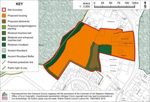
Site Allocation: Land at the Rainbow Trout Public House, Broad Oak
11.41 The site comprises the public house, which has recently closed, its large garden and part of an open field to the south. The public house, together with sufficient space for necessary facilities including a car parking area and garden, is to be retained in the north-western part of the site. The eastern part of the former pub garden, together with land to the south which links to the recent Ostlers Field development, offers an opportunity for residential redevelopment. It is anticipated that 20 dwellings will be provided, of which 40% will be affordable. The site is visually contained in the wider landscape and is centrally located in the village with good access to local services and amenities.
11.42 Access could be gained either via Ostlers Field to the west or direct from Chitcombe Road via a new access point to which the Highway Authority has agreed "in principle", subject to appropriate visibility being achieved through the remodelling of an existing layby, and the provision of a footway along the site frontage. Access from the A28 east of the site would not be supported due to the significant earthworks and tree removal which would be necessary.
11.43 In the event of the main vehicular access being from Ostlers Field, an additional pedestrian access to serve the new residential development should be provided on Chitcombe Road, in the interests of permeability and encouraging sustainable travel.
11.44 Existing planting on the site boundaries and in the central part of the site should be retained and enhanced for landscape and biodiversity reasons and to enhance historic field boundaries. A new landscape buffer will be required on the southern boundary. All new planting should utilise native species.
11.45 A sewer line passes through the southern part of the site. Its exact location, size and depth must be determined by any future developer on site and this will need to be taken into account in planning the site layout.
11.46 The site has a medium potential to contain prehistoric, Roman and medieval remains. An archaeological assessment would be a planning application requirement.
(2) Policy BRO2: Land at the Rainbow Trout public house, Broad Oak
Land at the Rainbow Trout public house, as shown on the Policies Map, is allocated for a comprehensive scheme comprising a public house and residential development. Proposals will be permitted where:
- the public house is retained, together with necessary facilities and features, including car parking and garden area;
- some 20 dwellings are provided in the proposed residential area as indicated on the Detail Map, of which 40% are affordable;
- a new vehicular access to serve the residential area is achieved to the satisfaction of the Highway Authority, either from Ostlers Field or direct from Chitcombe Road;
- a new pedestrian access is provided to link the residential area with Chitcombe Road, together with necessary highway infrastructure including a footway and crossing point, as advised by the Highway Authority; and
- existing trees and hedgerow planting on the site boundaries and in the central part of the site, as indicated on the Detail Map, are retained and enhanced and a new hedgerow employing native species is provided on the southern boundary of the site.
11.47 The Detail Map below provides an indicative general layout of the development site.
(1)
Figure 45: Policy BRO2
Detail Map
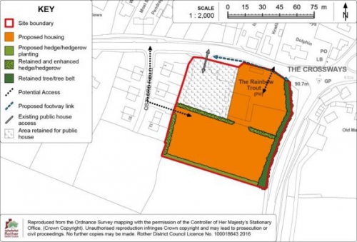
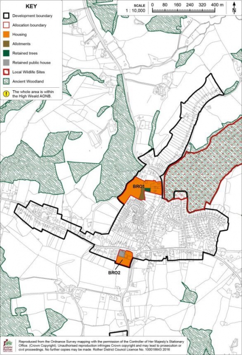
Camber
11.48 Camber is a coastal village in the eastern part of the district, close to the border with Kent. It has a small population but its large sandy beach, Camber Sands, can attract significant numbers of seasonal weekend and day tripper visitors. These population fluctuations have a significant impact on the role of the village and its ability to meet the service requirements of both residents and visitors successfully.
11.49 Camber is situated on a low lying area of coastal levels, with a relatively unpopulated surrounding hinterland. The settlement is bounded to the north, east and south by Sites of Special Scientific Interest (SSSI), which to the north and south-east also form part of the internationally protected Dungeness, Romney Marsh & Rye Bay Special Protection Area (SPA) and Ramsar site (wetland of international importance). Two distinct sections of sand dunes lie south of the village and also form part of the SSSI designation.
11.50 Most of the village falls within Flood Zone 3, as identified by the Environment Agency, although it is largely defended from flooding by its tall sand dunes.
11.51 Camber is relatively well served by local amenities, with shops, a village hall, pubs and restaurants, but it lacks a primary school. A branch doctor's surgery is provided at Camber Memorial Hall. Residents would generally look to Rye, as the main service centre for the eastern half of district, for other needs.
11.52 Camber is one of the more deprived communities in Rother, being geographically and economically isolated and dependent on a highly seasonal tourist trade.The regeneration of Camber is identified in the Corporate Plan as one of the Council's long-term executive priorities.
11.53 Camber is served by bus but not by rail, the closest station is at Rye. There is a single road into the village from the eastern and western directions. Congestion can be a particular issue during busy summer periods.
11.54 Camber and its surroundings are within the area covered by the Dungeness Complex Sustainable Access and Recreation Management Strategy (SARMS), which seeks to manage recreational pressure and disturbance of the internationally protected nature conservation sites (as further detailed in the Environment Biodiversity and Green Space section of this document). Particular recommendations of the SARMS in Camber include: monitoring numbers of both birds and visitors; consideration of access restrictions to sensitive areas; and improvements to signage and interpretation boards. It also promotes implementation of a works programme to manage access to the dunes.
Development Provisions and Development Boundary
11.55 Given the size of the village, the range of services available and, particularly, the environmental constraints of flood risk and nature conservation designations in the locality, the Local Plan Core Strategy set a modest target of 20 additional new dwellings on brownfield sites in the village up to 2028. However, for the reasons set out, it has only been possible to identify an allocation for 10 dwellings. Although this is somewhat less than the Core Strategy target, the constraints on expansion of the village are so substantial that there are no reasonable alternatives outside the built up area. There may, however, be further redevelopment opportunities within the village.
11.56 The adopted Camber Village Supplementary Planning Document (SPD) (2014) provides the current planning policy framework to steer development and change in the village.
11.57 There are very limited sites with development opportunity in Camber. Outward expansion of the village is prevented by the presence of nationally and internationally protected areas in all directions except the immediate west. Greenfield sites are discounted because they would be unlikely to pass the "exception test", necessary for sites in Flood Zone 3. Other potential sites have access constraints.
11.58 A significant proportion of the village footprint is accounted for by holiday parks, the residential redevelopment of which would conflict with Policies EC3 and EC6 of the Core Strategy, which seek to retain employment land and tourism accommodation in such use.
11.59 Two brownfield sites in the south central part of the village have been identified for redevelopment: land at the Former Putting Green and land at the Central Car Park. The allocations effectively reaffirm the principles advocated by the SPD. Both sites have good access to the village's main amenities. However, for flood risk reasons, permanent residential accommodation is not appropriate at the Central Car Park and it is anticipated that development at this site would include commercial and operational uses (including tourist accommodation), and an improved public realm.
11.60 The development boundary generally tightly encloses the existing built form of the village, preventing encroachment into the adjoining designated sites and the development of greenfield sites within Flood Zone 3.
(1) 11.61 The Development Boundary and site allocations are detailed on the Policies Map Inset Map at the end of this section.
Site Allocation: Land at the Former Putting Green, Old Lydd Road, Camber
11.62 The site is centrally located in the southern part of the village. It is a raised, rectangular shaped plot of 0.2 hectares, formerly used as a putting green but now cleared and in use as a pay and display car park for 70 cars.
11.63 There is a mixture of residential and commercial uses on Old Lydd Road but it is proposed the redevelopment of this site should be wholly residential. This will complement the commercial uses proposed nearby at the other allocation site at the Central Car Park. It is anticipated that 10 dwellings will be provided.
11.64 The site lies within Flood Zone 2 and a Flood Risk Assessment (FRA) will need to accompany the planning application. Sleeping accommodation will need to be restricted to the first floor level and above, but general living accommodation could be acceptable on the ground floor, subject to the FRA.
11.65 Built development should be focused on the southern section of the site to avoid overlooking and a reduction in light for the adjacent residential development to the north and west.
11.66 A new vehicular access should be provided from Marchants Drive to the east and/or the private track to the west, in consultation with the Highway Authority, and a new pedestrian footway should be provided along the site's southern boundary on Old Lydd Road.
11.67 In view of the proximity of the site to the international wildlife designations and the potential for additional recreational impacts, the development should contribute to achieving the SARMS strategy, which may also include financial contributions.
11.68 The sand dunes opposite the site are significant both as major landscape features and as part of the Dungeness, Romney Marsh & Rye Bay SSSI. The protection and management of the dunes are key landscape and ecological objectives of the adopted SPD. A planning application for the site's redevelopment will also need to demonstrate that there will be no adverse effect on the dunes.
11.69 Historically, the site was used as a school, and is of local archaeological interest. A heritage statement which considers any archaeological impacts will need to accompany the planning application in accordance with the Council's validation requirements.
11.70 The site's redevelopment will result in a small reduction in public car parking capacity in the village. However, there is a significant amount of alternative car parking provision in Camber, and the benefits of redeveloping this prominent site, including in terms of it making a valuable contribution to the village's housing supply and improving the street scene, are considered to outweigh this loss. It is noted that any additional demand for car parking in the winter months could be adequately accommodated elsewhere in the village, including at the Central Car Park, in the event of the redevelopment of the former putting green site. It is not proposed to utilise the western car park in the winter months (which would raise potential nature conservation issues).
(3) Policy CAM1: Land at the Former Putting Green Site, Old Lydd Road, Camber
Land at the former Putting Green site, as shown on the Policies Map, is allocated for residential development. Proposals will be permitted where:
- some 10 dwellings are provided, of which 40% are affordable;
- in relation to the form of development, regard is given to the Council's adopted Camber Village Supplementary Planning Document (2014);
- a site specific flood risk assessment has been undertaken which demonstrates that the development will be safe for its lifetime, taking account of the vulnerability of its users, without increasing flood risk elsewhere, and where possible, will reduce flood risk overall;
- a new access is achieved as indicated on the Detail Map;
- a new footway alongside the site's southern boundary is provided to link the new development to the existing Marchants Drive footway, as indicated on the Detail Map; and
- there is no adverse impact on the adjacent Dungeness, Romney Marsh and Rye Bay SSSI; and
- the development contributes towards the implementation of the Dungeness Complex Sustainable Access and Recreation Management Strategy (SARMS).
11.71 The Detail Map below provides an indicative general layout of the development site.
Figure 46: Policy CAM1
Detail Map
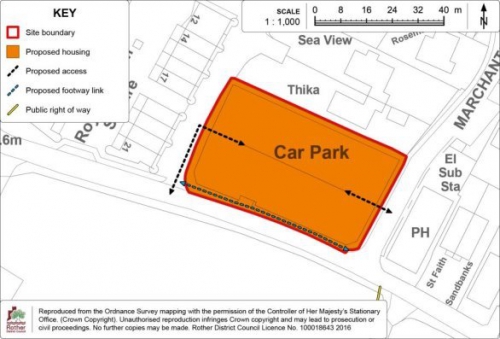
Site Allocation: Land at the Central Car Park, Old Lydd Road, Camber
11.72 The central car park occupies a level plot of 0.6 hectares, in a central position on the southern edge of the village and is within walking distance of the main amenities. It represents the centre of visitor activity for the village, with a large pay and display car park with 170 spaces next to the beach, and 4 buildings accommodating uses including the coastal management office, public conveniences and tourist shops.
11.73 Given its prime position, the redevelopment of the central car park site is an opportunity to act as a catalyst for the regeneration of Camber village by enhancing the tourist offer. A scheme should be brought forward as a comprehensive mixed use development to include an improved public realm together with tourism, commercial and operational uses (beach patrol office, police/ medical offices) and some car parking.
11.74 The site is within Flood Zone 3 and the Environment Agency has advised that, whilst much of Camber is protected from flooding to an appropriate standard by the presence of the sand dunes, the car park is not defended and therefore the site is not suitable for permanent residential development. However, holiday accommodation at first floor level, above the design flood level, would be acceptable. An application would need to be accompanied by a site-specific flood risk assessment.
11.75 The site is immediately adjacent to the Dungeness, Romney Marsh & Rye Bay SSSI to the east, west and south, and also to the Ramsar and SPA to the south. The dunes to the west are also designated as a Local Geological Site. The protection and management of the dunes are key landscape and ecological objectives of the SPD. A key factor contributing to dune erosion at Camber is the large numbers of recreational visitors, and effects are worst around the Central Car Park. Consequently, a planning application for the site's redevelopment will need to include measures to manage access to the dunes adjacent to the site and demonstrate that there will be no adverse effect on the designated areas, including the dunes, from visitors. In view of the proximity of the site to the international wildlife designations and the potential for additional recreational impacts, the development should contribute to achieving the SARMS strategy, which may also include financial contributions.
11.76 There are underground sewers in the central part of the site and these will need to be taken into account in planning the site layout.
11.77 The site contains World War II defence remains of local archaeological interest. A heritage statement which considers any archaeological impacts, including the preservation of any visible extant remains, will need to accompany the planning application.
11.78 The site is presently the principal car park for this part of the village, open all year round. In the winter period it is relied upon, due to the large car park at the western end of the village being closed. In busy summer periods, visitors seeking to access the car park can lead to congestion on Old Lydd Road. Therefore, the traffic implications of the site's redevelopment, including the reduction in car parking capacity, will need careful consideration including through a traffic management plan.
11.79 An opportunity to mitigate the reduction in car parking spaces exists in the "overflow car park" to the north-east of the site. This area, which is accessed through the Central Car Park, is currently only used on the busiest days when the Central Car Park is full. Increased use and formalisation of the overflow car park will require the agreement of the County Council as landowner and should be investigated through a traffic management plan. Another potential traffic management measure to ease congestion, identified in the SPD, is the formation of a one-way through-route from Old Lydd Road to the overflow car park and on to Lydd Road. This would necessitate a new access from Lydd Road to the overflow car park, through the adjacent public open space known as Johnson's Field, which would require the agreement of the County Council (both as landowner and highway authority) and the Parish Council, which leases the open space. Any such proposals, which could also be considered through a traffic management plan, will also need to assess the implications for open space provision and highway safety, as well as ensuring there is no adverse effect on the adjacent SSSI.
(3) Policy CAM2: Land at the Central Car Park, Old Lydd Road, Camber
Land at the Central Car Park, as shown on the Policies Map, is allocated for a comprehensive mixed-use scheme to include an improved public realm with tourism (including visitor accommodation), commercial and operational uses. Proposals will be permitted where:
- in relation to the form of development, regard is given to the Council's adopted Camber Village Supplementary Planning Document (2014);
- access is achieved off Old Lydd Road;
- a traffic management scheme is submitted to manage traffic impacts arising from the development, both during and after the construction period. The scheme shall include an assessment of the impact on public car parking provision throughout the year and demonstrate that appropriate provision will be retained in the village during the winter period (October to March);
- a site specific flood risk assessment has been undertaken which demonstrates that the development will be safe for its lifetime, taking account of the vulnerability of its users, without increasing flood risk elsewhere, and where possible, will reduce flood risk overall; and
- there is no adverse impact on the adjacent Dungeness, Romney Marsh and Rye Bay SSSI, SPA or Ramsar site, including the sand dunes; and
- the development contributes towards the implementation of the Dungeness Complex Sustainable Access and Recreation Management Strategy (SARMS).
11.80 The Detail Map below provides an indicative general layout of the development site.
Figure 47: Policy CAM2
Detail Map
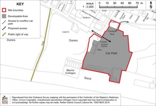
(1)
Policies Map Inset Map 7:
Camber
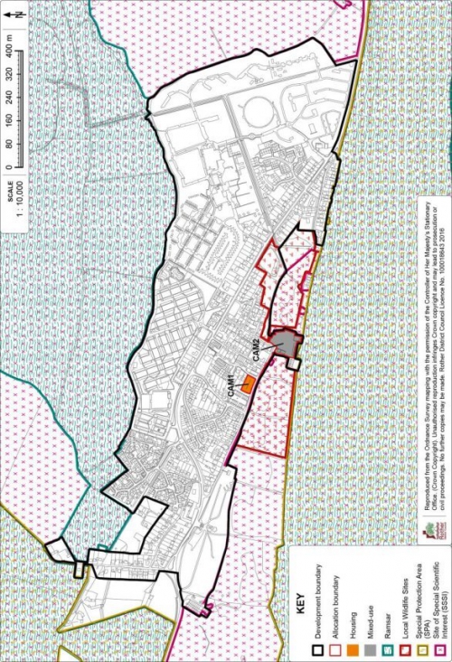
Catsfield
11.81 Catsfield is located on the B2204, two and a half miles from Battle, just over a mile from Ninfield and about four miles north of Bexhill. As a 'Saxon, medieval and post-medieval settlement', the village is identified as an Archaeological Notification Area. Historically, the village grew up as a 'nucleated cross' and the main part of the village is built around three roads that form a triangle.
11.82 Catsfield is set amongst the attractive undulating countryside of the Combe Haven Basin, although in terms of flood risk and habitat designations it is one of the least environmentally constrained villages in the District. The boundary of the High Weald AONB is immediately to the north of the village but does not 'wash over' the village itself, nor include land to the south of the village.
11.83 The village has a good range of local services including a primary school, a general store/post office, butcher's shop, public house, village hall, church and recreation ground including a pavilion and children's play area situated a little to the north of the village.
11.84 Catsfield has many elements of a sustainable community, as well as having public transport links to the larger towns of Battle, Hastings and Bexhill. As such, it is defined as a 'local service village' within the Core Strategy.
Development Provisions and Development Boundary
11.85 Catsfield is identified as having potential for 47 dwellings from new sites within the Core Strategy. Planning permission has recently been granted for 9 houses on land south of Skinners Lane,[70] leaving an outstanding target of 38 dwellings.
11.86 While the range of local services is good, there is a relative shortage of amenity open space when the Council's open space standards are applied at a village level. New development offers the opportunity to address this. In addition, there is a local aspiration to provide a skate ramp or facility for older children/teenagers. This would most appropriately be accommodated at the Catsfield Recreation Ground and Community Infrastructure Levy (CIL) payments from new development will offer a potential funding source.
11.87 In considering suitable areas for development within and around the village, there is little opportunity for infill development within the development boundary. Areas to the east are visually exposed and contained within a rural setting. The topography generally rises away from the village and development here would cause harm to the landscape and character of the High Weald AONB.
11.88 Development to the north of the village would be far removed from most services, out of keeping with the prevailing rural character of this area and would also cause harm to the landscape and character of the High Weald AONB. Areas to the south, while outside the AONB designation, are visually exposed with a strong sense of place as a pleasant stream valley and setting for the village. Development here would cause harm to the rural setting and landscape character of the village.
11.89 Consequently, the development boundary generally tightly encloses the existing built form of the village, preventing its expansion into the fields and woodland beyond. The development boundary also largely follows existing residential curtilages unless there are particular concerns about back land development encroaching into the countryside and harming the rural setting of the village.
11.90 One well-contained site, screened from the wider countryside, fronting the main road in the centre-west of the village, has been included within the development boundary, the development of which will effectively meet the village's outstanding housing target as well as accommodating a new area of public open space. The allocation of this site for housing and amenity open space is set out below. The site south of Skinners Lane, subject to the recent planning permission for 9 dwellings, is also included within the development boundary.
11.91 The Development Boundary and site allocations are detailed on the Policies Map Inset Map at the end of this section.
Site Allocation: Land west of the B2204, Catsfield
(1) 11.92 The site comprises an undeveloped field at the rear of the White Hart public house and residential properties fronting the B2204 (The Green), which has a frontage to the road. It is within the High Weald AONB but is well contained and screened from the wider landscape by mature trees. It is in close proximity to village services and bus stops. The developable area is approximately 1 hectare and it is anticipated that 35 dwellings will be accommodated, 40% of which will be affordable.
(1) 11.93 An area of at least 0.3 hectares of amenity open space in the form of a village green should be provided at the front of the site as part of its development, as illustrated on the Detail Map. In addition to providing a facility for new residents and enhancing the appearance of the development, this will make a valuable contribution towards reducing the deficit of this type of open space in the village. It will provide a location for small-scale community events at a central location and offer the additional benefit of complementing the setting of the adjacent public house, a Grade II Listed Building. In terms its design, the village green should benefit from passive surveillance of residential properties fronting onto it.
(1) 11.94 Historic field boundaries are present to the south-west, north-west, north-east and south-east of the site, which should be retained and reinforced with buffer planting of native species.
11.95 A tree survey will need to inform the future development scheme to ensure the retention of boundary trees, including the provision of a suitable buffer to protect their roots, and to avoid undue overshadowing from trees in the site layout. A new hedgerow of native species should be provided on the south-eastern boundary.
11.96 Access to the site would be from The Green (B2204) to the north of the existing pedestrian crossing. Provision of some street lighting and/or improved road markings on the B2204 may be necessary to meet highway safety requirements, subject to the further advice of the Highway Authority. A pedestrian link from the site to the adjacent 1066 Country Walk would benefit permeability.
11.97 Regard will need to be had, in developing a proposal, to protecting the amenities of adjoining residents to the east.
11.98 The site has high potential for prehistoric, Roman and medieval archaeological remains. Appropriate archaeological assessment will need to be undertaken in support of a planning application for its future development. The findings of the assessment may need to inform the layout and design of the proposal.
11.99 A sewer line crosses the eastern part of the site and this will also need to be considered in planning a development layout.
(4) Policy CAT1: Land west of the B2204, Catsfield
Land to the west of the B2204, as shown on the Policies Map, is allocated for a comprehensive scheme comprising residential development and amenity open space. Proposals will be permitted where:
- some 35 dwellings are provided, of which 40% are affordable;
- the development provides an amenity open space in the form of a village green of at least 0.3ha in size, extending across the road frontage and into the site as indicated on the DetailMap, and laid out to benefit from passive surveillance from adjacent dwellings;
- a new vehicle/pedestrian access is achieved off the B2204, together with a pedestrian link to the 1066 Country Walk;
- existing trees and hedgerows on the site boundaries are maintained and reinforced with planting of native species and a new hedgerow is provided on the south-eastern boundary, as indicated on the Detail Map;
- an assessment and evaluation of the site's archaeological potential has been carried out and mitigation measures are implemented accordingly; and
- care is taken to respect the amenity value and setting of adjoining properties on the eastern boundary.
11.100 The Detail Map below provides an indicative general layout of the development site in accordance with the above policy.
Figure 48: Policy CAT1
Detail Map
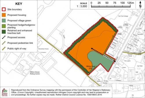
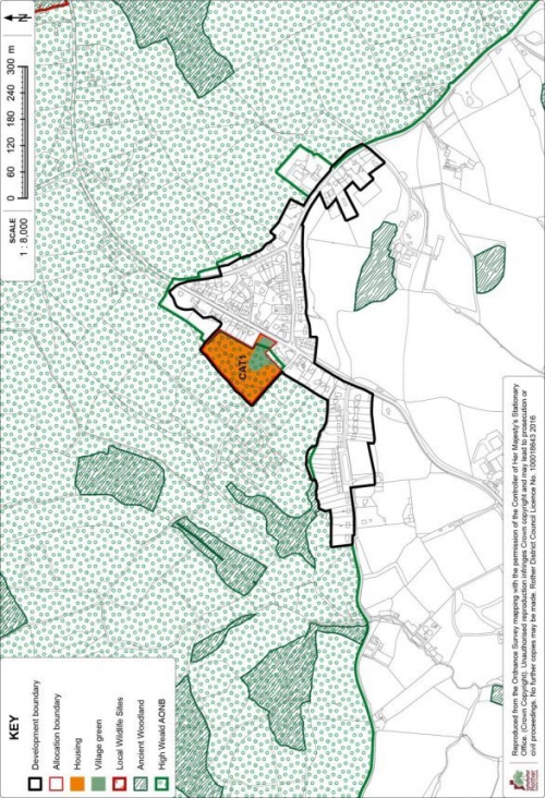
Fairlight Cove
(1) 11.101 The village of Fairlight Cove is situated on the coast approximately 5 miles north-east of Hastings. It is characterised by 20th century residential development extending inland from the cliff edge. It is the largest settlement within the parish of Fairlight. The village is accessed via Battery Hill/ Pett Level Road, a C-class road which is generally narrow with some tight bends, steep gradients and poor visibility in places.
(1) 11.102 Fairlight Cove has a limited range of services, despite having a larger population than many other Rother villages. This is in part explained by its proximity to Hastings. Services include a post office, village hall, recreation ground, public house (currently closed) and church. A part-time doctor's surgery operates from the village hall. A bus service links the village to Hastings and Rye. However, there is no primary school or train station. Fairlight parish has a notably higher proportion of residents aged 65 years and older, and a higher percentage of people with a long-term health problem or disability, compared to district averages.[71]
(1) 11.103 The surrounding countryside is generally wooded and undulating, lying within the High Weald Area of Outstanding Natural Beauty (AONB), although most of the developed areas of Fairlight Cove and Fairlight are excluded from the designation. The cliffs to the south of the village form part of the Hastings Cliffs to Pett Beach Site of Special Scientific Interest (SSSI), and those to the south-west are internationally protected for their wildlife and habitats as the Hastings Cliffs Special Area of Conservation (SAC).
11.104 Hastings Country Park Local Nature Reserve (LNR) adjoins the village to the south-west, following the Hastings borough boundary. An area of ancient woodland lies to the west. Land between Fairlight Cove and the district boundary is designated as a Strategic Gap, which has been extended to also include developed land in the smaller settlement of Fairlight[72]. Development within the Strategic Gap is strictly controlled and only permitted in exceptional circumstances in order to protect the generally open character of the area.
(1) 11.105 There are issues of coastal erosion and land instability at the cliff edge at Fairlight Cove. While there are engineering works, including rock bunds, in place to control erosion and land loss, they do not prevent it. The situation is further complicated by the lack of a surface water drainage system in the village. Consequently, Policies DEN5 and DEN6 of this Plan place limits on surface water run-off from development and restricts soakaway drains close to the cliff edge.
(1) Development Provisions and Development Boundary
(1) 11.106 The Core Strategy identifies a requirement for 37 dwellings in the village from large sites. This remains the target as at 1st April 2018, the base date of the Plan.
11.107 There are environmental constraints to the outward expansion of the village. The cliff edge and SSSI lies to the south and the Strategic Gap is to the west. To the north, land is in part elevated, offering panoramic views. Open countryside within the AONB lies to the east. Infill opportunities within the built-up area are limited, and access poses a constraint in many areas; a number of roads being narrow and unmetalled.
11.108 Two sites have been identified to accommodate the outstanding housing requirement. One is a former 2006 Local Plan allocation, centrally located in the village. It is a vacant site, formerly a garden nursery. It is bounded by residential development on all sides and within walking distance of services. Its redevelopment for housing is still appropriate, and it is subject to an outline planning application[73] for 16 dwellings which has delegated approval subject to conditions and the completion of a Section 106 legal agreement. As permission has not yet been granted, it is appropriate to reallocate the site.
(1) 11.109 It has not been possible to accommodate the outstanding requirement of 21 dwellings within the existing built-up area of the village. Consequently, a small area, forming part of Wakeham's Farm, known locally as the "East Field", on the north-eastern edge of the village, east of Waites Lane, has been identified. A Landscape Character Assessment has found that while the site is within the AONB, it is visually enclosed and the impact on the AONB from development would be limited. It would represent a logical extension to the built up area, relating well to existing development on Waites Lane and Pett Level Road. In landscape terms, the allocation site has a distinctly different character to the adjacent field to the east, which is open in character, with a strong visual relationship to the surrounding AONB and is not, therefore, suitable for development. The site offers an opportunity to provide a slightly higher housing figure than the Core Strategy target, together with a doctor's surgery and open space.
(1) 11.110 The development boundary tightly follows the existing built-up area together with the allocation site east of Waites Lane. Other than at this site, the boundary excludes the AONB. It also excludes the SSSI and Strategic Gap. The development boundary is drawn back from the cliff edge, to protect land that may be at risk of erosion or land instability. This is further detailed in the section on Land Stability and Policy DEN6 in the Environment chapter of this Plan.
11.111 The Development Boundary and site allocations are detailed on the Policies Map Inset Map at the end of this section.
Site Allocation: Land at the Former Market Garden, Lower Waites Lane, Fairlight Cove
11.112 The site is centrally located in the village, adjacent to Lower Waites Lane. It comprises vacant land that slopes down from north-west to south-east. The developable area is some 0.5 hectares and it is anticipated that 16 dwellings will be provided, of which 40% will be affordable.
11.113 There is a dense tree screen and a stream along the site's south-eastern boundary which should be retained as a wildlife area. There are several mature trees on other boundaries including two protected oaks on the south western and north eastern boundaries which will need to be retained. There is evidence of protected species on the site and appropriate mitigation will be required. A second wildlife area would be appropriate adjacent to the north-western boundary, as indicated on the Detail Map. Measures may also be necessary to manage any invasive species within the site.
11.114 SuDS will be required to manage surface water run-off, which will need to be restricted to the greenfield rate, in accordance with Policy DEN5. This is likely to require storage within the site, and may necessitate the realignment of the stream within the site, subject to the consent of the County Council as Lead Local Flood Authority. The developer will need to work with Southern Water to ensure the necessary sewerage infrastructure is available to serve the development.
11.115 The site has a medium potential to contain archaeological remains, and archaeological survey work will also be required.
11.116 The site is accessed via Lower Waites Lane, an unadopted road, via Smugglers Way to the south-west. Off-site road improvements will be required to increase the carriageway width at the junction.
(3) Policy FAC1: Land at the Former Market Garden, Lower Waites Lane, Fairlight Cove
Land at the Former Market Garden, Lower Waites Lane, as shown on the Policies Map, is allocated for residential development. Proposals will be permitted where:
- 16dwellings are provided, of which 40% are affordable;
- access is provided from Lower Waites Lane via Smugglers Way, as indicated on the Detail Map, and necessary off-site road improvements are secured;
- the existing tree belts on the south-eastern, north-eastern and north-western boundaries are retained and enhanced with additional planting of native species; and the trees subject to Tree Preservation Orders on the south-western and north-eastern boundaries are retained; as indicated on the Detail Map;
- a biodiversity strategy makes provision for any protected species found to be using the site, and includes appropriate mitigation and/ or compensation for any loss of habitat. The strategy shall include the retention and management of a wildlife corridor adjacent to the south-eastern boundary and a wildlife area in the northern part of the site, as indicated on the Detail Map;
- sustainable drainage (SuDS) is provided in accordance with Policy DEN5;
- an acceptable connection in made to the local sewerage system in liaison with the service provider; and
- an assessment and evaluation of the site's archaeological potential has been carried out and mitigation measures are implemented accordingly.
11.117 The Detail Map below provides an indicative general layout of the development site in accordance with the above policy.
Figure 49: Policy FAC1
Detail Map
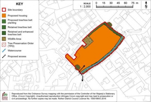
Site Allocation: Land east of Waites Lane, Fairlight Cove
11.118 The site forms part of an open field on the eastern edge of the village and measures some 3 hectares.
11.119 The site can accommodate some 30 dwellings, of which 40% would be affordable. Having regard to the village's demography and its lack of a school, the site is more suited to housing for older people. Background evidence gathered in support of the (now abandoned) Fairlight Neighbourhood Plan found demand amongst existing residents for smaller (1 – 2 bed) units to meet their future housing needs. Therefore, it is proposed that at least a half of the total number of dwellings provided should be age-restricted housing, of an appropriate size and layout, which could take the form in smaller individual houses, bungalows or possibly, some form of housing with care.
(1) 11.120 A doctor's surgery should also be provided for, subject to business case support from the Clinical Commissioning Group, which would replace the existing part-time surgery at the village hall and is particularly appropriate having regard to the older age profile of the village.
11.121 Unlike the remainder of the village, the site lies within the High Weald AONB, and its development will need to conserve and enhance this designated landscape. Buildings, access roads and open spaces should be of a high quality design, reflecting the High Weald local vernacular.
11.122 The site slopes gently down from north to south and a narrow strip of ghyll woodland is present on its southern boundary, which has in part been subsumed into the gardens of adjoining residential properties on Broad Way. The woodland will need to be retained in the site's development, and an open landscape buffer in the form of a sizeable area of amenity space should be provided between it and the southern edge of the new development. In addition to protecting the woodland, this will provide an amenity function for new residents and could also contain necessary SuDS features.
11.123 The site is bordered to the north and west by residential properties fronting Pett Level Road and Waites Lane respectively. The boundaries with adjacent properties are relatively open and would benefit from appropriate planting to offer screening. A prominent tree belt defines the site's eastern boundary, separating it from the adjoining field. This is important in enclosing the site from the wider countryside and should be retained and widened to create a broad tree belt with native species.
11.124 Access will need to be from Pett Level Road to the north, which the Highway Authority has indicated would be acceptable in principle. A speed survey would need to be carried out in support of the planning application to determine appropriate visibility splays. The access should be in a suitable position in relation to the access to the adjacent dwelling (Robin Croft). Subject to the retention of visibility splays, tree planting should be carried out on either side of the access road to assist in screening the development from land to the east. Suitable pedestrian facilities will also be required, including footways on either side of the access which link to the existing pavement on the southern side of Battery Hill to the east, and via a new pedestrian crossing to the pavement on the northern side of the road.
11.125 A pedestrian link from the development site to the west towards Waites Lane/ Broad Way would be advantageous in the interests of improving permeability, although this would require the use of third party land.
(1) 11.126 Surface water drainage capacity is limited throughout the village and a detailed surface water drainage strategy will need to be developed prior to the submission of a planning application for the site's development. Flows and volumes will need to be attenuated prior to discharge to a watercourse and restricted to greenfield rates in accordance with Policy DEN5. To achieve this, significant water storage may be required within the site, which could affect the site layout. The use of soakaways is unlikely to be acceptable. There is an indication of surface water flooding on the site's southern boundary and this will require mitigation. The developer will also need to work with Southern Water to ensure appropriate sewerage infrastructure is provided to serve the development prior to its occupation.
11.127 The site has high potential to contain archaeological remains and an archaeological assessment will need to be undertaken as part of the planning application for its future development, the results of which may inform the site layout.
(13) Policy FAC2: Land east of Waites Lane, Fairlight Cove
Land east of Waites Lane, as shown on the Policies Map, is allocated for a comprehensive scheme comprising residential development, doctor's surgery and amenity open space. Proposals will be permitted where:
- approximately 30 dwellings are provided in the residential area indicated on the Detail Map, of which 40% are affordable;
- at least 50% of the dwellings comprise appropriately designed, age-restricted housing for older people;
- a new doctor's surgery is provided, together with associated car- parking;
- the development provides an amenity open space extending across the southern part of the site, as indicated on the Detail Map;
- vehicular access is provided off Battery Hill together with footways to link to the existing footway on the southern side of Battery Hill and via a new pedestrian crossing to link to the footway on the northern side of the road, to the satisfaction of the Highway Authority;
- landscape planting is provided as indicated on the Detail Map, including a retained and enhanced tree belt on the eastern boundary; tree planting on either side of the access road; and new hedgerows on the northern and western boundaries. All planting shall be of native species;
- a detailed sustainable drainage strategy (SuDS), in accordance with Policy DEN5, is included and has informed the layout and form of development;
- an acceptable connection is made to the local sewerage system in liaison with the service provider; and
- an assessment and evaluation of the site's archaeological potential has been carried out and mitigation measures are implemented accordingly.
11.128 The Detail Map below provides an indicative general layout of the development site in accordance with the above policy.
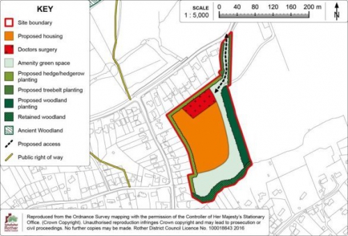
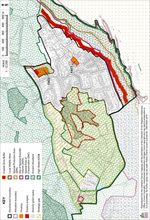
Iden
11.129 Iden is a small village close to the East Sussex/ Kent border, approximately two miles north of Rye and two miles east of Peasmarsh. It overlooks the marshes with the Royal Military Canal to the east. The village has a long history dating back to the Domesday book and contains a number of listed buildings and several Archaeological Notification Areas. It is wholly within the High Weald AONB and set in a pattern of historic fields.
11.130 The village straddles the B2082 while the historic core has grown around the crossroads in the centre of the village. Latterly, more modern development has grown along the roads leading out of the village: Wittersham Road, Grove Lane, Church Lane and along Main Street.
11.131 Iden has a reasonable range of services for its population, including a convenience shop, post office, community hall and play area. There is a limited bus service to Rye and Tenterden. As there is no primary school in the village, it is served by St Michaels CE at nearby Houghton Green.
Development Provisions and Development Boundary
11.132 Having regard to the limited scale of the village, its rural setting and limited opportunities for development, the Local Plan Core Strategy identifies a modest target for new housing to 2028 of 12 dwellings from larger (6+ dwellings) sites. No new sites have come forward recently; hence, this remains the target.
11.133 There is very limited scope for development in and around the village. There is little opportunity for infill within the development boundary. Development east of the village, where extensive views may be gained across the countryside, would encroach negatively into the wider AONB landscape. The development of sites along Wittersham Road to the north would inappropriately extend the village in a linear fashion, harming its character and rural setting. Sites north of the village are further disadvantaged due to their detachment from the settlement boundary and village core, together with their landscape impact, particularly to the west. Similarly, development to the south would inappropriately extend growth along Main Street, encroaching into an area of rural character. The narrow width of rural lanes and the proximity of listed buildings are other constraints affecting many locations.
11.134 Consequently, the development boundary encompasses a limited area between the crossroads of Wittersham Road/ Grove Lane and Church Lane (to the north), and the crossroads of Main Street/ Randolph Lane and Playden Lane (to the south). It defines the main built-up area of the village, including its historic core and adjoining areas of more recent development. In this manner the development boundary protects the rural setting of the village and prevents encroachment into the surrounding countryside.
11.135 One enclosed site on the western side of the village has been included within the development boundary to accommodate the outstanding housing requirement, which is within walking distance of many of the village's amenities.
11.136 The Development Boundary and site allocations are shown on the Policies Map Inset Map at the end of this section.
(1) Site Allocation: Land south of Elmsmead, Iden
11.137 The site is located on the western side of Main Street. It adjoins existing development to the north and east and is in close proximity to the village core and all amenities. The developable area is 0.4 hectares and it is anticipated that 12 dwellings will be provided, of which 40% are affordable.
11.138 The site forms the northern part of an undeveloped field associated with an adjacent residential property, Conkers, which was formerly a public house. Conkers is one of several grade II listed buildings fronting Main Street to the south-east of the site. There is a further grade II listed building, Rose Cottage, adjacent to the site to the north-east. Care will need to be taken to protect their settings.
11.139 The site is largely laid to rough grass with scattered self-seeded trees. Taller trees and scrub define the eastern and western boundaries. A new hedgerow of native species will be needed on the southern boundary of the site. Existing trees on the eastern and western boundaries will need to be retained and enhanced.
11.140 A small pond is located in the south-eastern corner of the site. The pond, together with adjoining trees and the field south of the site, has the potential to support biodiversity, including protected species. To ensure the development of the site makes appropriate provision for wildlife, the retention and enhancement of the pond and a suitable "buffer" around its perimeter is required. The precise measures necessary will need to be informed by detailed ecological surveys of the site. These measures will offer a biodiversity enhancement.
11.141 Access would be delivered off Elsmead to the north-west, via third party land to which there is an "in principle" agreement. There is an existing private right of way from Elmsmead to the field north-west of the allocation site and this will need to be retained. The access will need to be of an acceptable layout, width and alignment; and details including a swept path analysis will be required to be submitted with a planning application.
11.142 Regard will need to be had, in developing a proposal, to protecting the amenities of adjoining residents to the north and also the east.
11.143 The site has high potential for prehistoric, Roman and medieval archaeological remains. Appropriate archaeological assessment will need to be undertaken in support of a planning application for its future development. The findings of the assessment may need to inform the layout and design of the proposal.
(7) Policy IDE1: Land south of Elmsmead, Iden
Land south of Elmsmead, as shown on the Policies Map, is allocated for housing. Proposals will be permitted where:
- some 12 dwellings are provided, of which 40% are affordable;
- a new access is achieved off Elmsmead;
-
planting, comprising native species, is
provided as follows:
- a new hedgerow is provided on the southern boundary; and
- the existing trees/ hedgerow on the eastern and western boundaries of the site are maintained and reinforced;
- a biodiversity strategy makes provision for any protected species found to be using the site, and where necessary, includes appropriate mitigation and/ or compensation for any loss of habitat. The strategy shall include the retention and management of the pond and an ecological buffer around the pond;
- an assessment and evaluation of the site's archaeological potential has been carried out and mitigation measures are implemented; and
- care is taken to respect the amenity value of adjoining residential properties on the northern and eastern boundaries.
(1) 11.144 The Detail Map below provides an indicative general layout of the development.
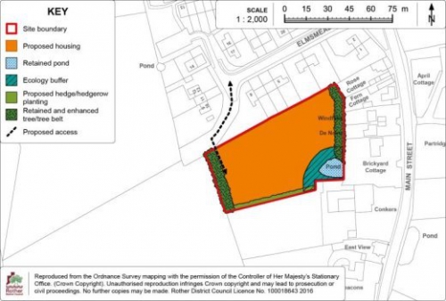
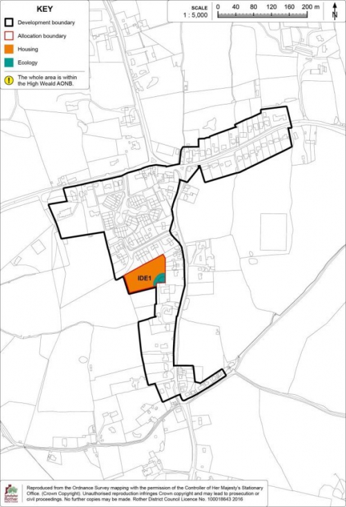
(1) Northiam
11.145 Northiam is in the north-eastern part of the district, 12 miles north of Hastings and about eight miles south of Tenterden. It is wholly within the High Weald AONB and lies along a generally north to south running ridge.
11.146 The original form of the village mainly consisted of ribbon development along the A28 and the minor roads that connect to it. More recently, a number of small residential estates have grown up to the rear of the established frontages. There are a substantial number of buildings listed for their architectural or historic interest in the southern / central part of the village and this more historic area has been designated a Conservation Area. Much of the village is categorised as an Archaeological Notification Area, identifying its potential for archaeological remains.
11.147 Undulating countryside surrounds Northiam and there are a number of areas of ancient woodland. There is a small Site of Special Scientific Interest (SSSI) at a disused quarry on the eastern side of the village. The southern part of the village is bordered by the Rother, Brede and Tillingham Woods Biodiversity Opportunity Area, where opportunities for habitat management and restoration have been identified. There are areas at risk of surface water flooding, particularly in the central part of the village and to the south-west.
11.148 Northiam is one of the larger villages in the District and supports a wide range of services and facilities including a primary school, a variety of shops, a village hall, church, recreation ground and children's play area.
Development Provisions
and Development Boundary
11.149 Northiam is classified as a Local Service Village within the Core Strategy and its housing target of 123 new dwellings up to 2028 from large sites reflects this. Taking into account a recent scheme[74], the remaining housing target is for 58 dwellings.
11.150 Given the location of the village within the High Weald AONB, allied with the many outstanding views out of and into the settlement, any growth needs to be considered sensitively. Development to the north, on the upper slopes of the Lower Rother Valley, should be robustly resisted for landscape reasons. Landscape constraints also affect sites to the north-west, where there are distant views out of the settlement in the proximity of Great Dixter. East of the village there are open fields and ghyll woodlands that are integral to the rural landscape. The development potential of sites in the centre and east of the village is limited by potential impacts on the Conservation Area and wider AONB landscape, in addition to access difficulties.
11.151 Two sites have been identified to accommodate the outstanding housing requirement. One is a former 2006 Local Plan allocation at land south of The Paddock, in the centre-east of the village and the other, smaller, site is on the southern boundary of the village. Both sites are unused land, well related to the village core, within walking distance of many of the village's amenities and are relatively well-contained in the landscape. The larger site, south of The Paddock, is particularly suited to older persons housing due to its close links with the village and level access, and could accommodate up to 52 dwellings. The smaller site is accessed directly from the A28 and could accommodate 6 dwellings, together with the retention of protected trees.
11.152 The development boundary generally tightly encloses the existing built form of the village, to prevent further ribbon development along the A28 to the north and south of the village, along Ewhurst Lane to the south-west, Beales Lane to the east, and the other rural lanes to the north-west and north. Extension of the village along these roads would represent inappropriate sprawl in the rural area, harming the rural character and setting of the village within the High Weald AONB landscape. The development boundary largely follows existing residential curtilages to prevent inappropriate backland development from encroaching into the countryside. The development boundary also includes the two allocations together with the land subject to the recent development of 66 dwellings at land at Donsmead, Station Road.
11.153 The Development Boundary and site allocations are detailed on the Policies Map Inset Map at the end of this section.
Site Allocation: Land South of Northiam Church of England Primary School, Northiam
11.154 The site is on the southern fringe of the village on the western side of the A28. It comprises an undeveloped area of land between the Primary School and Nursery (to the north) and a detached residential property (to the south). The developable area is some 0.36 hectares and it is anticipated that 6 dwellings will be provided, of which 40% will be affordable.
11.155 The land slopes down away from the road, and is mostly laid to grass. There are 2 mature Oak trees and a Pine tree on the frontage of the site and 2 mature Oak trees at the rear of the site, all of which are protected by Tree Preservation Orders. A comprehensive tree survey will need to inform any future development scheme to ensure the retention of the protected trees, including the provision of a suitable buffer to protect their roots, and to avoid undue overshadowing from the trees in planning the site layout. The opportunity should also be taken to enhance the existing hedgerow on the front boundary of the site and give consideration to the site's location within the Biodiversity Opportunity Area in identifying any additional opportunities for biodiversity enhancements as part of the development.
11.156 A single access point onto the A28 should be provided. This is likely to be achieved towards the northern end of the site's eastern boundary and must not harm protected trees on the site boundary. Access from the A28 to the adjacent school playing field must be retained. Given the close proximity of the site to the school and the junction with the B2088, a safety audit will need to be carried out as part of the planning application and suitable sight lines achieved, to the satisfaction of the Highway Authority.
11.157 A scheme for the site's development will need to be of a high design quality, appropriate to its location within the High Weald AONB and adjacent to the Northiam Conservation Area, in accordance with Policies EN1 to EN3 of the Core Strategy.
11.158 The site has high potential for prehistoric, Roman and medieval archaeological remains and an archaeological assessment will need to be undertaken as part of the planning application for its future development, the results of which may need to inform the site layout.
11.159 A sewer line passes close to the northern boundary of the site and this will also need to be considered in planning a development layout.
(2) Policy NOR1: Land south of Northiam Church of England Primary School, Northiam
Land south of Northiam Church of England Primary School, as shown on the Policies Map, is allocated for housing. Proposals will be permitted where:
- some 6 dwellings are provided, of which 40% are affordable;
- vehicle access is to the A28 to the satisfaction of the Highway Authority;
- existing trees on the eastern and western boundaries, protected by Tree Preservation Orders, are retained; and the hedgerow on the eastern boundary is retained and enhanced with native species; and
- an assessment and evaluation of the site's archaeological potential has been carried out and mitigation measures are implemented accordingly.
11.160 The Detail Map below provides an indicative general layout of the development site in accordance with the above policy.
Figure 52: Policy NOR1
Detail Map
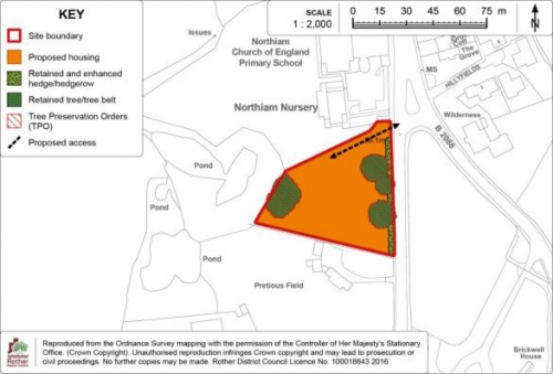
Site Allocation: Land south of The Paddock/ Goddens Gill, Northiam
11.161 Land south of The Paddock/ Goddens Gill is a largely unimplemented allocation from the 2006 Local Plan. Its suitability for residential development is further confirmed by an extant planning permission for 58 age-restricted dwellings[75]. However, as the permitted scheme is unlikely to proceed, it is considered appropriate to re-allocate the site.
11.162 The site is just east of the centre of Northiam. It relates well to the existing built form of the village on its northern and western boundaries, and is screened from the countryside to the south and east by boundary trees and ancient woodland.
11.163 The site is allocated for residential development; however, this could take one of two forms. The preference is for a residential scheme of older person's housing due to its proximity to village services, level access, a need for such housing in the rural area and its planning history. However, a non-age-restricted residential scheme of an appropriate mix in accordance with Core Strategy Policy LHN1 could be also be appropriate. If the first option is pursued, it is anticipated that some 52 units will be provided, while the second option could provide some 36 units. This is due to the lesser requirements for garden space and vehicular parking in an older person's scheme, together with the prospect that such a scheme would include some flats.
11.164 While the site is particularly appropriate for an older person's scheme due to its proximity to village services, level access, a need for such housing in the rural area and its planning history, it is appropriate for the allocation to cover both options to provide flexibility for a future developer. With both options, 40% affordable housing will be required.
11.165 A single access point from The Paddock should be provided. This is acceptable in highway terms subject to the improvement of parking provision, which currently partially obstructs the highway. A pedestrian link from the site westwards would provide a route towards the village core and its shops and services, improving connectivity.
11.166 An appropriate buffer zone of semi-natural habitat, at least 15 metres wide, will need to be retained between the edge of development and the ancient woodland on its eastern boundary, in accordance with Natural England's guidance.[76] Residential gardens must not extend into the buffer zone and the buffer should be managed appropriately to ensure it offers protection to the woodland and benefits to biodiversity.
11.167 A sewer pipe passes north to south through the central part of the site. This will require easements on both sides of it where no buildings or tree planting will be permitted.
(2) Policy NOR2: Land south of The Paddock/ Goddens Gill, Northiam
Land south of The Paddock/ Goddens Gill, as shown on the Policies Map, is allocated for residential development. Proposals will be permitted where:
-
either:
- some 52 age-restricted dwellings for older people are provided; or
- some 36dwellings are provided.
In both cases, 40% of the dwelling units shall be affordable.
- vehicle access is via The Paddockto the satisfaction of the Highway Authority;
- tree belts and hedgerows on the site boundaries are maintained and reinforced with planting of native species, and provision is made for the retention and future management of a buffer zone of semi-natural habitat, at least 15 metres wide (which does not include residential gardens), on the eastern boundary, between the edge of development and the ancient woodland.
11.168 The Detail Map below provides an indicative general layout of the development site in accordance with the above policy.
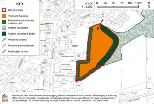
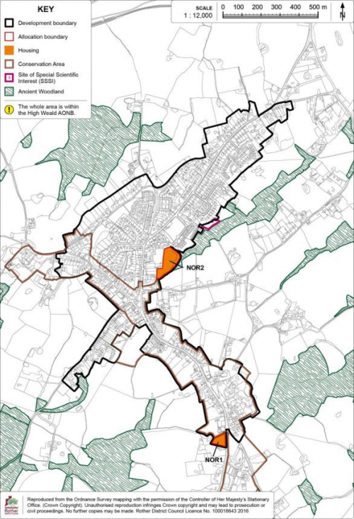
(1) Peasmarsh
11.169 Peasmarsh is situated on the A268 four miles north-west of Rye. The village is within the High Weald AONB and the surrounding landscape is gently undulating with large swathes of ancient woodland.
11.170 Although its ancient origins were centred upon the church to the south, the current village developed in a linear form, with dwellings abutting the A268 that runs through the centre and School Lane that branches from it. More recent estate developments have grown up to the north and south of the main road. A large part of the village is covered by an Archaeological Notification Area identifying its medieval and post-medieval history.
(1) 11.171 Today, the village has a good range of local services and, uniquely amongst Rother villages it hosts a supermarket which is on the west side of the village. It also has a primary school, village hall, church, public house and recreation ground.
Development Provisions and Development Boundary
(1) 11.172 The Local Plan Core Strategy has set a target of 50 new dwellings in the village up to 2028 from large sites. A scheme has been recently permitted at The Maltings[77] for 10 additional dwellings which can be taken into account.
11.173 Areas to the far west of the village are visually exposed and typified by a close network of historic field boundaries. Development to the north is heavily constrained by a large area of designated ancient woodland, and while areas outside the woodland are enclosed from view, they lack pedestrian accessibility. Areas to the east are further from key services and more exposed to the wider landscape.
11.174 One enclosed site in the centre-west of the village has been identified to accommodate the outstanding housing requirement together with an area of open space.
11.175 The development boundary generally tightly encloses the existing built form of the village, together with the residential area identified in the allocation, preventing the expansion of the village into the woodland and fields beyond. The development boundary also largely follows existing residential curtilages to prevent inappropriate backland development from encroaching into the countryside and harming the rural setting of the village.
11.176 The Development
Boundary and site allocations are detailed on the Policies
Map Inset Map at the end of this section.
Site Allocation:
Land south of Main Street, Peasmarsh
(1) 11.177 The site comprises fields/ paddocks and a traditional orchard at the rear of residential properties on Main Street. The developable area is 1.5 hectares and it is anticipated that 45 dwellings will be provided, 40% of which will be affordable. Open space provision including a children's play area also forms part of the allocation.
(1) 11.178 Access will be from Main Street via land currently occupied by "Pippins", a detached residential property which would be demolished. A priority solution for traffic will be required on a narrow section of the access road, some 70 metres into the site. A Road Safety Audit will be required to inform the precise details of the access, to be determined at planning application stage.
11.179 New pedestrian routes should traverse the site, linking it to Main Street to the north and the public footpath network to the south and west, as shown on the Detail Map. The existing track off Main Street, identified for this purpose, may require some upgrading. This would be for further consideration at planning application stage.
(1) 11.180 Residential development will be limited to the northern and central parts of the site as these areas are well screened from the wider countryside. The southern section has a rising topography and a more rural character and is suited to use as public open space. A children's play area should be provided in the south-eastern part of the site. In addition to serving the new residents, this will help address an existing shortfall in the village, identified through the Council's Open Space, Sport & Recreation Study (2007).
(1) 11.181 The traditional orchard, which is both a Priority Habitat and a character feature of the High Weald AONB, is to be retained, together with other existing ecological and AONB character features. These include historic field boundaries on the southern edges of the site, boundary hedgerows, mature trees (including a large oak tree on the western side of the site) and ponds. Additional hedgerows of native species would assist in screening the residential development and offer the opportunity for biodiversity enhancement. Future maintenance and management of these elements will need to be secured through a planning permission.
(1) 11.182 Surface water flow paths cross the southern part of the site and SuDS are likely to be required. Opportunities should be taken where possible to provide multi-functional SuDS, for example, a wetland habitat green corridor alongside the pedestrian link.
11.183 The site has high potential for prehistoric, Roman and medieval archaeological remains. Appropriate archaeological assessment will need to be undertaken in support of a planning application for its future development.
(48) Policy PEA1: Land south of Main Street, Peasmarsh
Land south of Main Street, as shown on the Policies Map, is allocated for residential development and amenity open space including a retained traditional orchard and children's play area. Proposals will be permitted where:
- some 45 dwellings (net) are provided in the area shown on the Detail Map, of which 40% are affordable;
- vehicle access is to Main Street to the satisfaction of the Highway Authority;
- additional pedestrian access is provided as shown on the Detail Map, to the north-east of the site, connecting down the length of the eastern boundary via a green corridor; and southwards connecting to the footpath network;
- a children's play area is provided, which should be subject to passive surveillance from residential frontages, with funding and management arrangements secured for its ongoing maintenance;
- open space is provided in the southern part of the site as shown on the Detail Map, incorporating the traditional orchard within it, with funding and management arrangements secured for its on-going maintenance;
- other existing ecological and High Weald AONB character features are retained and enhanced as far as reasonably practicable, including historic field boundaries, boundary hedgerows, existing trees and existing pond;
- existing landscaped boundaries around the site are maintained and reinforced with native planting, and new landscaped boundaries are created on exposed western edges;
- an assessment and evaluation of the site's archaeological potential has been carried out and mitigation measures are implemented accordingly; and
- sustainable drainage (SuDS) is provided in accordance with Policy DEN5.
11.184 The Detail Map below provides an indicative general layout of the development site in accordance with the above policy.
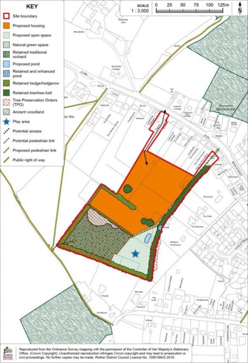
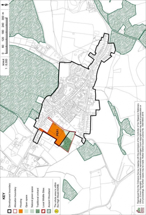
Rye Harbour
11.185 Rye Harbour is located near the mouth of the River Rother and is part of the civil parish of Icklesham. Rye Harbour has close economic links with Rye, one a half miles to the north-west, but is considered distinctly separate. This distinction is consolidated by the designation of a Strategic Gap between Rye and Rye Harbour.
11.186 Rye Harbour has a village hall, shop, recreation ground and public house, but lacks a primary school. There is a large holiday caravan site on the south-east fringe of the village. The Harbour Road employment area lies to the west of the village. It is a long-established concentration of industrial uses and is the largest employment area in eastern Rother. It incorporates Rye Wharf, the District's only commercial wharf for sea-going ships, and accommodates a broad range of businesses including some uses relating to its wharf-side origins.
11.187 Access to Rye Harbour is solely along Harbour Road, a long straight road which bisects the industrial area. Any proposal involving significant levels of traffic would be subject to careful consideration by both Highways England and the local Highway Authority in terms of the potential impacts on the junction of Harbour Road with the A259 Winchelsea Road. There is a limited local bus service between Rye and Rye Harbour and a shared walking and cycling route along Harbour Road.
11.188 The countryside surrounding Rye Harbour is subject to a number of international and national environmental designations, signifying its nature conservation importance. The Dungeness, Romney Marsh and Rye Bay Special Protection Area (SPA) and Ramsar site (wetland of international importance), which is also a designated Site of Special Scientific Interest (SSSI), covers land outside the built up area to the north, south and east of the village, and beyond the industrial area to the west. The smaller Rye Harbour SSSI lies to the north-west of the village. Adjacent to the village to the east, Rye Harbour Nature Reserve is also part of the international sites and attracts many visitors each year.
11.189 The whole of Rye Harbour lies within Flood Zone 3a, meaning it is at high risk of flooding, not taking account of existing flood defences. However, the risk is residual due to the presence of flood management measures including earth embankments, which have been improved in recent years.
11.190 The geology of the village consists of Storm Beach Deposits which are classed as a Secondary Aquifer. This makes the groundwater particularly vulnerable to pollution. There are known ground-contamination issues in parts of the Harbour Road employment area caused by the historic use of the land, which has included chemical manufacture, heavy industry and waste deposition.
Development Provisions and Development Boundary
11.191 The Local Plan Core Strategy presents an overall strategy for Rye and Rye Harbour and sets a target of 355-400 dwellings up to 2028. The Strategic Housing Land Availability Assessment Review (2013) (the SHLAA) identified a potential for 40 dwellings on new sites in Rye Harbour up to 2028; hence, this is taken to be its target as a contribution to the overall housing requirement for Rye and Rye Harbour. No new sites have come forward recently and the target remains the same. The Rye Neighbourhood Plan (which does not cover Rye Harbour) is progressing and is making provisions for housing, also in line with the findings of the SHLAA. The Core Strategy, at Policy RY1, promotes at least 10,000sqm of employment floorspace at Rye Harbour Road industrial estate.
11.192 Potential areas for development in and around the village are limited. Greenfield sites are discounted because they would be unlikely to pass the "exception test", necessary for sites in Flood Zone 3. Land within the nationally and internationally protected sites would not be suitable for development. Development east of the village would encroach on the nature reserve and could harm the setting of the Martello tower, a scheduled ancient monument. Much land to the west forms part of the employment area, where residential development would be inappropriate and would conflict with Policy DEC3. However, one brownfield site has been identified to accommodate the village's housing allocation, on the south-western fringe of the village. The site incorporates an unimplemented allocation from the 2006 Local Plan, together with adjoining land to the south.
11.193 The development boundary generally tightly follows the extent of existing development to prevent encroachment into the protected areas and the employment area. It includes the allocation site but excludes two large public open spaces, as these are greenfield sites within Flood Zone 3a.
11.194 The Development Boundary and site allocations are shown on the Policies Map Inset Map at the end of this section.
Site Allocation: Land at Stoneworks Cottages, Rye Harbour
11.195 The site is on the southern side of Harbour Road, to the west of existing residential development. It comprises a brownfield site currently in low-key employment use. The northern part of the site was previously designated in the 2006 Local Plan for at least 16 dwellings. The southern part of the site has little planning history but appears to have been used for informal storage. Redeveloping the site for residential use offers an opportunity to significantly improve its appearance, and the two parcels of land coming forward together will improve viability. The developable area is some 1.38 hectares and it is anticipated that 40 dwellings will be provided, of which 30% should be affordable.
11.196 Site boundaries are generally defined by unmanaged vegetation although there is a substantial tree belt on the south-western boundary which separates the site from a water-body within the adjacent SPA and Ramsar site, and which should be retained and enhanced with native species to provide a buffer to the protected area.
11.197 The site lies outside but in close proximity to the Dungeness, Romney Marsh and Rye Bay SSSI, SPA and Ramsar site. The Rye Harbour SSSI lies 140m to the north-west. An ecological survey has indicated that the site should not be considered as functional habitat for the Ramsar site and does not support the qualifying habitats or species; but it is likely to accommodate protected species. Therefore, further ecological surveys would need to accompany the planning application and mitigation measures proposed. Lighting will need to be carefully designed to prevent adverse effects on wildlife.
11.198 The site is also in close proximity to two grade II listed buildings, the School House and Church of the Holy Spirits, located to the north-west. The development will need to respect the setting of both.
11.199 A public footpath adjoins the eastern boundary and a pedestrian link to the site would be beneficial in the interests of providing a direct route to the Nature Reserve.
11.200 The groundwater is particularly shallow beneath the surface of the site and there may be an existing level of contamination which could leave the underlying aquifer vulnerable to pollution in the event of the site being developed. Therefore, a planning application will need to be accompanied by a land contamination assessment that demonstrates that any unacceptable risks will be managed appropriately through the re-development process. Foul and surface water drainage will also need careful consideration and the development will need to connect with the main sewer running along Harbour Road, subject to consultation with Southern Water. The site layout will need to take account of the position of the sewer, which crosses the northern part of the site, and the need to retain easements to allow for future works to it.
11.201 In flood risk terms, the Environment Agency has advised this area is defended to the '200 year' standard, meaning there is a 0.5% probability of it being flooded in any one year. The planning application will need to be accompanied by a site specific flood risk assessment and habitable rooms should not be included on the ground floor.
(4) Policy RHA1: Land at Stoneworks Cottages, Rye Harbour
Land at Stoneworks Cottages, Rye Harbour, as shown on the Policies Map, is allocated for housing. Proposals will be permitted where:
- some 40 dwellings are provided, of which 30% should be affordable;
- a new access is achieved off Harbour Road;
- the tree belt on the south-western boundary is retained and enhanced with native species with appropriate fencing erected to maintain an effective barrier between the site and the adjacent Dungeness, Romney Marsh and Rye Bay SSSI, SPA and Ramsar Site, as well as screen tree and hedgerow planting employing native species provided on other boundaries of the site, as indicated on the Detail Map;
- ecological surveys are carried out which demonstrate that there is no adverse impact on protected species or, if any protected species are found to be using the site, sets out appropriate mitigation for any loss of habitat;
- a site specific flood risk assessment has been undertaken which demonstrates that the development will be safe for its lifetime, taking account of the vulnerability of its users, without increasing flood risk elsewhere, and where possible, will reduce flood risk overall; and
- a ground contamination assessment has been undertaken which demonstrates that pollution risks, including to the underlying aquifer, will be managed appropriately through the re-development process.
Figure 55: Policy RHA1
Detail Map
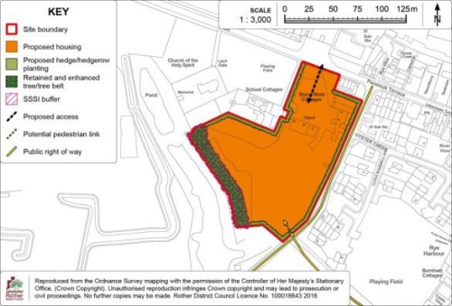
Site Allocation: Harbour Road Employment Area
11.202 The Harbour Road employment area is a long-established concentration of industrial uses, bisected by Harbour Road. Much of the employment land has a very stark industrial appearance with many buildings close to the road. In common with the village, it is within Flood Zone 3a; parts of it are affected by ground contamination; and it adjoins designated nature conservation sites. The area was subject to a supportive employment policy within the 2006 Local Plan and given the importance of the area to the local economy, it is appropriate for this to continue.
11.203 There are opportunities for further intensification of employment uses on brownfield sites at Harbour Road as this would not encroach into the protected sites. All proposals will need to include a site specific flood risk assessment and measures to alleviate the potential risks from flooding, appropriate to the scale and nature of the development.
11.204 The employment area incorporates two wharves (one of which is currently operational). One function of the wharf is the landing of minerals and, in accordance with the Waste & Minerals Local Plan, it will be necessary for proposals that could affect the wharf to demonstrate that the capacity for landing, processing, handling and associated storage of minerals is safeguarded and that there is no net loss of capacity within Rye Port. The County Council has confirmed there is also a safeguarded waste management operation at Rye Oil Ltd, Rye Harbour, and it is important that future development does not prejudice operations at the site.
11.205 A recent planning permission at The Saltings[78] will bring additional floorspace for B1, B2 and B8 Uses. As a result, an amendment to the former employment policy boundary is reflected in Figure 58 (Harbour Road Employment Area Boundary Map). The amendment affects land within the Rye Harbour SSSI, which is incorporated into the employment area. This was the subject of detailed discussions with Natural England during the determination of the planning application and the specific proposal was deemed acceptable due to measures proposed for habitat creation. While it is expected that the site will be developed in accordance with the planning permission, if an alternative proposal were to be considered, the impact on the SSSI would need to be deemed acceptable.
(4) Policy RHA2: Harbour Road Employment Area
Within the Harbour Road Policy Area, as defined on the Policies Map, business development (Use Classes B1, B2 and B8) will be permitted where the following criteria are met:
- proposals which result in a significant increase in vehicle, especially HGV, movements along Harbour Road adjoining the A259 will only be permitted where the relevant highway authorities are satisfied that any impacts are acceptable;
- a ground contamination assessment has been undertaken which demonstrates that pollution risks, including to the underlying aquifer, will be managed appropriately through the development process;
- proposals with frontages to Harbour Road include a comprehensive landscaping strategy to improve the overall appearance of development;
- there is no adverse impact on the adjacent Dungeness, Romney Marsh and Rye Bay SSSI, SPA and Ramsar Site or on the Rye Harbour SSSI;
- a site specific flood risk assessment has been undertaken which demonstrates that the development will be safe for its lifetime, taking account of the vulnerability of its users, without increasing flood risk elsewhere, and where possible, will reduce flood risk overall; and
- there are no adverse impacts on the capacity of wharves for the landing, processing, handling or associated storage of minerals; or on safeguarded waste management operations.
Westfield
11.206 The former iron-smelting village of Westfield straddles the A28 some three miles north of Hastings. Dating from Saxon times, the village grew up around the convergence of several small settlements. Westfield has experienced a relatively high level of post-war development and is now one of the larger villages in the District.
11.207 The village has a reasonable range of local facilities and services, including a shop, doctor's surgery, primary school, church, community hall, several recreational facilities and some local employment. Supporting evidence suggests a shortfall of allotments and a play facility for older children/teenagers,[79] and the Playing Pitch Study[80] identifies a need for high quality football and cricket facilities in the wider area.
11.208 Westfield is wholly within the High Weald AONB and is surrounded by undulating farmland, woods and streams with a network of public footpaths, including the 1066 Country Walk. The floodplain of the River Brede and its tributaries lie to the north-west, although the village itself is relatively free from the threat of flooding. Archaeological Notification Areas indicate two former Roman Roads in the south and east of the village and a medieval and post-medieval hamlet in the centre-west.
Development Provisions and Development Boundary
11.209 Westfield is classified as a Local Service Village within the Core Strategy and its housing target of 89 dwellings from large sites reflects this.
11.210 Opportunities for development on the edges of the village are limited due to topographical landscape constraints. Its position on a north-south elevated plateau is evident when approaching from the west, where there are also biodiversity constraints including ancient woodlands and wildflower meadows. The elevated far northern and north-western parts of the village enjoy distant views across the High Weald AONB. The southern edge is generally well-defined and the land beyond existing limits is integral to the wider countryside setting.
11.211 Areas on the north-eastern side of the village have the most potential for development to meet the identified needs, being relatively contained within the wider landscape, relatively free of wider environmental impacts and reasonably connected to existing services. These include the southern end of Westfield Down and the site of a former care home at Moorhurst. In addition, one site at the southern end of the village – Land off Goulds Drive, which was part of a previous Local Plan allocation, still offers a suitable opportunity for a smaller area of residential development.
11.212 The development boundary generally tightly encloses the built form of the village, including the allocation sites.
11.213 The Development Boundary and site allocations are shown on the Policies Map Inset Map at the end of this section.
Site Allocation: Land at Westfield Down, Westfield
11.214 Land at Westfield Down is an unimplemented allocation from the 2006 Local Plan. While it has the benefit of a planning permission for up to 39 dwellings[81], which also secures recreational provision on adjoining land, this permission is in outline and as it remains unimplemented it is appropriate to re-allocate the site.
11.215 The site comprises rising ground extending out of the village on the east side of the A28. The lower section of the site to the south-west is more visually contained in the wider landscape and is within reasonable walking distance of all key local services. It is therefore suited to housing development. The higher ground to the north-east is more sensitive to building development, but could satisfactorily accommodate sports and recreational uses, including pitches, for which there is a recognised need within the village. In future, there may also be scope to provide an older children's/youth play facility/MUGA on the recreational land, as well as enhanced pedestrian links across the site.
11.216 The site area is some 4.03 hectares with a developable area of 1.2 hectares. It is anticipated that 39 dwellings can be accommodated, plus recreational uses and facilities. Provision of the recreation land will need to include its re-grading as necessary to provide sports pitches, seeding, drainage and future maintenance, together with the construction of changing facilities to serve the new pitches and a car parking area. As there is no physical division within the site, and because of the need for recreational facilities to serve the community, the housing development and recreational element should proceed in tandem.
11.217 Vehicular access is proposed via a new joint access off the A28. Footpath links in the southern part of the site will provide pedestrian access to the village and the public footpath on the site's south-eastern boundary, creating sustainable links between the site and village shops and services. Public footpaths which pass through the site will need to be realigned on completion of the development.
11.218 SuDS are likely to be required to manage existing surface water flows on the site. It may be necessary to include some SuDS features on adjoining land.
11.219 The provision of tree belts across the northern boundary of the site and the northern edge of the residential area would provide screening from the wider High Weald AONB. The existing tree belt along the site's north-western boundary with the A28 should be retained and enhanced to provide screening from this direction. Biodiversity gains should be implemented as part of the development which may include, for example, the inclusion of natural features; the installation of bird and bat boxes along site boundaries; and the use of flower-rich grasses in field margins.
11.220 The site has high potential for prehistoric, Roman and medieval archaeological remains. Appropriate archaeological assessment will be required.
(1) Policy WES1: Land at Westfield Down, Westfield
Land at Westfield Down, as shown on the Policies Map, is allocated for housing and recreation purposes. Proposals will be permitted where:
- comprehensive proposals for both housing and recreational elements are put forward in tandem and the recreational land is secured;
- some 39 dwellings are provided within the identified residential area as shown on the Detail Map, of which 40% are affordable;
- screen tree planting is provided on the northern boundaries of the recreation area and the residential area; comprising native species; and the existing tree belt on the site's north-western boundary with the A28 is retained and enhanced with additional planting, also of native species, as indicated on the Detail Map;
- the recreation land includes pitches (at least one senior football pitch); changing facilities and car parking; and provision is made for its regrading as appropriate; seeding; drainage and future maintenance;
- access is provided off the A28;
- new pedestrian linkages are provided as indicated on the Detail Map, in the southern part of the site to join the footway alongside the A28 and public footpath no. 31F on the site's south-eastern boundary;
- sustainable drainage (SuDS) is provided in accordance with Policy DEN5, which may necessitate off-site works; and
- an assessment and evaluation of the site's archaeological potential has been carried out and mitigation measures are implemented accordingly.
11.221 The Detail Map below provides an indicative general layout of the development site in accordance with the above policy.
Figure 57: Policy WES1 Detail Map
Site Allocation: Land at the Former Moorhurst Care Home, Westfield
11.222 The site lies to the north of the village, on the north-western side of the A28. Now a brownfield site that is cleared of buildings, the site had a previous use as a residential care home. In addition, it has had a more recent permission (2009) for a 48 bed residential care unit[82] although this was not implemented and has now expired. As a consequence, the site has remained vacant for many years.
11.223 The site measures some 0.88 hectares and is generally well screened from the surrounding AONB countryside by virtue of both topography and mature boundary trees. A public footpath runs the length of its south-western boundary.
11.224 The potential volume of traffic generated is a factor in determining an appropriate use for the site on this stretch of the A28. In respect of vehicle trip generation, retirement living/sheltered housing is broadly comparable to a care home (the site's former use) and generates less traffic than standard residential development. An allocation for housing with care has the support of the landowner and would provide opportunities for local older persons to downsize, thus freeing up housing for families. There is a recognised need to provide more housing suitable for older people in the District, in response to demographic projections.
11.225 In order to make a development acceptable in planning terms, there are a number of measures that will be necessary to prioritise safe pedestrian access and sustainable forms of transport. A standard footway will need to be provided along the A28 connecting to the village core. This may require a traffic island and pedestrian refuge alongside the site. A bus stop should be provided immediately adjacent to the site. A pedestrian link from the site westwards to footpath 27 connecting to Cottage Lane should also be provided. For vehicles, utilisation of the existing northern access onto the A28 would be preferred, since this would minimise loss of trees/vegetation. However, this will require further investigation, including a highways safety audit to support a future planning application.
11.226 The development should incorporate native species planting to fill in any gaps in the trees and hedgerows on the site boundaries, particularly notable to the north-east. This will serve to limit the wider landscape impact and benefit biodiversity.
11.227 Retirement living/sheltered housing has a lesser demand for garden space than standard residential development, and consequently, a higher density can be achieved. It is expected that 40 dwellings will be accommodated within the site. Communal gardens/ amenity open space should be provided at a level of 25 square metres (sqm) per dwelling unit.
(1) Policy WES2: Land at the former Moorhurst Care Home, Westfield
Land at the former Moorhurst Care Home, as shown on the Policies Map, is allocated for housing with care. Proposals will be permitted where:
- some 40 dwelling units are provided, of which 40% are affordable;
- access is provided to the A28, with preference to utilising the previously established access;
- screen tree planting is provided on the north-eastern boundary of the site, and trees and vegetation on other boundaries are retained and enhanced, with new native species landscape planting provided to fill in gaps;
- communal gardens/ amenity open space is provided on site to a minimum of 25 sqm per dwelling unit; and
-
provision is made for:
- an upgraded footway along the A28 connecting to the village core, together with safe means of accessing it from the site;
- pedestrian access to footpath 27 on the south-western boundary of the site; and
- a bus stop adjacent to the site.
11.228 The Detail Map below provides an indicative general layout of the development site in accordance with the above policy.
Figure 58: Policy WES2 Detail Map
Site Allocation: Land south-east of Goulds Drive, Westfield
11.229 This site, in the southern part of the village, forms the remaining unimplemented section of a 2006 Local Plan allocation, the majority of which has been developed with a housing estate known as Goulds Drive. It is still appropriate for this remaining section to be developed. The developable area is approximately 0.26 ha and it is anticipated that 10 dwellings will be provided, 40% of which will be affordable.
11.230 There are two options for gaining vehicular access. A link from Goulds Drive to the north-west would be appropriate but there may be land ownership constraints and consequently, a new access from Stonestile Lane to the north-east is an acceptable alternative. This second option would necessitate other highway works including minor improvements to the junction of Stonestile Lane and Moor Lane and the construction of a footway from the new access on Stonestile Lane. Swept path analysis to demonstrate the access could serve the largest vehicles would be needed, together with a Road Safety Audit. Any junction realignment would require a Section 278 agreement with the Highway Authority and the new footway would need to be dedicated as public highway.
11.231 A new access from Stonestile Lane would require the removal of a section of the existing boundary hedgerow alongside Stonestile Lane in order to gain the required visibility. In order to reduce the visual impact of this on the streetscene, a new hedgerow should be replanted at the rear of the new footway.
11.232 A public footpath (number 44) runs along the southern boundary of the site. A pedestrian link to this should be provided to improve permeability of the wider area.
11.233 The southern section of the site is within the Hastings Fringes Biodiversity Opportunity Area. While a section of roadside hedgerow may need to be relocated, other boundary trees and hedgerows, including to the south, should be retained, with any gaps reinforced by native species planting for landscape and biodiversity reasons. SuDS will need to be carefully considered to avoid surface water run-off to surrounding areas.
11.234 The site has high potential for prehistoric, Roman (including a major Roman road) and medieval archaeological remains relating to the historic core of Westfield Moor. Appropriate archaeological assessment will need to be undertaken in support of a future planning application.
Policy WES3: Land south-east of Goulds Drive, Westfield
Land south-east of Goulds Drive, as shown on the Policies Map, is allocated for residential development. Proposals will be permitted where:
- some 10 dwelling units are provided, of which 40% are affordable;
- access is provided either from Goulds Drive or Stonestile Lane, as indicated on the Detail Map, to the satisfaction of the Highway Authority;
- in the event of the provision of an access from Stonestile Lane, a new footway is provided to link the new development to the existing Moor Lane footway, any section of boundary hedgerow removed is replanted at the rear of the footway subject to highways visibility requirements; and any necessary improvements to the Stonestile Lane/ Moor Lane junction are implemented; as indicated on the Detail Map;
- pedestrian access to footpath 44 on the southern boundary is secured;
- existing trees and hedgerows on the site boundaries are retained and reinforced with native species;
- care is taken to respect the amenity value of adjoining residential properties on the northern and western boundaries;
- sustainable drainage (SuDS) is provided in accordance with Policy DEN5; and
- an assessment and evaluation of the site's archaeological potential has been carried out and mitigation measures are implemented accordingly.
11.235 The Detail Map below provides an indicative general layout of the development site in accordance with the above policy.
Figure 59: Policy WES3 Detail Map
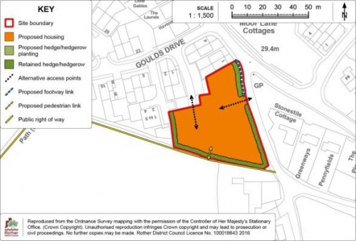
Site Allocation: Land between Moor Lane and the A28, Westfield
11.236 This is a narrow strip of undeveloped land that was set aside by the County Council for the construction of a bypass, but plans for that were abandoned a number of years ago and the land has remained vacant. It was proposed to become a footpath/ cycleway in the 2006 Local Plan, also linking to the Goulds Drive development, but this is not now readily achievable.
11.237 Consequently, there is the opportunity to allocate the land for an alternative use for allotments, of which there is a recognised shortfall in the village. Pedestrian access would be from Moor Lane, and a crossing point should be provided. Limited parking provision to serve the allotments would also be required, which could be accommodated at the northern end of the site or take the form of a small layby on Moor Lane, which the Highway Authority has indicated would be acceptable in principle.
11.238 A small area at the northern end of the currently vacant area is excluded from the allocation, but included within the development boundary and could potentially accommodate 1 or 2 dwellings fronting Moor Lane.
(2) Policy WES4: Land between Moor Lane and the A28, Westfield
Land between Moor Lane and the A28, as shown on the Policies Map, is allocated for allotments. Proposals will be permitted where:
- Allotments are provided in the area indicated on the Detail Map;
- Pedestrian access to the allotments is provided from Moor Lane; and
- Off-road vehicle parking provision for users of the allotments is achieved and a pedestrian crossing point on Moor Lane is provided, to the satisfaction of the Highway Authority.
(1) 11.239 The Detail Map below provides an indicative general layout of the development site in accordance with the above policy.
Figure 60: Policy WES4 Detail Map
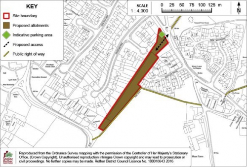
(1)
Policies Map Inset Map 14:
Westfield
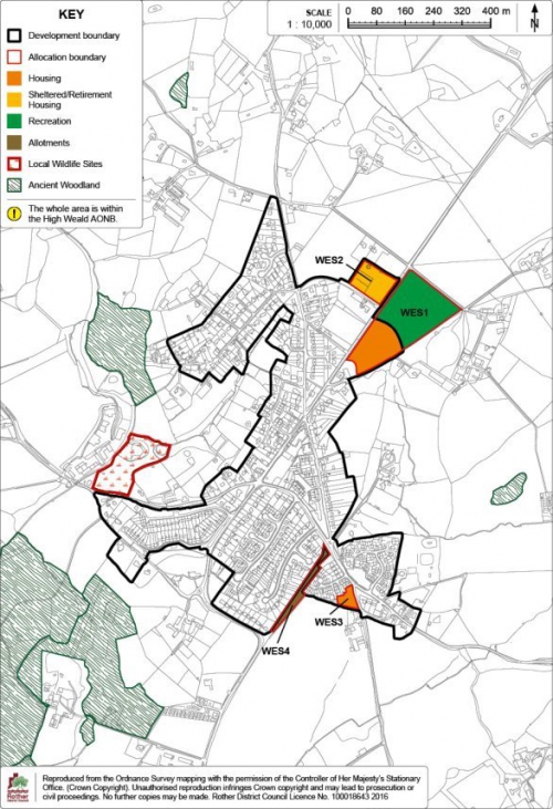
12. Other Villages with Development Boundaries
12.1 The use of Development Boundaries is the subject of Core Strategy Policy OSS2 and Policy DIM2 of this document.
12.2 In addition to the villages with site allocations detailed in chapter 11 and those settlements subject to Neighbourhood Plans, there are a number of other, typically smaller, settlements which contain some services and within which some small-scale development may be acceptable in principle. To define the areas in which such development could be supported, the following settlements include development boundaries:
- Brede and Cackle Street
- Guestling Green
- Icklesham
- Pett
- Staplecross
- Three Oaks
- Winchelsea
12.3 Other settlements without development boundaries are not considered suitable for most forms of new development for reasons including the presence of environmental constraints; being in an unsustainable location; and/ or a lack of services. Development outside development boundaries will be limited to that which accords with specific Local Plan policies or that for which a countryside location is demonstrated to be necessary, in accordance with Policies RA2 and RA3 of the Core Strategy.
Brede and Cackle
Street (Policies Map Inset Map 15)
12.4 Brede and Cackle Street are strongly linked with the neighbouring village of Broad Oak located within one mile to the north. The three villages form a relatively compact cluster of settlements running north-south along the A28 Northiam Road. Brede and Cackle Street are situated on the south facing slopes of the Brede valley and both villages are located within the High Weald AONB. Broad Oak is the larger settlement and contains a range of services.
12.5 There is a regular bus
service to Hastings, Northiam and Tenterden. Both Brede and
Cackle Street themselves have modest levels of service
provision. Brede has a church and a public house. Cackle
Street has a community hall which serves the wider
area.
12.6 The development
boundary reflects the more built up areas of the villages,
whilst also maintaining the valuable open countryside gap
between them.
Guestling Green
(Policies Map Inset Map 16)
12.7 Guestling Green is a small village located between Hastings and Icklesham, with direct access into the A259 trunk road. It is rural in character despite the impact of the A259, and lies within the High Weald AONB.
12.8 The village has a limited range of local services, including a primary school, although there is no shop. It is on a local bus route giving access to Rye and Hastings and is around one mile from Three Oaks railway station.
12.9 The development boundary defines the main built up area, protecting adjoining open areas which visually relate to the countryside. The boundary excludes the less intensive development along Chapel Lane to the east, and Winchelsea Road to the south, in order to protect the rural character of the village's hinterland.
Icklesham (Policies Map Inset Map 17)
12.10 Icklesham is in the eastern part of the district, five miles north-west of Hastings. A linear village, much of the original settlement fronted the A259, but more recent development has taken place north of the main road. Icklesham lies wholly with the High Weald AONB.
12.11 The village has a range of services including a primary school, village hall, recreation ground, farm shop, pub and a church. There is some employment provision at the Little Sherwood Industry Park and there is a peak time bus service to Rye and Hastings.
12.12 Icklesham's development boundary encloses its well-defined built up area, preventing encroachment into the surrounding open landscape.
Pett (Policies Map
Inset Map 18)
12.13 Pett is a linear village about four miles north-east of Hastings and is the main settlement within the parish of the same name. The village is washed over by the High Weald AONB and the surrounding area is a mix of agriculture and woodland, much of it ancient.
12.14 The village has a reasonable range of services including a village hall, two public houses, a play area, sports pitch and a church. However, there is no primary school and no village centre as such, with services dotted across the extent of the village.
12.15 The development boundary defines the main built up area, protecting the surrounding open countryside and woodland from encroachment and preventing inappropriate backland development.
Staplecross
(Policies Map Inset Map 19)
12.16 Staplecross is
located on a ridge above the Lower Rother Valley within the
High Weald AONB. It is the largest settlement in the parish
of Ewhurst. Staplecross is a reasonably compact village
centred upon a junction of the B2165. The village has a
number of services and amenities including a pub, shop,
children's play area, village hall and a primary
school.
12.17 The Local Plan Core Strategy identified a relatively modest target for new housing over the Plan Period to 2028 of some 25 dwellings, in addition to a recently built affordable housing exception site of 8 dwellings on the eastern edge of the village (planning permission RR/2011/2393/P). This housing requirement has already been accommodated by the granting of planning permission for 26 dwellings on land east of Cricketers Field (references RR/2014/1256/P, RR/2016/647/P and RR/2016/2952/P). The scheme is currently under construction.
12.18 The development boundary at Staplecross reflects the established built up area including the extent of both the above schemes, preventing encroachment into the very rural and distinct countryside setting of the village.
Three Oaks (Policies
Map Inset Map 20)
12.19 Three Oaks is a small village bisected by the Hastings to Rye railway. It is within the High Weald AONB and there are clusters of Ancient Woodland to the north and south of the village. The settlement is located half a mile west of the A259 trunk road, and the local service village of Westfield is located 1.25 miles north-west of the village.
12.20 Three Oaks is principally linear in form and has a limited range of local services, including a pub, village hall, church and a play area. There is a limited rail service (approximately every 2 hours in each direction) and no bus service.
12.21 The presence of a
railway station supports the retention of a development
boundary. The boundary properly reflects the ribbon nature
of the settlement, preventing encroachment into the
surrounding fields and woodland.
Winchelsea (Policies
Map Inset Map 21)
12.22 Winchelsea is a
historic hilltop settlement in the eastern part of the
district, within the High Weald AONB. Its citadel dominates
the surrounding landscape. Winchelsea, officially a town,
appears today as a large village, although it was once a
major urban settlement and one of the principal naval ports
of the country. It is of immense historic and
archaeological interest and value, being an outstanding and
rare example of medieval town planning. The formal grid
structure of the historic street pattern is still clearly
visible today and is a crucial element in defining its
character. The town, together with adjoining countryside,
is designated as a Conservation Area.
12.23 Winchelsea has a good
range of services including a primary school and
convenience shop. The development boundary serves to define
the existing form and pattern of the town, preventing
encroachment into surrounding wooded bluffs. However, in
reality, there is extremely limited scope for more
intensive development within the town, due to the
considerable heritage constraints.
Policies Map Inset Map 15:
Brede and Cackle Street
Policies Map Inset Map 16:
Guestling Green
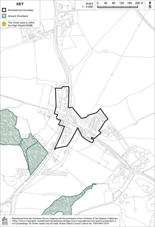
Policies Map Inset Map 17:
Icklesham
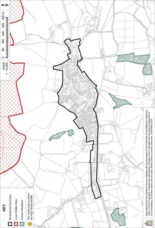
Policies Map Inset Map 18:
Pett
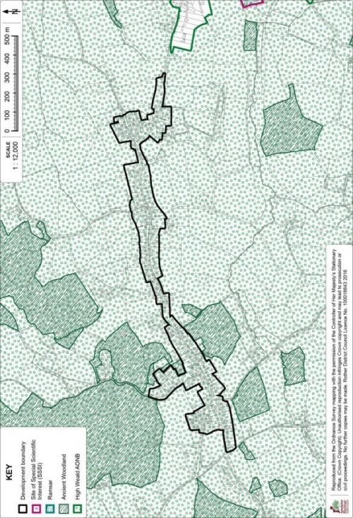
Policies Map Inset Map 19:
Staplecross
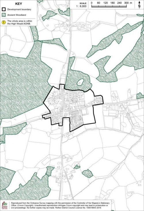
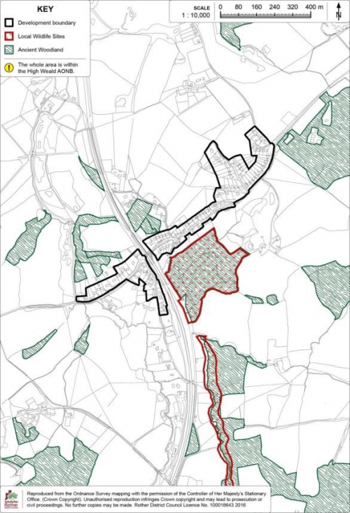
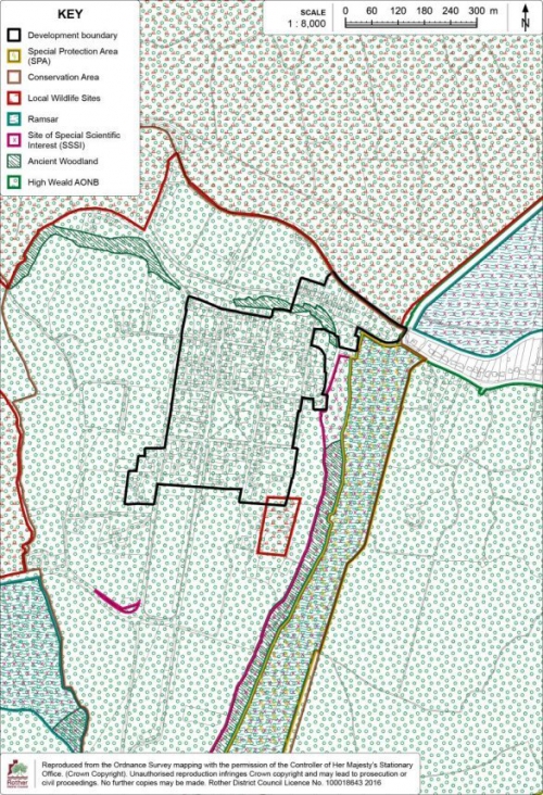
13. Other Policies
(1) Gypsies and Travellers
13.1 The Government's overarching aim is to ensure fair and equal treatment for Gypsies and Travellers in a way that facilitates the traditional and nomadic way of life while respecting the interests of the settled community. Its Planning Policy for Traveller Sites (PPTS) sets out the approach which Local Authorities should follow, firstly determining the level of need within the local area and then planning to meet that need.
13.2 The Core Strategy sets out the need for pitches over the plan period (2011-2028) through Policy LHN5 - Sites for the needs of Gypsies and Travellers, which states:
"Provision will be made for 5 permanent pitches within Rother for Gypsies and Travellers over the period 2011-2016, and a further 6 pitches between 2016 and 2028.
Sites will be allocated in the Development and Site Allocations Plan, taking into account any sites granted permission in the interim.
Site selection will take into account the Strategy objectives, the future needs of occupiers and the likely availability of sites for its intended occupiers. Sites should meet the criteria set in Policy LHN6".
13.3 Between 2011- 2016[83], 5 pitches[84] have been granted permanent planning permission, leaving a remaining requirement of 6 pitches up to 2028[85]. Just as for "bricks and mortar" housing, the Council is required to demonstrate how it will meet the targets for the provision of sites for Gypsies and Travellers. Therefore, sites are identified in this Plan to meet the outstanding requirement over the plan period. Having regard to the site selection criteria in Core Strategy Policy LHN6, two sites are allocated below as Gypsy and Traveller pitches to meet the outstanding need of 6 pitches, as at 1 April 2018, the base date of the Plan.
Site Allocation: Land adjacent to High Views, Loose Farm Lane, Battle
13.4 Land adjacent to High Views, Loose Farm Lane is located on the urban edge of Battle to the west of an existing Gypsy and Traveller site which comprises of two pitches. The site forms part of disused small holding which itself is an area of poor quality despoiled land which adjoins residential dwellings in ribbon development to the north and rolling open countryside to the south.
(1) 13.5 The site is in the ownership of a Gypsy/Traveller household and has previously been granted planning permission for a single pitch, although this was not implemented.
13.6 The site is accessed via a single track off Loose Farm Lane – a narrow lane which connects the small complex of buildings at Loose Farm with the A2100 (Hastings Road). This site and the adjacent two Gypsy/Traveller pitches are considered to be located on the most discrete part of the wider Loose Farm Lane small-holding and further pitches in this locality, over and above the additional pitch identified here is likely to have an adverse impact on the landscape character of the High Weald AONB. Immediately adjoining to the west are two existing pitches which a Planning Inspector accepted did not result in any material harm to the landscape character of this part of the AONB or compromise the objectives of its designation.
13.7 This site is similarly not prominent when viewed from the adjacent countryside to the south and appears to be well screened by existing fencing, although would benefit from some soft landscaping from further native species screening on the southern and western boundaries. Care should be taken to respect the amenity of adjoining properties on the northern boundary.
13.8 Theprovision of one pitch is considered to be acceptable in terms of access by vehicles, impact on the local environment and the amenity of residential neighbours and in terms of its proximity to services and relationship and scale with the settled community.
13.9 The site has a medium potential to contain prehistoric, Roman and medieval remains. An archaeological assessment would be a planning application requirement.
Policy GYP1: Land adjacent to High Views, Loose Farm Lane, Battle
Land adjacent to High Views, Loose Farm Lane, Battle as shown on the Policies Map, is allocated for one permanent pitch for Gypsies and Travellers. Proposals will be permitted where:
- the applicant has demonstrated that they meet the definition of Gypsies and Travellers in the Government's Planning Policy for Traveller Sites;
- the scheme proposes no more than one pitch; and
- the scheme is accompanied with an appropriate native planting scheme to ensure appropriate boundary screening, as indicated on the Detail Map.
Figure 61: Policy GYP1
Detail Map
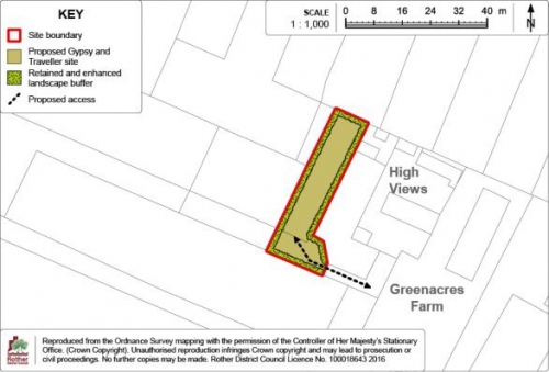
Site Allocation: Land at North Bexhill (Policy BEX3)
13.10 Provision for five further pitches is made for in the North Bexhill strategic allocation (Policy BEX3).
13.11 The site, for up to 5 pitches, is to be located at the end of the southern section of Watermill Lane immediately south of the North Bexhill Access Road (NBAR). With further boundary landscape planting to the west and south, this area is relatively contained in the landscape and would contribute to the outstanding district-wide need for such pitches.
13.12 The Policy (BEX3) and associated Inset Map and supporting Detail Map can be found in the Bexhill Chapter.
Transit[86] site provision
13.13 East Sussex County Council owns and manages a transit site for short-term occupation on behalf of all the authorities in East Sussex - a nine pitch transit site just outside Lewes, called Bridie's Tan. The site is one of only a few in the region, and was completely rebuilt in 2009.
13.14 In 2014, the Council worked in partnership with the other local authorities in East Sussex to produce a Gypsy, Traveller and Travelling Show people Accommodation Needs Assessment. The Assessment looked at the need for further Transit provision across the county, evidence showed that although the formal transit provision at Bridie's Tan appears to be in consistent use, there are regular vacancies on the site (pitches on Bridies Tan, on average, are only occupied 39% of the time).
13.15 The Assessment "suggests a provisional need for an additional eight transit pitches across the study area…. However, there is a need for all authorities to undertake more robust and consistent monitoring of households stopping on the existing transit provision and on unauthorised encampments in order to be able to more accurately assess future transit requirements".
13.16 As such, the Local Authorities have revised their monitoring practices of unauthorised encampments to provide consistency of recording and a central point of collection (East Sussex County Council Traveller Team), therefore being able to more accurately assess transit requirements across the County in the future. Given the high level of vacancies at Bridie's Tan it is considered that there is no immediate short-term need for a further transit site across the County. Detailed Countywide monitoring practices have been implemented and will be fed into a further review in due course.
13.17 It is considered that at the current time, there is no existing unmet short-term need for further transit pitches. However, the Council will continue to work with other Local Authorities across East Sussex to allocate land to meet the county-wide transit needs, particularly through collaborative working using the existing policy framework (Policy LHN6), should a need arise in the future.
Policies Map Inset Map 22:
Land adjacent to High Views, Loose Farm Lane, Battle
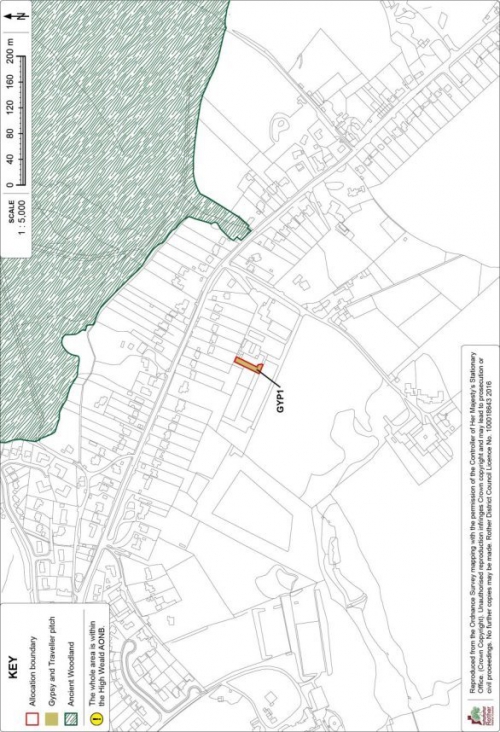
Marley Lane
Site Allocation:
Land at Felon's Field, Marley Lane
13.18 The site is on the southern side of Marley Lane, close to its junction with the A21 and adjacent to a highways depot. It was previously allocated in the 2006 Local Plan for employment/storage purposes. While planning permission was granted in 2014 for a highways depot, it is understood that this will not be implemented.
13.19 Although the site is outside any settlement and there is considerable woodland regeneration on its boundaries, the central part is hard surfaced and it provides a rare opportunity for new employment floorspace with good trunk road access. Therefore, it is still considered suitable for employment use and it is appropriate to reallocate it.
13.20 The developable area is just over 1 hectare and it is anticipated that some 3000 sqm of floorspace for industrial/storage purposes will be accommodated. The actual floorspace achieved will be dependent on the nature of the use.
13.21 The site is within the High Weald Area of Outstanding Natural Beauty (AONB) and is fringed to the south-west by designated ancient woodland. There are also thick tree belts on all boundaries, other than the north-eastern boundary, which are protected by a Tree Preservation Order (TPO) and would need to be retained and enhanced for landscape and biodiversity reasons. A single Oak in the central part of the site is also subject to a TPO. There is evidence of protected species, including dormice, using the site, and ecological surveys, together with any mitigation measures, would need to be included in development proposals.
13.22 The site has potential archaeological interest due to its location within an area of medieval and post-medieval activity, and archaeological survey work will need to accompany the planning application.
13.23 The site lies within a groundwater protection zone and an area of flood risk lies to the south. Surface water run-off will need to be appropriately managed and sustainable drainage (SuDS) included.
13.24 The site is not well connected for access by public transport or walking but does benefit from good access to the A21 trunk road. A Travel Plan will need to accompany the planning application to demonstrate how traffic generation will be minimised.
Policy MAR1: Land at Felon's Field, Marley Lane
Land at Felon's Field, Marley Lane, as shown on the Policies Map, is allocated for industrial/storage use. Proposals will be permitted where:
- some 3,000sqm of business floorspace is provided;
- trees subject to Tree Preservation Orders, are retained, and boundary tree belts are retained and strengthened with native species;
- a biodiversity strategy makes provision for any protected species found to be using the site, and where necessary, includes appropriate mitigation and/ or compensation for any loss of habitat;
- there is no adverse effect on ground water;
- sustainable drainage (SuDS) is provided in accordance with Policy DEN5, to include measures to minimise the risk of increased flooding due to surface water run-off, and
- a travel plan is included to show how the traffic to be generated is to be minimised.
13.25 The Detail Map below provides an indicative general layout of the development site in accordance with the above policy.
Figure 62: Policy MAR1
Detail Map
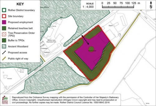
Policies Map Inset Map 23:
Land at Felon's Field, Marley Lane
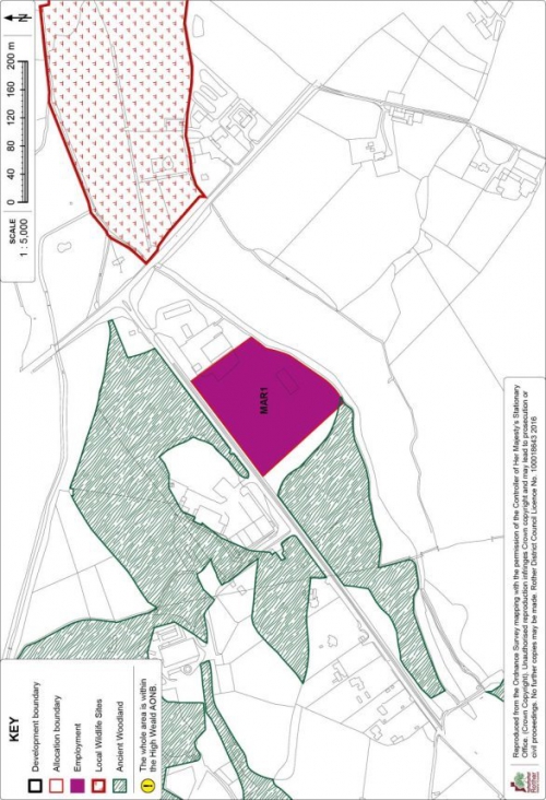
[54] This figure reflects the fact that a site with planning permission for 58 units is a specialised scheme which is not progressing. 52 units is regarded as a more reasonable estimate, leaving a balance of 6 dwellings.
[55] The residual requirement for Robertsbridge has been reduced to zero following the adoption of the Salehurst and Robertsbridge Neighbourhood Plan.
[56] The residual requirement for Sedlescombe has been reduced to zero following the adoption of the Sedlescombe Neighbourhood Plan.
[57] Insert weblink
[58] Beyond the base date of the DaSA (1st April 2018), hence this site is reallocated.
[59] In line with the Historic England Guidance understanding Historic Buildings: A Guide to Good Recording Practice 2016
[60] Insert relevant weblink.
[61] APP/U1430/A/06/2030466/NWF
[62] APP/U1430/W/17/3172068 & APP/U1430/W/17/3190282
[63] Insert relevant weblink
[64] Insert relevant weblink
[65] Add weblink
[66] Combe Valley Countryside Park Mission Statement.
[67] Land east of Burgess Road - RR/2016/85/P
[68] Land east of Burgess Road - RR/2016/85/P & Land at Rock Lane - RR/2015/1514/P
[69] "Ancient woodland and veteran trees: protecting them from development" at: www.gov.uk
[70] Planning permission reference RR/2016/2534/P
[71] 2011 census
[72] Policy DEN3 refers.
[73] RR/2017/457/P
[74] RR/2015/545/P: Land at Donsmead, Station Road (65 dwellings (net))
[75] RR/2013/1490/P
[76] "Ancient woodland and veteran trees: protecting them from development" at: www.gov.uk
[77] RR/2016/4/P
[78] RR/2013/1538/P
[79] Open Space, Sport & Recreation Study (November 2007)
[80] A Playing Pitch Strategy for Rother District Council (October 2012)
[81] Reference RR/2009/322/P
[82] Reference RR/2009/2687/C
[83] 01/04/2011 – 31/03/2016
[84] Two pitches at Loose Farm Lane, Battle and three pitches at Beeches Brook, Battle.
[85] There is one site within the District which has temporary planning permission – 1 pitch at Bramble Farm, Ewhurst. There is presently an undetermined planning application for 1 pitch at Coldharbour Farm, Dallington
[86] These are permanent sites that allow Travellers to stay for short periods (up to 12 weeks) when they are passing through an area.