Core Strategy Consultation on Strategy Directions 2008
(2) PART 3 - STRATEGY THEMES
(18) 10. Communities
Scope and Issues
10.1 This section addresses the diverse needs of all sections of Rother’s local communities. This includes the nature and affordability of housing, the need to feel safe and have well-developed community services and the promotion of healthy and active lifestyles.
10.2 It also considers the needs of particular sectors of the community, notably older people, children and young people, as well as gypsies and travellers.
Aims and Objectives
Box 19
Aim:To continue to support, and further develop, vibrant, safe, balanced and inclusive communities
Objectives:
- To provide housing in a way that supports local priorities and provides choice, including for affordable housing
- To develop inclusive community life including support networks
- To promote healthy, active lifestyles
- To support older people, particularly to live independently
- To be more attractive to young people as a place to live
- To maintain low crime levels and improve the feeling of safety across the District
10.3 Six main aspects of ‘communities’ are identified for strategy development:
- Housing
- Health, Recreation and Community Facilities
- Gypsies and Travellers
- Older People
- Young People
- Crime Reduction and Prevention
10.4 These are addressed in turn below, with preferred ‘strategy directions’ presented in the boxes.
10.5 The objective of developing inclusive community life is also a part of other sections of this document. The importance to communities of the public realm is addressed on the section on ‘Design Quality and Built Environment’ and elements of the section on ‘Economy’ are a vital component of successful communities. In addition, more locationally specific aspects of community development are addressed in the individual spatial strategies.
(13) HOUSING
Affordable Housing
10.6 The plan objective is ‘to be more attractive to young people as a place to live’. This involves encouraging more young people to stay in Rother, to return or be attracted to Rother as a place to live and work, which will necessitate easier access to housing.
10.7 Rother is attractive to in-migrants relocating from other parts of the country, particularly people over the age of 45. These in-migrants are generally able to out-bid local people for market housing. This especially affects the availability and affordability of housing for people on lower incomes who wish to live locally. As a result, Rother is one of the 30 least affordable Districts in the country according to research1. This is something for the Core Strategy to address, since a failure to provide more affordable housing will have negative impacts on the District – more people, particularly young people, will be excluded from the housing market, which in turn does not support balanced, inclusive or vibrant communities.
10.8 The current Local Plan Policy HG1 is for a standard 40% requirement on all sites of 15 dwellings or more in Bexhill, Battle and Rye or sites of 5 dwellings or more in rural areas. A lower percentage will only be considered where the applicant can demonstrate that the 40% requirement will make the development of the whole site unviable.
10.9 An Affordable Housing Supplementary Planning Document (SPD) was adopted in October 2006 and its purpose is to help increase the supply of affordable housing in accordance with local needs.
Quantity of Affordable Housing
10.10 The Council’s Housing Strategy has the overall objective of increasing provision of affordable housing to meet identified needs and an annual target of 92 affordable homes delivered via all methods, per year. This target will include 53 new homes provided via developer contribution (S106) per year.
Percentage of Affordable Housing
10.11 The option to raise, lower or maintain the percentage of affordable housing has been considered. Consideration of options needs to take account of the South East Plan context which recommends a region wide level of 35% affordable housing and a level of 40% in the Sussex Coast Sub Region.
10.12 The current Local Plan requirement of 40% across the District was supported by the Affordable Housing Supplementary Planning Document 2006. There is a case for not altering it, particularly as it is a relatively recent policy.
10.13 However, the Hastings & Rother Housing Assessment 2006 (HMA) suggested that ‘in rural Rother it would probably be realistic to seek to achieve a target of 50% of affordable housing on development sites, and justifiable in terms of housing need.’
10.14 However, other factors support a lowering of the percentages specified in the Local Plan, particularly recent market pressures/economic conditions which may serve to limit delivery, at least in the short term.
10.15 Given the need in rural areas as well as higher land values, it may be appropriate to raise the rural threshold relative to the Bexhill threshold. Therefore, there are two options – firstly to lower Bexhill to 35% whilst raising rural to 50%, or secondly to maintain all at 40%. Both options would adhere to the South East Plan.
Threshold of Affordable Housing
10.16 There is stronger evidence of affordability problems in rural areas than in Bexhill. The Housing needs Survey 2005 demonstrated particularly high housing need in Rye and Battle, which suggests that a distinction should be made between the two market towns and Bexhill when setting the thresholds.
10.17 It is estimated that lowering the threshold in Rye and Battle from 15 to 10 would result in over 100 extra affordable dwellings over a 20 year period.
10.18 Similarly, it is considered to address the affordable housing need in the wider rural area by lowering the threshold from 5 to 3. There are two possible methods by which to do this (as outlined in the Preferred Strategy Direction). It is estimated that lowering the threshold in rural areas would result in about 67 extra affordable dwellings over a 20 year period by either method.
Type of Affordable Housing
10.19 Current Local Plan policy and the Affordable Housing SPD do not specify tenure of affordable housing. Policy H3 of the South East Plan requires a mix comprising at least 25% social-rented and at least 10% intermediate across the South East region.
10.20 The Hastings & Rother Housing Market Assessment recommended that social rented housing should comprise no more than 25% in Bexhill due to concerns about the impact a higher level of social rented would have on the social mix and dynamics of the Bexhill community. Although the South East Plan Policy H3 suggests that the mix should comprise at least 25% social rented, a lower level of 20% on some Bexhill sites could be balanced by a higher level on some rural sites.
10.21 On sites in rural Rother, Rye and Battle, the preferred option is to tilt the balance slightly more to social housing. The Housing Market Assessment pointed out that ‘the stock of social rented housing in Rural Rother, has been eroded by the ‘Right to Buy’. In this light, it seems reasonable to propose a higher proportion of social rented in rural areas. Therefore a mix of 10%-20% intermediate housing and 20%-30% social rented is proposed.
Summary of Affordable Housing Preferred Options by Area
| Bexhill | Rye and Battle | Rural Villages | |
|
Percentage of Affordable Housing |
Option a - 40% | 40% | 40% |
| Option b - 35% | 40% | 50% | |
| Threshold | 15 | 10 | 3 |
| Mix |
15-20% intermediate 20-25% social rented |
10% - 20% Intermediate. 20%-30% social rented. |
|
Residential Mobile Homes
10.22 Many existing residential mobile homes provide a valuable source of affordable housing, which should not be diminished by their replacement with permanent dwellings. On sites within development boundaries, new residential mobile homes will be treated on their merits against the relevant planning criteria.
10.23 Outside development boundaries, new residential caravan sites and mobile homes would not generally be in keeping with the environment of the District. Their form and appearance are incompatible with the character of rural areas, especially the countryside of the High Weald, and they constitute inappropriate, sporadic and unsustainable development. New development for this purpose will thus usually be unacceptable unless it would otherwise accord with Plan policies. The Plan seeks to ensure that housing needs are met by the construction of permanent dwellings. Specific exceptions to this include where such accommodation is essential in association with the running of a farm, woodland or land based industry, as set out in the section on ‘Countryside’, or to meet the assessed needs for Gypsies and Travellers.
Allocations for Affordable Housing and Exception Sites
10.24 The Council has a ‘Rural Exception Sites’ Project specifically devised to tackle the problem of the lack of affordable rural housing. Rural Exception Sites are sites which may exceptionally be granted consent outside settlement development boundaries, contrary to normal planning policies, specifically to secure local needs affordable housing.
10.25 The principle of exception sites was adopted in the Local Plan in 2006 under Policy HG2, and the policy remains a positive step to help address the issue of the affordable housing shortage and should be retained.
10.26 PPS3 Housing states that sites can be allocated solely for affordable housing. The Hastings & Rother Housing Market Assessment suggests ‘This could be a very useful tool for Rother DC to use in encouraging provision of additional affordable housing in its rural area. Existing powers to foster new development on exception sites remain unaltered and should also be reflected in policy and active steps taken to identify and bring forward such sites.’
10.27 By implication, if allocations solely for affordable housing are permissible, it seems reasonable to assume that the local planning authority could also allocate sites that are in excess of the standard 40/50% level by allocating sites that are predominantly or substantially for affordable housing, where this is a viable approach.
10.28 Therefore, allocations that are wholly or substantially for affordable housing on smaller sites could supplement the provision of affordable housing in settlements of particular need. Such allocations may also include a small amount of open market housing to incentivise development. If applicable, they would be allocated through the LDF. This option would accord with PPS3. However, conditions may be applied to ensure the non-affordable element is of a scale appropriate to enable the development to be a viable option for the landowner to ensure that the development takes place.
10.29 On larger sites (more than 10 dwellings) it is considered that overly high proportions of affordable housing, particularly social rented housing may have a negative effect and run contrary to the PPS3 aim of mixed, balance communities.
10.30 Therefore it is not proposed to go above the standard 40/50% affordable housing level on any larger sites. Similarly, it is important to clarify that this ‘higher level’ of affordable housing would only apply on sites specifically identified and allocated by the Council. It would not apply to ‘windfall’ sites, to which the standard level would be applied regardless of their location.
10.31 This option will entail the identification of sites (through the LDF sites identification process) in or adjacent to settlements which have a particular need for affordable housing. Therefore, such sites would be capable of accommodating at least six dwellings (since this was the minimum size specified in the LDF sites identification process), but less than 10.
10.32 Another issue of relevance to this subject is the Council’s ongoing investigation in partnership with the High Weald AONB Unit into the possibility of including ‘land-based workers’ within a local definition of key workers, thus assisting them to access affordable housing. More detail on this is in the section on Countryside.
Housing Mix
10.33 Current Local Plan policy at HG3 requires a 30% requirement of 1 and 2 bed properties on new housing developments. An option is to alter this proportion.
10.34 A higher proportion of one and two-bed properties than the Local Plan requirement of 30% appears to be supported by the following evidence. The Housing Needs Assessment 2005 indicated that, of households moving within Rother, 48.4% of households require just one or two bedrooms. For concealed households moving within Rother, the figure is even higher with 98.3% requiring one/two bed properties.
10.35 The Housing Market Assessment of Hastings and Rother considered the need to plan for different household types. It forecast that the household composition of Rother in 2026 would be composed of 82% one or two person households. It also considered the need to plan to promote economic development, which could indicate the desirability of building houses attractive to potential in-migrants and hence, family housing. New housing may also improve the social balance in particular neighbourhoods, to foster regeneration, and increase access to housing for mainly younger people on low incomes within rural areas.
10.36 The Housing Strategy for Rother 2007-2012 identifies a requirement to develop a more balanced housing stock in both the private and social sectors with a need for more flats and terraced houses, particularly in the private sector. There is a much greater stock of smaller and rented property in urban areas than the rural areas and this works against the need to attract younger people, particularly to rural areas.
10.37 Building larger properties may still help address this need, as people currently in one and two beds then have more opportunity to move up the housing ladder. It is also acknowledged that household size and household space needs are not necessarily a direct relationship. However, the Housing Needs Assessment figures, at least for the rural areas indicate that here the need for smaller properties is greatest. Therefore the option is to require 40% one and two bed properties on development sites in rural areas.
Empty Homes, Prevention of Homelessness,
Private Sector Housing Renewal
10.38 There is a large stock of empty homes in the District and the Council is preparing an Empty Homes Action Plan and Strategy to address this. Whilst a reduction in empty homes cannot count towards the South East Plan housing figure, the initiative will increase the available housing stock. Improvements to the condition of private sector stock can help drive regeneration and renewal.
Box 20
(12) The Preferred Strategy for Housing is to:
a) For Affordable Housing
Secure increased provision of affordable housing to address
local needs.
This will be achieved by:
Quantity of Provision
- Delivering the targets for affordable housing provision as set out in the Housing Strategy.
(7) Percentage of Affordable Housing
Undertaking consultation and further assessment of two options:
-
(2)
Continue to seek 40%
affordable housing as set out in Local Plan Policy HG1,
as supported by the Affordable Housing Supplementary
Planning Document 2006,
or - (6) Seek 50% affordable housing in the rural parishes, a 40% level in Rye and Battle, and 35% in Bexhill.
(8) Threshold of Affordable Housing
- Lowering the threshold in Rye and Battle to 10 dwellings, but maintaining it at 15 dwellings in Bexhill; and
- Lowering the threshold in rural areas by one of two
possible methods; either:
-
Lower the threshold
from 5 to 3 dwellings
or - (1) Maintain threshold of 5 dwellings, but require all developments of 3 and 4 dwellings to provide one affordable dwelling
-
Lower the threshold
from 5 to 3 dwellings
NB It is the Council’s intention to undertake further viability work on options for percentages and thresholds of affordable housing.
(6) Type of Affordable Housing
- At Bexhill: social rented housing will comprise 20-25% of the mix on Bexhill major development sites, with the balance (15-20%) comprising intermediate housing;
- In Battle, Rye and Rural Areas: the mix will be 10%-20% intermediate housing, 20%-30% social rented housing.
(4) Allocations for Affordable Housing and Exception Sites
- The principle of ‘exception sites’ will be retained in line with current Local Plan policy;
- The provision of affordable housing in settlements of particular need will be enabled by allowing allocations that are wholly or substantially for affordable housing on smaller sites of less than 10 dwellings. (Affordable housing may be supplemented where necessary on allocated sites by an open market dwelling(s) to incentivise release.)
(5) b) For Housing Mix, Homelessness and Private Sector Housing Renewal
Make effective use of land and dwellings, and bring forward a range of housing to ensure the needs of local people are met in the community, with particular emphasis on enabling people to get on the housing ladder.
This will be achieved by:
- Providing more small, cheaper housing, either by:
-
Retaining a
requirement for 30% one or two bed properties on all
new housing developments District-wide;
or - (2) Retaining a requirement for 30% one or two bed properties on all new housing developments in Bexhill, Rye and Battle, but requiring 40% one or two bed properties on new housing developments in rural areas, (unless a local housing needs assessment indicates that this is not appropriate).
-
Retaining a
requirement for 30% one or two bed properties on all
new housing developments District-wide;
- Guiding developers in terms of the mix of households to provide for with reference to the findings of the Housing Market Assessment and the Local Housing Needs Survey;
- Initiatives to improve the condition of private sector housing by conversion and extension where appropriate and area approaches where concentrations exist;
- Incorporating housing for vulnerable groups in major residential developments, where a need is shown;
- Support initiatives to reduce the number of empty homes and prevent homelessness, in accordance with the Council’s respective strategies.
(4) HEALTH, RECREATION AND COMMUNITY FACILITIES
10.39 The provision of health, recreation and community facilities is integral to the physical and mental well-being of any community.
10.40 Access to doctor’s surgeries is important to any community, but particularly to one that has a high proportion of elderly people. The Primary Care Development Plan identifies a number of doctor’s surgeries that will need re-locating or replacing in the next few years. Access to the Conquest Hospital is also important, not least for accident and emergency, and maternity services.
10.41 Community halls, village halls and other buildings dedicated to community use have a key role to play in the vitality of settlements and their loss will be resisted. The Council will aim to assist with facilitating improved community facilities alongside new development, where needed.
10.42 It is important to ensure communities have access to a suitable range and quantity of outdoor recreation opportunities. Rother’s Open Space, Sport and Recreation Audit and Assessment recommended local standards for a number of recreational activities. They are as follows:
Recommended Quantity Standards
Table 3 Recommended Recreation Quantity Standards (District Wide)
| Typology | Existing Provision (per 1,000 population) | Recommended Local Standard (per 1,000 population | Surplus /Deficit (ha per 1,000 population) | |
| Parks and Gardens | 0.25 | 0.57 | 0.32 | deficit |
| Natural & Semi Natural Greenspace | 15.53 | 2.00 | 13.53 | surplus |
| Amenity Greenspace | 0.89 | 1.73 | 0.84 | deficit |
| Children | 0.06 | 0.20 | 0.14 | deficit |
| Young People | 0.02 | 0.20 | 0.18 | deficit |
| Outdoor Sports & Facilities | 2.75 | 3.90 | 1.15 | deficit |
| Allotments | 0.19 | 0.31 | 0.12 | deficit |
10.43 More geographically specific quantity standards - for Bexhill, Battle, Rye, East Rural Rother and West Rural Rother - can be found in the Audit and Assessment. Its recommendations, which have been accepted by the Council, also include a number of specific needs, which it will be appropriate to address in the forthcoming Site Allocations DPD.
Recommended Access and Quality Standards
10.44 PPG17 recommended the use of ‘access’ and ‘quality’ standards in addition to the more traditional assessment of quantity used in the Rother Local Plan. In response, Rother’s PPG17 study has recommended the following accessibility standards.
Table 4 Recommended Access Standards
| Outdoor Sports | Parks and Gardens | Amenity Green-space | Allotments & Community Gardens | Natural & Semi-Natural Greenspace | Provision for Children | Provision for Older children /teenagers | |
| Urban | 20 mins. walk time | 20 mins. walk time | 15 mins. walk time | 20 mins. walk time | 15 mins. walk time | 10 mins. walk time | 15 mins. walk time |
| Rural | 20 mins. drive time |
10.45 For a quality standard, rather than score-based criteria, the evidence study has recommended a statement setting out the aims and aspirations for each of the types of open space. Cross-reference can be made to the background evidence study ‘Open Space, Sport & Recreation Audit and Assessment’ for further details.
10.46 The above standards are useful in assessing the adequacy of provision around the District and as a means for justifying either:
- New on-site provision alongside new development
- Financial contributions from developers to address any open space shortfalls.
10.47 Rother’s PPG17 study also addresses indoor sport. Assessment and public consultation undertaken suggests a lack of swimming pools in the District. This finding was supported by supply and demand analysis in the study which suggested a current shortfall of 304sq.m rising to a shortfall of over 400sq.m by 2026. Other indoor sport facilities have a similar projected lack of provision by 2026, as demonstrated in the following table.
Table 5 Overall Supply and Shortfall
| Oversupply/shortfall | ||
| Existing |
2026 Projection without action |
|
| Swimming Pool | Shortfall 304sq.m | Shortfall 401sq.m |
| Badminton | Shortfall 7 courts | Shortfall 10 courts |
|
Health and fitness stations |
Shortfall 55 stations | Shortfall 101 stations |
| Indoor bowls | Oversupply 0.76 rinks | Shortfall 0.17 rinks |
| Indoor tennis | Shortfall 47 courts | N/a |
10.48 The study included a number of recommendations to address shortfalls in indoor facilities at the more local level. Major proposals are discussed in the relevant spatial strategies and will be looked at further in the forthcoming Site Allocations Development Plan Document (DPD).
Box 21
(15) The Preferred Strategy for Health, Recreation and Community Facilities is to:
Promote healthy, active and participatory communities with a suitable range and quantity of different types of recreational opportunities, health and community facilities that are accessible and of high quality.
This will be achieved by:
- The re-location or replacement of doctor’s surgeries in accordance with the Primary Care Development Plan, subject to conformity with relevant planning policies;
- The development of new community facilities and the improvement, upgrading and extension of existing ones, to address identified needs. The loss of existing community facilities will be resisted;
- A presumption in favour of retaining existing open spaces and application of the quantity, access and quality standards proposed in Rother’s PPG17 Open Space, Sport and Recreation Audit and Assessment. The net loss of open spaces that will exacerbate deficits, either in terms of quantity, access or quality will not be permitted. The Council will respond positively to proposals to address any identified shortfalls, subject to conformity with other relevant planning policies;
- Consideration of the Audit and Assessment’s recommendations with regard indoor sport. Planning applications that seek to address identified shortfalls, especially swimming, will be considered favourably, subject to conformity with other relevant planning policies. The net loss of facilities that will exacerbate deficits, either in terms of quantity, access or quality will not be permitted;
- Siting new built health, recreation and community
facilities within development boundaries. Such facilities
may be permitted outside development boundaries where:
- there is a demonstrable local need, having regard to the characteristics of the population, the results of any public surveys and recognised standards of provision;
- there is no scope for the need being met within the development boundary;
- the proposal is demonstrated to provide significant community benefits;
- the proposal is readily accessible by the community it serves by means other than the car;
- there is no significant harm to the countryside setting.
GYPSIES AND TRAVELLERS
10.49 The District Council is required by national policy to include policies and site allocations for Gypsies and Travellers where necessary to meet identified needs. The Housing Act (2004) introduced the requirement that local authorities undertake Gypsy and Traveller Accommodation Assessments (GTAAs) alongside reviews of the housing needs of the rest of the community. Information from the GTAA was then used to provide advice to the Regional Assembly on levels of provision.
10.50 As part of the Partial Review of the South East Plan the Assembly has checked the GTAAs from a regional perspective and has generated options for pitch provision across the region, upon which they are currently consulting.
10.51 The South East Plan Partial Review will determine the number of pitches that the Council will need to provide for; this may be between 3 and 7 additional permanent pitches for Rother 2006-2016. Transit requirements will not be allocated by the South East Plan Partial Review, but the Council will work with authorities in East Sussex to ensure sufficient provision across the county. There is no local need identified for travelling showpeople but there may be a requirement to provide a plot in line with regional need under one of the four consultation options.
10.52 The Council needs to provide locational criteria for the development of sites. The locational requirements of gypsy sites are similar to those for housing sites. At least in large part, the South East Plan figures relate to meeting local needs, and can be considered in parallel with affordable housing. Consequently, the criteria used to identify and assess sites for gypsies and travellers are not dissimilar to those used for other forms of housing.
10.53 Sites will need to be deliverable, either through being (or proposed to be) publicly owned, owned by gypsies/travellers or, possibly, promoted by developers as part of a comprehensive scheme that addresses the full range of housing need.
Box 22
(8) The Preferred Strategy for Gypsies and Travellers is to:
Positively address legal responsibilities regarding the provision of sites for Gypsies and Travellers.
This will be achieved by:
Permanent Site Provision
- Identifying sufficient land in its Sites Allocations DPD to accommodate the future requirements set out by SEERA (current draft proposals are between 3 and 7 permanent pitches).
- In the interim, assessing all proposals and applications for new pitches using policy DS1 of the Local Plan together with relevant Government guidance.
Transit Site Provision
The Council will work with ESCC, Eastbourne Borough Council, Hastings Borough Council and Wealden District Council to identify suitable land to deliver a transit site in line with locally identified needs.
Gypsies and Travellers Sites
The Council, in conjunction with the other local authorities in East Sussex, will agree a robust, generic, criteria-based policy for all local authorities engaged in allocating and/or providing gypsy and traveller sites in East Sussex. Criteria will include:
- The needs of gypsies and travellers including for work and travel patterns
- Priority given to sites in proximity to settlements with access to employment, education, health, shopping and other local services and infrastructure
- Consideration can then be given to more rural locations, particularly where they are well located in relation to major roads and/or public transport
- Potential for reuse of vacant/derelict sites and surplus public sector land
- The location of sites within the AONB must demonstrate that they do not compromise the objectives of designation.
- Avoidance of:
- Sites on or near refuse tips, significantly contaminated land
- Functional floodplains
- SACs, SPAs, Ramsar sites and other nationally recognised designations
- Suitability, availability and achievability of sites.
(8) YOUNG PEOPLE
10.54 A plan objective is for Rother to be more attractive to young people as a place to live. To achieve this, it is important that Rother’s Core Strategy reflects the needs and aspirations of the District’s children and young adults.
10.55 There is no specific strategy for young people at this stage, since aspects of the above ambition overlap with other strategies within this document. Attention is drawn to other sections:
- Housing Section - the need to provide sufficient housing that is affordable, of the right type and in the right location so that young adults are encouraged to stay in the area.
- Health, Recreation and Communities Section – the need to provide suitable recreational and community facilities to ensure the physical and mental well-being of Rother’s young people.
- Economy Section – in particular the need to provide quality education and recreation facilities for children and teenagers to the need to ensure there are sufficient job opportunities for school leavers.
10.56 Some young people in Rother feel marginalised and disaffected, which can lead to anti-social behaviour, crime and an increased concern about community safety. It is therefore essential to enable children, young people and their families to participate in the wider community and realise their potential. The East Sussex and Rother Community Strategies have both provided forums through which to engage young people and much progress has already been made in addressing young people’s issues.
10.57 It is worth highlighting how much has already been achieved or is in the pipeline. Improvements have also been made to play areas and there are now seven skate areas for teenagers in the District following recent projects at Peasmarsh and Camber. The latter measure has responded to results from Rother Residents’ Satisfaction Surveys which showed that ‘activities for teenagers’ is one of the top five things that need improving in the District.
10.58 A ‘Children and Young People’s Play Policy and Strategy for Rother’ has recently been completed in collaboration with Rother Play Partnership. Together with the ‘Open Space Audit and Assessment’ the aim is to ensure that Rother’s children and young people have access to a range of quality play opportunities within a practical journey of their homes.
10.59 New education facilities are already in the pipeline – a new secondary school at Bexhill, a new primary school at Etchingham and replacement primary school buildings at Rye and Hurst Green.
10.60 However, there are still issues to address - unauthorised absence in Rother schools is higher, and average GCSE/A level grades are lower, than the regional averages. Although rates of teenage pregnancy are much lower than the national average, they have risen in Rother over the last ten years. Similarly, the numbers of 16-18 year olds not in education, employment or training has risen slightly and stood at 8% in 2007. Rother’s Community Strategy monitors progress towards a number of targets on issues of direct relevance to young people and further consideration will be given to the role of the LDF in achieving these.
(2) OLDER PEOPLE
10.61 Rother’s demographic profile shows a high proportion of older people. Most recent estimates (2007) are that 28.5% of the population are aged over 65, compared to 16.2% in the South East and 16.7% in England as a whole. Within the District, the greatest proportion of older people live in the coastal area, notably in Bexhill, where 35.9% of the population is aged over 65.
10.62 Moreover, population forecasts indicate that a high proportion of future housing growth will be of older people, such that the percentage of people aged 65+ will increase from 28% to 36,5%, with a notable increase in people over 85 years old.
10.63 Therefore, planning in Rother needs to give specific consideration to the needs of this ageing population. Providing the necessary support services will clearly become an even greater responsibility for public, and voluntary, bodies. The key challenges are around maximising accessibility to support services, including specialised services, as well as the nature of housing to be provided across what is a large rural area.
10.64 The well-being of older people in Rother’s communities is also influenced by opportunities for activity and social engagement.
10.65 The following strategy approaches draw heavily on the ‘Housing and Support Strategy for older people and carers in Hastings and Rother 2001/2027’, the East Sussex Supporting People Strategy (updated 2007) and the ‘Older People’s Commissioning Strategy’.
10.66 The preferred strategy set out below should be read in conjunction with other strategies that have a bearing on supporting older people. This includes the provision of community facilities, accessible shops and services and leisure opportunities that support active lifestyles.
Box 23
(5) The Preferred Strategy for Older People is to
Address the needs of older people in the community.
This will be achieved by:
- ensuring that both existing and new homes provide choices for older people to live in their home communities;
- Develop innovative approaches “hubs” for older people, linking new housing with community facilities and services available for older people;
- making safety in the home environment a priority in urban design;
- improving and increasing the range of housing options for older people with care and support needs;
- providing support for (private sector) nursing homes in locations where a clear unmet need exists;
- supporting “living at home”, through grant availability for refurbishment where appropriate;
- building new homes to ‘lifetimes homes’ standards, including all affordable housing.
(1) CRIME REDUCTION and PREVENTION
10.67 A key objective is ‘to maintain low crime levels and improve the feeling of safety across the District’. This echoes the Rother component of the Community Strategy, which indicates that ‘Level of Crime’ is the main thing that needs improving in Rother and the second in the list of things that Rother residents think have got worse.
10.68 Notwithstanding this, Rother is a relatively safe place to live, with noticeably lower levels of criminal offences than both the region and the country as a whole see below:
Recorded crime by key offences - rate per 1,000 population (2006/07)
| Crime | Violence against the person | Sexual offences | Robbery | Burglary dwelling | Theft of a motor vehicle | Theft from a vehicle |
| England/Wales | 19.3 | 1.1 | 1.9 | 5.5 | 3.6 | 9.3 |
| South East | 18.6 | 1.1 | 0.8 | 4 | 2.7 | 8 |
| East Sussex | 18.7 | 1.1 | 0.6 | 3.4 | 2.1 | 6.2 |
| Rother | 13.7 | 0.9 | 0.3 | 2.9 | 1.8 | 6.2 |
10.69 Although local crime levels are low, the fear that an incident may occur, including incidents of anti-social behaviour, influences peoples’ view of their safety and can deter people from accessing and using streets, spaces, places and facilities in the town. This is socially damaging and detrimental to quality of life and the economy.
10.70 Community safety issues are addressed in particular through specific local initiatives, particularly those guided by the Safer Rother Partnership. The Partnership has produced a Crime and Disorder Strategy 2005-2008. This aims to reduce crime and anti-social behaviour as well as the fear of crime.
Box 24
(3) The Preferred Strategy for Crime Reduction and Prevention is to:
Work with partner authorities to address issues of crime and disorder and promote development that will have a positive impact on the reduction of crime and disorder.
This will be achieved by:
- Support for local initiatives to reduce crime and disorder
- Seeking to secure, for all new development which could impact on community safety, a statement setting out the measures incorporated to address crime and disorder and to achieve “Secured by Design” status where relevant.
- Providing places with well defined routes, spaces and entrances that aid convenient movement without compromising security. Creating a sense of ownership by providing a clear definition between public and private spaces.
- Providing adequate natural surveillance (overlooking) of adjacent streets and spaces and ensuring that all new developments are designed to make crime difficult to commit by increasing the risk of detection.
- Providing places that are designed with management and maintenance in mind with well designed security features, to discourage crime in the present and the future.
INFRASTRUCTURE
10.71 The implementation of the above Communities strategy will be supported by appropriate physical, social and green infrastructure. Working with its partners the Council will ensure the timely provision of necessary infrastructure. The following list is by no means exhaustive but serves as an example of the infrastructure requirements that are currently known. Other requirements for infrastructure will be better understood as site-based work is completed.
- Utilities connections for gas, electricity, water and wastewater for allocations
- Community projects to improve social infrastructure in line with Local Action Plans
- Improvements to existing, and new open spaces and play areas in accordance with RDC’s Open Space Space Audit and Assessment, Local Action Plans and pending more detailed investigation in Site Allocations DPD.
- Public transport improvements (see Transport and Accessibility).
- Replacement and/or relocation of health facilities in accordance with the Primary Care Development Plan (PCDP).
- Replacement and/or relocation of education facilities (see spatial sections)
IMPLEMENTATION
10.72 The strategy for Communities will be implemented through:
- Site Allocations DPD
- New guidance on Developer’s Contributions
- Review of Affordable Housing SPD, as appropriate
- Further Local Development Documents
- The determination and monitoring of planning applications and appeals
- Working with Housing developers, Registered Social Landlords, Parish Councils, Action in Rural Sussex (AiRS), landowners, statutory agencies, transport operators and the local community
- The use of planning obligations
10.73 Implementation of the strategy and policies requires concerted action by many organisations. The following table indicates which would be the lead agency in relation to each area of action:
| Strategy Area | Lead Agencies / Partners |
| Affordable housing | Housebuilders, Registered Social Landlords (RSLs), LPA, LSP |
| Housing Mix, Homelessness and Private Sector Renewal | LPA, LSP, RSLs |
| Health & Recreation | LSP, LPA, ESCC, Primary Care Trust, Sport England |
| Gypsies & Travellers | LPA, ESCC |
| Older People | LPA, ESCC, Voluntary Sector |
| Younger People | LPA, ESCC, Parish Councils |
| Crime Reduction and Prevention | Sussex Police, LSP, LPA |
(14) 11. Economy
Scope and Issues
11.1 The need to address the serious weaknesses in the local economy, and low earnings, receive strong emphasis in both the South East Plan and the Integrated Sustainable Community Strategy for East Sussex.
11.2 Such priority attention is a reflection of the combination of relatively low skill levels, (only 20.9% of working age people has NVQ4 or above, compared to 30.5% for the region), average earnings of full time workers being only 71% of the regional average, and 35% of jobs being part-time.
11.3 Also, the business base is relatively small, with only marginal growth in VAT-registered firms over the last 10 years. Lower paid service sectors dominate, with only 16.5% of jobs in Finance/IT/other business activities, compared to 24% for the region. Public administration, education and health accounts for 31% of all employment. Tourism plays a significant role, supporting some 3,100 jobs.
11.4 There is a high reliance on jobs outside the district, with net out-commuting of 5,824 workers (2001), equivalent to 17.2% of the workforce. Even so, a higher proportion of people work at or from home than in any other district in the South East.
11.5 Hastings is the centre of the local labour market area, but is particularly weak in economic terms, and is identified as the most deprived urban area in the region.
11.6 Further details of the condition of the local economy, workforce and jobs forecasts, and the demand and supply of employment land are contained in an ‘Employment Strategy and Land Review’ prepared jointly with Hastings Borough Council. This also highlights other economic strategies with which the Core Strategy should dovetail.
11.7 Objectives are put forward that seek to reflect local economic priorities, while the strategy looks to present a holistic view of what is required to secure a “step change” in economic performance. This places the contribution of land use policies within a wider context of education and skills, and business, development.
11.8 Specific policies are proposed in relation to employment land and premises as well as the particular needs of tourism.
11.9 The main areas for consideration are regarded as being:
- the best ways of delivering a better, more rewarding and accessible range of jobs
- the overall scale of land and floorspace required
- the relationship between economic development and transport communications
- the contribution of the rural development, and
- the balance between tourism promotion and conserving the very heritage that provides attraction
11.10 This section focuses on business and tourism developments. Retail development is addressed in the relevant town/area sections.
Aim and objectives
11.11 The aim and objectives below provide a framework for addressing the above issues.
Box 25
Aim:To secure sustainable economic growth for existing and future residents and provide greater prosperity for all
Objectives:
- To raise aspirations and improve educational attainment
- To increase skill levels
- To increase the business base and overall productivity
- To expand the range of job opportunities
- To improve the balance of homes and jobs
- To increase local earnings relative to living costs
Strategy for Sustainable Economic Development
11.12 Options have been considered that relate to alternative approaches to promoting economic development. These considered the potential for “smart growth”, which relies mainly on more effective use of existing accommodation, and the need to offer more space opportunities to stimulate business growth.
11.13 Drawing on both the joint employment review and a sustainability appraisal, it is concluded that improved availability of a range of accommodation is a necessary component of the economic strategy for the area and that, because of the poor state of the economy and the pressing needs of businesses for more, and more modern, accommodation that this should be provided as soon as possible.
11.14 However, it is clear that the take-up of employment land and premises needs to be supported by an equally vital and complementary range of other interventions, including business support, training and facilitating effective use of IT, investment in IT infrastructure, which in part compensates for the area’s relative peripherality. This will require close cooperation between a number of agencies.
(1) Employment Land and Premises
11.15 The Employment Strategy and Land Review, referred to above, concluded that in order to meet the economic objectives for the Rother and Hastings area, provision should be made for some 100,000sqm of business floorspace across the district, with approximately 60,000sqm at Bexhill, 10,000sqm at Battle, 10,000-20,000sqm at Rye and 10,000sqm in the rural areas.
11.16 These targets relate primarily to business accommodation. The agricultural sector is considered in the Rural Areas section, while retailing is considered within the scope of the particular settlement sections.
Tourism
11.17 Visitors to Rother contribute significantly to the local economy. They come for the area’s arts and culture, history and heritage, seaside (most notably Camber Sands), literary connections, events, gardens and local crafts/produce. The prospect of longer, hotter summers, as well as transport costs and increasing awareness of the environmental impacts of flying, will assist the domestic tourist market.
11.18 A selective approach to tourism development is proposed, focussing on higher quality markets and on those that are related to, and support, the area’s environmental qualities. It is recognised that there are both areas of tourism opportunity as well as areas of pressure, which need to be effectively managed. Local implications of the following overall approach are contained in the relevant area strategy sections.
Box 26
(11) The Preferred Strategy for the Economy:
(3) (a) For a coordinated approach to Sustainable Economic Development:
Continue to develop collaborative working between education, training, business support and inward investment agencies to secure sustainable improvements in economic opportunities and performance.
This will be achieved by:
- increasing workforce skills through investment in education, including through extended vocational training and sector skills programmes, including development of a Vocational Skills Centre at Bexhill;
- effective business support services, principally through ‘1066 Enterprise’, and the development of business networks;
- the continued catalytic role of the Hastings and Bexhill Task Force and its executive regeneration company, SeaSpace;
- increased promotional activity of the opportunities for business in the District in line with improving capacity, particularly encouraging financial and business services and other growth/high technology businesses and “enviro-industries”.
(2) (b) For employment land and premises
To expand the range employment land and premises, including new strategic sites, and maintain a suitably broad and readily available supply to provide for employment growth that at least matches workforce growth, facilitates higher levels of economic activity and reduces reliance on out-commuting.
This will be achieved by:
- providing for some 100,000sq.m of employment floorspace over the Plan period, with the majority within the first 10 years;
- retaining existing business sites and premises in employment use wherever practicable and compatible with local amenities, and supporting their effective use through suitable intensification, conversion, redevelopment and/or extension, access/environmental improvements and marketing, where appropriate, and, in certain circumstances, public intervention;
- increasing the supply of high quality employment sites, with the main strategic locations being to the north east of Bexhill close to the proposed Link Road;
- encourage suitable employment development in locations that make effective use of rail and water transport opportunities, notably at the Port of Rye.
- continuing to give priority to the re-use and adaptation of suitable buildings in the countryside for employment, including for tourism purposes;
- maintaining and improving the supply and range of small-medium sized sites and units, including incubation space, in the towns and villages, particularly those that have good strategic accessibility (i.e. to the A21 road and rail corridor) and which act as local service centres;
- seek town centre, or edge of centre, sites for offices, including as part of mixed-use developments;
- in circumstances where continued employment use of a site/premises is demonstrated not to be viable, (in conjunction with other measures where relevant), seek complementary enabling development as part of an overall scheme to make most effective use of the property for employment purposes;
- incorporate an appropriate level of business development within residential allocations, where there is a demonstrable need for additional business space locally and where such accommodation is otherwise appropriate in the site circumstances;
- facilitating (where permission is required) business activities operating from residential properties wherever there is no adverse impact on local amenities.
(12) (c) For Tourism
To recognise and support the role of tourism in Rother, and to develop sustainable tourism as part of the ‘1066 Country’ programme.
This will be achieved by:
- Focussing support on quality improvements to existing attractions, in conjunction with the regional and county tourism bodies;
- Giving greater emphasis to developing “green tourism”, including use of public transport to destinations, accommodation and events, encouraging take-up of green accreditation schemes and developing the markets for local produce;
- Retaining and further improving the range and quality of visitor accommodation, in particular promoting good quality B & B accommodation including public houses and self catering accommodation, a small “boutique” hotel in Bexhill, and the expansion of country house and golf hotels;
- Giving priority to the conversion of buildings for tourism (as well as other employment) purposes, and for sympathetic extensions to existing buildings;
- Continuing to provide for the extension of the Kent and East Sussex Steam Railway;
- Recognising the contribution of holiday chalets, caravans and camping sites to the tourism economy by retaining such sites for holiday use (through occupancy conditions), continuing to provide only for improvements and upgrading to existing static accommodation sites, but providing for further touring caravan and camping facilities where relevant environmental criteria are met;
- Enhancing Camber’s potential as a quality, year-round tourism destination through effective management of the beach and dunes, providing for both family-orientated and active uses in the area, and the upgrading of visitor facilities, accommodation and the public realm, in ways that respect local amenities;
- Ensuring that high environmental standards in relation to the tourism heritage are maintained, both through sensitive management of the public realm, of tourist pressures and of development proposals.
Infrastructure
11.19 The infrastructure required to facilitate the strategy for local economic regeneration and growth includes both transport schemes, available sites and requisite skills:
- Bexhill Hastings Link Road
- Baldslow Improvement
- public transport improvements (see Transport and Accessibility)
- serviced employment land (and premises)
- effective business (including tourism) support services
- expanded, educational and skills facilities
- navigable channel of River Rother at Rye Harbour
Implementation
11.20 The main mechanisms through which the strategy will be delivered are:
- The Business community
- Hastings and Bexhill Task Force/Sea Space
- Regional Transport Programme and agencies responsible for schemes
- Local Authority regeneration programmes
- Employment allocations (including via mixed-use schemes) in the Site Allocations DPD and relevant SPDs
- A new Tourism Strategy
- Learning and Skills Council and Local Education Authority programmes
- Environment Agency maintenance and investment programmes
11.21 Implementation of the strategy and policies requires concerted action by many organisations. The following table indicates which would be the lead agency in relation to each area of action:
| Strategy Area | Lead agencies / Partners | |
| Strategy | Workforce skills | Colleges; Learning and Skills Council; ESCC |
| Workforce growth | LPA; | |
| Supporting enterprise | 1066 Enterprise, Business Link, SEEDA | |
| Land and premises | LPA; developers | |
| Sub-regional initiatives | Task Force; SEEDA | |
| Sector support | Sussex Enterprise; SEEDA | |
| Marketing | RDC; 1066 Enterprise | |
|
Land and premises |
LPA; businesses, Locate East Sussex | |
| Tourism | 1066 Country Marketing Group; RX Group; LPA Kent and East Sussex Railway; site operators; RDC; Parish and Town Councils; attractions |
(23) 12. Environment
Scope and Issues
12.1 The importance of the natural and built environment in Rother District is evidenced by the extent of the District (some 82%) which is designated as an Area of Outstanding Natural Beauty (AONB), a Conservation Area, or an Archaeologically Sensitive Area and by the key role which the District’s architectural heritage and natural environment, including the sea, play in the tourist industry.
12.2 The high ecological value of the District’s countryside is reflected in a variety of designations (covering a further 7%) including Sites of Special Scientific Interest, (SSSI), Special Protection Areas (SPA), Special Areas of Conservation (SAC) and a Ramsar and candidate Ramsar site.
12.3 The environmental qualities that make the District so special are under considerable pressure from a number of factors. These include development, flooding, pollution, the challenges of climate change, and a changing agricultural economy. The custodianship of such a beautiful natural and built district requires a high level of environmental stewardship. This alongside the development of robust strategies to ensure that such positive characteristics are preserved and successfully managed for future generations.
Aim and Objectives
Box 27
Aim:To maintain the high quality and improve the long term stewardship of the natural and built environment, with full regard to potential future consequences of climate change
Objectives:
- To place greater emphasis on design quality in all development
- To conserve, where appropriate enhance, and manage the high quality ecological and landscape resources including the historic built environment
- To protect communities from flooding and effectively manage risk
- To minimise carbon emissions, including though greater use of renewable energies
- To improve air quality
- To encourage and support efficient use of resources, including land, water and energy
- To maintain areas of remoteness
12.4 Six main aspects of the environment are identified for policy development:
|
|
(1) LANDSCAPE STEWARDSHIP
12.5 Landscape provides the backdrop or setting for our lives and is about the relationship between people and place. Landscape contributes to our sense of identity and well-being and provides inspiration. The landscape also has great economic and environmental importance.
12.6 The draft ESCC Landscape Assessment seeks to improve understanding of our local landscape character by describing and recording what makes this place distinctive and what is special about it. This is in order to better manage change and to ensure that change and development do not undermine what is distinctive about landscape, as well as informing ways of enhancing character.
12.7 The Assessment identifies a number of areas of distinct landscape character within the Rother District, and recommends specific Landscape Action Priorities tailored to the special characteristics and pressures facing each area.
12.8 The County Council has also produced a paper on ‘remoteness’ that helped inform the Landscape Assessment, and this has parallels with work that has been carried out by the Campaign to Protect Rural England (CPRE) on areas of tranquillity. These highlight large areas within the district where current human impact is relatively limited, including the upper Rother and Dudwell valleys, the Dallington-Ashburnham area and the Walland Marsh. It is recognised that there are many threats to rural tranquillity from new buildings and infrastructure but that such areas contribute significantly to quality of life.
12.9 The High Weald AONB Management Plan 2004 addresses the primary purpose of an Area of Outstanding Natural Beauty - the conservation and enhancement of the special features that represent its natural beauty. In doing so it sets out the main policies and guidelines for the management of the landscape.
12.10 The Plan sets out a unique approach to landscape management by defining Natural Beauty in terms of its key features. The principle components are; Geology and Water Systems, Settlement, Woodland, Routeways and Field and Heath, and their combined contribution to forming the cultural landscape of the High Weald.
12.11 A particular challenge for new development in sensitive environments is maintaining the visual character of settlements in the landscape and in particular settlement edges.
12.12 The East Sussex Inventory of Ancient Woodland is currently being updated and woodlands in Rother are currently being re-surveyed. Such woodlands are those that have been in continuous existence since 1600 and provide a rich environment for a broad range of flora and fauna.
12.13 Further pressures on landscape character come from recreational land-uses, including tourism and leisure. It should be recognised that such uses can create awareness of landscape management issues and provide investment to implement improvements, as well as being crucial for the wider rural economy.
12.14 There are considered to be no reasonable alternatives to the preferred strategy outlined overleaf.
Box 28
(16) The Preferred Strategy for Landscape Stewardship is to:Manage the high quality historic, built and natural landscape character.
This will be achieved by:
Ensuring the protection and wherever possible enhancement of the District’s nationally designated and locally distinctive landscapes for the benefit of all; they include:
- The distinctive identified landscape character, ecological features and settlement pattern of the High Weald Area of Outstanding Natural Beauty;
- The distinctive low-lying levels to the east of the District with particular regard to the landscape setting of Rye and Winchelsea;
- Nationally designated historic sites including listed Parks and Gardens, Scheduled Ancient Monuments and the Registered Historic Battlefield at Battle;
- The undeveloped coast;
- Open landscape between clearly defined settlements;
- Urban fringes;
- Ancient woodlands;
- Tranquil and remote areas;
- Key landscape features across the District, including, native hedgerows, field patterns and waterways.
(2) DESIGN QUALITY AND THE BUILT ENVIRONMENT
12.15 Rother District has a valuable and extensive historic building stock and the towns and villages display particular relationships with their landscape surroundings. The pattern, form, appearance and use of individual buildings and the materials of their construction are peculiar to both the regional and local setting and contribute to the unique sense of place, cultural identity and local distinctiveness of both the District as a whole, and each settlement.
12.16 New development in the District can simultaneously pose a potential threat and an opportunity: a potential threat to the integrity, character and appearance of the historic built environment and its landscape context; and an opportunity to create new places and buildings with their own positive architectural character and place-making qualities that respect their local context and setting.
12.17 The principal choices for the strategy are either to maintain the general expectation of design quality as a criterion within the planning process, or to set high quality design as a central and distinct strategy theme.
12.18 Ensuring that design quality is a fundamental consideration in the planning process and to ensure constantly improving design standards, calls for proposals to demonstrate standards of design against recognised criteria. This will also improve clarity of design assessment. Consequently the Council’s preferred strategy aims to raise the profile of high quality design. The strategy is outlined in the box below.
Box 29
(11) The Preferred Strategy for Design Quality and the Built Environment is to:Place high quality design centrally in the planning process.
This will be achieved by:
- Development of Key Design Principles including:
- Character Identity, Place-Making & Legibility
- Continuity and Enclosure
- Quality of Public Realm, Ease of Movement, and ‘Secured By Design’
- Diversity
- Landscape Setting of Buildings and Settlements
- Design in Context (Understanding & Appraisal of site and wider setting, and incorporation of existing natural site features into proposals)
- Building Appearance & Architectural Quality
- Sustainable Design and Construction
- Requiring new development to contribute positively to the character of the site and surroundings and demonstrate skilful and robust design solutions (tested against the Key Design Principles) tailored to a thorough and empathetic understanding of a particular site and context;
- Including ‘Design Quality’ as a key component in development briefs for specific allocated sites;
- Providing design guidance, including endorsement of
centrally produced best-practice guidance (i.e. by English
Heritage, CABE) for specific topics of local relevance such
as:
- householder development in or affecting historic areas
- areas of archaeological significance or potential, historic buildings,
- locally distinctive vernacular forms, features and materials;
- Preparation of appraisals, including management proposals, for all Conservation Areas within the District, to help identify local character and distinctiveness.
(2) BIODIVERSITY AND GREENSPACE
12.19 Rother District has a very rich natural environment, which functions as both an important ecological habitat and an attractive visual resource and amenity, important to both the tourism economy and the local community.
12.20 Other than the internationally designated sites referred to in the introduction to this chapter there are important habitats which are vital to biodiversity in the District. Rother has one of the highest concentrations of ancient woodland in the country which is a nationally important and endangered habitat and which is recognised in the Biodiversity Action Plan for Sussex.
12.21 The quality of the environment and access to “green space” is essential to the prosperity of the District and quality of life of the local community. Therefore, the continued protection of important wildlife assets needs to accompanied by better management, the reduction of fragmentation of sites and where possible the expansion of habitats. With increasing pressure from growth, the protection and access to natural green space is also considered key.
12.22 The options considered for biodiversity and greenspace include using existing policy mechanisms to enhance and protect natural green spaces where opportunity arises (option 1). Alternatively identifying areas where there is potential for improvement and providing a District-wide framework to underpin the provision of strategic green space (using the ANGst2 model to build up an evidence base) (option 2).
12.23 Option 2 builds upon the first by taking a more proactive approach to the provision of green space and the conservation and enhancement of biodiversity. It would do this by building up an evidence base to underpin the provision of green space and highlight opportunities for enhancement of wildlife habitats. This approach would be less reliant on development as a driver. It would enable gaps and opportunities in the ecological and recreational networks to be identified and, as such, has greater opportunities for improving accessibility, water resource management and biodiversity than option 1.
12.24 The strategy for biodiversity and green space must recognise the multifunctional use of green space. It should consider the protection and enhancement of biodiversity, heritage and recreation values of key green spaces, functionality of green spaces such as for flood storage and overall connection by a network of bio-diverse green corridors, providing links for people and wildlife.
Box 30
(10) The Preferred Strategy for Biodiversity and Green Space is to:Promote the maintenance of biodiversity and the enhancement of priority habitats and be proactive in identifying a strategic green space network
This will be achieved by:
- Protecting priority habitats and species in accordance with the Sussex Biodiversity Action Plan, including ancient woodland, water features and hedgerows;
- Requiring developers to integrate biodiversity into development schemes, by protecting existing habitats in development, and by enhancement to improve habitat and biodiversity, including measures to mitigate for any losses;
- Preparing a ‘Green Network Strategy’ which will use the mapping of key green spaces within the Natural England’s Accessible Natural Green Space Strategy, to identify gaps and strategic opportunities in the ecological and recreational networks;
- Developing a multifunctional green network across the District, considering the protection and provision of green space, restoration and creation of priority habitats;
- Identifying (with partners) strategic areas of opportunity for biodiversity improvement in the coastal areas of the Romney Marshes, as identified in the South East Plan’s Policy NRM 4, by developing the ‘Romney Marsh Living Landscapes Projects;
- Delivering the Pebsham Countryside Park project as a response to the shortfall of natural green space identified in southeast Bexhill and further identify opportunities for green space around the urban fringes of Bexhill and Hastings.
(10) SUSTAINABLE RESOURCE MANAGEMENT
12.25 Sustainable resource management deals with the protection of all natural resources. It looks at how we use resources, how we should use them, what affects them and how they can be best protected and preserved. It aims to manage the way people and organisations interact with natural resources to ensure their long-term availability. Environmental conservation is a central feature to sustainable resource management.
12.26 Environmental conservation in respect of biodiversity is covered by the biodiversity and greenspace section in this chapter. Other cross-cutting topics relevant to sustainable resource management include sustainable design, the management of flood risk and water supply and wastewater, which are also covered in separate sections of this chapter. This section will focus on energy and water use in the construction and refurbishment of development and potential for the generation of renewable energy.
12.27 Within Rother District there is some potential for bio-mass, while favourable wind conditions prevail along the Fairlight-Hastings-Heathfield ridge for on-shore wind power. However, any proposals for renewable energy generation would need to be compatible with the AONB and nature conservation designations.
12.28 In terms of reducing the demand for energy and water through efficiency measures, the District currently relies on building regulations. These require that certain provision shall be made for the conservation of fuel and power in buildings by limiting heat gains and losses and sets out minimum energy performance requirements; there is no direct equivalent for water efficiency.
12.29 Sustainable resource management is a major challenge for the planning system. The emphasis from Government has been on encouraging local planning authorities to promote sustainable development within their local development frameworks. However, it could be argued that sustainable construction is essentially a national issue ultimately for Government to control through raising the standards of building regulations. Nonetheless it may be some time before renewable energy comes on stream given that it’s not an imperative under the lower levels in the Code for Sustainable Homes.
12.30 The Government has introduced the Code for Sustainable Homes to drive a step-change in sustainable home building practice. It is a standard for key elements of design and construction and will become the single national standard for sustainable homes. It will form the basis for future developments of the building regulations in relation to carbon emissions and energy use in homes. Other design categories included within the Code are: water, materials, surface water run-off, waste, pollution, health and well-being, management and ecology.
12.31 The Government proposes that new development would meet a certain level of the Code and the required level would be increased over time to ensure continued improvements in sustainable home-building. The proposed levels are: Level 3 in 2010; Level 4 in 2013 and to achieve Code Level 6 by 2016.
12.32 In light of the volume of work still to be undertaken on this issue both within the District and on a wider sub-regional basis, it is proposed to put forward both options under consideration for comment and to be led by the outcomes of the formal consultation process.
12.33 Assessment of the alternative approaches suggests that the accepted imperative to move to greater energy and water efficiency and a greater use of renewable energy sources, setting higher than national standards where applicable is preferred – if this attainable.
Box 31
The Strategy for Sustainable Resource Management is to:Achieve construction and future operation of development that minimises environmental impact including: energy/CO2 emissions, air pollution, water use, waste generation and maximises adaptation to climate change
This will be achieved by either:
(16) Option 1 The promotion and application of new Government targets and setting supportive criteria for both efficient use of resources and renewable energy production
This would involve policies that will:
- Promote and encourage sustainable design and construction techniques, including energy efficiency and grey water systems in development;
- Develop supportive criteria for renewable energy production in line with the South East Plan policies as directed by PPS22 and for the efficient use of resources in line with PPS1 Supplement;
- Set renewable energy production thresholds for strategic sites;
- Promote the Government-led mandatory level of the Code for Sustainable Homes: Level 3 in 2010; Level 4 in 2013; Level 6 by 2016.
Or:
(6)
Option 2 Extending
beyond the Government targets where appropriate and setting
locally specific targets and criteria for the efficient use
of resources and identifying opportunities for renewable
energy production
This would involve policies that will:
- Promote and encourage high standards of sustainable design and construction;
- Set requirement for levels of the Code for Sustainable Homes to be met in advance of Government standards for identified development areas e.g. Level 3 now; Level 4 in 2010; Level 5 in 2013; Level 6 by 2015 (more research required);
- Set District wide and strategic site requirements for on-site renewable energy production – often set at 10% (Merton rule);
- Identify areas suitable for strategic renewable and low-carbon energy generation and supporting infrastructure in line with PPS1 Supplement (this would be most appropriate on a sub-regional joint working basis).
(2) WATER SUPPLY AND WASTEWATER RESOURCE MANAGEMENT
12.34 Managing demand for water is covered by the Code for Sustainable Homes and involves encouraging installation of water conservation measures such as low flow taps, showers, low flush toilets and water butts.
12.35 However, it is still necessary to acknowledge the potential need for the development of water resources and allocate appropriate land accordingly. This will ensure that, if required, planning permission can be delivered in a timely fashion. The expansion of Bewl Water reservoir is a strategic water resource option for the South East. The enlargement of Darwell reservoir is another option currently under consideration by Southern Water.
12.36 If investment is required to local water or sewer networks, Ofwat takes the view that water and sewerage companies should seek to finance this work through contributions from developers. This reduces the financing burden on existing customers, who would otherwise have to pay through increases in general charges. Rother District Council, therefore, has an important role to play in terms of delivering the water supply and wastewater infrastructure required to meet the objectives of the Core Strategy.
12.37 As well as the Bewl Water, Darwell and Powdermill reservoirs, there are also smaller groundwater resources. Pollutants from the built up areas of new development could potentially be carried into rivers, reservoirs and groundwater by run-off or seepage and adversely affect the quality of water resources. Rapid run-off can reduce the availability of water for abstraction. Land use planning decisions can therefore significantly impact on water supply issues. Protection of water resources is therefore in the public interest.
Box 32
(15) The Preferred Strategy for Water Supply and Wastewater is to:Promote and encourage the provision of water supply and wastewater infrastructure in an efficient and sustainable way.
This will be achieved by:
- Securing, as appropriate through contributions from developers, the appropriate level of investment for local water supply and sewerage networks;
- Securing, where appropriate, the provision of water supply and wastewater infrastructure in a co-ordinated way;
- Protecting water resources in the public interest and treating them as a material consideration in the determination of planning applications;
- Permitting development only if it has no adverse effect on the quality and potential yields of water resources;
- Safeguarding the potential need for the enlargement of Bewl Water Reservoir and/or Darwell reservoir and, if necessary, allocating land to ensure that capacity increases can be delivered in a timely fashion.
(5) FLOOD RISK
12.38 The low-lying and coastal nature of the District makes it particularly vulnerable to flooding, indeed the Environment Agency estimates that, within Rother, some 3,092 properties are at risk of flooding. This should be qualified by saying that these figures do not take account of flood defences.
12.39 Flooding from rivers and coastal waters is a natural process that plays an important role in shaping the natural environment. However, flooding threatens life and causes substantial damage to property. Although flooding cannot be wholly prevented, its impacts can be avoided or reduced through good planning and management.
12.40 The Council fully recognises the importance of flood risk and new development will not be permitted in undefended high flood risk areas, unless that use is compatible with its location. This is important as a measure to protect both life and property and prevents the reduction of existing flood storage capacity. The Strategic Flood Risk Assessment (SFRA) identifies flood risk in the District and will be used to guide development to areas of lower risk or where the risk can be adequately mitigated without increasing flood risk elsewhere.
12.41 Development should be phased sequentially on the basis of flood risk as defined by National Guidance PPS25 Development and Flood Risk. In Rother’s case, application of the ‘Sequential Test’ in some settlements may lead to the application of the ‘Exception Test’, which will look at local need and recognise the level of protection afforded by flood defences.
12.42 Locating development on sites outside flood risk areas would fail to achieve regeneration objectives, resulting in the decline of the area and a decline in economic activity. Consequently there would be an increase in underused or unused brownfield sites as the settlement or area declined. Rock Channel, Rye is an example of such a location. Excluding regeneration in such an area would be economically and socially unacceptable resulting in less sustainable development.
Box 33
(16) The Preferred Strategy for Flood Risk is to:Identify, manage and reduce flood risk to people and properties.
This will be achieved by:
- Ensuring flood defences are maintained and where necessary improved to provide a high level of protection;
- Guaranteeing routine maintenance of all watercourses ensuring they are clear of debris that could affect flood flow conveyance;
- Mitigating flood risk from developments through development of flood storage schemes which will also provide amenity benefit;
- Ensuring development does not take place in areas at risk of flooding, unless providing wider sustainability benefits and suitable flood management and mitigation measures, having regard to the Strategic Flood Risk Assessment (SFRA) and application of the Sequential Test and Exception Test, where necessary;
- Having regard to the Environment Agency’s Catchment Flood Management Plans and Shoreline Management Plans/Coastal Strategies, as well as any specific findings from the Council’s Strategic Flood risk Assessment;
- Not allowing development to increase the risk of flooding to properties elsewhere (e.g. through additional surface water run-off, or by impeding the flow or storage of flood water);
- Not allowing development to have a detrimental effect on existing flood defences or inhibit flood control or maintenance work;
- Requiring a site-specific Flood Risk Assessment (FRA) in accordance with the SFRA and consistent with PPS25, its Companion Guide and any supplementary information from the Government and the Environment Agency;
- Ensuring development makes use of Sustainable Drainage Systems (SuDS) wherever practicable.
INFRASTRUCTURE
12.43 The implementation of the above Environment strategy will be supported by appropriate physical, social and ‘green’ infrastructure. The Council working with its partners, identified in the above table, will ensure the timely provision of necessary infrastructure accompanies new development.
12.44 The following list is not necessarily exhaustive but aims to provide and example of the type of infrastructure associated with implementing this strategy.
- Multifunctional greenspace network including Pebsham Countryside Park
- Habitat creation/restoration including the Romney Marsh Project
- Sustainable Drainage Systems (may include flood storage, balancing ponds, for example)
- Water supply and wastewater infrastructure as necessary
- Reservoir expansion(s) as necessary
- Flood defences (bunds, walls as necessary)
- Renewable energy infrastructure (potentially)
IMPLEMENTATION
12.45 The strategy for environment will be implemented through:
- The determination of planning applications and appeals
- The Sussex Biodiversity Action Plan 2006–2011 and subsequent reviews
- Conservation Area Appraisals
- Design Guidance, including Key Design Principles
- Design component of site-specific SPDs, particularly for North Bexhill, Bexhill Town Centre, and Rock Channel, Rye
- Catchment Flood Management Plans and Shoreline Management Plans
- Application of the Sequential and Exceptions Tests in relation to flood risk
- Flood mitigation measures as necessary (e.g. emergency planning documents, flood warning and evacuation procedures)
- Proposals of and consultation with the Environment Agency
- Subsequent policies and guidance in further Local Development Documents
12.46 The following table identifies the main lead agencies with whom the council would be working in partnership.
| Strategy Area | Lead Agencies |
| Landscape stewardship | ESCC and RDC |
| High quality design | RDC |
| Biodiversity and open space | Natural England; RDC; ESCC, Kent CC; Shepway DC; Hastings BC; Rye Harbour Nature Reserve Management Team |
| Sustainable development | ESCC, RDC |
| Water Supply and wastewater | Southern Water, South East Water, the EA |
| Flood risk | RDC in conjunction with EA (NE and EH where appropriate) |
(26) 13. Transport and Accessibility
Scope and Issues
13.1 The main issue in relation to transport is how to maximise accessibility to jobs, shops and services, particularly within a predominantly rural area with a dispersed pattern of settlements. Access by buses has been a specific issue raised during earlier public consultation.
13.2 Rother generally is disadvantaged, at least in economic terms, by the journey time involved in travelling to London as well as the regional centres of Brighton and Ashford and other parts of the South East. While certain infrastructure schemes are planned or under active consideration, there is uncertainty of many of these due to an ongoing regional review.
13.3 Two principal transport corridors traverse Rother district. Towns along the coast, including Bexhill and rye, are connected by the A27/A259 trunk road and the south Coast railway line. The other main artery is towards London, with the A21 and the London railway line from Hastings.
13.4 Improvements to these routes have long been sought to improve the area’s connectivity with the rest of the region. However, only certain schemes on the A27 and A21 outside the district have been implemented in recent years. The Brighton to Ashford express train service has improved access to those main employment centres. The Government’s approach is not to promote a strategic upgrade of the A27/A259 but to look at local schemes. There are a number of planned A21 improvements but none in Rother is currently programmed.
Aim and Objectives
13.5 The overall aim and objectives proposed below, a well as the subsequent strategy, takes on the twin priorities of the South East Plan to improve accessibility by more sustainable modes, and thereby reduce the need to travel by car, and of reducing the area’s relative peripherality to the rest of the region.
Box 34
Aim:To provide a higher level of access to jobs and services for all ages in both urban and rural areas, and improve connectivity with the rest of the region
Objectives
- To increase the potential for travel by more sustainable modes
- To provide effective access to health, recreation and social services for all
- To ensure that transport infrastructure and services are ‘fit for purpose’, both in terms of its capacity to serve both existing and new development and to support economic objectives.
Strategy
13.6 Consideration has been given to two alternative emphases of transport strategy, namely a focus on investment in strategic road and rail transport, and a focus on investment in improvements in local transport infrastructure and services.
13.7 Assessment of these options highlighted the beneficial effects for both business and tourism economies of improved strategic transport improvements, with consequent prosperity improvements. However, these may increase overall traffic with adverse environmental impacts. A more local focus of investment is more difficult to assess these without details of local schemes. Specific attention would need to be given to rural communities where sustainable transport choices are less readily available, or achievable.
13.8 It is concluded that the transport and accessibility strategy should clearly highlight the contribution of strategic transport infrastructure and services in the longer-term prosperity of the area, and the importance of key improvements. However, this should not detract, or distract, from local priorities for improved access to local jobs, shops, education and healthcare, and for the opportunities for this by sustainable transport modes.
(2) Strategic Accessibility
13.9 In terms of strategic accessibility, the various road and rail schemes in the regional transport programme, that is currently being reviewed are:
| Scheme/Initiative | Lead agency (ies) | Completion |
| Bexhill Hastings Link Road | ESCC | 2012/2013 |
| A21 Tonbridge-Pembury dualling | Highways Agency | 2012/2013 |
| Kippings Cross-Lamberhurst | Highways Agency | 2013/2014 |
| Flimwell- Robertsbridge | Highways Agency | Post 2016 |
| Baldslow improvement | Highways Agency | Pre-2016 tbc |
| A259 East Guldeford/Brenzett | Highways Agency | Post 2016 |
| Bexhill ‘Country Avenue’ extension | Developers;LPA;ESCC | Post 2016 |
| Ashford Hastings line improvements | Network Rail; Seaspace | 2014/2015 |
| London trains service capacity | Network Rail; Operator | Not programmed |
| Willingdon Chord | Network Rail | Post 2016 |
| Developer contributions SPD | RDC (with other LPAs) | 2009/2010 |
| Connections with Hastings | ESCC;RDC;HBC; bus operators; SUSTRANS | ongoing |
| Travel plans | LPA | ongoing |
| Accessibility strategies | ESCC | ongoing |
13.10 The above timings will become clearer following the current regional transport programme review. The top local priority is the Link Road, while it is also recognised that the most substantive differences to journey times will be made by the Tonbridge–Pembury scheme and the Baldslow Improvement. At the same time, proper consideration needs to be given to the need to reduce the impacts, including severance, of the a21 on communities along it.
Local Accessibility and Sustainable Travel Patterns
13.11 Policies that will address improved travel choices by rail, bus cycling and walking need to take account of the fact that two thirds of people rely on the car to get to work. It is notable that 14% of people work mainly at or from home. This breakdown is similar for urban and rural areas, albeit that more rural workers worked at home and less walked or cycled to work.
13.12 The emphasis of planning policies will support sustainability principles by reducing the need to travel, reducing the length of journeys and making it safer and easier for people to access jobs, shopping, leisure facilities and services by public services, walking and cycling.
13.13 Controlling car parking provision can also be a tool for managing use of the car. At the same time, care must be taken to avoid damaging the vitality of commercial centres. The Council reviewed parking standards in 2006 and the policy approach seeks to balance the desire to encourage alternative modes of travel with recognising the importance of the car to people’s accessibility to work, learning and social networks.
13.14 The strategy direction below builds on that of the Local Plan, with further commitment to proactive measures both to identify and secure developer contributions towards local transport infrastructure and capital elements for service improvements.
Box 35
(12) The Preferred Strategy for Transport and Accessibility is:(7) (a) For strategic accessibility:
To give priority to improving strategic transport infrastructure that increases access to jobs and provides the regeneration of the coastal towns.
This will be achieved by:
- Provide for early construction of the Bexhill Hastings Link Road;
- Also give priority to the A21 Baldslow Improvement;
- Within Rother, prioritise other improvements along the A21 that will provide benefits in terms of both accessibility to the coastal towns and in local traffic conditions as well as ensuring that the character of the AONB is not prejudiced (with priority to relieving villages);
- Investment in rail infrastructure be focussed on increasing capacity to Ashford to enhance its role in meeting the need for longer distance journeys to the east;
- Build in provision for increased rail passenger capacity to London over time to meet increasing demand;
- Support strategic transport schemes that improve connectivity including the A21 Tonbridge- Pembury scheme, the Willingdon Chord rail link, A27 schemes to the west and local improvements to the A259 around East Guldeford/Brenzett;
- The Council work closely with other Authorities in East Sussex to develop mechanisms to secure developer contributions towards strategic transport infrastructure in the sub-region;
- Reserve land for additional railway stations at Glyne Gap and Wilting, subject to further studies;
- Support Hastings in developing its role as a regional hub, and particularly in bringing forward proposals that improve connections to it from the towns and villages in Rother District
(3) (b) Local Accessibility and Sustainable Travel Patterns
To give further attention to increasing the accessibility of jobs and facilities by the development of an effective public transport network and of safe pedestrian and cycle routes. The potential for further improving the availability of sustainable travel options will be key to development decisions and the focus of area transport strategies.
This will be achieved by:
- Ensure that all development is in a location that is accessible by a range of modes and provides safe, convenient links to key facilities and services, and jobs, wherever reasonably practicable;
- Require that development is carried out in a manner that makes full provision for walking, cycling and public transport as an integral part of scheme design, as well as through off-site improvements and/or financial contributions as appropriate;
- Implement local accessibility strategies and further developing these as part of community action plans and development strategies, with specific focus on improvements in the availability, quality and efficiency of bus routes and pedestrians safety, together with, in the towns, cycle networks and facilities;
- Provide a framework for managing car use through:
- meeting but not exceeding maximum parking standards that enable the residual needs of developments to be met, having had full regard to the potential for access by means other than the car;
- requiring travel plans that aim to minimise car use, and parking needs, for developments that have significant transport implications;
- ensuring that sufficient parking provision is retained for the future where that would be necessary to prevent harm to the safety or free-flow of the highway;
- requiring an adequate number of parking spaces designed and signed for disabled people;
- securing cycle parking;
- seeking to maximise the potential for shared use of car parks and, in particular, not allow large single-user car parks in town centres and other locations where a more efficient use of parking space may be achieved;
- Only allow development where it is clear that the transport infrastructure, and capacity, exists or will be available to meet the needs of the development;
- Make best use of the existing transport infrastructure and services of the area, with particular regard to the availability of such capacity, as well as the opportunities for travel by non-car modes when considering the location of development;
- Give particular support to sustainable transport initiatives in complementing the improved connectivity between Hastings and Bexhill to be provided by the Link Road.
Infrastructure
13.15 The strategy is essentially related to transport infrastructure necessary to support spatial strategies.
13.16 Certain assumptions have to be made, which reflect current programmes and priorities as updated by the Regional Transport Board in May 2008, although given the ongoing “refresh” of the programme, the spatial strategy also addresses contingencies.
Implementation
13.17 The strategy’s realisation will be delivered through the following mechanisms:
- New guidance on development contributions
- Local Transport Plan and component Strategies
- A new Bus Strategy
- Regional Transport Programme and Regional Investment Fund
- Site specific requirements in DPDs and SPDs
- Bus operators plans
- New Quality Bus Partnerships
- Network Rail franchise requirements and train operating companies proposals
- Travel Plan requirements
13.18 East Sussex County Council, through the Local Transport Plan, has a central role in initiating and co-ordinating sustainable transport measures, while the planning authorities, highway authorities and those responsible for controlling, providing and operating public transport facilities and services such as trains and buses also have key roles.
13.19 The table at paragraph 13.9 identifies the lead agencies for schemes and their assumed timing.
(1) 14. Implementation and Monitoring Framework
Scope and Issues
14.1 It is essential that proper regard is given to how the Strategy will be delivered. This requires careful attention to the realism of assumptions and to alignment with the plans and programmes of the respective agencies.
14.2 It is equally important to enable agencies and other service bodies, as well as developers, to appreciate their role in contributing to the strategy, and for local people to understand how and when the various elements of the strategy, including infrastructure and development, will happen.
14.3 While a clear vision and strategy is vital to guide implementation, it should be recognised that a range of uncertainties exist, not least due to the 20-year timeframe. There are also uncertainties associated with the wider economy and environmental imperatives, as well as the shorter timescale of most investment strategies.
14.4 As well as assessing such risks, Government’s advice is to provide requisite flexibility within core strategies. This may be done by avoiding undue specificity and by setting out contingencies linked to deviations from key assumptions.
14.5 Monitoring is central to ensuring that the strategy is being achieved and for assessing if and when any adjustments need to be made to policies. This referred to as a “plan-monitor-manage” approach.
14.6 The following aim and objectives set out the main purposes of an implementation strategy and monitoring framework.
Aim and Objectives
Box 36
Aim:To ensure that the strategy is robust in terms of ensuring the effective and timely delivery of development and infrastructure
Objectives:
- To have a clear monitoring framework, linked to the Community Strategy, as well as to the Core Strategy’s vision and objectives
- To ensure a continuity of supply of housing and business land and premises
- To ensure that these is, or will be, adequate infrastructure to meet the needs of communities and of development
- to integrate infrastructure programmes of key agencies
- To provide requisite flexibility in the strategy together with contingencies based on a risk assessment that still meet the overall vision
Strategy for Implementation and Monitoring
The necessary robustness of the strategy may be achieved by a combination of effective liaison with service and infrastructure providers and a clear indication, and monitoring, of progress in providing development and infrastructure, as well as in meeting overall outcomes.
These processes are still being developed and will build on the identification of ‘Infrastructure’ and the means of ‘Implementation’ set out at the end of each of the above sections.
The Council already monitors both the economic, social and environmental circumstances of the district, and key development indicators, on an annual basis. It is envisaged that this will become more extensive to reflect the full scope and spatial dimension of the strategy.
Government is currently preparing new arrangements for securing development contributions towards infrastructure provision. It is recognised that this may be a means of utilising some of the uplift in land value to meet the needs of local communities for improved infrastructure.
Box 37
(5) The Preferred Strategy to guide overall implementation is to:- Develop the ‘Monitoring Framework’ in Appendix 2 in conjunction with the Local Strategic Partnership and lead delivery bodies,
- Monitor and report on progress towards objectives of the Core Strategy in the LDF Annual Monitoring Reports, with specific reference to progress in relation to ‘trajectories’ for housing and business development;
- Work closely with East Sussex County Council regarding progress of the Bexhill Hastings Link Road, report any significant delay to the current programme, and make any necessary amendments to the timing or rate of development in accordance with the Overall Spatial Strategy;
- Develop new guidance through a Supplementary Planning Document setting out how developers will be expected to contribute towards the provision of infrastructure and community facilities associated with their development, either on-site, through a contribution or via off-site provision.
(7)
Map 1 - District Key
Diagram
(1)
Map 2 - Bexhill and Hastings
Fringes Inset Diagram
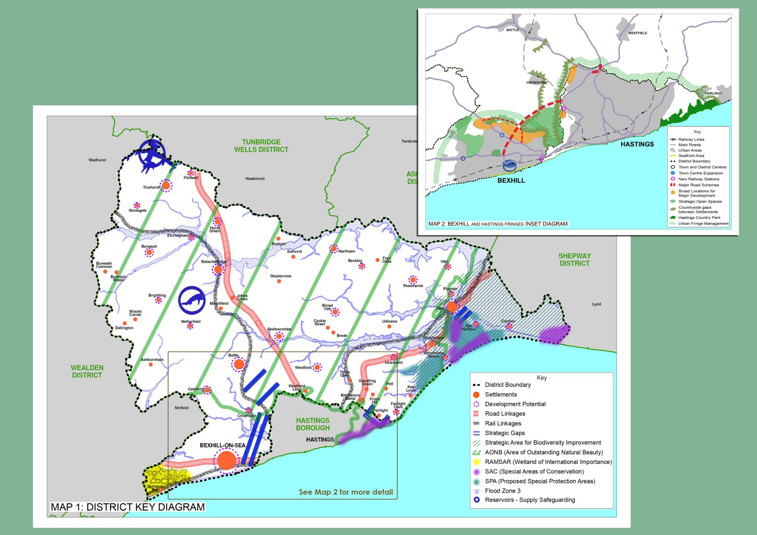
(4) Appendix 1 Glossary of Terms
1066 Country - 1066 Country is recognised throughout the world as a leading brand of historical experience; its spectacular coast and countryside are littered with relics and ruins from the Norman invasion.
1066 Enterprise - the Enterprise Agency for Hastings and Rother, and also the Chamber of Commerce for Hastings and St Leonards.
1066 Group – the Steering Group for the partnership of Local Authorities (Wealden, Rother and Hastings), the tourist attractions and accommodation providers that cooperate in setting a marketing strategy for 1066 Country.
Accessibility – the ability of people to move around an area and reach places and facilities, including elderly and disabled people, those with young children and those encumbered with luggage or shopping.
Action in Rural Sussex - Sussex Rural Community Council was formed in 1931 as a registered charity and has served rural communities ever since. In 2002 SRCC changed its name to Action in rural Sussex. Its role is to identify problems and to respond to the needs of rural communities.
Affordable housing – housing, whether for rent or shared ownership, provided at a cost considered affordable in relation to incomes that are average or below average, or in relation to the price of general market housing.
Agri-Environmental Schemes - a term used to describe national (or local) schemes that pay farmers to farm in an environmentally sensitive way.
Air Quality Management Areas – areas to be established by borough and district councils following local assessment of air quality where individual pollutants are forecast to exceed standards defined in the National Air Quality Strategy.
Ancient semi-natural woodland – woodland that is likely to have existed before 1600 and contains trees and shrubs that are predominately native not obviously planted but have arisen through natural regeneration or coppice re-growth.
Annual Monitoring Report (AMR) – produced by the local authority this will assess the impact of policies and whether targets are being met, and where necessary identify adjustments or revision to policies/proposals.
Area of Outstanding Natural Beauty (AONB) - areas of national importance for their landscape character and appearance, within which the conservation and enhancement of their natural beauty is a priority. These are designated under the National Parks and Access to the Countryside Act 1949 by the Secretary of State for the Environment
Backland Development - can usually be defined as development on land behind the rear building line of existing housing or other development, and is usually land that is formally used as gardens, or is partially enclosed by gardens. It does not include sites where development, as opposed to access to the development, adjoins a public highway.
Baldslow Improvement - The Highways Agency is currently developing options for the Queensway to Baldslow link to the A21 Trunk Road.
Bexhill Hastings Link Road – the current proposal by East Sussex County Council for a new road that will link the outskirts of Bexhill and Hastings. The link road will be 5.5km long and start at the A259 in Bexhill and end at Queensway just north of Crowhurst Road.
Biodiversity – the whole variety of life encompassing all genetic, species and ecosystem variations, including plants and animals.
Biodiversity Action Plan (BAP) – a strategy prepared for a local area aimed at conserving and enhancing biological diversity.
Brownfield Land/Site - land which has previously been developed (see Previously Developed Land)
Building Regulations - regulations which are separate from planning but which have to be adhered to in the construction of development.
Catchment Flood Management Plan - A Catchment Flood Management Plan (CFMP) is a strategic planning tool through which the Environment Agency will seek to work with other key decision-makers within a river catchment to identify and agree policies for sustainable flood risk management.
CDRP - Crime Disorder Reduction Partnership - aims to provide information and resources to help practitioners involved in, or working with, partnerships to make them the most effective possible vehicle for tackling crime, anti-social behaviour, behaviour that adversely affects the local environment and substance misuse (including drugs & alcohol) at a local level.
Commitments - all proposals for development which are the subject of a current full or outline planning permission or are allocations in an existing Local Plan.
Community Strategy – a strategy all Local Authorities are required to produce in response to the Local Government Act 2000, with the aim of improving the future economic, social and environmental well being of the local area.
Commuted payments - are monetary payments made through a legal agreement with the Council, which are ring-fenced to pay for specific infrastructure improvements, e.g. developers can sign a legal agreement that they will pay for highway improvements, for example a pedestrian crossing.
Comparison shops - Comparison shops provide items not obtained on a frequent basis. These include clothing, footwear, household and recreational goods.
Conservation Area- an area designated under the Town and Country Planning (Listed Building and Conservation Areas) Act 1990 on account of its special architectural or historic interest, the character and appearance of which it is intended to preserve and enhance.
Conservation Area Appraisal – this is a written and pictorial assessment of the special interest, character and appearance of a particular Conservation Area.
Contaminated land – land that has been polluted or harmed in some way making it unfit for safe development and usage unless cleaned.
Convenience shops - Convenience shops provide everyday essential items, including food, drinks, newspapers/magazines and confectionery
Core Strategy Development Plan Document – sets out the long–term vision for the future of the area, the spatial objectives and strategic policies to deliver that vision.
Cumulative Impact – where there are a number of developments in a locality, or a continuous activity over time that together may have an increased impact on the environment, local community or the local economy.
DEFRA – Department for the Environment Food and Rural Affairs - the UK Government department tasked with issues such as the environment, rural development, the countryside, wildlife, animal welfare and sustainable development.
Developer Contributions - contributions made by a developer to remedy the impact of development, either by paying money for work to be carried out or by directly providing facilities or works either on or off-site.
Development Plan - the statutory development plan is the starting point in the consideration of planning applications for the development or use of land. In future the development plan will consist of Regional Spatial Strategies prepared by the regional planning bodies; and Development Plan Documents prepared by the District Council, with Minerals and Waste Development Plan Documents, prepared by County Councils.
Development Plan Documents (DPDs) – These will replace the Local Plan and have the same status for decision-making. More than one DPD can be used to provide for the Development Plan at the local level. Types of DPDs include the Core Strategy, Site Specific Allocations and Area Action Plans.
Diversification – a term used to suggest the variation in use of a facility e.g. a playing field can be used by a variety of users for different recreational and sporting activities.
Employment Land - that which is in use for the following purposes – office, industrial and warehousing.
Employment Land Review - an assessment of the demand for and supply of land for employment purposes. The suitability of sites for employment development are assessed to safeguard the best sites in the face of competition from other higher value uses and help identify those which are no longer suitable for employment development which should be made available for other uses.
English Heritage - government advisors with responsibility for all aspects of protecting and promoting the historic environment. English Heritage is responsible for advising the government on the listing of historic buildings.
Environment Agency - incorporating the former National Rivers Authority, this body is responsible for wide-ranging matters, including the management of water resources, surface water drainage, flooding and water quality.
Environmental Stewardship Schemes – are agri-environment schemes which provide funding to farmers and other land managers in England who deliver effective environmental management on their land.
Evidence Base - The information and data gathered by local authorities to justify the "soundness" of the policy approach set out in Local Development Documents, including physical, economic, and social characteristics of an area.
Exception site – a site, located outside a development boundary that should only be used for affordable housing to address the needs of the local community by accommodating households who are either current residents or have an existing family or employment connection.
Farm Diversification - the development of farm-based, non-agricultural activities to help sustain the farm holding.
Floodplain - an area of land over which water flows in time of flood or would flow but for the presence of flood defences where they exist.
Flood Zone 1 (Low Probability) - this zone comprises land assessed as having a less than 1 in 1000 annual probability of river or sea flooding in any year (<0.1%).
Flood Zone 2 (Medium Probability) - this zone comprises land assessed as having between a 1 in 100 and 1 in 1000 annual probability of river flooding (1% – 0.1%) or between a 1 in 200 and 1 in 1000 annual probability of sea flooding (0.5% – 0.1%) in any year.
Flood Zone 3a (High Probability) - this zone comprises land assessed as having a 1 in 100 or greater annual probability of river flooding (>1%) or a 1 in 200 or greater annual probability of flooding from the sea (>0.5%) in any year.
Flood Zone 3b (Functional Floodplain) - this zone comprises land where water has to flow or be stored in times of flood (land which would flood with an annual probability of 1 in 20 (5%) or greater in any year or is designed to flood in an extreme (0.1%) flood)
Government Office of the South East (GOSE) – one of nine regional offices by which a wide range of Government policies and programmes are delivered in the English regions. They act on behalf of the Department for Communities and Local Government.
Greenfield land or site - Land (or a defined site) usually farmland, that has not previously been developed, also include allotments.
Habitat - the natural living space of a plant or animal
Hastings and Bexhill Task Force - a partnership of public sector organisations which came together in September 2001 to improve the area's economy. Its members are the South East England Development Agency (SEEDA), Hastings Borough Council, Rother District Council, East Sussex County Council, English Partnerships, the Government Office for the South East, the MP for Hastings & Rye and the MP for Bexhill & Battle.
Highways Agency - An executive agency of the Department of Transport. The Highways Agency is responsible for operating, maintaining and improving the strategic road network of England.
Housing Association - a non-profit making, independent organisation that provides housing; generally they provide accommodation for people in housing need who are unable to afford to buy or rent housing on the open market.
Infill development – development of a vacant site in a substantially developed frontage or area.
Infrastructure – the basic requirements for the satisfactory development of an area and include such things as roads, footpaths, sewers, schools, open space and other community facilities.
Intermediate Housing - housing at prices and rents above those of social rent, but below market price or rents. This can include shared equity schemes, such as HomeBuy, other low cost homes for sale and intermediate rent.
Key Workers – are essential public sector workers such as nurses, teachers and social workers.
Landscape Character Assessment - an assessment to identify different landscape areas which have a distinct character based on a recognisable pattern of elements, including combinations of geology, landform, soils, vegetation, land use and human settlement.
Listed Building – a building of special architectural or historic interest as designated by English Heritage on behalf of the Department for Culture, Media and Sport, this is a statutory listing.
Learning and Skills Council – non-departmental public body which began work in 2001, taking over the roles of the former Further Education Funding Council and Training and Enterprise Councils. It exists to make England better skilled and more competitive. They have a single goal: to improve the skills of England’s young people and adults to ensure we have a workforce of world-class standard.
Local Action Plans - aim to help local communities take stock of their parish, or locality, and identify ways of enhancing it over the next few years. A number of parishes in the District have produced or are producing Parish Plans/Action Plans.
Local Plan – adopted 2006 provides the policy framework for the District.
Local Development Framework (LDF) – A loose leaf folder, prepared by each Local Planning Authority, containing Local Development Documents. It will replace Local Plans and together these documents will provide the framework for delivering the spatial planning strategy for the Local Planning Authority area
Local Development Scheme (LDS) – A document setting out the programme for the preparation of the Local Development Documents. It sets out a 3-year programme and includes information on consultation dates.
Local Distinctiveness – the particular positive features of a locality that contributes to its special character and sense of place, distinguishes one local area from another.
Local Nature Reserve (LNR) – an area designated by local authorities, in consultation with English Nature, under the National Parks and Access to the Countryside Act 1949, to provide opportunities for educational use and public enjoyment, in addition to protecting wildlife or geological and physiographical features of special interest.
Local Strategic Partnership (LSP) - A local strategic partnership is a partnership of stakeholders who develop ways of involving local people in shaping the future of their neighbourhood in how services are provided. They are often single, multi-agency bodies which aim to bring together locally the public, private, community and voluntary sectors.
Local Transport Plan (LTP) - A five-year integrated transport strategy, prepared by local transport authorities in partnership with the community, seeking funding to help provide local transport projects. The plan sets out the resources predicted for delivery of the targets identified in the strategy. Local transport plans should be consistent with the policies and priorities set out in the Regional Transport Strategy as an integral part of the Regional Spatial Strategy.
Locate East Sussex - is a service provided on behalf of the East Sussex Economic Partnership Limited (ESEP), the company set up to improve the economy of East Sussex. ESEP funding partners are the District and Borough Councils of East Sussex, East Sussex County Council and the South East England Development Agency (SEEDA).
LPA – Local Planning Authority - The local government body responsible for formulating planning policies (in a local development framework), controlling development through determining planning applications and taking enforcement action when necessary. This is a district council, unitary authority, metropolitan council or national park authority.
Material consideration - a matter that should be taken into account in deciding a planning application or on an appeal against a planning decision.
Mitigation measures - those which are put in place to reduce or eliminate any harm caused e.g. building a house in an area of flood risk, the developer could build the house on stilted foundations to minimise the risk as a mitigation measure
Mixed Use – area or site where a mixture of commercial, retail and/or residential uses predominates.
Natural England - is a Non-Departmental Public Body of the UK Government. It was formed (vested) on 1 October 2006. It is responsible for ensuring that England's natural environment, including its land, flora and fauna, freshwater and marine environments, geology and soils are protected and improved. It also has a responsibility to help people enjoy, understand and access the natural environment.
Natura 2000 - European Union network of sites designated by Member States under the birds directive and under the habitats directive.
NVQ - National Vocational Qualifications - are work-related, competence-based qualifications. They reflect the skills and knowledge needed to do a job.
Planning Obligations and Agreements - Legal agreements between a planning authority and a developer, or undertakings offered unilaterally by a developer, that ensure that certain extra works related to a development are undertaken, for example, the provision of highways. Sometimes called "Section 106" agreements
Planning Policy Statement (PPS) / Planning Policy Guidance (PPG) – Statements setting out the Government’s policy framework at the national level on planning issues such as housing, employment and rural areas, PPS’s replace existing Planning Policy Guidance (PPG)
Previously Developed Land – for the purposes of housing policy in PPS3, land which is or was occupied by a permanent (non-agricultural) structure and associated fixed surface infrastructure, including the curtilage of the development, in urban and rural areas. It excludes land and buildings that have been used for agricultural purposes, forest and woodland, and land in built-up areas, which has not been developed previously
Ramsar Site – a wetland site of international importance (especially as a waterfowl habitat) designated by the Secretary of State for the Environment, Food and Rural Affairs.
Regional Economic Strategy for South East England (RES) – sets a 10 year framework for delivering economic aspirations and vision within the broader context of sustainable development.
Regional Planning Guidance (RPG) – non-statutory document produced by the regional offices of Government setting out guidance on the regional framework for the preparation of local authority development plans. RPG9 is the Regional Planning Guidance for the South East and will ultimately be replaced by the South East Plan.
Regional Spatial Strategy (RSS) – document setting out the planning framework at the regional level. RSS’s are a statutory part of the Development Plan and replace Regional Planning Guidance (RPG) and Structure Plans. In the south-east region, this is The South East Plan.
Regional Transport Board - comprises six South East England Regional Assembly members and representatives from transport, environment and business sectors. It is responsible for the Regional Transport Strategy (RTS), which ensures transport projects in the region complement and support sustainable development. The RTS forms part of the South East Plan, the Assembly's 20-year planning vision.
Registered Historic Battlefield - the English Heritage Register of Historic Battlefields identifies forty-three important English battlefields. Its purpose is to offer them protection and to promote a better understanding of their significance.
Registered Parks and Gardens - since the 1980s, there has been a national record of the historic parks and gardens which make such a rich and varied contribution to our landscape. This record, known as the Register of Parks and Gardens of special historic interest in England and now containing nearly 1450 sites, was established, and is maintained by, English Heritage.
Registered Social Landlords (RSL) - these are independent housing organisations registered with the Housing Corporation under the Housing Act 1996. Most are housing associations, but there are also trusts, co-operatives and companies.
Renewable Energy - renewable energy is energy flows that occur naturally and repeatedly in the environment, for example from the wind, water flow, tides or the sun.
RSL – see ‘Registered Social Landlords’
Run-off - that part of precipitation, snow melt, or irrigation water that runs off the land into streams or other surface water. It can carry pollutants from the air and land into the receiving waters.
Safer Rother Partnership - statutory members of the Partnership were Rother District Council, Sussex Police and East Sussex County Council – now also includes East Sussex Fire & Rescue, Hastings & Rother Primary Care Trust and Sussex Police Authority. The role of the Partnership is to work with other statutory and voluntary agencies within the Rother district to develop and implement a crime and disorder strategy.
Scheduled Ancient Monument (SAM) – is a building or structure, above or below ground, whose preservation is of national importance. Listed in a schedule that is compiled by the Secretary of State for Culture, Sports and Recreation.
Section 106 agreement - A legal agreement under section 106 of the 1990 Town & Country Planning Act. Section 106 agreements are legal agreements between a planning authority and a developer, or undertakings offered unilaterally by a developer, that ensure that certain extra works related to a development are undertaken.
Sea Space - is the development company the Bexhill and Hastings Task Force set up in 2003 to put its economic development programme into action.
SEEDA – Refer to definition at ‘South East England Development Agency’
SEERA – Refer to definition at ‘South East England Regional Assembly’
Sequential Approach - a planning principle that seeks to identify, allocate or develop certain types or locations of land before others. For example, brownfield sites before greenfield sites or town centre retail sites before out-of-centre sites, or areas at low risk of flooding before areas of medium and high risk of flooding.
Shared Ownership - this is a scheme operated by a Housing Association where the borrower owns part of a property, and pays the mortgage on this, while a Housing Association owns the rest of the property, and the borrower pays rent on this.
Site Allocations DPD - Development Plan Document (DPD) in the Local Development Framework that will identify specific sites between 2006 and 2026 in the District in line with the core strategy.
Site of Special Scientific Interest (SSSI) – an area of special interest by reason of its flora, fauna, geological or physiographical features as identified by Natural England (formerly English Nature) and designated under the Wildlife and Countryside Act 1981.
Site of Nature Conservation Importance (SNCI) – an area (non-statutory) designated by the Surrey Nature Conservation Liaison Group as being of county or regional wildlife value.
Small Market Town – the term ‘market town’ is used to mean towns roughly between 2,000 and 20,000 in population, with a history of, or potential of, supporting and servicing a rural hinterland. A ‘small market town’ is usually understood as above but with a population below 10,000.
SMART growth - Smart growth means using comprehensive planning to guide, design, develop, revitalize and build communities for all that: have a unique sense of community and place; preserve and enhance valuable natural and cultural resources; equitably distribute the costs and benefits of development; expand the range of transportation, employment and housing choices in a fiscally responsible manner; value long-range, regional considerations of sustainability over short term incremental geographically isolated actions; and promote public health and healthy communities. Compact, transit accessible, pedestrian-oriented, mixed use development patterns and land reuse epitomize the application of the principles of smart growth.
Social rented - housing provided by a landlord, where access is on the basis of housing need, with rents no higher than target rents set by the government for housing association and local authority rents.
Soundness - a Development Plan Document is considered sound if it is based upon good evidence and has been prepared in accordance with all the necessary procedures including the measures set out in the authority's Statement of Community Involvement.
South East England Development Agency (SEEDA) – is the Government funded agency set up in 1999 for the economic and social development of the South East England. SEEDA is responsible for the preparation of the Regional Economic Strategy for South East England.
South East England Regional Assembly (SEERA) – one of nine regional bodies in England responsible for preparing Regional Spatial Strategies. This body comprises elected Councillors and representatives from various interested bodies in the region. SEERA represents the views of councils and communities in the South East. The Assembly has a strategic role, setting priorities for the region in six key work areas: regional planning; regional housing; regional transport; advocacy; alignment; accountability. It is also responsible for producing the South East Plan.
South East Plan (SEP) - once adopted the South East Plan will provide the regional spatial strategy for the South East and will replace current planning policy – Regional Planning Guidance Note No.9.
Spatial Planning - spatial planning goes beyond traditional land use planning to bring together and integrate policies for the development and use of land with other policies and programmes which influence the nature of places and how they function. This will include policies which can impact on land use, for example, by influencing the demands on or needs for development, but which are not capable of being delivered solely or mainly through the granting of planning permission and may be delivered through other means.
Special Area of Conservation (SAC) - designated natural habitat areas to comply with the EEC Directive on the Conservation of Natural Habitats and of Wild Fauna and Flora Directive (92/43/EEC). Member states are required to identify sites for designation and establish measures necessary for conservation. (Together with SPAs, SACs form a network of European sites known as Natura 2000.)
Special Protection Area (SPA) – designated wild bird areas to comply with the EC Directive on the Conservation of Wild Birds - (79/409/EEC); (Together with SACs, SPAs form a network of European Sites known as Natura 2000.)
Statement of Community Involvement (SCI) – sets out the ways in which the Local Planning Authority will consult the community and stakeholders, not only on other LDDs but also on major planning applications.
Supplementary Planning Documents (SPDs) – these can be produced to provide policy guidance to supplement the policies and proposals in DPDs. However they do not form part of the Development Plan although they must undergo a formal process of consultation.
Sussex Enterprise - the largest business organisation in the county, they support and represent businesses in Sussex. Established as a business-led membership organisation in 1946, they are owned by Sussex businesses through their membership.
Sustrans - Sustrans is the UK's leading sustainable transport charity. As a registered charity, Sustrans is dependent on funding from a wide range of sources including charitable trusts and companies, local and central government, Non-Departmental Public Bodies, and the European Union.
Statutory Development Plan - the Development Plan for an area which has been taken to statutory adoption. In other words, it has been through all the formal stages and has been approved by the relevant Government office and adopted by the Council.
Statutory Organisations / Consultees - organisations the Local Authority has to consult with at consultation stages of the Local Development Framework.
Strategic Flood Risk Assessment (SFRA) - An assessment of the likelihood of flooding in a particular area so that development needs and mitigation measures can be carefully considered.
Strategic Gap - area of largely open land between settlements, which helps to maintain the separate identity and amenity of settlements and prevent them merging together. The boundaries are defined in the Local Development Framework.
Structure Plan - sets out the County Council’s general strategy, policies and main proposals for land use and transport over a period of about 15 years. It consists of a statutory written statement (the policies) and key diagram together with non-statutory explanatory memorandum. Under the new planning system, structure plans will no longer be prepared and strategic planning will take place through the preparation of statutory regional spatial strategies which will replace regional planning guidance.
Submission - the final stage in preparation of Development Plan Documents and the Statement of Community involvement. The documents are sent to the Secretary of State and an Independent Examination will be held.
Sustainability Appraisal (SA)/Strategic Environmental Assessment (SEA) – Local Planning Authorities are required to assess the environmental and sustainability impact of policies and proposals in Development Plan Documents and Supplementary Planning Documents. This is a tool for appraising policies to ensure that they reflect sustainable development objectives, i.e. social environmental and economic factors.
Sustainable communities – Places where people want to live and work, now and in the future. They meet the diverse needs of existing and future residents, are sensitive to their environment, and contribute to a high quality of life. They are safe and inclusive, well planned, built and run, and offer equality of opportunity and good services for all.
Sustainable construction -construction which has due reference to the environment, for example in the materials it uses, the methods of construction and the installation of energy efficient and water conservation systems, e.g. use of solar panels and SUDS
Sustainable Development – Development which meets the needs of the present without compromising the ability of future generations to meet their own needs; ensures a better quality of life for everyone now and for generations to come.
Sustainable transport – Often meaning walking, cycling and public use of transport, which is considered to be less damaging to the environment and which contributes less to traffic congestion than one-person car journeys.
Sustainable Urban Drainage Systems (SUDS) – They include a range of different drainage systems that are designed to promote the filtration and evaporation of water as close to the source as possible and to break down pollutants. SUDS are an alternative to drainage through pipes directly to a water course and will help enhance water quality and biodiversity, maintain groundwater levels and reduce the risk of flooding.
Travel Plan – a document most commonly produced by/for a large employer which tends to generate a large number of journeys by car. The plans include measures to reduce car dependency and facilitate transport choice, by encouraging more sustainable alternatives to car use.
Tree Preservation Order (TPO) – an Order made by a planning authority specifying trees which may not be lopped, topped or felled without consent, except where they become dead, dying or dangerous, when replacements may be required.
VAT Registered Business - a business must register for VAT (Value Added Tax) if their turnover for the previous 12 months is above £67,000. This is known as the VAT registration threshold. It changes regularly.
Vitality and Viability - in terms of retailing, vitality is the capacity of a centre to grow or to develop its level of commercial activity. Viability is the capacity of a centre to achieve the commercial success necessary to sustain the existence of the centre.
Wildlife Trust - Each of the 47 Wildlife Trusts (in the UK) is an independent, autonomous charity with its own trustees, whose primary concern is the conservation of nature within its own geographical area.
Windfall site - a site not specifically allocated for development in a development plan, but which unexpectedly becomes available for development during the lifetime of a plan. Most "windfalls" are referred to in a housing context. They tend to be small sites for a small number of homes.
(2) Appendix 2 List of relevant policies, plans, strategies and programmes
| Title | Date |
| International | |
| Kyoto Protocol on Climate Change | 1997 |
| The Johannesburg Declaration on Sustainable Development | 2002 |
| European Union | |
| European Spatial Development Perspective | 1999 |
| European Strategy on Sustainable Development | 2001 |
| European Communities Directive on the Conservation of Wild Birds (79/09/EEC) | 1979 |
| EC Council Directive on the Conservation of Habitats and of Wild Fauna and Flora 92/43/EEC | 1992 |
| The Landfill Directive (1999/31/EC) | 1999 |
| The Air Quality Directive Framework Directive (1996/62/EC) | 1996 |
| Water Framework Directive (2000/60/EC) | 2000 |
| National | |
| Securing the Future – The UK Sustainable Development Strategy | 2005 |
| UK Climate Change Programme | 2006 |
| UK Air Quality Strategy (DEFRA) | 2000 |
| The Historic Environment: A Force for our Future | 2001 |
| Countryside and Rights of Way Act (CROW) | 2000 |
| Code for Sustainable Homes | |
| Working with the Grain of Nature – A Biodiversity Strategy for England | 2002 |
| Waste Strategy for England | 2007 |
| Making Space for Water Taking forward a new Government Strategy for flood and coastal erosion risk management in England | 2005 |
| State of the Environment Report | 2006 |
| PPS 1 Creating Sustainable Communities | 2005 |
| PPS 3 Housing | 2006 |
| PPG 4 Industrial Commercial Development and Small Firms | 1992 |
| PPS 6 Planning for Town Centre | 2005 |
| PPS 7 Sustainable Development in Rural Areas | 2004 |
| PPG 8 Telecommunications | 2001 |
| PPS 9 Biodiversity and Geological Conservation | 2005 |
| PPS 10 Planning for Sustainable Waste Management | 2005 |
| PPS 12 Local Development Frameworks | 2004 |
| PPG 13 Transport | 2001 |
| PPG 15 Planning and the Historic Environment | 1994 |
| PPG 16 Planning and Archaeology | 1990 |
| PPG 17 Planning for Open Space, Sport and Recreation | 2002 |
| PPG 20 Coastal Planning | 1992 |
| PPG 21 Tourism | 1992 |
| PPS 22 Renewable Energy | 2004 |
| PPS 23 Planning and Pollution Control | 2004 |
| PPG 24 Planning and Noise | 1994 |
| PPS 25 Development and Flood Risk | 2006 |
| Regional | |
| Regional Planning Guidance for the South East (RPG9) | 2001 |
| Regional Transport Strategy | 2004 |
| Strategy for Energy Efficiency and Renewable Energy | 2004 |
| Tourism and Related Sport and Recreation | 2004 |
| Strategy for energy efficiency and renewable energy | 2004 |
| Sustainable Communities in the South East | 2003 |
| South East Regional Housing Strategy 2006-2009 | 2006 |
| Regional Economic Strategy 2002-2012 | 2002 |
| Action for Biodiversity in the South East | |
| Seeing the Woods for the Trees – Regional Forestry Framework | 2004 |
| South East Region Social Inclusion Statement (SEERA) | 2002 |
| Draft Regional Spatial Strategy – The South East Plan | 2005 |
| Highways Agency’s Regional Transport Programme | |
| Sub regional / County | |
| Sussex Learning & Skills Council Annual Plan 2006 – 2007 | 2006 |
| Pride of Place – a community strategy for East Sussex | 2003 |
| East Sussex & B/H Structure Plan 1991 – 2011 | 1999 |
| East Sussex and B & Hove Waste Local Plan | 2006 |
| East Sussex and B & Hove Minerals Local Plan | 1999 |
| East Sussex Local Transport Plan (LTP2) | 2006 |
| Sussex Biodiversity Action Plan | 1998 |
| Hastings and Bexhill Area Investment Framework Annual Performance Plan 2007-2008 | 2007 |
| South Foreland to Beachy Head Shoreline Management Plan | 2006 |
| Environment Agency Catchment Flood Management Plan: Rother and Romney (in progress) | 2007 |
| Rother Catchment Abstraction Management Strategy | 2006 |
| High Weald AONB Management Plan | 2004 |
| Rural Deprivation in East Sussex | 2006 |
| East Sussex Landscape Character Assessment | 2004 |
| East Sussex Biomass Fuel Strategy | 2004 |
| East Sussex Rights of Way Improvement Plan | 2007 |
| Local Transport Plan | 2000 |
| Primary Care Development Plan | 2007 |
| Education Development Plan | 2002 |
| Local / District | |
| Rother District Local Plan | 2006 |
| Rother DC Affordable Housing SPD | 2006 |
| Rother Annual Monitoring Report | 2007 |
| Rother Community Plan | 2004 |
| Rother Corporate Plan | 2006 |
| Rother Performance Plan | 2007 |
| Rother Economic Regeneration Strategy 2004 – 2009 | 2004 |
| Rother Crime and Disorder Reduction Strategy 2005-2008 | 2005 |
| Rother Cultural and Leisure Strategy | 2006 |
| Rother District Council Housing Strategy 2007-2012 | 2004 |
| Rother Housing Needs Survey 2005 | 2005 |
| Hastings and Rother Housing Market Assessment | 2006 |
| Rother DC Homelessness Strategy 2008-13 | |
| Safer Rother Partnership Crime and Disorder Reduction Strategy | 2005 |
| Rother Play Strategy | 2007 |
| Rother Environmental Policy Statement | current |
| Rye Conservation Area Appraisal | 2006 |
| Battle Conservation Area Appraisal | 2006 |
| Bexhill Town Centre Conservation Area Appraisal | 2004 |
| Sedlescombe Conservation Area Appraisal | 2004 |
| Parish Action Plans and Village Design Statements (various) | 2000-2008 |
| Neighbouring Authority Local Plans | |
| Hastings Local Plan | 2004 |
| Approved Non-Statutory Wealden District Local Plan | 2005 |
| Shepway Local Plan | 2006 |
| Ashford Borough Local Plan | 2000 |
| Tunbridge Wells Borough Local Plan | 2006 |
(1) Appendix 3 Components of Housing land Supply
| Allocation Requirements | Number of dwellings | |||||
| Bexhill | Hastings fringes | Battle | Rye | Villages | Total | |
| Preferred distribution | 3100-3300 | 200-450 | 450-500 | 450 | 1250-1300 | 5,600-5,850 |
| Completions 2006-2008 | 400 | 0 | 48 | 58 | 298 | 803 |
| Current permissions (large sites) | 413 | 43 | 262 | 22 | 190 | 930 |
| Current permissions (small sites) | c111 | 1 | c38 | c45 | c205 | 400 |
| Current allocations (including reserve sites) | 1,311 | 14 | 305 | 188 | 1818 | |
| Additional allocations | 965 (865 -1065) | 281 (156-406) | 113 (88 to 138) | 20 | 394 | 1773 |
(3) Appendix 4 Implementation and Monitoring Framework
As stated in Section 14, the Council will develop an ‘Implementation Plan’, which will be updated and reviewed as part of regular monitoring. It will embrace both the delivery of infrastructure and progress of other activities and interventions that are integral to achieving the Strategy.
Actual progress towards strategy outcomes will be assessed through ongoing monitoring of key indicators. These are set out in the following ‘Monitoring Framework’. The indicators draw on …….
Progress will be measured against the baseline position, as identified in the Sustainability Appraisal, in the council’s ‘Annual Monitoring Report’ and ‘Performance Plan’.
Indicators are identified in relation to each objective as well as the respective strategy areas for the relevant spatial area or theme. It is noted that the links between the strategy elements and objectives have also been established through Sustainability Appraisal.
Key indicators for the overall spatial strategy in section 5 will be chosen from the respective area and thematic sections.
Bexhill
| Objective | Strategy area | Key Indicators |
| i) foster a more balanced age profile | Development and housing; Services; Economy | Percentage of population aged 0 – 14 and 15 - 29 |
| ii) improve quality of the built environment | Open spaces and public realm | Public satisfaction (survey) |
| iii) increase range of job opportunities | Economy/Business development |
Increase in local employment Increase in business floorspace |
| iv) improve community infrastructure | Services and community development; Access improvements |
Investment in community facilities Index of Multiple Deprivation, particularly child poverty |
| v) strengthen character and identity | Town centre; Environment |
Increase in retail floorspace Seafront improvements |
Battle
| Objective | Strategy area | Key Indicators |
| i) enhance commercial tourism attractiveness | Town centre |
Shopping floorspace Visitor numbers |
| ii) conserve character and AONB setting | Environment |
% appeals successfully defended on design grounds |
| iii) reduce congestion and improve access | Accessibility |
Town centre traffic flows Parking spaces |
| iv) maintain identity | Environment | Definition of strategic gap |
| v) increase local employment | Economy, Development | Increase in business floorspace |
| vi) improve community and sports facilities | Services and community development; | Parks and open space improvements |
Rye
| Objective | Strategy area | Key Indicators |
| i) high quality education employment and housing | Economy; Development and housing |
Index of Multiple Deprivation, particularly child
poverty Economic activity rates Unemployment Increase in business floorspace Number of new affordable homes |
| ii) sustainable tourism and leisure | Economy; Environment | Visitors to Nature Reserve |
| iii) availability of goods and services | Town Centre | Shopping floorspace |
| iv) community facilities, pedestrian/cycle routes | Services and community development; Accessibility | New Public Rights of Way |
| v) conserve character and quality of the Citadel | Environment | % appeals successfully defended on design grounds |
| vi) protect ecological and landscape resources | Environment | Condition of SSSIs |
| vii) protect from and manage risk of flooding | Environment |
Planning permissions granted contrary to EA advice Property defended to 0.5% standard |
| viii) enhance amenities of Rye Harbour | Economy; Environment; Development; services | tbd |
Rural Areas
| Objective | Strategy area | Key Indicators |
| i) recognise village distinctiveness and retain cultural heritage | Historic Environment of Villages | Production of Village Action Plans, Village Design Statements and Conservation Area Appraisals. |
| ii) ensure viable rural services | Services and Community Development |
Production of Village Action Plans. Provision of village
shops, schools, doctors, dentists, chemists, post
offices, public houses, village halls, children’s play
areas, sports pitches, places of worship, mobile library
services, nurseries and petrol filling stations. Usage of existing services and community facilities, losses of services and community facilities |
| iii) social cohesion, more inclusive, access to housing | Accessibility of Villages | Rural bus services, rural train services, % commuting other than by car, Number of larger settlements within 5 minute drive-time. |
| iv) Development for local needs /setting | Housing in Villages, For Development in the Countryside |
Delivery of affordable homes in rural areas, Number of
households in housing need, Number of households in
housing need as a % of all households, Number of
households on housing register seeking accommodation as a
% of all households in the parish. Reuse and adaptation of rural buildings. Rural ‘exception sites’ completions |
| v) Local employment opportunities | Economy of Villages, Countryside Economy |
Rural unemployment Levels of economic activity Levels of in:out commuting Proportion of commuting by non-car modes Index of Multiple Deprivation scores in rural areas. Sq.m of employment space, loss of employment space. |
| vi) Agriculture and land-based industries | Countryside Economy | Farm diversification (including farm shops) |
| vii) Environmentally sensitive land management | Countryside Character and Amenities | Take up of environmental stewardship schemes |
| viii) Natural habitats | Countryside Character and Amenities |
Hectares of ancient woodland in district, hectares of
ancient woodland lost Numbers of Biodiversity Action Plan protected species |
| ix) Tourism, recreation and access | Countryside Character and Amenities, Countryside Economy |
Maintenance of rights of way, Tourism visitor numbers to rural attractions |
| x) Public transport | Accessibility of Villages | Rural bus services, rural train services. |
Communities
| Objective | Strategy Area | Key Indicator |
| (i) housing provision | Housing, Gypsies and Travellers | Housing Completions, Affordable housing completions, Provision of housing for key workers, Houses with Insulation, Household accommodation without central heating, Homelessness in District, Empty Homes, Vacant Private Sector dwellings Returned to Occupancy |
| (ii) community life | Health, Recreation and Community | Participation in LSP, participation in Parish & Town Councils, usage of community/village halls. |
| (iii) healthy, active lifestyles | Health, Recreation and Community | On-going monitoring of recommended quantity, quality and access standards in relation to recreation and open space provision, Amount of completed leisure development, Primary Care Development Plan aims for new/expanded GP surgeries |
| (iv) Older people | Older People | Affordable Warmth, Number of new homes built to ‘lifetimes homes’ standards. |
| (v) Young people | On-going monitoring of recommended quantity, quality and access standards in relation to children’s play space | |
| (vi) Crime | Crime Reduction and Prevention | Burglary from dwellings, Violent crime, vehicle crime. |
Economy
| Objective | Strategy area | Key Indicator |
| i) raise aspirations and educational attainment | Co-ordinated approach |
% Passes at grades A-C at GCSE % students in higher education |
| ii) increase skill levels | Co-ordinated approach | % students with NVQ level 2 or above |
| iii) increase the business base and overall productivity | Land and premises; Tourism |
Increase in VAT registered firms % of firms in growth/high tech sectors Increase in inward investment enquiries |
| iv) expand the range of job opportunities | Land and premises |
Amount of business floorspace built Commercial rental values Unemployment levels |
| v) improve the balance of homes and jobs | Land and premises | Ration of jobs:housing growth |
| vi) increase local earnings relative to living costs | Land and premises |
Average earnings Lower quartile earnings relative to lower quartile house prices |
Environment
| Objective | Strategy area | Key Indicator |
| i) greater emphasis on design quality | Design and the Built Environment |
% Appeals successfully defended on design grounds % Conservation Areas with an up-to-date Appraisal Preparation of Design Guidance Promotion of design as a key theme in site-specific SPDs |
| ii) conserve and enhance ecological and landscape resources | Biodiversity and Green space |
Condition of SSSIs Loss of ancient woodland Loss of native hedgerow Quality of river water |
| iii) protect communities and manage flood risk | Managing Flood Risk |
Properties at risk from flooding Planning permissions granted contrary to EA advice on flood risk grounds Implementation of planned improvements to defences |
| iv) minimise carbon emissions | Sustainable Resource Management |
Emissions of greenhouse gases Permissions granted for decentralised renewable energy installations |
| vi) encourage efficient use of resources | Sustainable Resource Management |
% new development with renewable energy generation Total domestic water consumption per capita Proportion of development on Brownfield land |
| vii) maintain tranquil areas | Landscape Stewardship |
Transport and accessibility
| Objective | Strategy area | Key Indicator |
| i) increase sustainable travel potential | Local Access and Sustainable Travel Patterns |
Increase year on year of major developments with travel
plans Reduction in % of people who travel to work by car |
| ii) effective access to services | Local Access and Sustainable Travel Patterns; Strategic Accessibility |
Increase in % of people with bus access to major
centres % of new housing within 30 minutes of key services |
| iii) transport infrastructure and services are fit for purpose | Strategic Accessibility; Local Access and Sustainable Travel Patterns | Major schemes completed in accordance with programme |
Sustainability Appraisal targets
Monitoring is also specifically required under the SEA Directive to identify unforeseen adverse effects and to enable appropriate remedial action to be taken.
The targets proposed in Table 8.1 of the Sustainability Appraisal Report are reproduced below. These will help assess progress in achieving the broad outcomes for sustainable development in Rother as a whole. They will be refined and added to, drawing on the above indicators, following consultation on the Core Strategy and further discussions with delivery agencies.
| Priority | Targets |
| ENVIRONMENT | |
| Recycling of waste |
National targets for reuse, recycling, composting 40% by
2010, 45% by 2015 and 50% by 2020 The South East region has a target to recycle or compost 50% of all waste by 2010 |
| Built Environment | Up to date Conservation Area Appraisals for all Conservation Areas. |
| Reduce the number of entries on the English Heritage At Risk Register | |
| Biodiversity | No loss in the area of semi-natural ancient woodland |
| Improvement in the condition of SSSIs – Government target 95% favourable or unfavourable recovering | |
| Landscape Quality | Landscape Character Assessment for the District |
| Climate Change | The UK's Kyoto target is to lower greenhouse gas emissions 12.5% below 1990 levels by year end 2012 |
| No increase in the number of properties at risk from flooding | |
| No permissions granted contrary to EA advice on flood grounds | |
| Water Quality | Improve bathing quality at beaches Camber, Bexhill and Normans Bay to standard 1 |
| The objectives of the Water Framework Directive include the aim to achieve 'good chemical status' for surface water bodies and groundwater by 2015 | |
| Air Quality | Reduce car use for travel to work |
| Maintain air quality within UK Strategy for Air Quality targets | |
| Prudent Use of Natural Resources | Reduce water use to 130 litres/head/day (l/h/d) by 2030 and reduce water use to 125 l/h/d in new homes from 2009 (DEFRA Water Strategy Feb 2008) |
| RSS target of 60% of all new development across the region on previously developed land (in line with national target) | |
| SOCIAL | |
| Community Safety |
25% reduction target in theft from vehicles 23% reduction target in domestic burglaries (ESCC targets linked to national performance indicators) |
| Children and Young People | Reduce child poverty in the District (particular problem areas within Rye and Bexhill in top 20% most deprived in the country) |
| Culture and Leisure | Target 50% by 2009 satisfaction with theatres and concert halls |
| Target of 60% in 2009 and 65% in 2010 satisfaction with sport and leisure facilities | |
| Health | Each Health Authority Area by 2010 to reduce by at least 10% the gap between the quintile of areas with the lowest life expectancy at birth and the population as a whole (The National Health Inequalities Targets) |
| Housing | Housing completions target of 280 per annum minima |
| Government target of 40% of completions annually to be affordable | |
| Government target to cut the number of households living in temporary accommodation by half by 2010 | |
| Deprivation | Government target to eradicate fuel poverty in vulnerable homes by 2010 and all homes by 2016 |
| Reduce child poverty in the District | |
| Target to see an improvement in the IMD score | |
| Transport and Accessibility | Improve the percentage of new development within 30 minutes public transport of facilities and services |
| ESCC target to have at least 59% of Public Rights of Way signposted and easy to use 2007/2008 (not currently meeting target 51.1% 2007/08 – survey based upon 5% of total length) | |
| ECONOMIC | |
| Education and Skills |
Department for Innovation Universities and Skills has the
following targets for adult education and skills:
|
| The Learning and Skills Council is aiming for at least 90% of 16-18 year olds to be participating in some kind of formal learning by 2015. | |
| Jobs | Improve GVA per person to align more with regional average |
| Reduce unemployment | |
| Local Economy & Regeneration | Increase business start ups and improve annual percentage change in stock |
| To increase the number of VAT registered businesses to 3200 by 2009 (Rother Action Plan) | |
1 Joseph Rowntree Foundation
2 ANGst is the Access to Natural Green Space standard set by Natural England
(24) Comments on any other Core Strategy Matter
If there are any other Core Strategy matters that you wish to comment on that have not been covered by preceeding comments, please do so here. This may for example be a comment on the document in its entirety or on a matter that you feel has been insufficiently covered in the document. Please explain your reason for supporting, objecting or for your comment. Please use a separate form for each comment and please clarify which section of the document, if any, your comments refer to. If possible please outline what amendments, deletions or additions you suggest.