Rother Local Plan 2025-2042 Regulation 19 (pre-submission) version September 2026

Ends on 24th November 2026 (43 days remaining)

Chapter 15: Settlements with Development Boundaries but no site allocations Comment

Southern Rother and the Hastings Fringes

Pett
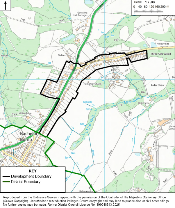
Planning map showing proposed development boundary around Batchelors Bump, extending north toward Three Acre Wood and Holiday Site. Black outline marks Development Boundary, green line marks District Boundary, with roads, buildings, waterways, woodland, field labels, north arrow, and 1:7,500 scale.
Batchelors Bump
Planning map showing proposed development boundary around Batchelors Bump, extending north toward Three Acre Wood and Holiday Site. Black outline marks Development Boundary, green line marks District Boundary, with roads, buildings, waterways, woodland, field labels, north arrow, and 1:7,500 scale.

Rye and the Eastern Settlements

Winchelsea
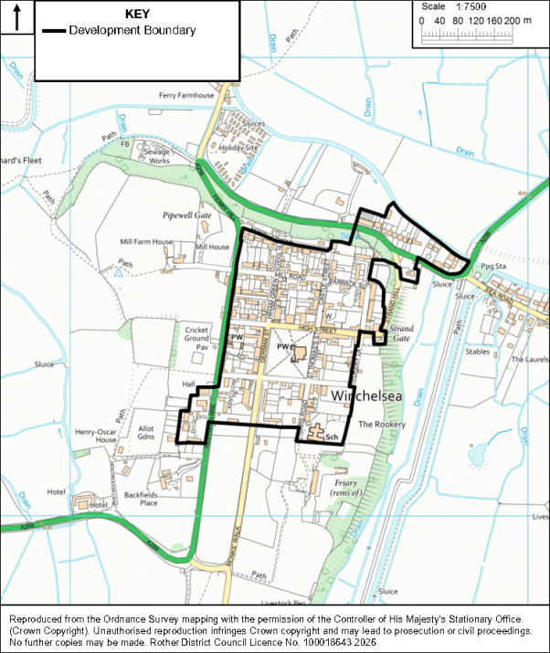
Map showing Winchelsea development boundary, with black outline marking designated area against Ordnance Survey topography. Green corridors, waterways, roads, buildings, named sites, and 0–200-meter scale provide planning context.
For instructions on how to use the system and make comments, please see our help guide.
back to top back to top