Rock Channel Rye Development Brief
Development Principles
31. This section sets out the key principles and considerations with which development proposals in the Rock Channel area will be expected to comply.
32. Later sections in the brief set out additional, specific considerations which apply to the identified opportunity areas.
33. The Principles are:
- Planned, Selective Redevelopment
- A Vibrant Mix of Uses
- Ensuring and Improving Accessibility
- Providing Affordable Housing
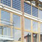
- Achieving High Quality Design
- Making the Best Use of the Riverfront
- Managing Flood Risk
- Respecting and Recording Archaeology
- Maintaining Quality into the Future
Principle 1 - Planned, Selective Redevelopment
34. The nature of the area and the diversity of land ownerships means that redevelopment will come forward on selected sites. Much of the area is in established residential use where little change, beyond normal householder development, is likely.
35. Where redevelopment does happen, account must be taken of its impact on existing properties, residents and businesses. The brief identifies 'opportunity areas' where change is likely to be focused. These are areas where redevelopment could bring particular benefits and where, importantly, landowner interests are known.
36. That is not to say that other areas may not come forward for redevelopment over time. Such proposals will need to be considered in accordance with the principles established in this brief. However, it is critical that all proposals that come forward contribute to the objectives for the wider policy area, to ensure a coherent and consistent approach to its evolution.
37. To this end, development proposals will be expected to indicate via spatial planning, how such proposals might fit with adjacent and wider site redevelopment and how such proposals would not prejudice the wider site objectives and development principles of this brief.
Principle 2 - A Vibrant Mix of Land Uses
38. The area already comprises a mix of land uses. This situation should continue, with a prevalence of uses which will draw people and activity into the area.
39. Specific uses are identified for the opportunity areas in a later section of the brief. However, for the area as a whole, new development should focus on the delivery of the following priority land uses:
Small scale retail (use class A1)
- Small, individual retail units may help to attract visitors into the area and thereby to the riverside.
Cafés/restaurants (A3)
Small scale workshops (B1)/Offices (A2)
- There is the opportunity here to provide a range of accommodation from small office and workshop space/incubation units to through light industrial space that would allow for small scale manufacture.
- Large-scale buildings such as storage and warehouses would not be appropriate as they would neither meet the expectations of a vibrant, higher density environment nor are they consistent with such a sensitive location.
High density housing (C3)
, on selected areas, including live/work units.
- The nature and spatial constrictions of the site mean that accommodation will be predominately small scale, typically 2-3 bed terraces and 1-3 beds apartments.
- Formal play area must also be provided at a rate of at least 0.1ha/50 dwellings (Local Plan Policy CF4).
Maritime related uses
(for example boat yards, moorings, chandlery)
40. Other uses which could be consistent with the principles established through this brief, depending on the detail of any specific proposal, are:
- Hotel (C1)
- Non-residential institutions (D1)a public hall or art gallery
- Assembly and leisure uses (D2)a performance venue or a venue for indoor/outdoor sport and recreation. Such community and leisure facilities could also have a role in bringing both the tourist and local communities into the area and could be compatible with capitalising on the riverside setting to create a vibrant and active public place. Again, buildings must be of modest scale.
41. Any other uses proposed through a planning application will be tested for their compatibility with the guidance in this brief.
Approach to Mix of Uses - Sustainability Appraisal
The Sustainability Appraisal process was used to test the approach that the brief should take to the mix of uses in the Rock Channel area. The following options were tested:
- Job-creation led
- Service/tourist economy led
- Residential led
Generally, options A and B scored positively against a greater number of the 26 sustainability criteria, helping to sustain economic activity in the town and the associated benefits for overall training and skills levels. Additional residential development will serve to increase the availability of housing, including affordable housing in a location well related to the existing services and facilities of the town.
The selected approach serves to encompass elements of all three options, the residential element having the additional role of helping to cross-fund the provision of economic-related uses.
Principle 3 -Ensuring and Improving Accessibility
Existing situation
42. There are two main road access points into the area from A259(T); St Margarets Terrace and Rock Channel. In addition Shipyard Lane is a private unmade road which is primarily used by residents for access and parking. There is a public footpath through the area which is quite poorly signed and runs close to residential properties. This could discourage its use by visitors and by others who don't know the area well.
43. Accessibility issues for the area include:
- Improving pedestrian access through and to the area;
- Achieving a cycle link through the site and facilitating links to cycle routes elsewhere in Rye;
- Implementing the junction and road improvements needed to serve the future development; and
- Providing adequate, well-designed car parking.
44. Planning applications with accessibility implications should be accompanied with an access statement and a Traffic Impact Assessment, demonstrating how the proposals address the issues outlined above.
Site Access Principles
45. Figure 1, below, illustrates the basic principles of access and circulation into and around the site, including vehicular and service access, a riverside walk, and connections to the National Cycle Network.
Figure 1: Site Movement Diagram

Improving pedestrian access
46. Pedestrian access through the site should be encouraged by improving the existing Public Right of Way to provide an attractive and coherent walkway that will provide an effective link between the Strand Quay area to the Fishing Quay and the Salts.
47. This link must be provided as part of redevelopment proposals for individual sites and opportunities for the link to run in sight of the river, to provide the 'riverside walk', should be maximised. The link should be clearly demarcated and surfaced with high quality materials, consistent with the overall design framework for the area. The integration of public art into the walk, which could have the dual function of sign-posting the route through the site, will be encouraged whilst steps and other features incompatible with disabled access should be avoided where possible.
48. Financial contributions will also be sought for the improvement of the parts of the walk which will not be directly provided as part of development.
49. Access points into the area should be designed to encourage pedestrians into the area, for example by the inclusion of clear pathways and safe road crossings. This is particularly the case where access into the site involves crossing the A259(T).
Cycle links
50. Redevelopment proposals in the area are an opportunity to achieve a cycle link through the site which could link to National Cycle Route 2 and provide a flat alternative to the route through the Citadel area and a more attractive route between the Salts and Strand Quay than A259(T).
51. As with the pedestrian link, the cycle link should be directly provided as part of redevelopment proposals. Given the anticipated traffic flows on the roads within the area, and the likely speed of this traffic, the cycle traffic should be able to use the carriageway without the need for a segregated or delineated cycle lane.
52. Contributions will be sought to secure those addition links through the Rock Channel area which will not be directly provided through development and towards the improvements needed to the footpath north of the Rock Channel area to enable a link with National Cycle Route 2 at Monkbretton Bridge.
53. In the vicinity of the allotments this route would follow the alignment of the existing footpath with sections cleared of vegetation and levelled as necessary to achieve a 2-3m wide shared cycle and footpath.
Junction & Road Improvements
54. Redevelopment proposals in the western part of the site will require improvements to the St Margaret's Terrace junction with A295(T). A junction design incorporating a single lane exit onto A259(T) has been tested and found to be capable of accommodating the scale of development envisaged in this brief. Such an improvement is likely to require the re-siting of the Southern Water pumping station.
55. Given the limitations of the existing Rock Channel junction with A259(T), the Highways Agency has advised that any increase in traffic using this junction, as a result of additional development, would necessitate the relocation of the junction to a position where adequate sight lines can be achieved.
56. The nature of the uses proposed for the Rock Channel area, the likely traffic generation and the proximity of the A259(T) itself means that the creation of a road link through the site linking the fishing peninsula area to the St Margaret's Terrace area is not required.
57. The roads, and the access arrangements within sites generally should be planned to follow the principles within 'Manual for Streets' (Dept. for Transport, Dept. for Communities and Local Government, March 2007).
Parking
58. Proposals should provide parking space in line with the Council's adopted parking standards. The design of schemes should avoid the creation of large areas dedicated solely to parking. Integrating private garages within development is a means to ensure adequate floor heights for residential development referred to under Principle 7 - Managing Flood Risk.
59. The scope for providing additional public/residents parking within the area is explored in the site specific section of the brief.
Principle 4 - Providing Affordable Housing
60. In accordance with Policies HG1 and RY3, 40% of the housing provided should be affordable. Each site should cater for the affordable housing requirement it generates by providing the required number of units on site, 'pepper-potted' with the market housing. There should be no significant difference in design terms between the market and affordable units.
61. The tenure of the affordable dwellings should be primarily social-rented although an element of shared-ownership may also be appropriate where these are provided at an entrance equity level that local people can afford on local incomes. The exact tenure balance and size of the affordable dwellings will be informed by the nature of local affordable housing need identified at the time.
62. The Housing Corporation can provide funding for affordable housing if the site is proven to be unviable without such finance. The Corporation requires homes to be built to agreed standards and if the standards are not met, then funding will not be available.
63. Details of the Council's affordable housing policy, and how it is applied, is set out in Policy HG1 of the Local Plan and in the Council's Affordable Housing Supplementary Planning Document.
Principle 5 - Achieving High Quality Design
64. The design strategy for the site seeks to comply with current best practice in urban design in terms of:
- protecting positive characteristics of the sites and their surroundings;
- promoting high standards of layout and design;
- creating a distinctive 'sense of place'; and
- assisting the general development objective of improving connectivity between the historic core of the town and its riverside.
65. To deliver this, applications for the redevelopment should be accompanied by an extensive and detailed Design and Access Statement explaining how the proposals address the following design principles:
-
Movement
A highly legible network of streets within the site will need to be defined in any development proposals, providing visual and hospitable connections into and through the site.
Apart from the main access route, streets are to be designed with shared surfaces, i.e. no distinction or demarcation between pedestrian and vehicular traffic, in order to create a slower, safer, more pedestrian-friendly environment.
-
Layout
Blocks of buildings should primarily be orientated to run at right angles to the cliff face to allow glimpse views through to this important landscape feature, to maximise visual permeability, and to avoid 'slabs' of elevations being presented on longer views from the countryside towards the Citadel. Existing views punctured through the South Undercliff terraces are to be maintained and their pattern reflected in the layout of new development. Development should have particular regard to 'Secured by Design' principles.
-
Site Character & Identity
The site should not attempt to replicate that of the historic Citadel above but rather define its own 'sense of place', drawing on the maritime character of the Strand Quay warehouses, and other similar precedents including the fishing huts at Hastings and Whitstable in Kent.
Characteristic of these maritime environments is a tight-knit grouping of buildings with jumbled roofscapes, permeated with networks of alleyways and winding streets, glimpsed vistas of landscape features beyond and unexpected openings out into larger, yet still intimate, open spaces.
-
Built Form
The residential elements of schemes should follow the 'Building for Life' good practice principles and standards (www.buildingforlife.org).
Concepts of defensible space and clearly defined public and private space should be embodied in any design solutions. Buildings should form continuous street scene frontages within a comprehensive layout and design. Buildings should sit tight on roadways creating hard edges and a sense of enclosure.
Heights of buildings should generally vary between two and two-and-a-half storey (utilizing rooms in roofs) with occasional three storey to help get daylight into a tight-knit development and to provide visual interest in the roofscape. Eaves heights should typically be 5metres (9-10m AOD) to avoid disruption of long views towards the Citadel.
Figure 2:
Materials Palette
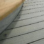
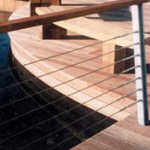
Streets and squares


Riverside Walk


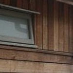
Buildings
Architectural Imagery


-
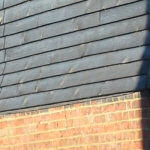
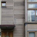
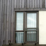
Materials
Materials might include contemporary interpretations of a traditional palette such as dark-stained weatherboard, stone and brick plinths, areas of glazing and slate or metal roofs for buildings, with streets and squares within the development formed with stone setts, reflecting Rye's rich heritage of characterful hard-landscaping materials, and a timber broadwalk approach to areas of the riverside walk.
-
Sustainable Technologies
Sustainable construction techniques and renewable energy technologies should be incorporated into the planning and design of development where possible. The energy efficiency of buildings, both residential and commercial, should be a central consideration in the design process.
-
Open Space & Public Realm
The treatment of open space within the site, both green and hard-landscaped places, is important for visual amenity, recreational and ecological purposes and development proposals should plan for this carefully. In addition formal, equipped playspace will be required at a rate of 0.1ha/50 dwellings (Rother Local Plan Policy CF4)
A coordinated, quality design approach to signage, street furniture and surfacing materials will be required across the site, to reinforce identity and character. The Design and Access Statement should include details of all such materials proposed so that they can be considered alongside the planning application.
-
Public Art
The inclusion of public art within development proposals for the area will make a significant contribution to the visual quality and public enjoyment of the area. There are particular opportunities to include public art within the areas of public open space and to integrate it into the design of the pedestrian and cycle routes.
Accordingly, and in line with Policy CF7 of the Local Plan, development proposals should contribute to the installation of public art within the Rock Channel area.
66. A later section of the brief gives more detailed design advice for the individual opportunity areas, along with indicative spatial plans to demonstrate the design principles. Meanwhile Fig 2 indicates a variety of architectural and materials imagery that is considered to accord with the objectives for the site.
Principle 6 - Making the Best Use of the Riverfront
67. The area currently lacks clear visual and physical links to its riverside setting. Key to the success of redevelopment here is the re-establishment of these connections. Such re-connection will contribute to the vibrancy of the area, helping to create an environment for leisure, recreation and commercial activity.
68. Development will be expected to:
- Maximise opportunities for public access to the river for maritime and leisure pursuits;
- Provide selective development overlooking the river, to enable public 'ownership' and activity along its length; and
- Incorporate an attractive and place-sensitive riverside walk which will also serve to encourage movement through the site and thereby improve connectivity between Strand Quay and the Fishing Quay.
Principle 7 -Managing Flood Risk
69. The greatest part of the Rock Channel area benefits from the Rother Tidal Walls scheme which is due for completion in Autumn 2007.
70. The Environment Agency's advice for new development in the Rock Channel area is as follows:
- Commercial uses can be at ground floor level, including the 'work' element of a live/work unit.
- For residential properties, the main habitable areas (kitchen, study, lounge, dining) should be at 6m AOD floor height, sleeping accommodation at 6.6m AOD. Garage/utility room at ground floor level.
- Buildings should be 'flood resilient'.
- There should be means of safe/dry access/egress where possible and appropriate.
- Occupants in the area should be registered with the Flood Warning Scheme.
- Development should not take place immediately behind the tidal defences to allow sufficient access to the defences for maintenance.
71. Planning applications should be submitted with a Flood Risk Assessment which should;
- Assess and address tidal flood risk
- Provide a surface water disposal strategy to include measures for groundwater pollution prevention both during and after construction. The use of Sustainable Drainage systems should also be considered.
Principle 8 - Respecting and Recording Archaeology
72. At present, little exists in terms of well-recorded archaeological remains from within the area. However, given the position of the policy area at the foot of the cliffs to the south of Rye town and the shifting nature of past river channels, beaches and marshes, there is high potential of the survival of evidence of past environmental conditions, for a range of land use changes such as reclamation and for industrial activities such as ship-breaking, fishing and shipbuilding. Historic mapping from the 19th century shows the position of shipyards and ironworks on the site.
73. Therefore, in accordance with policies EN22 and EN24 of the East Sussex and Brighton & Hove Structure Plan (1999), applications for development on the site will need to be accompanied by assessments, based on field evaluations, of likely archaeological implications and should provide for the appropriate investigation, recording and safeguarding of any findings.
Principle 9 - Maintaining Quality into the Future
74. Key to controlling future maintenance requirements and costs is the use of good quality materials, sound construction techniques, and planned appropriate management regimes.
75. Where infrastructure is to be transferred to a public body after the development's completion, contributions will be sought through a Section 106 agreement to provide for future maintenance and management. This could be the case for items such as improved surface water drainage measures, additional flood defences (to protect additional areas not covered by the Tidal Walls Scheme), public open space, landscaping, street furniture, lighting and the riverside walk.