Development and Site Allocations (DaSA) Local Plan - Options and Preferred Options
Part C: Site Allocations
12. Overview
Development targets
12.1. The adopted Core Strategy's targets for the numbers of additional homes and business floorspace over the plan period (2011-2028) are set out in the respective polices for each locality and summarised in Figure 8, which is reproduced below.
|
Approximate development levels 2011-2028 |
||
|
Housing |
Employment |
|
|
Bexhill |
3,100 dwellings |
At least 60,000sqm. |
|
Hastings fringes |
100-250 dwellings |
At least 3,000sqm. |
|
Battle |
475-500 dwellings |
At least 10,000sqm.* |
|
Rye |
355-400 dwellings |
At least 10,000-20,000sqm. |
|
Villages |
1,670 dwellings |
At least 10,000sqm. |
|
Total |
At least 5,700 dwellings |
At least 93,000 – 103,000sqm. |
* includes sites on Marley Lane
12.2. The distribution of dwellings between villages in the rural areas is set out in Core Strategy Policy RA1 and Figure 12. This identifies the number of dwellings that are anticipated from new sites, taking account of completions between 2011 and 2013, outstanding planning permissions and allocations in the earlier 2006 Local Plan that do still not have planning permission.
12.3. In line with national policy guidance, existing sites allocations that have not been carried forward by a planning permission are reviewed as part of the review of options to meet the residual requirement.
12.4. Figure 14 below identifies the residual requirement for additional homes on new sites of 6+ dwellings in each of the towns as at 1st April 2016.
Figure 14. Residual requirement for additional homes on new sites of 6+ dwellings
|
Settlement/Area |
Total |
Completions over plan period |
Large site commitments |
Small site commitments |
Small site windfalls |
Residualrequirements |
|
Battle |
475 |
20 |
0 |
9 |
21 |
425 |
|
Bexhill |
3,100 |
318 |
1,588 |
43 |
107 |
1,044 |
|
Hastings Fringes |
100 |
8 |
78 |
0 |
1 |
13 |
|
Rye & Rye Harbour |
355 |
198 |
22 |
6 |
22 |
107 |
12.5. The table below presents similar information for villages covered by this plan where there is a housing target from new sites (shown in bold) and the nine villages for which neighbourhood plans are being prepared. It covers larger sites (of 6+ dwellings) as there is a separate small sites allowance applied across the whole Rural Area.
Figure 15. Large site housing requirements for villages as at 1st April 2016
|
Settlement/Area |
Parish |
Large site requirement |
Large sitecompletions 13-16 |
Large site permissions |
Residualrequirements |
|
Beckley Four Oaks |
Beckley |
26 |
6 |
0 |
20 |
|
Broad Oak |
Brede |
50 |
0 |
0 |
50 |
|
Burwash |
Burwash |
52 |
0 |
17 |
35 |
|
Camber |
Camber |
40 |
20 |
0 |
20 |
|
Catsfield |
Catsfield |
53 |
0 |
6 |
47 |
|
Crowhurst |
Crowhurst |
20 |
0 |
0 |
20 |
|
Etchingham |
Etchingham |
51 |
21 |
0 |
30 |
|
Fairlight Cove |
Fairlight |
37 |
0 |
0 |
37 |
|
Flimwell |
Ticehurst |
43 |
0 |
34 |
9 |
|
Hurst Green |
Hurst Green |
75 |
0 |
0 |
75 |
|
Iden |
Iden |
12 |
0 |
0 |
12 |
|
Netherfield |
Battle |
48 |
0 |
0 |
48 |
|
Northiam |
Northiam |
123 |
0 |
123 |
61 |
|
Peasmarsh |
Peasmarsh |
50 |
0 |
0 |
50 |
|
Robertsbridge |
Salehurst and Robertsbridge |
147 |
0 |
17 |
130 |
|
Rye Harbour |
Rye |
40 |
0 |
0 |
40 |
|
Sedlescombe |
Sedlescombe |
49 |
8 |
0 |
352 |
|
Staplecross |
Ewhurst |
25 |
0 |
25 |
0 |
|
Ticehurst |
Ticehurst |
87 |
21 |
40 |
263 |
|
Westfield |
Westfield |
89 |
0 |
39 |
50 |
|
Totals |
1117 |
76 |
301 |
740 |
|
1) This figure for Northiam reflects the fact that a site with planning permission for 58 units is a specialised scheme which is not progressing. 52 units is regarded as a more achievable form of development; hence, the balance of 6 dwellings
2) The residual requirement for Sedlescombe is reduced to reflect an expired planning permission which is still expected to come forward.
3) It is noted that the residual requirement for Ticehurst is reduced to zero following a subsequent approval for 30 dwellings at Hillbury Field subject to a legal agreement in April 2016.
12.6. Sites for at least 740 dwellings need to be identified in villages through the DaSA Local Plan and Neighbourhood Plans, of which this Plan should identify at least 370 dwellings.
12.7. The figures in this table will provide the baseline for assessing conformity with the Core Strategy in terms of the numbers of dwellings being put forward on housing sites in villages through neighbourhood plans.
12.8. In interpreting these requirements when identifying the potential for further development, attention is drawn to the Villages section of the Core Strategy, which states that 'Previously unidentified large sites (6 dwellings and over) in a village gaining planning permission before adoption of the relevant Plan may be deducted from the total 'Potential new sites' that an individual village is expected to achieve, depending on the stage reached and the suitability of other potential sites.'
12.9. The essence of this statement is that plans should not dismiss sustainable sites simply because other sites have come forward that mean that development targets can be met without it. At the same time, it is appropriate to have regard to the general scale of development in a settlement relative to its overall sustainability and status in the settlement hierarchy, as well as to have proper regard to the individual merits, and demerits, of sites.
Sources of supply and consideration of options
12.10. Development interests have suggested a substantial number of possible development sites to be considered. These have been received over the course of preparing the DASA, the Core Strategy and supporting evidence. In addition, the Council has thoroughly investigated a significant number of sites identified via other sources, including identification by Council officers themselves. The 'other sources' have been explained in more detail in supporting evidence[40].
12.11. A summary of the process by which options and preferred options have been identified and considered (including via Sustainability Appraisal) is set out in the supporting background paper 'Site Assessment Methodologies' (see separate background Paper).
12.12. The process for considering the suitability and capacity of both existing and potential further business sites is set out in the 'Employment Sites Review' Background Paper.
Overview of allocations
12.13. The proposed allocations for Bexhill, the Hastings Fringes and the villages covered by the DaSA will meet the respective requirements. Allocations for a couple of settlements are slightly greater, while Catsfield is a few dwellings under, but this properly reflects site circumstances.
12.14. Overall and subject to the ongoing Neighbourhood Plans meeting their minimum requirements for new homes, the preferred allocations would meet and, potentially, slightly exceed the minimum Core Strategy requirement. This is critical to ensuring that the 'soundness' of the plan will be supported at independent examination.
12.15. The proposed business allocations supplement sites with existing planning permissions, as well as the existing stock, to meet the Core Strategy's minimum quantitative requirements. As importantly, the allocations together with other Local Plan policies in support of the retention and improvement of business space, should meet the qualitative needs of businesses, including for inward investment.
13. Bexhill
Context
13.1. Bexhill is by far the largest settlement in Rother district, with a population of some 43,100 people (2011 Census) and is its administrative centre. It has a population equivalent to some 48% of that of the district as a whole. It is primarily residential in character with an established employment, shopping and service centre role. As such, the focus of development identified through the Core Strategy is within Bexhill.
13.2. The underlying environmental quality of the town is high. Key assets are the seafront, the internationally acclaimed De la Warr Pavilion, the well-preserved and mixed-use town centre and a variety of pleasant residential areas interspersed with substantial areas of parkland and open space.
13.3. The countryside setting of the town, although not part of the High Weald Area of Outstanding Natural Beauty, is also undulating and attractive. The area is rich in wildlife habitats. Parts of Combe Haven and High Woods are Sites of Special Scientific Interest. Beyond the western fringe are the Pevensey Levels, of international nature conservation importance.
13.4. The town centre maintains its role as the principal shopping area serving the town, even though a significant proportion of retail expenditure is "lost" to Ravenside Retail Park, Hastings and Eastbourne. Competition from other centres, allied to the physical constraints on development in the town centre and the fairly static spending power within the town, have combined to limit retail investment in recent years.
13.5. The amount of business accommodation is relatively low for the size of the town, with only Beeching Road and, to a lesser extent, Brett Drive and Elva Way forming recognised industrial estates.
13.6. Policy relating to the Combe Valley Countryside Park is covered within the Hastings Fringes Chapter.
Development Provisions
13.7. In view of its relative size, range of services and location outside any national landscape or nature conservation designations, the Core Strategy identifies Bexhill as the focus for development within the District. It sets a requirement of at least 3,100 dwellings over period 2011 to 2028, as well as at least 60,000sqm of new business floorspace within Bexhill.
13.8. In terms of housing, 318 dwellings have been constructed to date (2011-2016) and a further 1,631 dwellings have planning permission – a large majority of which are at 'North East Bexhilll' – see box below. This leaves a remaining requirement of 1,151 dwellings to 2028.
13.9. There has also been significant progress in bringing business land forward since the construction of the Link Road, with completions and planning permissions to date already accounting for some 32,738sqm of floorspace. Hence, there is a need to identify at least a further 27,262sqm through this Plan.
13.10. The Core Strategy also identified a retail investment potential in the town; its Policy BX2 looks for provision of some 2,000sqm additional convenience goods and 4,000sqm comparison goods floorspace, primarily through edge of centre development north of the railway, as well as effective use of town centre units.
Site options for employment
13.11. The background to business site proposals is contained in the Employment Sites Review. The preferred development site for employment is 'Land at Levetts Wood and Oaktree Farm, Sidley' (Ref, BX113).
Preferred Site: Land at Levetts Wood and Oaktree Farm, Sidley (Ref: BX113)
|
Existing use(s) |
Greenfield site (farmland and equestrian use) |
|
Size |
14.3ha |
|
Key constraints/ opportunities |
A landscape of gently rolling, enclosed, well-wooded countryside and tall hedgerows. Levetts Wood, to the south, is an Ancient Woodland providing a buffer to existing housing at Sidley. The grazed fields create an impression of woodland clearings. The land slopes gently down to the north, towards Combe Haven. The sunken Buckholt Lane, with its species-rich hedges and fringing trees, cuts through the area. The only buildings are those at Oaktree Farm. The North Bexhill Access Road (NBAR), currently under construction, will form the northern boundary of the site and provide vehicle, cycle and pedestrian access. The site is well-contained and largely separated from residential areas to the south and west. It was allocated for 'major business development' in the Rother District Local Plan (2006) as part of the North East Bexhill urban extension (Policy BX3). It remains an important employment site to meet business floorspace needs over the plan period, offering direct access via the NBAR to Combe Valley Way. It is proposed that there will be one access off a roundabout onto NBAR at Buckholt Lane to serve the three discrete land parcels that comprise the site. Internal road connections should involve minimal intervention to the intervening tree belts; these may need to be strengthened – see below. A comprehensive approach is required to ensure integrated provision of employment floorspace, high quality urban design, green infrastructure and mitigation and/or compensation for any biodiversity losses. The degree of self-containment allows different design approaches for each development area. Buildings should be set within a strong landscape structure, both through the site and around its perimeter to minimise its visual impact. Flexible building design is encouraged, to suit a variety of possible business requirements. Development should be well set back from the NBAR. The most appropriate form would be buildings clustered around a predominantly rural natural grassed informal central space to retain 'woodland clearing' site character, combined with the creation of water features to both "soften" development and, together with ponds, provide a sustainable drainage system. Office and light industrial uses are expected, being most compatible with the strategic importance of the site and the business land requirements of the area. The layout should take full account of existing site features, strengthening existing tree belts to provide informal amenity space, providing new green links to form a series of connected spaces and corridors, softening the visual impact of commercial buildings both by partial screening and physical separation, preserving generous areas for the movement of wildlife through the site and accommodating attractive cycle/footpath links. The gently sloping ground may accommodate a range of building sizes, but larger buildings should be cut into the slope to minimise their height and associated visual impact. Linkages with facilities and services in Sidley are vital and will be achieved by improving Buckholt Lane as the main footpath, cycleway and bridleway route from Sidley, creating an attractive pedestrian/cycle route to the proposed residential allocation to the west (Policy BEX2) and connecting to the linear park and new housing of Policy BEX3 (North Bexhill). Land along the Combe stream to the north-west of the site should be retained as an amenity/wildlife corridor. This includes land around Pebsham Hall and Cottage (both Grade II listed). Beyond the site to the east, adjacent to the Combe Valley Way (Bexhill Hastings Link Road), lies a sloping field that constitutes a green "tongue" as part of the Countryside Park. This is excluded from the business area and should remain open. |
|
Proposed use(s) |
Employment. |
|
Developable area |
Developable area is constrained by existing mature trees and hedges on field boundaries and the need for ancient woodland buffer planting but estimated to be 9.3ha (subject to ecological surveys). |
|
Capacity |
28,000sqm (at a floorspace to site area ration of 0.3) |
Policy BEX1: Land at Levetts Wood and Oaktree Farm, Sidley
Land at Levetts Wood and Oaktree Farm, Bexhill, as shown on the Policies Map, is allocated for a comprehensive business development. Proposals will be permitted where:
- proposals conform to a masterplan covering the entire policy area;
- some 28,000sqm of business floorspace is provided. This will be predominantly light manufacturing and offices, falling within Class B1 of the Use Classes Order;
- vehicle, cycle and pedestrian access is provided from the North Bexhill Access Road's Buckholt Lane roundabout, together with cycle and pedestrian access through the site to the adjacent residential allocation (Policy BEX2), pedestrian access to the footpath on the western boundary and cycle and pedestrian access to the urban extension envisaged by Policy BEX3; and
- existing landscaped boundaries around the site are maintained and reinforced and proposals for structural open spaces, landscape and woodland belts are developed and implemented as an integral part of proposals.
Site options for housing
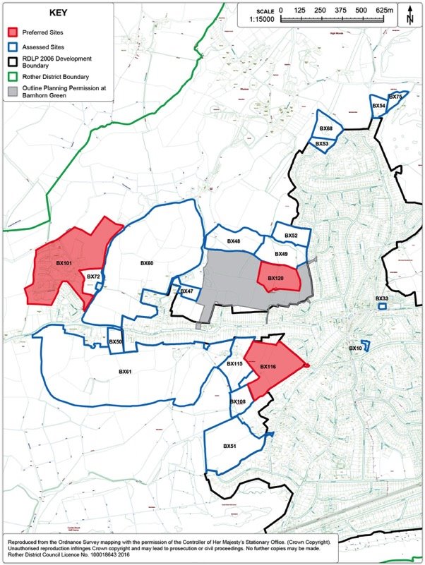
13.12. Fourty three sites were considered as options for potential housing development within Bexhill. The sites considered as potential housing sites can be identified in Figures 18, 19 and 20 below. The sites are spread throughout Bexhill, with a mix of sites within the existing built-up area but also a significant number concentrated on the peripheral areas of Bexhill adjacent to or removed from the existing development boundary.
13.13. The preferred development sites for housing are:
1) BX19: Land at Preston Hall Farm, Bexhill
2) BX124: North Bexhill
3) BX4: Former High School Site and Drill Hall, Down Road
4) BX5: Knole Road, Bexhill
5) BX30: Cemetery Lodge Field/276 Turkey Road
6) BX64: Land at Moleynes Mead, Fryatts Way
7) BX81: Land South of Terminus Road, Bexhill
8) BX116: Land off Spindlewood Drive, Bexhill
9) BX120: Barnhorn Green Expansion, Bexhill
10) BX101: Northeye (Former United Arab Emirates -Technical Training Project)
13.14. The preferred housing sites generally comprise of a mix of small scale brownfield sites within the existing development boundary of Bexhill, with some larger, greenfield sites on the periphery. There are two significant areas of expansion identified in line with the broad locations identified within the Core Strategy: one area at North Bexhill where potential has been identified for some 450 dwellings and land off Spindlewood Drive to the west, where potential has been identified for some 160 dwellings. Altogether, these sites listed above yield some 1,046 dwellings which, together with completions since 2011, sites which have planning permission and the small site windfall allowance slightly exceeds the minimum target of 3,100 dwellings within Bexhill.
13.15. Further details of the assessment of all individual sites can be found in Appendix 3 while proposals for the preferred sites are elaborated upon below.
Figure 18. Bexhill East Housing Options Map
Figure 19. Bexhill North Housing Options Map
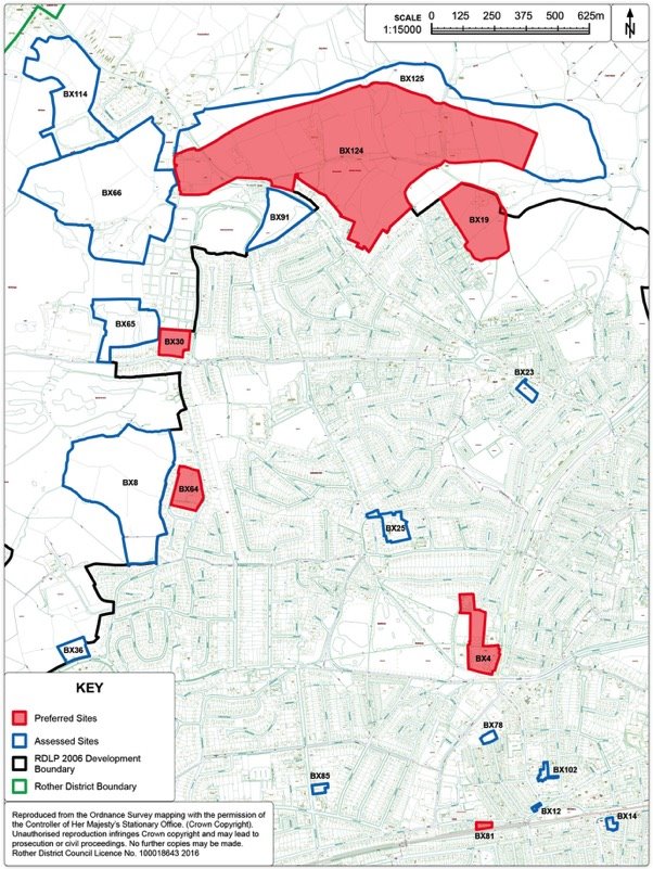
Figure 20. Bexhill West Housing Options Map
Preferred Site: Land at Preston Hall Farm, Sidley, Bexhill (Ref: BX19)
|
Existing use(s) |
Greenfield site (farmland with farm buildings) |
|
Size |
5.24ha |
|
Key constraints/ opportunities |
The site is bounded by existing residential properties to the west, Redgrove Wood, which is designated as Ancient Woodland, and adjoining hedgerow to the north-west, a private lane (also a public footpath in part) to the Grade II Listed Preston Hall and Preston Hall Cottage to the north-east and a strong hedgerow to the east. The land slopes generally down to the north-east, but is also bisected by a ditch which naturally divides the site into two parts. A small pond occupies a central position just west of Preston Hall Farm. The site relates to the adjacent housing off Watermill Lane and an access can be created via Watergate. A vehicle, cycle and pedestrian access would be required through the upgrading of the existing spur and the alternative provision of existing parking spaces on Watergate. Development here should create a small residential enclave drawing on the positive natural characteristics of the site. The form of development should reflect the transition from the higher density, more suburban character of north Sidley to the countryside beyond, and should bring the countryside into Sidley. The site was allocated in the Rother District Council Local Plan (2006) as part of the North East Bexhill urban extension and remains an important part of that development. Linkages with facilities and services in Sidley as well as the countryside are vital and will be achieved by upgrading the existing footpath from Watermill Lane and retaining land as an amenity/wildlife corridor, both to the north of Combe stream and the land around Pebsham Hall and Cottage (both Grade II listed), creating an attractive pedestrian/cycle route from the proposed employment allocation to the east (Policy BEX1); and pedestrian/cycle connection to the linear park and new housing of Policy BEX3 (North Bexhill). The layout should take full account of existing site features – the pond, (which could form a focus for a "village green" as well as a sustainable drainage system), tree cover around it, the hedgerow, existing properties to the west and ecological considerations. Given the tenure of existing housing in the locality, as well as low levels of economic activity, the affordable housing here should provide for a range of tenures including intermediate housing to encourage low-cost home ownership and re-balance the housing and social mix. Older children's play would most effectively be provided for by upgrading the existing 'Levetts Field' adjoining the site to the south, while younger children should benefit from open space in the scheme. The traffic implications of development on the Watermill Lane/A269 junction will be lessened with construction of the North Bexhill Access Road, although it may still impact on the A269/Holliers Hill /A2036 Wrestwood Road/ London Road junctions, the need for improvements to which have been identified through traffic modelling. Contributions to primary and nursery school education provision at NE Bexhill are also expected, to ensure sufficient capacity in the locality. |
|
Proposed use(s) |
Residential and amenity open space. |
|
Developable area |
Developable area is constrained by buffer requirement to existing residential properties/vegetation/pond/ancient woodland as well as the need to provide amenity open space, but estimated to be around 3.8ha (subject to ecological surveys). |
|
Capacity |
135 dwellings (estimated) plus amenity open space. |
Policy BEX2: Land at Preston Hall Farm, Sidley
Land at Preston Hall Farm, as shown on the Policies Map, is allocated for a comprehensive scheme comprising residential development and amenity open space. Proposals will be permitted where:
- approximately 135 dwellings are provided, of which 30% are affordable;
- the development provides an amenity open space centred on the existing pond. The layout of the site will be such that the green will be afforded passive surveillance from adjacent residential properties;
- a new vehicle, cycle and pedestrian access is achieved off Watergate, together with cycle and pedestrian access through the site to the adjacent employment allocation (Policy BEX1); upgrading of the footpath to Watermill Lane on the eastern boundary; and cycle and pedestrian connectivity to the adjacent urban extension (Policy BEX3);
- existing landscaped boundaries around the site are maintained and reinforced;
- care is taken to respect, the amenity value and setting of adjoining properties on the eastern boundary; and
- development contributions towards improvements to the A269/Holliers Hill /A2036 Wrestwood Road/ London Road junctions and towards primary and nursery school education provision at NE Bexhill.
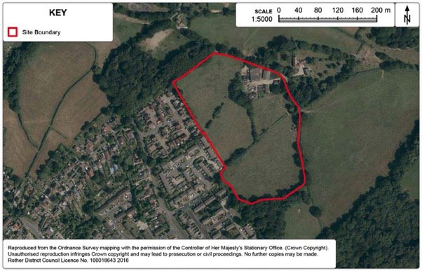
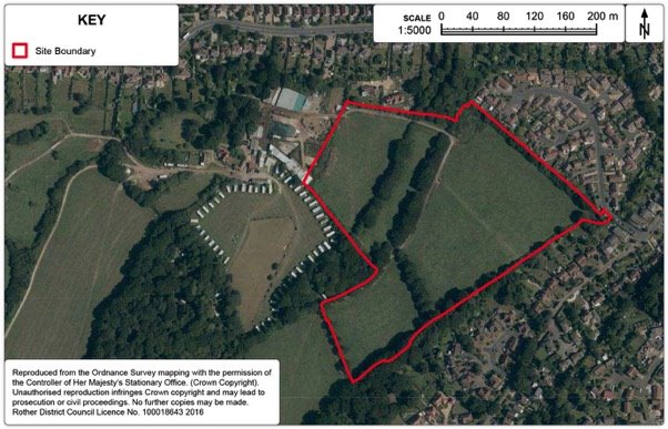
Preferred Site: North Bexhill (Ref: BX124)
Context
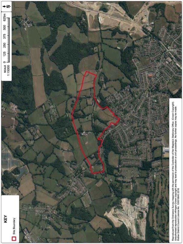
13.16. Within the context of Bexhill being the focus of development in Rother District, Local Plan Core Strategy Policy BX3 set out targets of some 3,100 additional homes and 60,000sqm of business space planned over period 2011-2028. To accommodate this scale of growth, it states that the primary focus is on development to the north of Pebsham and Sidley (as already planned through the Rother District Local Plan 2006 and the related North East Bexhill Supplementary Planning Document), together with further sites to the north and west of the town.
13.17. The broad location for future development is shown on the Core Strategy Bexhill Inset Diagram. The Core Strategy identifies the opportunity provided by construction of the now approved North Bexhill Access Road[41] (NBAR) to provide access not only to the previously allocated business sites, but also to further development extending westwards.
13.18. Alongside the ongoing development to the east of the new Bexhill to Hastings link road (Combe Valley Way), development in this area will have a key function not only in meeting the town's development requirements, but also in contributing to the overall vision for it to be one of the most attractive places to live on the south coast, more prosperous and vibrant with a more balanced demographic profile.
13.19. The area of investigation forms the slopes either side of the Combe Haven to the north of the existing built-up area. It is currently open, farmed land for the most part, with intervening tree/hedge belts and woodland blocks, but with urban fringe influences in the form of established allotments and horse paddocks. Also, to the east of the A269, there is a strong visual relationship with the existing settlement edge, including existing housing along Ninfield Road, Mayo Rise and Mayo Lane, although it becomes more rural in character towards Watermill Lane. The more rural character of the land to the east of Watermill Lane will change following development of land around Preston Hall Farm that was allocated for development in the 2006 Local Plan and is proposed to be carried forward in this Plan (See Policies BEX1 and BEX2). In contrast the western end of the 'broad location', west of the A269, is more separated from the wider settlement by the Cemetery and St Mary's Recreation Ground.
Site Options
13.20. The Council considers that development options should take their lead from the landscape and ecological context. Hence, a 'Landscape and Ecology Study' provides a key document from which guiding principles for development are developed.
13.21. Three options have been developed, with differing level of, principally housing, development:
Option 1: 450 dwellings[42]
Option 2: 515 dwellings39 + 6,500sqm of business floorspace
Option 3: 665 dwellings39 + 6,500sqm of business floorspace
These give distinct options for consideration, of a scale of development broadly in line with the indicative scale of housing growth suggested in this broad location in the Strategic Housing Land Availability Assessment, 2013, also taking account of the now known line of the North Bexhill Access Road. Each of the options is shown on the plans below.
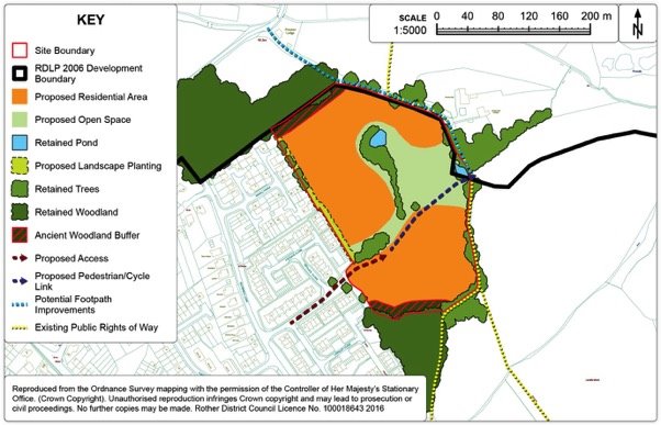
Figure 23. North Bexhill Detail Map - Option 1 (Preferred Option)
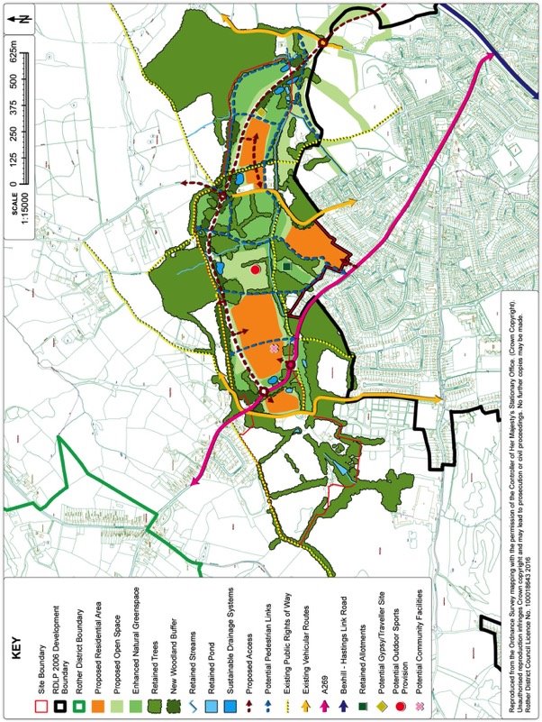
Figure 24. North Bexhill Detail Map - Option 2
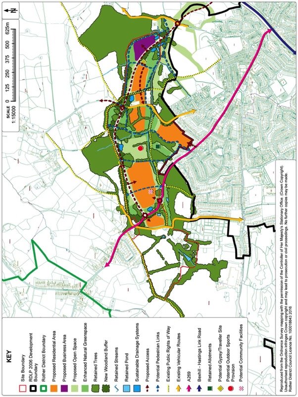
Figure 25. North Bexhill Detail Map - Option 3
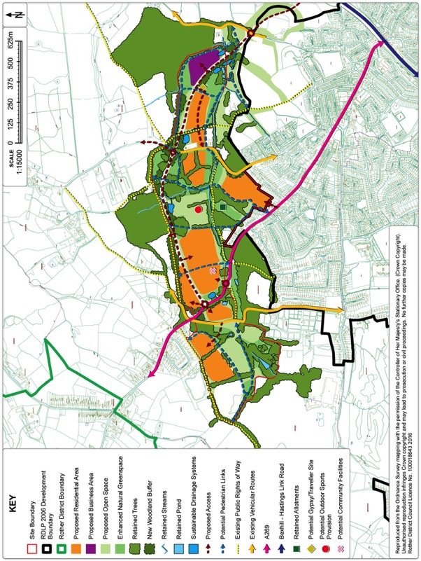
Figure 26. North Bexhill Aerial Map
13.22. It can be seen that Option 2 differs from Option 1 in that it also includes residential development on the west side of Watermill Lane and business development to the north east of the NBAR, while Option 3 further includes residential development to the north of the NBAR and a much larger area of residential development west of the A269 than in the other options. A small travellers' site is common to all options. This is proposed to accommodate five pitches, in line with the provisions in the Housing section.
13.23. Considerable "green infrastructure" is integral to the respective development options, all of which create a broad green corridor along the valley bottom of the Combe stream and incorporate significant additions to the network of footpaths.
13.24. Option 1 is found to be most sustainable, as the additional areas of development in Options 2 and 3 are found to lack the containment provided by the new road, which is regarded as an important factor in maintaining the setting of the town and avoiding visual intrusion into the rural landscape to the north. Also, the development of the small fields west of Watermill Lane would involve the loss of an ecologically more valuable grassland habitat. Also, Option 3 would result in coalescence with The Thorne and Lunsford Cross, and an inappropriate "urban creep" into the more rural approach to the town, while the development west of St Mary's Lane is not seen as a natural extension of the town, as well as creating serious traffic issues.
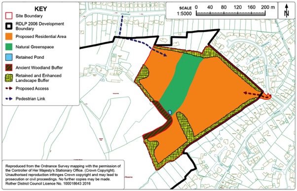
Preferred Development Option: North Bexhill Option 1 (Ref: BX124)
|
Existing use(s) |
Most agricultural, some woodland, equestrian uses, residential |
|
Size |
c50ha |
|
Key constraints/ opportunities |
Housing should be of a high quality, befitting a sustainable urban extension on a key approach to the town, with a high proportion of family homes and a modest net density, which should also take account of the local topography and existing landscape features, including trees and hedges. Accessibility to local services will require careful attention, with further consideration of bus services along the NBAR to complement or link to that along the Ninfield Road in order that all housing is within easy walking distance of a bus stop. Both existing and new residents should benefit from the proposed extensive areas of open space, which should be structured to create a series of green corridors, principally along the valley bottom, connecting to larger areas of public open space, to include recreation facilities with playing pitches, natural amenity spaces or play areas, and to the Countryside Park further to the east. There are several existing footpaths crossing the area, which should be retained and new connections created to them, in order to improve public access through the area and into the wider countryside. In particular, an east-west route alongside the stream course may be the main artery for sustainable travel. To mitigate the traffic impacts of the new development, as well as new bus, cycle and pedestrian facilities, developments will need to provide the necessary works to secure safe and effective access into the site and to manage impacts on the local road network, notably to restrict inappropriate rat-runs along St Mary's Lane and Peartree Lane. Further consideration should be given to the position of junctions to minimise turning movements on the NBAR and to maximise connectivity to the existing urban area. No new school provision is anticipated, but further consideration should be given to local shops and community facilities to meet the needs of the development, to complement measures to encourage easy access to Sidley District Centre. Further consideration should be given to renewable energy options, including maximising passive solar gain. Overall, a comprehensive approach is required, not least to ensure the integrated provision of housing and infrastructure, not least the green infrastructure and mitigation and/or compensation for any biodiversity losses. |
|
Proposed use(s) |
Housing, public open space, semi-natural green space and supporting community facilities, together with a small travellers site and access improvements. |
|
Developable area |
15ha residential. |
|
Capacity |
Some 450 dwellings, 5 traveller pitches. |
Policy BEX3: Land at North Bexhill
Land at North Bexhill, as shown on the Policies Map, is allocated for a mixed development incorporating housing together with substantial green space for public open space and amenity purposes.
A comprehensive approach to the delivery of development in parallel with the provision of the green space and other infrastructure will be required. This will be achieved through preparation of a Supplementary Planning Document. In particular, it will provide for:
- development to be contained to the south of the approved North Bexhill Access Road;
- retention of a local open gap between new development and Lunsford Cross;
- some 450 dwellings, of which 30% are affordable;
- a small travellers site, for 5 pitches;
- the creation of a linear park, predominantly semi-natural green space and incorporating footpath and cycle routes, alongside the Combe stream;
- a new recreation area, including playing pitches, with arrangements for its layout and ongoing management;
- retention of Ancient Woodland, as well as other trees and hedgerows as far as practicable;
- the identification of areas of habitat retention and mitigation, to be based on an area-wide ecological strategy, with arrangements for its implementation;
- identification of local community facilities, including local shops and services;
- footpath and cycle routes that connect to the existing Public Rights of Way network and to routes to be provided as part of developments to the east;
- a restriction on the occupation of development until the NBAR is constructed and open to traffic;
- traffic mitigation measures to manage flows along St Mary's Lane and Peartree Lane; and
- improvements to the A269 to improve traffic safety and residential amenities in the vicinity of St Mary's Cottages.
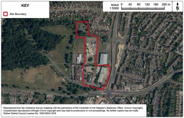
Preferred Site: Former High School Site and Drill Hall, Down Road, Bexhill
(Ref: BX4)
|
Existing use(s) |
Leisure Centre, Drill Hall, skate park, motorcycle training area,former school canteen. |
|
Size |
2.4ha |
|
Key constraints/ opportunities |
This site is identified for mixed use in the Rother District Council Local Plan (2006) for offices, community buildings and high density housing. Part of the identified site in the Local Plan (2006) has been developed for the Skills Centre (east of the site, with land to the north for a possible extension in due course). The King Offa Primary School, playing field and nursery is situated on the western part of the site and therefore also no longer forms part of the development area. The existing leisure centre is situated to the south of the site along with the Drill Hall. The Bexhill Hastings Link Road (Combe Valley Way) forms the eastern boundary. The site is located on a prominent position at the Bexhill end of Combe Valley Way and allows for the opportunity to create a landmark destination for leisure facilities. There is a need for a comprehensive consideration of the site to ensure a high quality public realm on this highly prominent gateway site into the town. There are aspirations for a combined wet and dry sports and leisure facility on one site along with other complementary facilities to create a leisure destination, along with a modest number of dwellings. Access is likely to be from Down Road, although there is potential to access the site from Combe Valley Way. The Drill Hall will require relocation as a part of any scheme. The development should focus on an accessible, sustainable and high quality leisure hub facility, through the creation of high quality buildings and public realm on this highly prominent gateway site into the town. |
|
Proposed use(s) |
Mixed use (wet/dry leisure facility, residential, hotel, restaurant space, car parking to serve adjacent school). |
|
Developable area |
1.17ha (residential area only). |
|
Capacity |
Some 30 residential dwellings, wet/dry leisure facility (circa 6,000sqm), hotel (circa 80 beds), restaurant space (circa 800sqm), plus car/coach parking for adjacent school. |
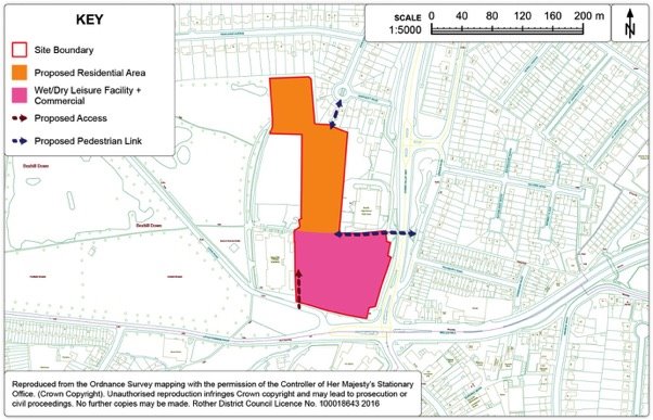
Policy BEX4: Land at Former High School Site and Drill Hall, Down Road, Bexhill
Land at Former High School Site and Drill Hall, Down Road, Bexhill, as shown on the Policies Map, is allocated for mixed use development creating a leisure destination, comprising of a wet/dry leisure facility, housing, hotel, restaurant space, and associated car parking to serve adjacent school.
Development should focus on an accessible, sustainable and high quality leisure hub facility, creating a landmark leisure destination through high quality buildings and public realm on this highly prominent gateway site into the town.
Proposals will be permitted where:
- a high quality wet and dry sports and leisure facility of around 6,000sqm;
- some 30 dwellings are provided, of which 30% are affordable;
- complementary commercial development, including a 80-100 bed hotel, plus up to 4 units of restaurant space each around 200sqm;
- car-parking to serve the development, along with associated car/coach parking and drop-off area for the adjacent school;
- the Drill Hall facility has been provided for at an alternative location; and
- provision is made for the retention and enhancement of boundary planting on the northern boundary.
Development of the site should be through a comprehensive masterplan.
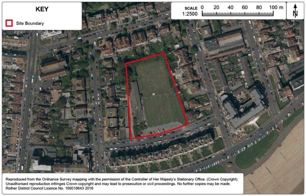
Preferred Site: Land at Gullivers Bowls Club, Knole Road (Ref: BX5)
|
Existing use(s) |
Two outdoor bowls greens (one disused), pavilion and clubhouse and indoor rink. |
|
Size |
0.7ha |
|
Key constraints/ opportunities |
The site is located within the development boundary of Bexhill. The site is surrounded on three sides by properties in Middlesex Road, Brassey Road and Cantelupe Road whilst there is a substantial Grade II listed terrace of late-Victorian dwellings in De la Warr Parade on the south side of Knole Road. The site is just to the east of the Bexhill Town Centre Conservation Area and visually forms part of the setting of the listed terrace to the south known as De La Warr Parade. The site is on the northern side of Knole Road and is roughly rectangular in shape. The site steps up by approximately 1.5m from Knole Road to its northern boundary, whilst east to west the site is relatively level. The site is currently used as an outdoor bowls facility consisting of 2 outdoor greens (one is disused) with an additional indoor rink, along with other associated facilities. The existing bowls club buildings run along the length of the western boundary and are in poor condition. The site is well related to the town centre and other associated services such as doctors. There are also nearby bus services connecting to the town and wider transport network within walking distance. The train station is also within a reasonable walking distance. A recent High Court Decision quashed the 2014 application for 39 sheltered housing units – (Case No: C1/2015/2398) on grounds of failed consultation of the Victorian Society. |
|
Proposed use(s) |
Sheltered housing plus replacement outdoor bowls green, indoor rink and other bowling club facilities. |
|
Developable area |
0.7ha |
|
Capacity |
39 sheltered housing units. |
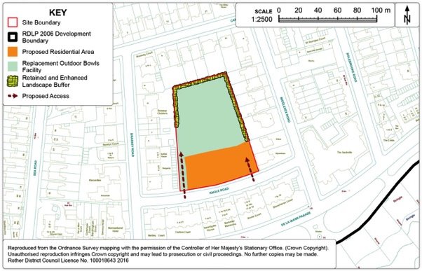
Policy BEX5: Land at Gullivers Bowls Club, Knole Road, Bexhill
Land at Gullivers Bowls Club, Knole Road, Bexhill, as shown on the Policies Map, is allocated for mixed use development comprising of housing and a replacement bowls facility. Proposals will be permitted where:
- some 39 sheltered dwellings are provided, of which 30% are affordable;
- an improved bowls facility comprising of an outdoor bowls green, an indoor rink and associated clubhouse and maintenance facilities is provided;
- development at the rear of the site is single storey only;
- separate access points are provided for the residential and bowls facility part of the scheme;
- the design of the scheme does not adversely affect the character of the area or the setting of the listed terrace to the south; and
- provision is made for the retention and enhancement of boundary planting, particularly on the western, northern and eastern boundaries.
Preferred Site: Land adjacent to Cemetery Lodge /276 Turkey Road, Bexhill
(Ref: BX30)
|
Existing use(s) |
Field (disused). |
|
Size |
1.2ha |
|
Key constraints/ opportunities |
This greenfield site is located within the existing development boundary for Bexhill. There are three residential properties at the south-eastern corner of the site, with a further residential property along the western boundary. Bexhill Cemetery is to the east. The site received planning permission subject to a legal agreement in 2003 but the decision notice cannot be issued as the original company who put in the planning application no longer exists. The site was restricted for development due to Liquid Propane Gas tanks at Ashdown Brickworks. These have been removed, resulting in the Hazardous Substances consent lapsing. The site is partially contained from wider views by the boundary trees but there are more localised views due to the types of trees on the perimeter. There is an existing Tree Preservation Order (TPO - no.312) along western and southern boundaries. Development of the site would allow for boundary landscape improvements. The site is relatively well located in terms of access to some services (schools) and is close to existing bus routes, although there are not any footpaths immediately adjacent to the site (there are some on the opposite side of the road). There is no existing access point for the site, but the most likely access point is at the south-west corner of the site onto Turkey Road (in the same ownership). Highway improvements are likely to be required to make the development acceptable. The site is located within the Pevensey Levels Hydrological Catchment, with implications for SuDS treatments. |
|
Proposed use(s) |
Residential. |
|
Developable area |
1.2ha |
|
Capacity |
30 dwellings. |
Policy BEX6: Land adjacent to Cemetery Lodge /276 Turkey Road, Bexhill
Land adjacent to Cemetery Lodge /276 Turkey Road, Bexhill, as shown on the Policies Map, is allocated for residential development. Proposals will be permitted where:
- some 30 dwellings are provided, of which 30% are affordable;
- an appropriate access is provided onto Turkey Road; including any necessary off-site highway works necessary to make the development acceptable;
- provision is made for the retention and enhancement of boundary planting, particularly in relation to the existing Tree Preservation Order on the site; and
- in accordance with Policy DEN5 'Sustainable Drainage', at least two forms of appropriate SuDS are incorporated.
Preferred Site: Land at Moleynes Mead, Fryatts Way, Bexhill (Ref: BX64)
|
Existing use(s) |
Residential with equestrian uses including stable, manège & paddock. |
|
Size |
1.6ha |
|
Key constraints/ opportunities |
The site is located within the development boundary and is relatively well screened from the wider countryside by existing residential development on all four sides (although there are some gaps to the west). The site is reasonably located in terms of access to services in line with Policies OSS4 and TR3. There is also a bus route within walking distance of the site. It is likely that a footpath link to Ellerslie Lane would be required to encourage a more direct walking route. The site is occupied by an existing dwelling (Moleynes Mead) which although not listed, is considered to be an undesignated heritage asset. It is therefore considered that any re-development of the site which involved in demolition of Moleynes Mead would not be acceptable. There is an existing access to Ellerslie Lane that is likely to require re-location and/or improvements for any redevelopment. There is also potential for an additional access from Fryatts Way. The site contains a number of mature trees and these contribute positively to the character of the area, any development should seek to retain them. The southern section of the site is separated from the wider site by an existing TPO and therefore this area is not considered appropriate as part of the developable area of the site. There are protected species on the site. In terms of planning history, two planning applications have been refused on this site (one also refused on appeal reference APP/U1430/W/14/3001671). Although the principle of development was considered acceptable on this site, reasons for refusal focused on poor design and layout and loss of a heritage asset. The site is located within the Pevensey Levels Hydrological Catchment, with implications for SuDS treatments. |
|
Proposed use(s) |
Residential. |
|
Developable area |
0.9ha |
|
Capacity |
Some 22 dwellings (in addition with the retention of the existing dwelling on-site). |
Policy BEX7: Land at Moleynes Mead, Fryatts Way, Bexhill
Land at Moleynes Mead, Fryatts Way, Bexhill, as shown on the Policies Map, is allocated for residential development. Proposals will be permitted where:
- some 22 dwellings are provided, of which 30% are affordable;
- the existing dwelling, Moleynes Mead, is retained;
- provision is made for the retention and enhancement of existing boundary planting, particularly in relation to the existing Tree Preservation Order on the site;
- the southern section of the site remains undeveloped as an ecology area;
- a footpath link is provided through to Ellerslie Lane;
- an appropriate primary access is provided from Fryatts Way, with a potential secondary access from Ellerslie Lane; and
- in accordance with Policy DEN5 'Sustainable Drainage', at least two forms of appropriate SuDS are incorporated.
Preferred Site: Land south of Terminus Road, Bexhill (Ref: BX81)
|
Existing use(s) |
Car sales and car wash. |
|
Size |
0.15ha |
|
Key constraints/ opportunities |
This is a site within the existing development boundary on an existing employment site (car sales/cash wash) site in Bexhill. The site is bounded by the railway line to the south, residential to the west and further offices to the east, with the Beeching Road industrial estate to the north. The site is an edge of the town centre location and is extremely well located in terms of its access to services. The site currently occupied by a car sales and car wash business but would be well suited to a more intense business use such as offices given its proximity to the town centre Policy BX2 refers). Retention of business use on this site is imperative given the proximity to the town centre and adjacent uses; although it is acknowledged that in order for this to come forward (and given previous, but expired planning permissions) some residential is likely to be needed to facilitate an office development. |
|
Proposed use(s) |
Residential and offices. |
|
Developable area |
0.15ha |
|
Capacity |
6 dwellings plus 100sqm B1 offices. |
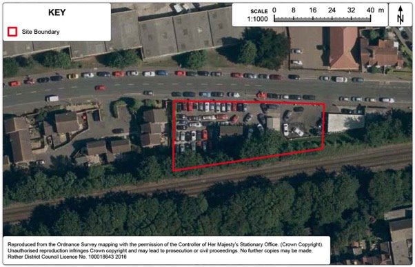
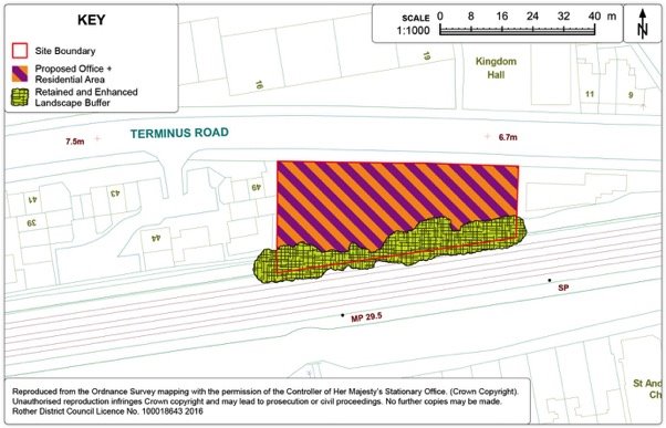
Policy BEX8: Land south of Terminus Road
Land south of Terminus Road, as shown on the Policies Map, is allocated for residential development. Proposals will be permitted where:
- some 100sqm of offices are provided;
- some 6 flats are provided; and
- appropriate boundary landscaping is provided.
Preferred Site: Land off Spindlewood Drive, Bexhill (Ref: BX116)
|
Existing use(s) |
Grazing land. |
|
Size |
7.3ha |
|
Key constraints/ opportunities |
The site is adjacent to the development boundary of Bexhill, just south of Barnhorn Road/Spindlewood Drive, Little Common. It is relatively well contained from wider views by the adjacent wood (Cooden Wood), and this is important in containing any development at this location. The site levels are higher towards the existing residential development along Barnhorn Road, and any development will have to consider wider views. The Council's landscape assessment (2008) makes particular reference to the 'block of woodland and trees and hedges' to the west of this site that provide relative enclosure to this area and that this lends the area to some modest development. However, there is a gap with wider views to the Pevensey Levels from the adjacent (south-western) field (BX108). The adjacent Ancient Woodland to the west of the site is important in containing any potential development. There are two bands of trees that run through the site linking a wooded area to the north with Ancient Woodland to the south. This is an important feature and acts as a wildlife corridor between the two areas of woodland. There is a pond within this area which should be retained and enhanced. The area bounded by these trees should remain open and undeveloped as a wildlife corridor/open space feature of the area. Part of this area may be suitable for children's play space. There is a viable access point from Spindlewood Drive through an existing field gate and a recent transport assessment relating to highway capacity of adjoining roads by the landowner is considered acceptable by the Highway Authority. The site is relatively close to bus services on Barnhorn Road, but there is no current pedestrian route to access Barnhorn Road directly from the site. Any development should provide for a pedestrian route to Barnhorn Road. The site is relatively well located in terms of access to services. The site is located within the Pevensey Levels Hydrological Catchment, with implications for SuDS treatments. |
|
Proposed use(s) |
Residential. |
|
Developable area |
4.8ha |
|
Capacity |
160 dwellings. |
Policy BEX9 Land off Spindlewood Drive, Bexhill
Land off Spindlewood Drive, Bexhill, as shown on the Policies Map, is allocated for residential development. Proposals will be permitted where:
- some 160 dwellings are provided, of which 30% are affordable;
- highway access is provided from Spindlewood Drive;
- a footpath link is provided through to Barnhorn Road;
- provision is made for the retention and enhancement of existing boundary planting, particularly in relation to the existing Tree Preservation Order on the site;
- suitable provision is made for children's play space in the form of both a Locally Equipped Area for Play (LEAP) and a Local Area for Play (LAP);
- a green corridor is provided through the centre of the site between two areas of existing adjacent woodland areas, including the retention and enhancement of the existing pond;
- a woodland buffer is provided to protect the adjacent Ancient Woodland to the south-west of the site;
- provision is made for the retention and enhancement of existing boundary planting; and
- in accordance with Policy DEN5 'Sustainable Drainage', at least two forms of appropriate SuDS are incorporated.
Consideration should also be made to the provisions of Policy SRM1 with regards to a renewable energy strategy for the site.
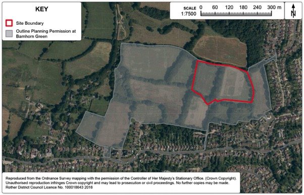
Preferred Site: Land at Barnhorn Green (Ref: BX120)
|
Existing use(s) |
Grazing land. |
|
Size |
3.53ha |
|
Key constraints/ opportunities |
This site forms part of the Barnhorn Green area which has an extant outline planning permission for 275 dwellings, up to 3,500 sqm of employment floorspace, a nursing home, a doctors surgery, and a one form entry primary school, together with associated landscaping, drainage and highway infrastructure works. Recent discussion with East Sussex County Council has indicated that the area set aside for the primary school is no longer required. Generally the area is well enclosed and the strong tree structure affords opportunities for good mitigation of any potential development. These tree structures form a good basis for the development of defined neighbourhoods. The site is reasonably well located for access to local services at Little Common District centre. Development in this location requires a number of highway improvements along Barnhorn Road and to Little Common Roundabout in order to make the development acceptable (as part of the wider Barnhorn Green site). Low risk contamination was identified at the outline planning application stage for the wider site, and must be mitigated against as part of any development. Development should not increase flood risk (regulated outflow of water to Picknell Green Stream). There is an existing TPO (No.341) which runs through the site and are primarily located along the existing field boundaries. A number of Public Rights of Way (PRoW) run through/abut the site (11a, 11b, 12a) and any development must ensure that these footpaths are maintained and enhanced. The site is located within the Pevensey Levels Hydrological Catchment, with implications for SuDS treatments. |
|
Proposed use(s) |
Residential. |
|
Developable area |
2.84ha |
|
Capacity |
67 dwellings. |
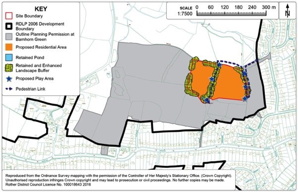
Policy BEX10: Land at Barnhorn Green, Bexhill
Land at Barnhorn Green, north of Barnhorn Road, Bexhill, as shown on the Policies Map, is allocated for residential development. Proposals will be permitted where:
- some 67 dwellings are provided, of which 30% are affordable;
- the scheme is comprehensively integrated into the surrounding development;
- the existing footpath network is maintained and enhanced;
- provision is made for the retention and enhancement of existing field boundaries as green corridors, particularly in relation to the existing Tree Preservation Order on the site;
- the existing pond is retained and where possible, enhanced;
- suitable provision is made for children's play space in the form of Locally Equipped Areas for Play (LEAPs) and a Local Areas for Play (LAPs); and
- in accordance with Policy DEN5 'Sustainable Drainage', at least two forms of appropriate SuDS are incorporated.
Preferred Site: Northeye (Former United Arab Emirates - Technical Training Project), Bexhill (Ref: BX101)
Context
13.25. This large site lies on a north-facing slope extending down to the edge of the Levels on the north side of the A259 a little beyond the western extent of Bexhill. Access is provided by Wartling Drive, served off Coneyburrow Lane, a short distance from its junction with the A259.
13.26. The site is owned by the United Arab Emirates, but its use as a Training Centre ceased some years ago and the site is presently mothballed. The owners advise that there is no intention to bring the site back into training use for its purposes. Hence, consideration should be given to alternative uses.
13.27. Of note, its somewhat exposed countryside location reflects the fact that the site was originally established as a RAF base in 1944 and then developed as a prison, which existed until 1992 before being taken over by the United Arab Emirates.
13.28. The total site area is approximately 15ha, with a variety of accommodation, education and operational buildings covering about 9ha. The remainder is open, with the northern part previously providing recreation fields for the Centre.
13.29. Alongside the approach to the site is the small residential estate off Wartling Drive. The last six houses on Wartling Drive are still part of the principal site, others having since been sold and now privately occupied. Otherwise, the setting is very rural in character.
Site Options
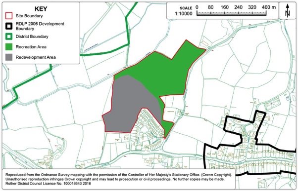
13.30. It is evident that this is a very sensitive site, most notably due to its position adjacent to an internationally-designated ecological site (the Pevensey Levels), its largely rural setting and associated visual exposure, as well as being somewhat isolated from the main built-up area of Bexhill. New development in such a situation would normally be resisted, but given the brownfield nature of a large part of the site, redevelopment of that area (excluding land that falls in Flood Zone 3) should be considered.
13.31. The countryside setting of the site, allied to its fairly self-contained nature, gives rise to a number of possible future uses. The scope of these and their pros and cons are summarised in Figure 41 below.
13.32. Common to all options is the proposal that the essentially undeveloped area of the site north of the stream course should remain open and not be built upon. In particular, this land offers an opportunity to provide additional playing fields, the need for which is identified in the recent Playing Pitch Strategy for Rother and Hastings. If recreational demand does not materialise, then the northern half of the site could return to an agricultural (or possibly low-intensity equestrian) use.
13.33. Also, in all cases, any development would need to be sympathetic to its sensitive location, both in terms of its impact on the Levels and in reducing the existing visual impact of existing buildings which are seen in the context of fields surrounding the site, particularly when viewing them from the west and the north.
Figure 41. Northeye site options
|
Option |
Description |
Commentary |
|
1. Employment-led redevelopment |
Some 11,000sqm business floorspace on the southern part of the site, contained by buffer planting on southern and south western edges, with playing pitch/open space on the northern half. |
The site offers access to the trunk road and would suit a "campus" layout of R&D/offices/headquarters in landscaped grounds, providing valuable local jobs. Would need to improve A259 junction and to separate access from housing; slope may limit large-footprint buildings. |
|
2. Residential-led redevelopment |
Residential development of some 115 dwellings (including 30% affordable) on the southern part of the site, contained by buffer planting on southern and south-western edges, with playing pitch/open space uses on the northern half. |
Compatible with adjoining housing to south. Layout could work with slope of land. Would be quite car-dependent, as few services nearby, although partially mitigated by bus route along A259. Would need to improve A259 junction. |
|
3. Tourism-led redevelopment |
A high quality (eco) holiday lodge park, potentially with a hotel. This would also be focused on the southern part of the site, contained by buffer planting on southern and south-western edges, with ancillary amenity open space and/or playing pitch on the northern half. |
The size and rural fringe location of the site, coupled with good access to many tourism assets, may attract a high-quality holiday lodge operator, complementing existing accommodation and generally supporting the tourism sector. Buildings may be set within a well-landscape setting. Peak traffic flows would be relatively low. The costs of such a scheme on a brownfield site would be relatively high. |
|
4. Institutional-led redevelopment |
This would cover similar uses to those in the past i.e. secure residential/training accommodation, but would also allow for an educational establishment. The northern part of the site may be incorporated into such a use or used separately for playing pitch/open space purposes. |
Such uses reflect both the past use of the site and its self-contained, rural fringe but still reasonably accessible location. Different institutional uses may raise specific issues, but traffic generation is likely to be relatively low. Such uses would have relatively little connection with the needs of Bexhill, although would provide some employment. |
Figure 42. Northeye Aerial Map
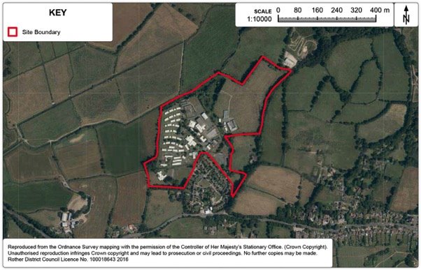
Figure 43. Northeye Detail Map
Site options for playing pitches
13.34. The Council's Playing Pitch Strategy assesses existing pitch provision and is a demand led assessment. It also provides a strategic framework for the maintenance and improvement of existing playing pitches and ancillary facilities up to 2028. It covers the sports of football, rugby, cricket, hockey, artificial grass pitches, tennis, outdoor bowls, stoolball and American football.
13.35. The Strategy identifies where new provision is needed and how future provision of playing pitches should be secured. It also includes an Action Plan which identifies any surpluses or deficiencies in playing pitch provision and recommends actions relating to individual sites that are identified as having issues e.g. the pitch is overplayed, is of poor quality or changing facilities are required.
13.36. The Strategy highlights specific deficits in both football and rugby pitches and the need for two artificial grass pitches across the district. The Strategy indicates that the deficit of football pitches, in terms of match equivalents is particularly acute in Bexhill. In addition to this identified shortfall, there are a number of Bexhill based clubs who require enclosed pitches to progress through the football league structure.
13.37. It is envisaged that some of the shortfall in pitches would likely come through pitch condition improvements, it is clear that additional sites will be needed to address the shortfall, particularly in Bexhill.
13.38. As such, it is imperative that existing facilities are safeguarded but also new sites are found/previously used sites are brought back into use. The Strategy specifically highlights the need to safeguard existing sites (Core Strategy Policy CO3) and bring disused sites back into use.
13.39. Options for new sites within Bexhill for new playing pitches are limited due to the availability of land and the topography of the town. Therefore, the most likely option for additional playing pitches is to bring back former playing pitches into use. Policy BEX3 (North Bexhill) & Site BX101 (Northeye) highlight potential new provision alongside large scale development. The Strategy recommends that the former Sidley Sports and Social Club site which ceased its current use in 2013 should be safeguarded for playing pitch provision and brought back into use.
13.40. The former Sidley Sport and Social Club site is a two hectare site in the centre of Sidley which previously accommodated a full size adult football pitch and a full size cricket pitch. The sports clubs which were displaced have struggled to find alternative pitches to accommodate their games, with both the cricket and football clubs now playing at pitches outside Bexhill.
Preferred Site: Land at Sidley Sports and Social Club, Bexhill (Ref: BX123)
|
Existing use(s) |
Disused football and cricket pitches and clubhouse. |
|
Size |
2.0ha |
|
Key constraints/ opportunities |
The application site comprises a 2ha area of grassed, open space formerly used as a playing field accommodating a full size adult football pitch and a full size cricket pitch. The site is currently in private ownership. The site is located within the Development Boundary. It is bordered by the rear gardens of houses on North Road on its western side and bungalows at Festival Gardens on its northern side. On its southern side are flats on Glovers Lane. Buckholt Lane, a public right of way, borders the eastern side of the site and there are houses on Ingrams Avenue on the opposite side of the Lane. The site is about 80m from Sidley's main shopping area which is focused around Ninfield Road to the south-west of the site. The southern part of the site is relatively level but the northern part slopes gently upwards towards its northern boundary. The site is largely covered with long grass and there are some mature trees on its boundaries. |
|
Proposed use(s) |
Playing pitch/es. |
|
Developable area |
2ha |
|
Capacity |
One adult football pitch, with potential for additional pitch marking for smaller pitches. |
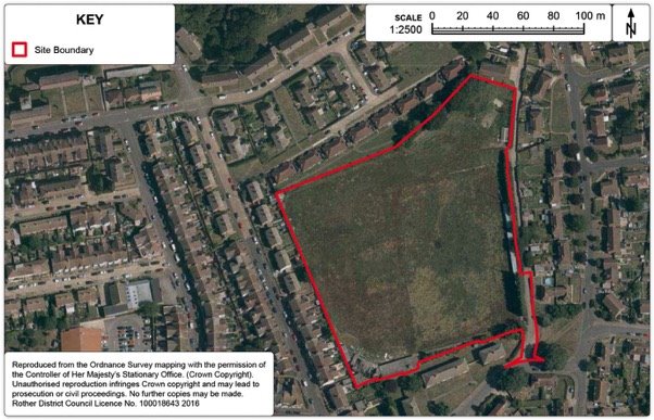
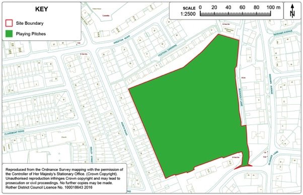
Policy BEX11: Land at Sidley Sports and Social Club, Bexhill
Sidley Sports and Social Club, Glovers Lane, as shown on the Policies Map, is allocated for playing pitches for formal sport.
Bexhill Town Centre
13.41. The Core Strategy identifies the hierarchy of shopping centres in the District and sets out a generic policy approach for the relative growth of these areas, as well as for retail development elsewhere.
13.42. The Council wishes to see the town centre build on its position as the commercial and cultural heart of the District. This includes building on its considerable strengths in the mix of land uses and strong architectural and historic character to support regeneration, create a more vibrant shopping environment and better integration between key facilities including between the seafront and the town centre.
13.43. Bexhill's many small independent shops help lend the town centre its special character. These small independent shops provide an important role in servicing the day-to-day needs of local residents, workers and visitors and can provide consumer choice and local employment. The Core Strategy highlights the retail role of Bexhill and the retail investment potential within the town through Policy BX2.
13.44. An allocation of land for a significant retail development is set out below. Other smaller sites may come forward for redevelopment or intensification within the designated town centre. Such sites and premises will be favourably considered for retail use in accordance with Policy EC7 in the Core Strategy.
13.45. Improved accessibility and public realm will be key to strengthening the town centres' position, and a town centre traffic management strategy is envisaged. This strategy will be prepared in conjunction with East Sussex County Council and will articulate a cohesive approach to town centre traffic movement, connectivity and the public realm, including the management thereof, and focus on some potential interventions that could deliver improvements. It will recognise the relationship between traffic management, connectivity and the public realm with the wider vitality and viability of the Town Centre, and make recommendations that will seek to strengthen one via the other. The strategy will be expected to encompass sustainable transport initiatives, accessibility of the town for cars, pedestrians, cyclists and public transport, traffic management within the town centre, including car-parking provision and location, and the potential for 20mph zones and pedestrian zones, and public realm design, management and maintenance. A draft of such a strategy will be subject to consultation in due course.
13.46. The arts and cultural offer in Bexhill is centred round the De La Warr Pavilion – a Grade I listed building which is internationally renowned for art installations and venue for live music and the arts. To the south lies the recently restored Grade II listed Colonnade, and the Bexhill Rowing Club, to the east the Grade II listed terrace of residential properties Marina Court Avenue, then Marina Arcade, a mixture of commercial and residential, and lastly Bexhill Sailing Club and the war memorial. Meanwhile the recently refurbished West Parade leads away from the Pavilion to Bexhill Museum to the west. The De La Warr Pavilion and its surrounding area is seen as a significant asset and hub for cultural and social activity within the town, being the focal point for events such as the 'Roaring 20's', 'Bexhill Festival of the Sea' and 'Bexhill Motofest' and being critical in not only providing local amenity but also attracting visitors from further afield.
13.47. The District centres of Little Common and Sidley also form an important function in fulfilling day-to-day shopping needs to local communities. They were defined in the 2006 Local Plan. Their function and physical extents are detailed further below.
Bexhill Town Centre and Cultural Area
13.48. Bexhill's 'shopping centres' in the Core Strategy follow a hierarchy with Bexhill being the town centre, and District Centres being Little Common and Sidley. A variety of 'Town Centre' uses are directed to these centres, Policy BX2 in the Core Strategy sets out this approach. However, this policy does not define the boundary of the town centre.
13.49. The 2006 Local Plan Proposals Map makes specific provision for a shopping area and office area within Bexhill town centre, highlighting areas for the focus of retail and office uses respectively. The National Planning Policy Framework indicates a differing approach which focussed on town centres and primary shopping areas[43], which should be defined on the Policies Map.
13.50. The town centre is the most sustainable location for retail investment with good accessibility by a range of means of travel. With the primary shopping area being the main concentration of retailing and associated high street uses. The purpose in identifying the primary shopping area is to support the primary retail function of the town centre.
13.51. Meanwhile the designation of a 'cultural area' affords the opportunity to focus the enhancement of the activity and facility offer to improve patronage and evening economy around the seafront as a significant amenity asset to the town.
13.52. The proposed town centre, primary shopping area and cultural area boundaries are shown in Figure 46 below.
Figure 46. Proposed Bexhill town centre, primary shopping area and cultural area boundaries
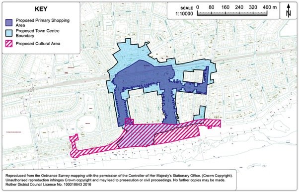
Policy BEX12: Bexhill Town Centre
Bexhill Town Centre is defined on the Policies Map, and this will be the focus for retail and other town centre uses.
Within the town centre, as defined on the Policies Map, the loss of significant town centre uses will be resisted.
Public realm improvements and traffic management to support better access within the town centre and improved environmental quality and appearance will be supported.
Policy BEX13: Bexhill Primary Shopping Area
The Bexhill Primary Shopping Area, as defined on the Policies Map, gives priority to retail and associated services (A1 and A2 uses) and seeks to protect the predominant shopping role and character of the area by controlling the loss of such units.
Planning permission will be granted for the introduction of new shops and the expansion or refurbishment of existing premises, subject to compatibility with other Plan policies.
In schemes for the redevelopment and change of use of sites within this area, regard will be made to the following factors:
- whether there is harm to the shopping character, diversity and vitality of the area;
- the size and type of unit. The provision of new and retention of larger retail units will be encouraged;
- the type and characteristics of other uses in proximity to the application site; and
- the need to avoid an over concentration or clustering of non-retail uses.
Consideration should also be made to Policy DEC1 Shopfronts.
Policy BEX14: Bexhill Cultural Area
Bexhill Cultural Area is defined on the Policies Map, and will be the primary focus for arts, culture and tourism activities within the town. Within the cultural area, as defined on the Policies Map, the loss of significant existing arts, culture and tourism uses will be resisted.
Improvements to the quality of the public realm to complement the arts, culture and tourism offer, to improve the quality of the promenade experience, to strengthen connections between the beach and the town, and create a sense of place in keeping with the destination role of the seafront will be supported.
Facade restoration to reinstate the original architectural features at Marina Arcade will be supported, subject to compatibility with other Plan policies.
Additional infrastructure, including high quality visitor accommodation, to support cultural activity and facility offer in close proximity to the Cultural Area will be encouraged, subject to compatibility with other Local Plan policies.
Site options for retail
13.53. In line with national planning policy and the Core Strategy (Policies BX2 and EC7), it is important that Bexhill town centre is the focus of both convenience and comparison retail growth. The Council is committed to supporting and promoting Bexhill town centre including enhancing the diversity of the retail offer by taking a pro-active approach in directing and encouraging growth. Because of its accessibility, Bexhill town centre is considered as a sustainable place suitable for the provision of a wide range of shopping facilities and services.
13.54. Given that Bexhill town centre is vital for the well-being of the local residents and faces stiff competition from nearby town centres, it is important that Bexhill town centre is promoted and developed in a way that allows it to strengthen its local distinctiveness, whilst also offering improved and enhanced consumer choice. The Council will therefore require applications for main town centre uses to be located in the designated centres, then in edge-of-centre locations and only if suitable sites are not available would out-of-centre sites be considered as set out in Policy EC7 in the Core Strategy. When considering edge-of-centre and out-of-centre proposals, preference would be given to accessible sites that are well connected to the town centre, and to proposals which satisfy the sequential test and are not likely to have significant adverse impact on the vitality and viability of the town centre.
13.55. The Council will apply a sequential test and impact assessment to planning applications for main town centre uses that are not located in the existing designated centres above 500sqm as set out in Policy EC7 in the Core Strategy.
13.56. Policy BX2 in the Core Strategy identifies the strategy for Bexhill town centre and seeks to "provide for some 2,000sqm additional convenience goods and 4,000sqm comparison goods floorspace, primarily through 'edge of centre' retail expansion on the north side of the railway, as well as effective use of town centre accommodation".
13.57. There are three sites considered as potential locations for the identified retail need within Bexhill. These sites considered as potential retail sites can be identified on Figure 47 below.
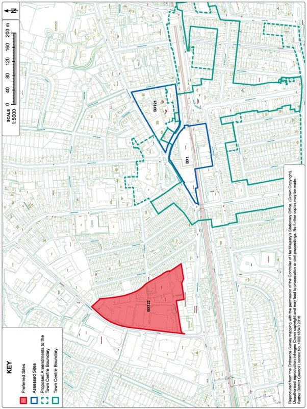
13.58. The sites are located in edge of town centre locations on the north side of the railway, within an area from Sea Road through to Terminus Road, including the southern end of Beeching Road, in line with the provisions of Policy BX2 in the Core Strategy. The sites considered are:
BX1: Sainsburys/Station Road/De La Warr Mews/Clifford Road/Buckhurst Road
BX121: Land adjacent to Station Road
BX122: Land on the southern end of Beeching Road industrial estate
13.59. The preferred development site for retail is:
BX122: Land on the southern end of Beeching Road industrial estate
13.60. The 2006 Local Plan policy which identified a mixed-use redevelopment proposal on the existing Sainsburys site and related redevelopment along Western Road (Policy BX6) has not come forward over the Plan period. There has been no recent market interest regarding this site and redevelopment of this area is unlikely to be viable. The assimilation of land to bring the site forward would rely on a large number of landowners; therefore it is not possible to consider the site as available for development. Hence, it is not appropriate to maintain this allocation forward.
13.61. Given the historic character, mix of ownerships and already intensive use within the town centre, it is highly unlikely that there is a large scale opportunity for redevelopment to accommodate the level of convenience goods floorspace identified within the Core Strategy for Bexhill. Therefore, the Council must apply the sequential test in the consideration of sites to accommodate the floorspace, by firstly looking at edge-of-centre sites (i.e. within 300 metres of the town centre boundary) and, if necessary, out-of-centre sites with good links to the town centre.
13.62. For similar reasons to site BX1, land adjacent to Station Road is also a challenging site, primarily due to the large number of landowner/interests within this area and it is not possible to consider the site as available for development.
13.63. The preferred retail site is the only edge of centre site which can be considered available. Work undertaken for the Council by GL Hearn in 2013, considered a number of sites in terms of suitability to accommodate convenience goods retail floorspace and their location in proximity to the town centre. This identifies an edge-of-centre site on the southern end of Beeching Road. The centre of this area is within the 300m threshold to be considered edge of centre. The route from the edge of the town centre is relatively flat and there are no major roads or railway lines to cross, meaning that there are not obstacles which would hinder the scope for linked trips with the town centre. Even so, achieving linked trips needs an attractive and safe pedestrian link from the site (likely utilising the existing pedestrian footpath), and along Terminus Road towards the town centre.
13.64. A clear frontage on Terminus Road would be a desirable outcome, but the scope to achieve this may be unviable. This is the only available edge of centre site and is capable of achieving attractive town centre linkages.
13.65. The location of the store car park is likely to be a key factor in promoting linked trips with Bexhill town centre. Therefore, it is likely that the car park for a retail store would be best located towards the Terminus Road end of Beeching Road, although the route to walk through the car park to the store entrance will also need to be safe and well managed.
Preferred Site: Land south east of Beeching Road, Bexhill (Ref: BX122)
|
Existing use(s) |
Existing employment estate. |
|
Size |
2.7ha |
|
Key constraints/ opportunities |
BX122 is located on the south-eastern end of Beeching Road and comprises of a mix of uses, predominantly employment uses but with some large vacancies. Mixture of large format warehouse buildings and smaller terraces of start-up type units. There is an existing public car park and coach/lorry park within the area. There is also a Police Station, scout hut and veterinary surgery adjacent to the area. With predominantly two-storey residential properties along the eastern boundary (Reginald Road). There are significant level differences across the site, falling from Beeching Road in the west towards the eastern boundary. There is a culvert which runs through the site. A large proportion of the site suffers from surface water flooding. The centre of the site is located within 300m of the Bexhill town centre boundary, which is likely to be considered edge-of-centre (in sequential test terms) provided there is a clear and unimpeded pedestrian route between the site and the town centre. There is an existing footpath along the eastern boundary of the site joining Terminus Road with Wainwright Road, but it is narrow, unmade and uninviting. There is an existing public car park and coach and lorry park within the site which would require appropriate reprovision within the site or elsewhere. There is no existing pedestrian crossing across Terminus Road between Beeching Road and Sackville Road/Buckhurst Place. Redevelopment of this area would involve the redevelopment of part of an existing industrial estate which would result in the net loss of employment floorspace. This may be mitigated by the provision of office space within a retail-led redevelopment. The freehold of the land is in one ownership but there are multiple leases and sub-leases. There has been some consolidation of leasehold ownerships in recent years. |
|
Proposed use(s) |
Retail (convenience goods). |
|
Developable area |
2.7ha |
|
Capacity |
2,000sqm convenience goods floorspace. |
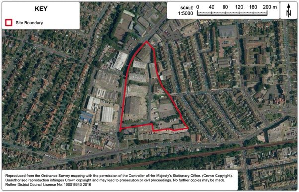
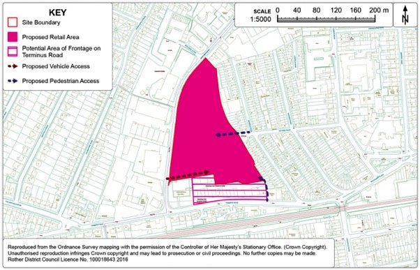
Policy BEX15: Land south-east of Beeching Road
Land south-east of Beeching Road, as shown on the Policies Map, is allocated for convenience retail development. Proposal will be permitted where the scheme:
- provides 2,000sqm of convenience floorspace;
- provides only food and ancillary retail sales, and excludes a pharmacy and any other form of service outlet which might undermine the vitality and viability of the town centre;
- is accompanied with a Retail Impact Assessment in line with the requirements of Policy EC7;
- includes provision for the development of office units, if practicable;
- provides an appropriate proportion of Terminus Road frontage to create a visual connection with the Town Centre;
- brings forward an attractive and safe pedestrian link from the retail store car park/store entrance to Terminus Road along the eastern boundary and the environmental improvement of pedestrian links across Terminus Road;
- provides a commuted sum for the improvement of public transport to serve the development;
- provides consequential offsite highway works to improve the junction of Beeching Road and London Road;
- locates the car park on the southern part of the site and agreement is made for the store's car park to be made available for use by any member of the public;
- the existing coach and lorry park is reprovided for at a suitable location; and
- demonstrates that the access arrangements and the service yard are located in a position that protects the residential amenity of adjacent properties.
London Road - Sackville Road Enhancement Area
13.66. Travelling into Bexhill along the A259, the A269 or the new Combe Valley Way, the Town Centre is approached via the southern section of London Road, Buckhurst Place and Sackville Road. Sackville Road also continues to the seafront and the De La Warr Pavilion.
13.67. However, it does not appear as an obvious or easy "gateway" for people approaching to the Town Centre either on foot or by car and, furthermore, presents a poor initial impression.
13.68. Large advertising hoardings adjacent to the A259 junction do not set a high quality tone on entering London Road. Traffic flows, particularly on the northern section between Chepbourne Road and the A259, is regularly impeded by cars illegally parked on yellow-lined sections on both sides of the road, in some cases mounting the kerb, which adds to the general poor appearance of the street and limits the footway width on both sides. Traffic queues regularly form in London Road from the traffic lights at the A259, while the lack of a right-hand turn lane into Beeching Road can also cause queueing at the junction with the A259. While there are private car parks for a few businesses, there is no readily accessible public off-street parking to support the wide range of shops along London Road.
13.69. Shops variously serve either the local catchment or seek to take advantage of the through-route location. However, not untypical of fringe retail areas in a constrained environment, the presentation of shopfronts and advertising can be poor and lacking continuity of appearance, often also reflected in the upper parts of the buildings. Vacant units occur regularly and can become an eyesore. The condition and mix of materials on footways and several private forecourts is variable.
13.70. Buckhurst Place (also referred to as "Town Hall Square") benefits from its central Green, with flower beds and Cherry trees, but any "sense of place" is not helped by the long flank brick wall of Sainsburys. In addition dominating traffic flows, on-street parking and the prominent taxi rank around the gyratory create confusion for some users and pedestrian crossing difficulties, particularly on the western side across the square.
13.71. Sackville Road contains Edwardian terraces worthy of the Conservation Area status. However, entering it from the north is inauspicious, the junction with Buckhurst Place and Terminus Road having an awkward road layout, slow-moving traffic and hoardings dominating the railway arch, along with narrow pedestrian footways through the arch. The condition of buildings is generally good and there is a mix of activities, including retail, food and drink (which are also present on London Road) and residential (although predominantly on the upper floors). However, there is a marginal "feel" to commercial activities, which may not be helped by the constantly occupied on-street parking.
13.72. The significance of these streets to the appeal of, and approach to, the Town Centre is considered to warrant positive plans for their enhancement, based on a clear understanding of the role and priorities for each of the areas discussed above.
13.73. Priorities may relate to traffic, parking, pedestrian safety and public realm improvements and supporting commercial activities, including promoting cultural uses close to the De La Warr Pavilion (see Cultural Area proposal in Policy BEX14), as well as improving or increasing the housing stock; recognising that the upper parts of buildings over the shops are or could be converted into flats which provide a demand for local services.
13.74. The area being considered for identification as an "enhancement area" is shown on Figure 50 below.
Figure 50. London Road - Sackville Road Enhancement Area
District shopping centres of Little Common and Sidley
13.75. Access to shops and services, particularly those that meet day-to-day needs, is a vital aspect of sustainable development. These centres provide a focus for communities, are a source of jobs and help reduce the need to travel, especially by car. Government policy for sustainable communities gives emphasis to sustaining and enhancing the vitality and viability of these centres. In line with the Core Strategy, the hierarchy of shopping centres is identified and, in relation to Bexhill, district centres are identified at Little Common and Sidley.
13.76. Little Common District Centre appears to be functioning well; there is a low vacancy rate within the centre and there is a good mix of retail and professional services such as banks and estate agents, although the former Co-op building remains vacant. There is a small supermarket within the centre. There are some pockets in the centre which experience high turnover of occupants but generally the traders have been in Little Common for a long time. There are some restaurants, cafes and takeaways, but the predominant use is retail. In considering the role and function of the centre and how it is currently performing, no amendments are proposed to the existing boundary.
13.77. Sidley district centre has experienced a challenging time in recent years; although the vacancy rate is not high, there has been a high turnover of occupants within the centre and there is a very high proportion of takeaways. Sidley is one of the most deprived areas within the District and for this small geographical area, it represents over-concentration of such uses which could negatively impact on the health and well-being of the local population. Local consultation highlights concern by residents of the numbers of takeaways in Sidley and the impact on its function to perform as a shopping area in the daytime and the impact of external shutters on the shop facades.
13.78. Given the high concentration of takeaways in Sidley district centre and the known deprivation issues in the locality it is considered that the further concentration of takeaways should be resisted. Retail uses in this area should be encouraged to promote a district centre with more vitality and vibrancy.
13.79. In considering the role and function of the centre and how it is currently performing, modest areas on the northern and southern fringes are not currently occupied by retail or service uses and have not been for some time. Therefore two minor changes are proposed to the District Centre to consolidate this defined boundary. Figure 52 details these proposed amendments.
Figure 51. Proposed boundary to Little Common District Centre
Figure 52. Proposed boundary to Sidley District Centre
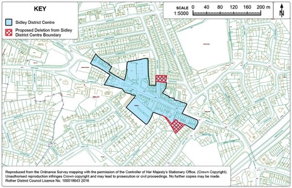
Policy BEX16: Little Common and Sidley District Centres
Little Common and Sidley District Centres are defined on the Policies Map, and will be the primary focus for retail and other town centre uses.
Within these centres, as defined on the Policies Map, the loss of significant existing ground floor retail floorspace falling within Use Class A1 will be resisted. Planning permission will be granted for the introduction of new shops and the expansion or refurbishment of existing premises, subject to compatibility with other Plan policies.
Within Sidley District Centre further concentration of A5 takeaway uses will be resisted.
Development boundary
13.80. Policy OSS2 of the Core Strategy establishes the principle of development boundaries within Rother District but does not define their boundaries. The 2006 Local Plan 'saved policy' DS3 defines the physical development boundaries on the relevant 'Inset Maps'. It is therefore the role of this document to review these development boundaries. It follows that the preferred development sites discussed earlier in this Chapter should be included within revised settlement development boundaries within Bexhill. An exception is Northeye, as this site is well beyond the built-up area of Bexhill and would not warrant a development boundary extension to include this site. These are shown in Figures 53 - 56 below.
13.81. Consideration is given to the scope for any small-scale development boundary amendments along the edges of Bexhill, where there may be development opportunities. As part of this review, amendments are considered as to whether sites have well-defined natural boundaries or topographical features, thereby creating a new defensible edge to the area. The function of the land and its relationship to the settlement are also important factors.
13.82. In reviewing the potential for small-scale development boundary amendments along the edges of Bexhill, generally it is considered that there is little scope to provide infill and rounding off opportunities that are physically, functionally and visually well related to the existing urban area, taking account of any environmental development constraints. Some minor changes are made to the development boundary in the west, in addition to those amendments made to accommodate the preferred development sites, where there is some development potential and its inclusion does not harm the structure, form and character of the adjacent countryside. Equally, consideration has also been given to whether there are any areas that warrant removal from the development boundary. No proposed changes are put forward with regard to removal from the Bexhill development boundary.
Figure 53. Bexhill Development Boundary Map
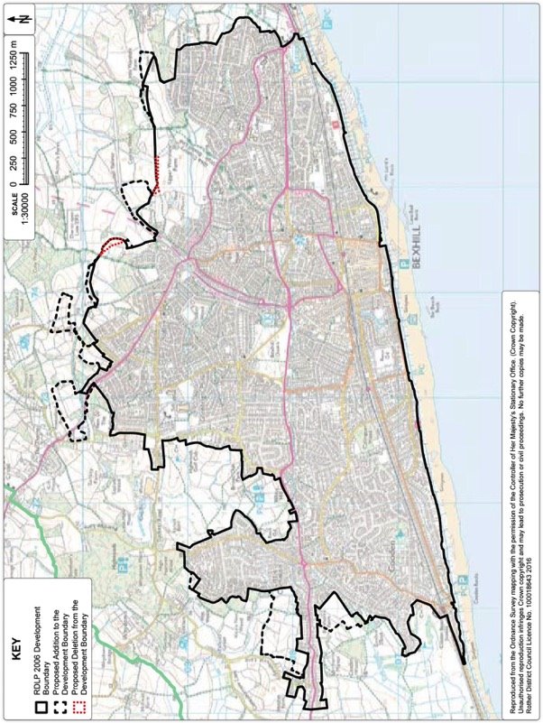
Figure 54. Bexhill East Development Boundary Map
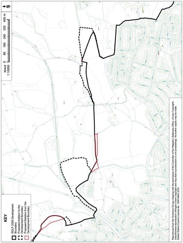
Figure 55. Bexhill North Development Boundary Map
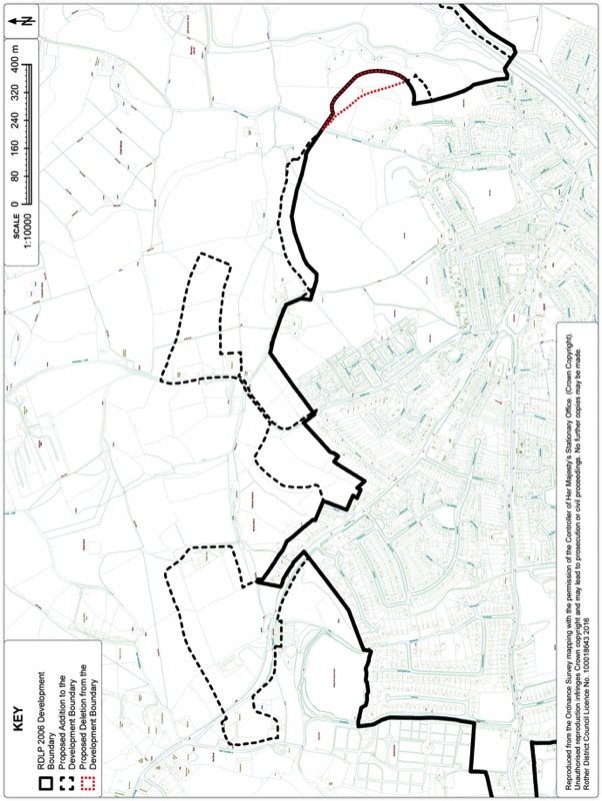
Figure 56. Bexhill West Development Boundary Map
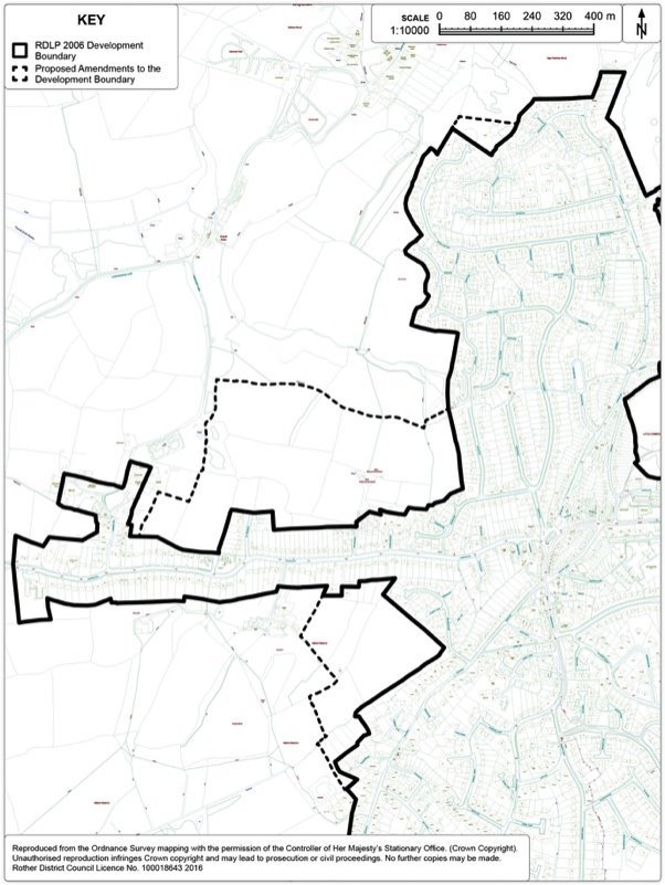
14. Hastings Fringes
Context
14.1. The built-up area of Hastings extends in most parts up to the administrative boundary, with a number of its peripheral areas extending over into Rother district. The Hastings Fringes is defined within the Core Strategy as those areas that are within Rother district and contiguous with the built up area of Hastings, encompassing areas along Westfield Lane, Beaneys Lane, Woodlands Way, Parkwood Road, Sandhurst Gardens, Stonestile Lane, Chowns Hill, Ivyhouse Lane, Rock Lane and Batchelors Bump.
14.2. There are existing development boundaries containing development along Westfield Lane, Woodlands Way, Parkwood Road, Ivyhouse Lane and Rock Lane. Generally, although Rother residents who live within these areas are physically close to Hastings, many of these areas relate far more to their rural surroundings than to the town and are important to its setting.
14.3. A large proportion of the Hastings Fringes are heavily constrained, principally by the High Weald Area of Outstanding Natural Beauty (AONB) designation.
Development Provisions
14.4. The Core Strategy identifies 100-250 dwellings up to 2028 as well as at least 3,000sqm of business floorspace within the Hastings Fringes. As at 1st April 2016, 8 dwellings have been constructed and 78 dwellings have planning permission. This leaves a remaining minimum requirement of 14 dwellings to 2028. In terms of employment floorspace, as at 1st April 2016, there are no sites with planning permission or completions along the Fringe since the Core Strategy base date of 2011.
Site options for housing
14.5. There are eleven sites considered as potential housing sites along the Fringe and can be identified within Figure 57 below. The sites are spread along the Fringe, but mainly concentrated along the northern boundary of Hastings, the majority are greenfield sites adjacent to existing development boundaries. The sites considered are:
BB2: Land adjoining Milward Gardens, Batchelors Bump
BB3: Land west of Winchelsea Road (Lidham Farm), Batchelors Bump
BB4: Land at Thorsfield and Chatswood House
HF2: Land adjacent to Capricorn, Chowns Hill
HF3: Land on Stonestile Lane
HF4: Land at Michael Tyler Furniture, Woodlands Way
HF5: Land at Breadsell Lane[44]
HF6r: Land adjacent to Rock Lane
HF9: Land west of Rock Lane
HF9a: Land north of Austen Way
WL2: Land rear of 66-78 Westfield Lane
14.6. The preferred development site for housing is Land at Michael Tyler Furniture, Woodlands Way (Ref: HF4).
14.7. The preferred housing site is a brownfield site located within the existing development boundary along the Fringe area to the north of 'The Ridge' at Michael Tyler Furniture, Woodlands Way (Ref:HF4). The site is an existing employment site that has become increasingly underused over the years and the older style format of the buildings has deterred other employment occupiers from utilising the site for alternative business uses. The owners have marketed the site for a number of years to let out the vacant space but have received little interest. It is considered that this brownfield site is preferable over other greenfield options along the Fringe. This site yields some 35 dwellings which, together with what has already been permitted, exceeds the minimum target of 100 dwellings along the Hastings Fringes.
14.8. Further details of individual sites can be found in Appendix 3.
Figure 57. Hastings Fringes Options Map
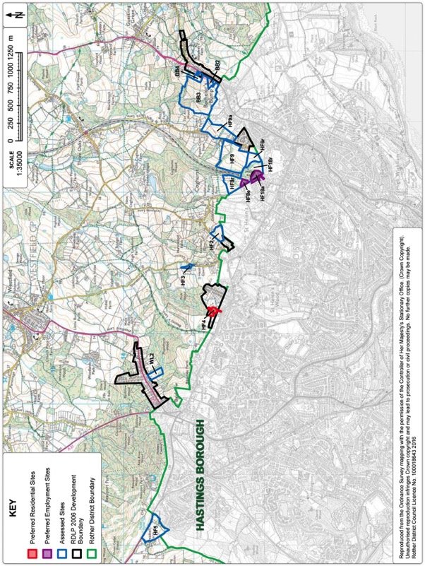
Preferred Site: Land at Michael Tyler Furniture, Woodlands Way (Ref: HF4)
|
Existing use(s) |
Employment floorspace, partly vacant. |
|
Size |
0.97ha |
|
Key constraints/ opportunities |
The site is located on the northern side of The Ridge, Hastings within the development boundary along the Hastings Fringes. The site is adjacent to the High Weald Area of Outstanding Natural Beauty (AONB). This brownfield site comprises of three existing industrial buildings which are only partly in use and have been for some years. These buildings are poor grade, low value units which are not of modern construction. Policy EC3 in the Core Strategy allows for the change of use of employment sites where there is no prospect of their continued use. The low density residential properties to the south, west and north of the site with further residential development currently under construction to the east. Residential dwellings to the north are few and set within large plots, thereby representing low density development and maintaining a rural context to the High Weald AONB. Any development would need to be mindful of the AONB countryside to the north and appropriate landscape buffers would need to be incorporated within any potential scheme to respect wider views from the north. Care should also be taken to respect the relationship with residential properties on the periphery of the site. The general topography falls to the north-west at a few degrees. To provide level areas for the existing buildings/parking there has been some cut-and-fill. There is a bank down to the adjacent bungalows to the north, and a bank and retaining wall down from the adjacent site to the east, around 2.0m high. Parts of the site are located within areas of surface water drainage issues. The site may contain Japanese Knotweed. This area off Woodlands Way has been subject to incremental residential developments which individually have not provided children's play space. Additional residential development would assist in providing play space for a large residential area where there is a lack of provision. |
|
Proposed use(s) |
Housing and children's play space. |
|
Developable area |
0.97ha |
|
Capacity |
Some 35 dwellings. |
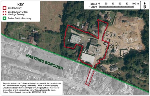
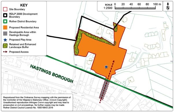
Policy HAS1: Land at Michael Tyler Furniture, Woodlands Way, Hastings
Land at Michael Tyler Furniture, Woodlands Way, Hastings, as shown on the Policies Map, is allocated for housing purposes. Proposals will be permitted where:
- some 35 dwellings are provided, of which 30% are affordable;
- suitable provision is made for children's play space in the form of a Locally Equipped Area for Play (LEAP);
- development does not intrude into views from the Area of Outstanding Natural Beauty to the north; and
- the tree belt on the west and north of the site is strengthened.
Site options for employment
14.9. There are four sites considered as potential employment sites along the Fringe and can also be identified within Figure 57. The sites are spread along the Fringe, but are predominantly concentrated on the northern boundary of Hastings. Three sites abut the existing development boundary adjacent to the existing Ivyhouse Lane Industrial Estate, with a further site considered on the extreme western edge of the Fringe, off Breadsell Lane. The sites considered are:
HF5: Land at Breadsell Lane
HF8e: Land north of A265, Ivyhouse Lane
HF8r: Land north of A265, Ivyhouse Lane
HF18a: Land east of Burgess Road
14.10. The preferred development sites for employment are:
HF18a: Land east of Burgess Road
HF8e: Land north of A265, Ivyhouse Lane
14.11. Individual site conclusions can be found in the Employment Sites Review.
14.12. The two preferred employment sites are located on land adjacent to the existing Ivyhouse Lane industrial estate located within Hastings borough where there is already a substantial quantum of well-used employment floorspace in this area. The sites are relatively sustainable in the sense that they are located adjacent to existing transport links and relatively close to services within Ore (Hastings). These sites comprise of an existing wood/scrubland on the edge of Ivyhouse Lane Industrial Estate, which has suffered from misuse and a lack of management in recent years. Some enabling employment development in the form of small scale extensions to the existing industrial estate could be developed to enable the 'raw edge' of the industrial estate to be softened and create a more acceptable transition between the estate and the High Weald AONB beyond, whilst also providing managed public access across the valley. These two sites together yield some 4,800sqm of employment floorspace, relative to a minimum target of at least 3,000sqm for the Hastings Fringes.
14.13. In terms of the alternative options, the site off Breadsell Lane was considered previously as part of large sustainable mixed use urban extension jointly with Hastings Borough Council. However, the site was considered by the Hastings Inspector as part of their Core Strategy Examination and robustly concluded that the site should be omitted from their Plan on both sustainability and environmental grounds. In terms of 'land north of A265, Ivyhouse Lane' (ref:HF8r), this site is not considered a favoured option due to the landscape impact on the valley between Ivyhouse Lane and Rock Lane. Development of this site would result in an unacceptable intrusion into the valley which would have a detrimental impact on the landscape on this part of the High Weald AONB.
Preferred Site: Land east of Burgess Road (Ref: HF18a)
|
Existing use(s) |
Woodland/scrub land adjacent to existing industrial estate. |
|
Size |
3.1ha (in Rother District only) |
|
Key constraints/ opportunities |
The existing industrial estate presents a very "raw" edge on its eastern side. The area is situated in the High Weald Area of Outstanding Natural Beauty. The adjoining land, whilst established woodland, is degraded in several ways. It is mostly rough scrub grass ground traversed by tracks and holes made for trial motorcycles and bicycles. Historically, there are also several burnt-out cars. Areas have also been cleared for overhead transmission lines and three pylons rise from within this area. Some trees, mostly oak and birch, remain. The woodland quickly thickens beyond the pylons and remains largely intact. The district/borough boundary runs through this land. Hastings Borough Council has supported the inclusion of adjacent land in its administrative area, amounting to 0.4ha, for employment use within its Development Management Plan (Policy HOV12). The site is an existing, unimplemented, Local Plan Allocation (Policy HF1 – Rother Local Plan 2006). This area abuts the Rock Lane Urban Fringe Management Area identified in Policy HAS4. In view of these conditions and the very limited ecological value of this fringe area, it is proposed that a limited expansion of the existing industrial development, by the inclusion of approximately 1.1ha of land abutting the District boundary, would enable improvements to the visual appearance of the area, including the management of adjacent woodland. Employment development here, along with development of adjacent land across the valley (Policy HAS4 below and residential development off Rock Lane with extant planning permission - RR/2015/1514/P) could also create managed access to this area of countryside and the wider area beyond, which is presently used in a haphazard way. Outline planning permission has been delegated to approve, subject to a legal agreement across both the land in Rother (RR/2016/85/P) and Hastings (HS/OA/16/00023) for 4,601sqm of business floorspace. The proposal also includes the overall approach for the management of the adjacent woodland. The accompanying legal agreement will secure provision of a footpath to become a Public Right of Way, to safeguard a route for a potential further footpath and a financial contribution towards works to construct bridges necessary to join the new footpath to adjoining land. This site is put forward for allocation as this is beyond the base date of this consultation draft Development and Site Allocations Plan (1st April 2016). At this stage, it is assumed that the area in Rother District will accommodate some 3,000sqm of business floorspace. |
|
Proposed use(s) |
Employment, managed woodland and new public rights of way. |
|
Developable area |
1.1ha (in Rother District only) |
|
Capacity |
3,000sqm (B1/B2/B8) floorspace. |
Policy HAS2: Land east of Burgess Road, Hastings
Land east of Burgess Road, Hastings, as defined on the Policies Map, is allocated for employment purposes. Proposals will be permitted where:
- access is provided off Burgess Road in the form of a loop to Haywood Way;
- some 3,000sqm of business floorspace is provided;
- a comprehensive scheme is developed in conjunction with the adjoining employment allocation in Hastings Borough;
- provision is made for the retention and future management of woodland to the north of the site;
- provision is made for public footpaths within the site to join adjacent land to the west (Policy HAS3) and land to the east (Policy HOV12 in the Hastings Development Management Plan) with Haywood Way; and
- it does not detract from the principles set out in Policy HAS4 relating to the adjacent Rock Lane Urban Fringe Management Area.
Preferred Site: Land north of A265, Ivyhouse Lane, Hastings (Ref: HF8e)
|
Existing use(s) |
Open grassland and scrub adjacent to existing industrial estate. |
|
Size |
0.65ha |
|
Key constraints/ opportunities |
North-east sloping and undulating area of vacant land. The area is used for informal recreation and some anti-social activities. The general area contains a significant area of impenetrable ghyll woodland. The southern part of the area is affected by the adjacent industrial units and urban fringe problems such as illegal dumping. The existing industrial estate presents a very "raw" edge to the openness of the adjacent High Weald AONB. There are long views from Rye Road and Hastings Academy/North Seat on the ridge to the east over the wider valley area. However, this area is obscured by topography and woodland cover. This area abuts the Rock Lane Urban Fringe Management Area identified in Policy HAS4 and the district/borough boundary with Hastings forms the western boundary of this land but does not exist as a physical boundary. Hastings Borough Council have allocated a site adjacent to this area for employment use (Policy HOV11 in Hastings Development Management Plan), with roughly the top third of the allocation being boundary planting. Inclusion of a wider area for further modest employment use should provide additional scope to secure improvements to the visual appearance of the area, including the improved landscape management of the valley to create a softer edge to the existing industrial estate. Employment development here, along with development of adjacent land across the valley (Policy HAS2: Land east of Burgess Road and the recent planning approval on Rock Lane - RR/2015/1514/P) could also create managed access to this area of countryside and the wider area beyond, which is presently used in a haphazard way. Although a financial contribution towards bridge works across the valley will need to be sought to apportion the cost of these works to developments along this fringe area. At this stage, it is assumed that the area in Rother District will accommodate some 1,800sqm of business floorspace. In addition to the 7,000sqm identified within the adjacent allocation within Hastings borough. |
|
Proposed use(s) |
Employment (B uses) and new public rights of way. |
|
Developable area |
0.65ha |
|
Capacity |
Some 1,800sqm (B1/B2/B8) floorspace (the site is expected to be planned in conjunction with the wider area (Policy HOV11 in Hastings Development Management Plan)) within Hastings Borough. |
Policy HAS3: Land north of A265, Ivyhouse Lane, Hastings
Land east of A265, Ivyhouse Lane, Hastings, as defined on the Policies Map, is allocated for employment purposes. Proposals will be permitted where:
- some 1,800sqm of business floorspace is provided;
- a comprehensive scheme is developed in conjunction with the adjoining employment allocation in Hastings Borough;
- access is provided off Ivyhouse Lane in Hastings Borough;
- provision is made for landscape management of this part of valley, including new and enhanced green infrastructure to the north of the employment site;
- provision is made for public footpaths across the site to join adjacent land to the east (covered by Policy HAS2) with land to the west in Hastings Borough (Policy HOV12 in the Hastings Development Management Plan) and extending northwards alongside the railway line for a potential future footpath link joining the 1066 Country Walk;
- a financial contribution towards off-site bridge works across the valley is provided; and
- it does not detract from the principles set out in Policy HAS4 relating to the adjacent Rock Lane Urban Fringe Management Area.
Rock Lane Urban Fringe Management Area
14.14.
14.15. The area of land north of Hastings either side of the railway as it approaches The Ridge, with Rock Lane to the east and Ivyhouse Lane to the west is identified within the Core Strategy as an area of potential for a joint urban fringe management approach. This area lies within the High Weald AONB, but its quality could be improved. Moreover, it could provide a valuable amenity for the surrounding areas, especially if access opportunities were increased.
14.16. There is an opportunity in this location to facilitate the creation of an area of multifunctional green space as a buffer between town and countryside. The area has no doubt fallen into poor management as it is not especially attractive for agricultural use and, due to this neglect some areas are misused for anti-social behaviour. By contrast, it is well used as accessible natural green space and this use could be formalised and greatly enhanced. To release some of the less sensitive areas for development could be the catalyst to address this urban fringe issue. This would also provide an opportunity to secure the future management of the area as a resource to serve the surrounding population.
14.17. Therefore, some small-scale development in this area, as identified earlier in this Chapter, and by the recently approved housing development on Rock Lane, would not only facilitate improvements to existing green infrastructure but also enable the adjacent population with access to nature and recreation through the creation of not only new formal footpaths but also introducing improved management of woodland and the wider countryside to protect existing nature and biodiversity.
14.18. Therefore, any development potential in this locality should be viewed in the context of a wider area-based initiative to improve the landscape quality and formal access to the countryside to establish an appropriate transition area between the built-up area of Hastings and the immediately adjacent High Weald AONB countryside.
Figure 64. Rock Lane Urban Fringe Management Area
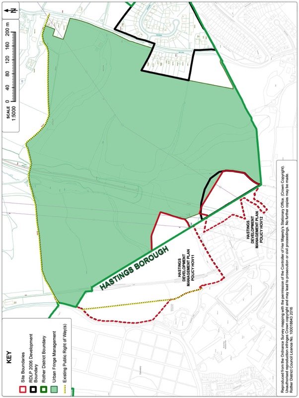
Policy HAS4: Rock Lane Urban Fringe Management Area
Land between Ivyhouse Lane and Rock Lane, as shown on the Policies Map, is allocated as the Rock Lane Urban Fringe Management Area.
Development that would harm the openness of this Urban Fringe Management area or its significance and value to the local community will not be permitted.
Landscape management proposals which improve the landscape character, green infrastructure, biodiversity interest or formal access opportunities within this area will be supported, subject to compatibility with other policies of the Plan.
Development in the vicinity of the Urban Fringe Management Area should support the principles of its designation.
Combe Valley Countryside Park
14.19. The Park was originally developed jointly by Rother District Council, Hastings Borough Council and East Sussex County Council, managed by councillors from all three authorities. In 2015, it moved over to a Community Interest Company (CIC) with a board of directors including representatives of the three councils, local businesses, landowners and stakeholders including the Friends of Combe Valley Foundation which was established by local residents.
14.20. The Countryside Park covers an area of 600ha within Rother District and Hastings Borough. The northern area comprises the Combe Haven valley Site of Special Scientific Interest (SSSI) and reed beds. The southern part adjoining Bulverhythe contains a landfill site, a waste transfer station, a household waste site and a waste water treatment works. The Park was set up to facilitate the restoration of the landfill areas and to manage to countryside between the towns. The Countryside Park creates a significant green space between the two towns.
14.21. The Countryside Park is a long term project which addresses the deficiency in green space for the towns of Hastings and Bexhill. The Park serves an immediate population of 22,500 people and an overall urban population of 130,000 persons. It provides an opportunity for active recreation, walking, cycling, equestrianism, bird watching, nature studies etc. New and improved public access routes will enable the whole community to gain safe and controlled access to the Countryside Park. It is envisaged that these will help to generate new commercial opportunities for local landowners and businesses to enhance the local economy.
14.22. The newly established CIC oversees the strategic direction of the Park and is currently focusing on promoting the Park and encouraging and improving access. Their first project has been the construction of a Discovery Centre at Bulverhythe to provide a café and information point for the Park.
14.23. The principle of the Countryside Park Project established through Policy BX4 of the Rother District Local Plan (2006) and has been carried forward into Core Strategy - Policy HF1. This sets out the strategic importance of the Countryside Park, particularly in respect to the overall shared approach to future prosperity for Hastings and Bexhill and is also has a key role in maintaining the open gap between Bexhill and Hastings. The Countryside Park clearly has a very significant role in providing a substantial leisure resource for the large urban population in the Hastings/Bexhill area. As this becomes established, it is also expected to reduce the pressure on more sensitive leisure destinations in the area and will specifically help to manage the recreational pressure on more sensitive habitats, most notably the international Natura 2000 designations to the south-east and south-west of the District.
14.24. It should be noted that Policy HF1 did not define the boundary of the Countryside Park and therefore it is the role of the Development and Site Allocations Plan to identify the extent of the Park. Figure 65 below shows the extent of the Countryside Park.
14.25. The main policy elements of Local Plan (2006) Policy BX4 are proposed to be carried forward through the new Countryside Park policy. These relate to the importance of the area as a recreational and amenity resource for the residents of both Rother and Hastings, the conservation and management of the national and local nature designations within the Park including the Site of Special Scientific Interest (SSSI) and the Site of Nature Conservation Importance (SNCI). The Countryside Park also forms part of the identified Strategic Gap between Bexhill and Hastings and it is considered important to make specific cross reference to the Strategic Gap policy within the Plan. The only element not carried forward through to the new policy relates to areas at risk of flooding within the Park. The National Planning Policy Framework substantially covers policy relating to flooding and therefore it is not considered appropriate to duplicate the national policy.
Figure 65. Combe Valley Countryside Park
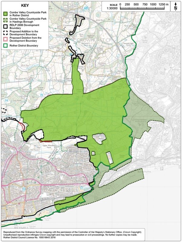
Policy HAS5: Combe Valley Countryside Park
Land between Bexhill and St. Leonards, from Galley Hill in the south to Crowhurst to the north, as shown on the Policies Map, is allocated as the Combe Valley Countryside Park.
Within the Countryside Park area, proposals will only be acceptable where they:
- are consistent with the establishment and maintenance of the area as a key recreational and amenity resource for Bexhill and Hastings and their wider catchment;
- provide for the proper conservation and, where appropriate, management of the Site of Special Scientific Interest and the Site of Nature Conservation Importance within it; and
- accord with the provisions set out in Policy DEN3 regarding Strategic Gaps.
Development Boundary
14.26. Policy OSS2 of the Core Strategy establishes the principle of development boundaries within Rother District but did not define their boundaries. The 2006 Local Plan 'saved policy' DS3 defines the physical development boundaries on the relevant 'Inset Maps'. It is therefore the role of this document to review these development boundaries. It follows that the preferred development sites discussed earlier in this Chapter should be included within revised settlement development boundaries along the Hastings Fringes. These are shown in Figures 66 and 67 below.
14.27. Consideration is made to the scope for any small-scale development boundary amendments along the Hastings Fringes, where there may be development opportunities. As part of this review, amendments are reviewed as to whether sites are surrounded by development which have well-defined natural boundaries or topographical features, thereby creating a new defensible edge to the area. The function of the land and its relationship to the settlement are also important factors.
14.28. In reviewing the potential for small-scale development boundaries amendments along the Fringes, generally it is considered that there is little scope to provide infill and rounding off opportunities that are physically, functionally and visually well related to the existing urban area, taking account of any environmental development constraints. Typically those areas which are adjacent to the Fringes are open areas which visually relate to the open countryside rather than the urban areas of Hastings and their inclusion would harm the structure, form and character of the countryside.
Figure 66. Hastings Fringe (East) Development Boundary Map
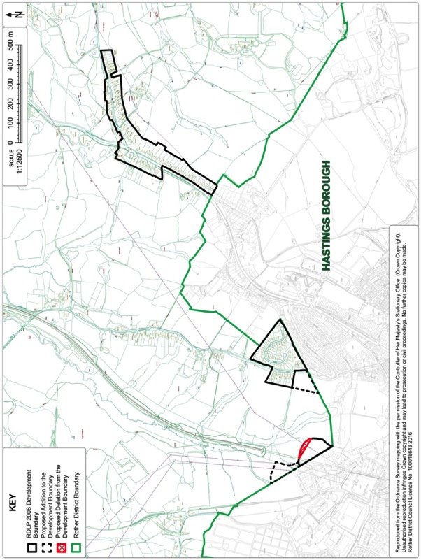
Figure 67. Hastings Fringe (West) Development Boundary Map
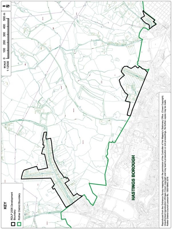
15. Villages with Site Allocations
Beckley Four Oaks
Context
15.1. Beckley Four Oaks is linear in form, straddling the B2088. The village is situated some 1.2 miles east of Northiam and approximately 1.5 miles west of Peasmarsh, which both offer a wider range of goods and services. The village is characterised by surrounding farmed pasture land, its weather board houses and ribbon development along a historic routeway.
15.2. Beckley Four Oaks and the surrounding countryside lie within the High Weald AONB. It is a landscape of gently undulating farmed countryside with large blocks of mixed woodland particularly to the south of the village, some of which are designated as Ancient Woodland.
15.3. The village is reasonably well served by local services with a primary school, recreation ground, village hall all actively used, however the loss of the local pub and the local garage/shop has impacted on the local community in recent years. There is a regular but limited bus service to Northiam, Rye and Hastings.
Development Provisions
15.4. Given the size of the village, the range of services available and consideration of the constraints in the locality, the Local Plan Core Strategy set a target of 20 additional dwellings on new sites in the village up to 2028. This remains the requirement.
15.5. The Council's Open Space, Sport and Recreation Study indicates a shortfall in provision of children's play space and amenity green space; the former is expected to be addressed by improvements to the existing children play area on Jubilee Field, which may benefit from Community Infrastructure Levy (CIL) payments from new development.
Site Options
15.6. In total, 15 sites have been considered as potential allocations in order to meet the identified housing requirement for Beckley Four Oaks - see Figure 68 'Options Map' below. The sites are broadly located across the settlement with the majority abutting the existing settlement boundary.
15.7. A number of sites involved infilling of gaps along the village streetscape and this is resisted as they are seen as being integral to the character of the village. The impact of development on the wider AONB landscape has also been a factor, with many sites to the north of B2088 generally more exposed in the wider landscape than to the south of B2088. Other constraints, such as surface water flooding and impact on historic field patterns, have also been factors affecting some sites. All sites considered through the process are reviewed in Appendix 3.
15.8. It is proposed that the requirement for Beckley Four Oaks be accommodated on two relatively small sites.
15.9. Land south of Buddens Green (Ref: FO12) is relatively central to both Beckley and Four Oaks and relatively close to existing services. There is scope to consolidate the existing Buddens Close estate with a sympathetic development alongside open space that maintains and enhances the amenities and character of this part of the village.
15.10. The other site is on the northern edge of the village to the east of Hobbs Lane and comprises an existing brownfield site known as the Former Manroy Engineering Works (Ref: FO15) and a small adjacent area of farmland which creates a more logical development area. The site abuts the existing settlement boundary and relates well to the main built-up area and is relatively contained in the landscape. It is an opportunity to redevelop a brownfield site that has been vacant for a number of years.
Figure 68. Beckley Four Oaks Options Map
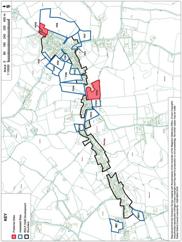
Preferred Site: Land east of Hobbs Lane, Beckley Four Oaks (Ref: FO15)
|
Existing use(s) |
Former Engineering Works and Farmland. |
|
Size |
0.62 ha |
|
Key constraints/ opportunities |
FO15 comprises of the Former Manroy Engineering Works and a small part of the adjacent farmland, which will 'round off' and consolidate the north-east edge of the village. The former armaments factory has been vacated for a number of years and despite marketing it has failed to find another occupier. The change of use to residential development is accepted. It is expected a ground survey will be undertaken as part of the application process and potential contamination of the site mitigated through appropriate measures. To minimise visual intrusion into the wider countryside to the north and east, the applicant will be expected to plant landscape screening along the northern and eastern boundary using native species. To integrate new development with the existing village, a new footway is required along Hobbs Lane. |
|
Proposed use(s) |
Housing. |
|
Developable area |
0.62ha |
|
Capacity |
12 dwellings. |
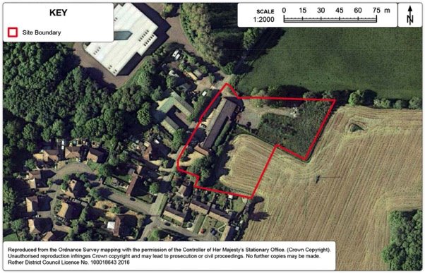
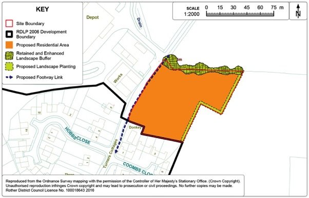
Policy BEC1: Land east of Hobbs Lane, Beckley Four Oaks
Land east of Hobbs Lane, Beckley Four Oaks (Ref: FO15) as shown on the Policies Map, is allocated for housing. Proposals will be permitted where:
- some 12 dwellings will be provided within the identified residential area as shown on the Policies Map, of which 40% should be affordable;
- access is achieved off Hobbs Lane;
- screen tree and hedgerow planting employing native species is provided on the northern and eastern boundaries of the site; and
- a new footpath is provided to link the new development to the existing Hobbs Lane footway.
Preferred Site: Land south of Buddens Green Beckley Four Oaks (Ref: FO12)
|
Existing use(s) |
Pasture. |
|
Size |
1.63ha |
|
Key constraints/ opportunities |
The area of development should be limited to the area south of Buddens Green as it is largely enclosed by the existing estate to the north and a mature tree belt to the south and west, limiting the visual impact on the wider AONB landscape. Access can be achieved off Buddens Green. A western extension of development is not considered appropriate, as this area has been recognised, via appeals, as providing an important, characteristic open gap along the road frontage, with views over it. Furthermore, the north-eastern part already provides an amenity open space function for the existing homes. It is considered that this could be enhanced as an amenity for the existing and new homes, as well as accommodating SuDS features to mitigate surface water flooding. Hence, it is proposed to incorporate this area as open, amenity land within the proposed allocation. This will also help address the shortfall against the recognised standard, as identified in the Council's Open Space, Sport and Recreation Study. There is an opportunity to strengthen the western boundary of the site to reinforce a historic field boundary. Development is restricted due to the shadowing effect of the adjacent trees. |
|
Proposed use(s) |
Comprehensive development to provide housing and open, amenity land. |
|
Developable area |
0.4ha |
|
Capacity |
Some 8 dwellings. |
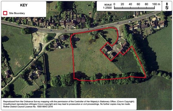
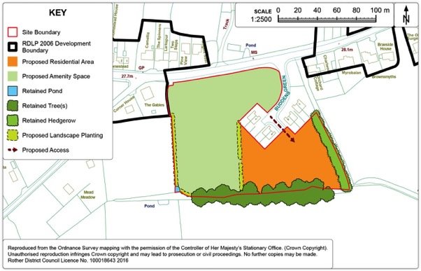
Policy BEC2: Land south of Buddens Green, Beckley Four Oaks
Land south of Buddens Green, Beckley Four Oaks (Ref: FO12) as shown on the Policies Map, is allocated for housing and Local Green Space. Proposals will be permitted where:
- some 8 dwellings are provided within the residential area as indicated on the Policies Map;
- access is provided though the Buddens Green estate;
- financial contributions are made towards affordable housing; and
- existing landscaped boundaries around the site are retained and enhanced along with the creation of new landscape buffers.
Development Boundary
15.11. The purpose of development boundaries is set out in Chapter 11.
15.12. It is proposed to amend the development boundary as set out on Figure 73 below.
15.13. The proposed amendment to the development boundary will reflect the new allocations in the village.
Figure 73. Four Oaks Development Boundary Map
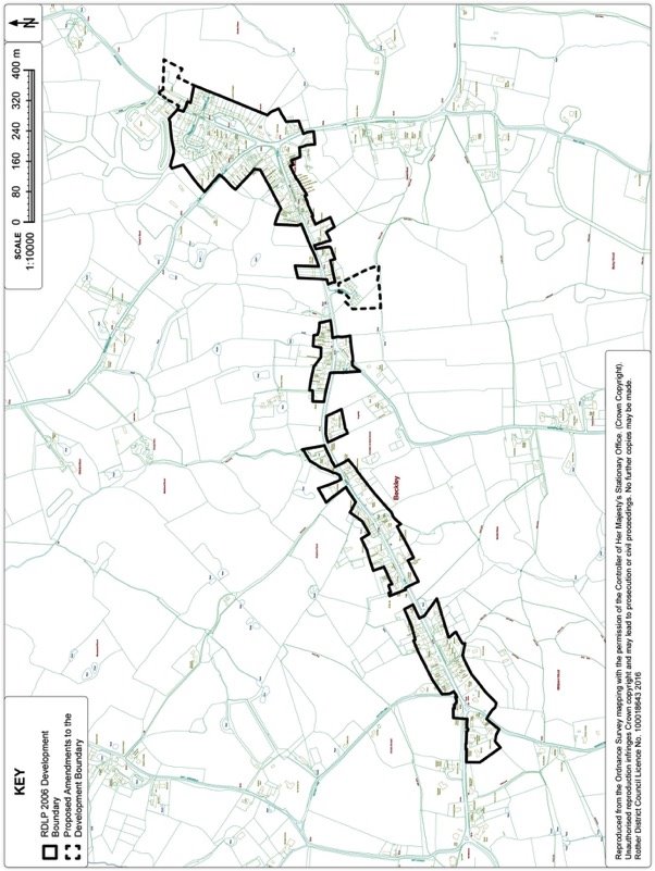
Broad Oak
Context
15.14. The village of Broad Oak is situated approximately 8 miles north of Hastings and 4 miles south of Northiam. The B2089 bisects the village east to west along the ridge, while the A28 runs north to south through the village.
15.15. Broad Oak is closely linked to the neighbouring villages of Cackle Street and Brede to the south and the three of them form a relatively compact cluster of settlements running north-south along the A28. The majority of Broad Oak has expanded north of the B2089, away from the more exposed slopes of the land south of B2089. The village has a good range of local services to meet the basic needs of the community including a shop, public house, a recreation ground, a church and primary school.
Development Provisions
15.16. Given the size of the village, the range of services available and consideration of the constraints in the locality, the Local Plan Core Strategy set a target of 50 dwellings on new sites in the village up to 2028. This remains the requirement. Work is being carried out to undertake a Housing Needs Survey for the village. The results will inform affordable housing provision on potential sites coming forward in the village.
15.17. It is noted that the Council's Open Space, Sport and Recreation Study identified a shortfall in allotment provision in Broad Oak.
Site Options
15.18. In total, 13 sites were assessed to meet the housing requirement for Broad Oak. The majority of sites abut the existing development boundary - see Figure 74: 'Options Map' below. A number of sites were discounted because development would come into conflict with an environmental designation such as Ancient Woodland or the site is visually exposed in the wider AONB landscape. Sites were also discounted because they not did provide adequate safe access arrangements. Please refer to Appendix 3 for further details regarding assessment of individual sites.
15.19. The housing requirement for Broad Oak may be accommodated on two preferred sites. Land west of Northiam Road (Ref. BO16) is an amalgam of three SHLAA sites, two within the existing development boundary and the adjoining field, which is relatively well contained in the landscape. This site can also accommodate local allotments.
15.20. Land south of the Rainbow Trout (Ref. BO17) is also well contained in the landscape as well as being central to the village and well placed to local services. Access can be provided via Ostler Field to the west.
Figure 74. Broad Oak Options Map
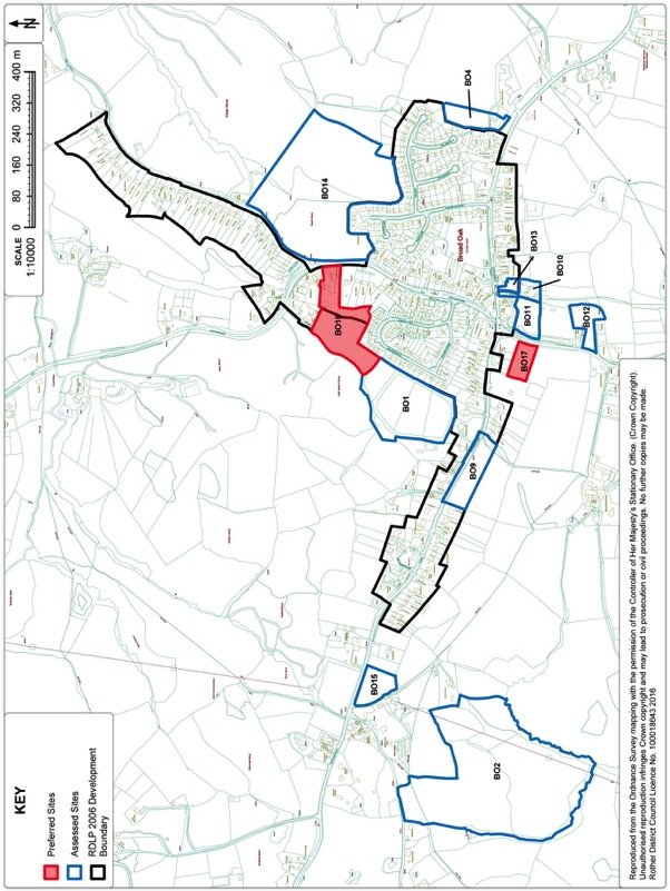
Preferred Site: Land west of A28, Northiam Road, Broad Oak (Ref: BO16)
|
Existing use(s) |
Two residential properties and their curtilages, together with adjoining pasture land. |
|
Size |
2.2 ha |
|
Key constraints/ opportunities |
The site has a frontage to the A28 within the existing built-up area, with two adjoining properties in the same ownership, at least one of which would be demolished as part of the development. A new single access point off the A28 Northiam Road would be required to serve both the new dwellings. The site extends to the rear to include a relatively narrow strip of open land with well-treed boundaries running behind several properties, as well as the field behind, currently under grass, which is in separate ownership. The site should be bought forward as a comprehensive development. A buffer would be required to the Ancient Woodland of Little Austen's Wood immediately to the west. This should be kept as natural as possible. All planting should be native species. An existing public footpath along the western boundary should be retained and a link provided to it through the development. Trees in the centre of the site within the hedgerow should be retained as far as possible. Any layout design should be informed by a Tree Survey. The disposition of the strip of land in the south east corner, relatively flat and well contained by trees, is proposed to be new allotments for the village, for which a need has been recognised and is supported by the Parish Council. SuDS may also be required in this area to manage surface water flood risk. The site is fairly central to the village, while accessibility may be improved further if a pedestrian link to the south via the Tillingham View estate could be created. This should be investigated further, as should parking requirements, although a small layby may suffice. Affordable Housing provision will be provided on-site. At this point the normal requirement of 40% is assumed, this may increase if the ongoing Housing Needs Survey identifies a higher requirement. |
|
Proposed use(s) |
Housing and allotments. |
|
Developable area |
1.6ha |
|
Capacity |
Some 40 dwellings. |
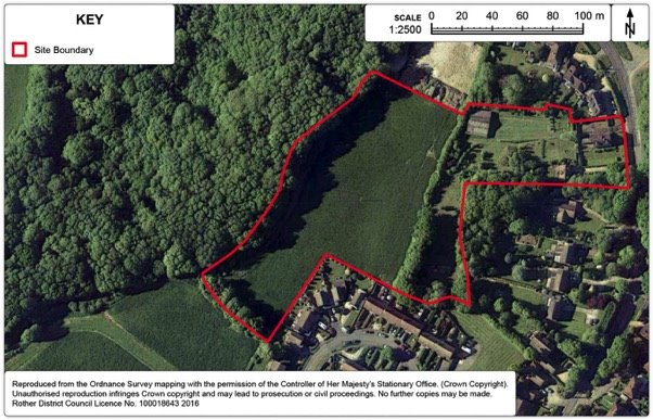
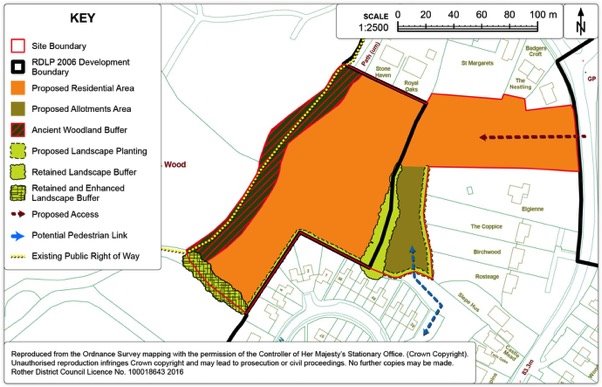
Policy BRO1: Land west of A28, Northiam Road, Broad Oak
Land west of A28, Northiam Road, Broad Oak (Ref: BO16) as shown on the Policies Map, is allocated as a comprehensive scheme for housing and allotments. Proposals will be permitted where:
- some 40 dwellings will be provided within the identified residential area as shown on the Policies Map, of which 40% should be affordable;
- a new access is achieved off A28 Northiam Road;
- allotments to be provided within the area shown on the Policies Map;
- screen tree and hedgerow planting employing native species is provided on the boundaries of the site; and
- a buffer zone of at least 15 metres is provided to the Ancient Woodland.
Preferred Site: Land south of the Rainbow Trout Pub, Broad Oak (Ref: BO17)
|
Existing use(s) |
Meadow. |
|
Size |
0.49ha |
|
Key constraints/ opportunities |
The rectangular site is located behind the public house the Rainbow Trout but is landlocked. BO17 is visually contained in the wider landscape. The recent completion of the adjacent estate of 13 dwellings for local needs to the west further consolidates this location as being sustainable with good access to local services and amenities. Access into BO17 will be delivered through the existing estate via Ostler Field to the west. Additional screen planting along boundaries of the site, especially on the southern boundary, will create a long-term, well-defined boundary. Affordable Housing provision will be provided on-site. At this point the normal requirement of 40% is assumed, this may increase if the ongoing Housing Needs Survey identifies a higher requirement. |
|
Proposed use(s) |
Housing. |
|
Developable area |
0.49ha |
|
Capacity |
Some 11 dwellings. |
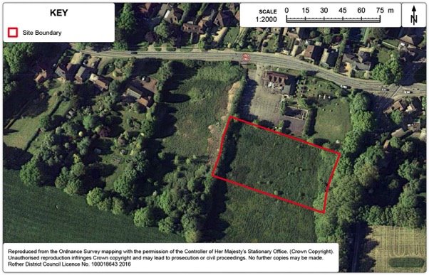
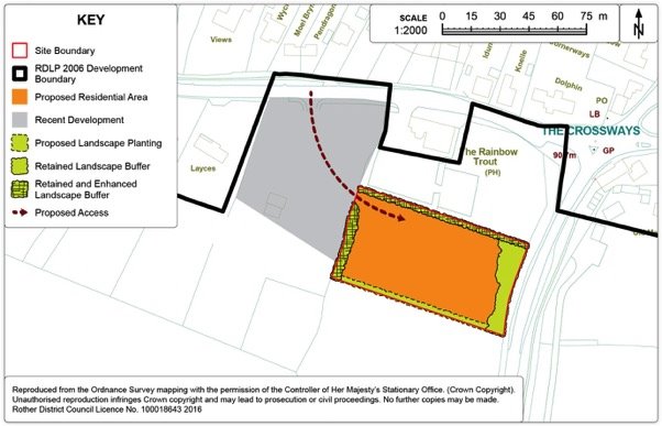
Policy BRO2: Land south of the Rainbow Trout Pub, Broad Oak
Land south of the Rainbow Trout Pub, Broad Oak (Ref: BO17) as shown on the Policies Map, is allocated for housing. Proposals will be permitted where:
- some 11 dwellings will be provided within the identified residential area as shown on the Policies Map, of which 40% should be affordable;
- a new access is achieved off Ostler Field; and
- screen tree and hedgerow planting employing native species is provided on the boundaries of the site.
Development Boundary
15.21. The purpose of development boundaries is set out in Chapter 11.
15.22. It is proposed to amend the development boundary as set out on Figure 79 below.
15.23. The proposed amendment to the development boundary will reflect the new allocations in the village, as well as the recently built Ostler Way.
Figure 79. Broad Oak Development Boundary Map
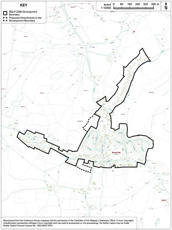
Camber
Context
15.24. Camber is located on the East Sussex coast, close to the border with Kent. Camber has a small population but its large white sandy beach – Camber Sands - can attract significant number of weekend and day tripper visitors, being well-connected to London, Kent and Sussex by road. However, it is not well connected by rail, with the closest station being in Rye. These population fluctuations have a significant impact on the role of the village and its ability to meet the service requirements of both residents and visitors successfully.
15.25. Camber is situated on a low lying area of coastal levels, with a relatively unpopulated surrounding hinterland. The settlement is bounded to the north and east by the extensive flat, open levels of Walland Marsh SSSI, stretching into Kent and forming part of the great Romney Marsh tract of levels. The whole of the village falls within Flood Zones 3 as identified by the Environment Agency.
15.26. Camber is relatively well served by local amenities, with shops, a village hall, pubs and restaurants, but lacks a primary school. A branch doctors surgery services is provided at Camber Memorial Hall. Residents would generally look to Rye, as the main service centre for the eastern half of district, for other needs.
15.27. Camber is one of the more deprived communities in Rother, being geographically and economically isolated and dependent on a highly seasonal tourist trade. The regeneration of Camber is identified in the Corporate Plan as one of the Council's long-term executive priorities.
Development Provisions
15.28. Given the size of the village, range of services available and the environmental constraints of flood risk and nature conservation designations in the locality, the Local Plan Core Strategy set an appropriate target of 20 additional new dwellings on sites in the village up to 2028. This remains the target.
15.29. The adopted Camber Supplementary Planning Document (SPD) (2014) provides the current planning policy framework to steer development and change in the village.
Site Options
15.30. In total, 10 sites of varying sizes have been considered in order to meet the housing requirement for Camber - see Figure 80: 'Options Map' below. The sites are broadly located in and around the village. Greenfield sites abutting the development boundary are discounted because of flood risk concerns and their close proximity to the SSSI. Some sites have poor access. Another site had commercial constraints attached to it and its availability was not certain so it is also discounted.
15.31. It is proposed that the housing requirement is accommodated on two brownfield sites within the existing settlement boundary. Both the Former Putting Green Site (Site Ref: CM2) and Central Car Park Site (Ref: CM6a) sites are relatively central to the village with good access to the main amenities Camber has to offer. The proposals effectively reaffirm the principles advocated by the adopted Camber Village Supplementary Planning Guidance (SPD). For further details of assessment of individual sites please refer to Appendix 3.
Preferred Site: Land at the Former Putting Green, Camber (Ref: CM2)
|
Existing use(s) |
Car Park. |
|
Size |
0.2ha |
|
Key constraints/ opportunities |
The Former Putting Green site is currently a car park opposite the dunes. It is located on the Old Lydd Road and is on a prime route for visitors and residents heading towards Camber Sands. The site is centrally located and within easy walking distance of all the main village amenities. It is a brownfield site within the settlement boundary and lies within Flood Zones 2 and 3. It is expected a Flood Risk Assessment will be submitted as part of the application. A mix of housing and commercial development is considered appropriate for this site. Residential development should not be provided on the ground floor due to flood risk but commercial uses would be acceptable on the ground floor. Built development should be focused on the southern section of the site to avoid overlooking and rights to light issues for the existing adjacent buildings to the north and west in particular. Proposals should seek to provide 'active' frontages on the southern edge to the Old Lydd Road. The dunes opposite the site are significant both as major landscape feature and as a Site of Special Scientific Interest (SSSI) and the protection and management of the dunes are a key landscape and ecological objective of the adopted SPD. The redevelopment of the Former Putting Green site should not destabilise the integrity of the dunes. Please refer to the Council's adopted Camber Village SPD for further guidance. |
|
Proposed use(s) |
Housing and Commercial. |
|
Developable area |
0.2ha |
|
Capacity |
10 |
Policy CAM1: Land at the Former Putting Green Site, Camber
Land at the Former Putting Green Site, Camber (Ref: CM2) as shown on the Policies Map, is allocated for mixed use commercial and residential development. Proposals will be permitted where:
- some 10 dwellings will be provided;
- in relation to the form of development, regard is given to the Council's adopted Camber Village Supplementary Planning Document (2014); and
- new access is achieved as shown on the Policies Map.
Preferred Site: Land at Central Car Park, Camber (Ref: CM6)
|
Existing use(s) |
Car park, commercial and related operational uses. |
|
Size |
0.6ha |
|
Key constraints/ opportunities |
The principles supporting the redevelopment of the Central Car Park have been previously outlined in the adopted Camber Village Supplementary Planning Document (SPD), 2014. It could potentially be the catalyst for regeneration of Camber village by enhancing the tourist offer. A scheme should be brought forward as a comprehensive mixed use development to include housing, commercial, operational uses (beach patrol office, police/medical offices) and some car parking. Any loss of car parking on the Central Car Park site should be relocated to the adjacent overflow park in partnership with East Sussex County Council. The land at Central Car Park lies within Flood Zones 2 and 3. It is expected a FRA will be submitted as part of the application but no habitable rooms should be provided on ground floor. The dunes at Camber Sands are part of Dungeness, Romney Marsh & Rye Bay SSSI complex. The protection and management of the dunes are a key landscape and ecological objective of the SPD. The redevelopment of the Central Car Park site should not destabilise the integrity of the dunes. |
|
Proposed use(s) |
Housing, Commercial, Operational Uses and Public Realm. |
|
Developable area |
0.5ha |
|
Capacity |
10 |
Policy CAM2: Land at the Central Car Park, Camber
Land at the Central Car Park, Camber (Ref: CM6) as shown on the Policies Map, is allocated for a comprehensive mixed-use scheme to include residential, commercial and operational uses. Proposals will be permitted where:
- in relation to the form of development, regard is given to the Council's adopted Camber Village Supplementary Planning Document (2014);
- some 10 dwellings will be provided within the developable area as shown on the Policies Map;
- access will be achieved off Old Lydd Road; and
- any loss of parking spaces as a result of redevelopment should be provided elsewhere in the locality.
Development Boundary
15.32. The purpose of development boundaries is set out in Chapter 11.
15.33. It is proposed to amend the development boundary as set out on Figure 85 below.
15.34. The proposed amendment to the development boundary will reflect the new allocation in the village. In addition, the development boundary will be adjusted to exclude two parcels of land located on the northeast fringe of Camber. As the village lies in Flood Zone 3a, it is considered that this risk outweighs the identification of greenfield sites for further development.
15.35. Furthermore, the amendment of the development boundary to remove the parcel of land to the north of the White Sands Estate will prevent development coming forward in the Dungeness, Romney Marsh & Rye Bay SSSI.
Figure 85. Camber Development Boundary Map
Catsfield
Context
15.36. Catsfield is located on the B2204, two and a half miles from the historic town of Battle, just over a mile from Ninfield and about four miles north of Bexhill. As a 'Saxon, medieval and post-medieval settlement', the village is identified as an Archaeological Notification Area. Historically, the village grew up as a 'nucleated cross' and the main part of the village is built around three roads that form a triangle.
15.37. Catsfield is set amongst attractive undulating countryside of the Combe Haven Basin, although in terms of flood risk and habitat designations, it is the one of the least environmentally constrained villages in the District. The boundary of the High Weald AONB is immediately to the north of the village, but does not 'wash over' the village itself, nor include land to the south of the village.
15.38. Today, the village has a population approaching 400, with a high proportion of persons over 45. It has a good range of local services including a primary school, a general store/post office, butchers, public house, village hall, church recreation ground including a pavilion and children's play area, situated a little to the north of the village. However, it is not connected to the main gas grid.
15.39. Catsfield has many elements of a sustainable community, as well as having public transport links to the larger towns of Battle, Hastings and Bexhill. As such, it is defined as a 'local service village' within the Core Strategy. Nearby smaller hamlets include Catsfield Stream, Henley's Down, Parkgate and Stevens's Crouch.
Development Provisions
15.40. Catsfield is identified as having potential for 47 dwellings from new sites within the Core Strategy, which remains the target.
15.41. There is a relative shortage of amenity open space when the Council's open space standards are applied at a village level. New development offers the opportunity to address this. In addition, there is a local aspiration to provide a skate ramp or facility for older children/teenagers. This is most appropriately accommodated at the Catsfield Recreation Ground for which Community Infrastructure Levy (CIL) payments from new development will offer a potential funding source.
Site Options
15.42. As shown on the Options Map below, a number of sites have been considered. Several were more rural in context and character, further from village services and/or detached from the village development boundary. The assessment of all sites is contained at Appendix 3.
15.43. Two sites - land to the rear of the White Hart (Ref. CA12) and land south of Skinner's Lane (Ref. CA6) - to the west of the village stand out as preferred options, being relatively contained from the wider countryside; accessible to local services; and relatively devoid of flood risk or environmental/heritage constraints. The larger site has the additional benefit of being well placed centrally to address the shortage of amenity open space by providing a village green for the benefit of the community.
Figure 86. Catsfield Options Map
Preferred Site: Land to the rear of The White Hart, Catsfield (Ref: CA12)
|
Existing use(s) |
Vacant greenfield site (scrub and rough grassland). |
|
Size |
1.65ha |
|
Key constraints/ opportunities |
Although within the AONB, the site is well contained and screened from the wider landscape and situated adjacent to village services and bus stop. Vehicle access would be via the Green/B2204. Its position is partially dictated by the presence of the existing pedestrian crossing, needing to be further north for safety reasons and to avoid conflict of movement. Pedestrian access should also connect to the 1066 Country Walk in the south-west corner of the site. The shortage of amenity open space in the village may be addressed by some provision alongside development. The southern frontage lends itself to the creation of a central green for the village, providing a potential location for small-scale community events. Locating the green here would have additional benefits of complementing the setting for the adjacent White Hart pub (which is a Grade II Listed Building) as well as being adjacent to the pedestrian crossing. In terms of future design it should benefit from the passive surveillance of residential properties fronting onto it. The lack of gas supply suggests renewable energy options (solar, ground source heat pumps) may be a particularly appropriate option here. Given that the adjacent B2204 has a poor accident record, provision of some street lighting and/or improved road markings may be necessary to meet highway safety requirements; this should be investigated with the Highway Authority. The historic field boundaries should be retained and would benefit from reinforced buffer planting of appropriate native species, as informed by ecological survey. |
|
Proposed use(s) |
Residential and amenity open space. |
|
Developable area |
Developable area is partially constrained by vegetation/buffer planting as well as desirability of providing amenity open space, but estimated to be at least 1 hectare (subject to ecological surveys). |
|
Capacity |
35 dwellings (estimated) plus amenity open space (at least 0.3ha). |
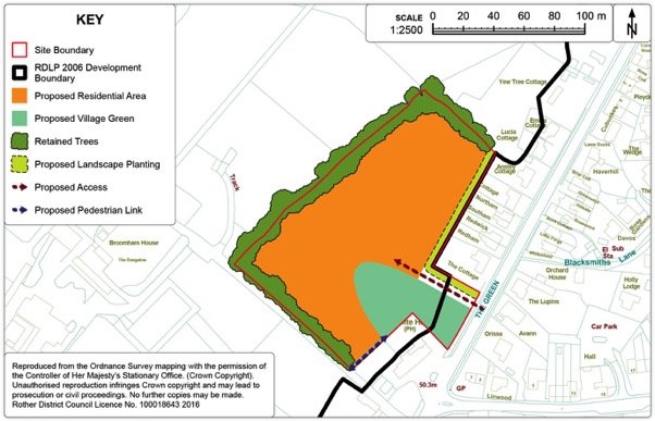
Policy CAT1: Land to the Rear of the White Hart, Catsfield
Land to the Rear of the White Hart, Catsfield, as shown on the Policies Map, is allocated for a comprehensive scheme comprising residential development and amenity open space in the form of a village green. Proposals will be permitted where:
- approximately 35 dwellings-are provided, of which 40% are affordable;
- the development provides an amenity open space in the form of a village green of at least 0.3ha in size, extending across the road frontage and into the site and laid out to benefit from passive surveillance from adjacent dwellings;
- a new vehicle/pedestrian access is achieved off the B2204, together with a pedestrian access to the 1066 Country Walk;
- existing landscaped boundaries around the site are maintained and reinforced;
- care is taken to respect the amenity value and setting of adjoining properties on the eastern boundary.
Preferred Site: Land South of Skinner's Lane, Catsfield (Ref: CA6)
|
Existing use(s) |
Greenfield pasture |
|
Size |
0.46ha |
|
Key constraints/ opportunities |
A residential frontage scheme would be in accordance with the prevailing character. Loss of hedgerow should be avoided in line with Core Strategy Policy EN5 (viii). Design should seek to retain integrity of hedge as much as possible (i.e. via shared access point(s)). New native species hedgerow planting would be required at rear (south) of scheme to mitigate any partial loss of frontage hedgerow, habitat ideally connecting down the east boundary to provide screening for neighbouring properties. A frontage scheme with south facing back gardens has the additional benefit to maximise potential for passive solar gain, which will be beneficial in this location which lacks gas connections. Parking is required on-site, to limit on-street parking problems. SuDs will be required on site and at the low-lying frontage. The site is on the boundary of the Pevensey Levels hydrological catchment area, so two stages of appropriate treatment will be required, in accordance with the policy on sustainable drainage. A vehicle access connecting to the rear field should be retained to ensure the continued usage and viability of the field to south. The lack of footways means that enhancements for pedestrian access should be included alongside any proposal in order to improve connectivity to the village core. In order to satisfy Core Strategy Policy TR3(i) and to make the site acceptable in planning terms, contributions would be required to facilitate these. |
|
Proposed use(s) |
Residential. |
|
Developable area |
0.35ha |
|
Capacity |
9 |
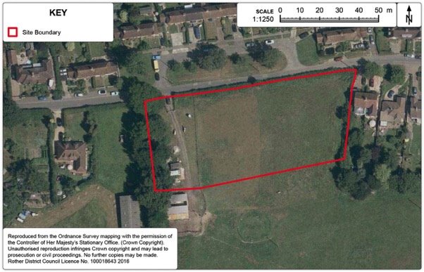
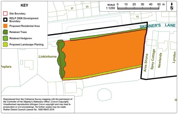
Policy CAT2: Land on Skinners Lane, Catsfield
Land on Skinners Lane, Catsfield, as shown on the Policies Map, is allocated for residential development Proposals will be permitted where:
- development is in a frontage facing scheme in line with prevailing character;
- some 9 dwellings-are provided including provision for affordable housing;
- development is served by one or two vehicle access points off Skinners Lane, minimising the loss of hedgerow;
- existing landscaped boundaries around the site are maintained and reinforced, including:
- the retention of the frontage hedgerow (subject to access);
- a new native species hedgerow boundary is created along the extent of the south boundary.
- care is taken to respect the amenity and setting of adjoining properties;
- an access is retained to the field to the south; and
- in accordance with Policy DEN5: 'Sustainable Drainage', at least two forms of appropriate Sustainable Drainage (SuDS) are incorporated.
Development Boundary
15.44. The purpose of development boundaries is set out in Chapter 11.
15.45. It is proposed to amend the development boundary to reflect the two allocations in the village. In addition, a small area of residential curtilage is proposed to be included within an extended development boundary on Church Lane. Otherwise, the existing development boundary reflects the main built-up area of the village. Other areas considered but were felt to have a detrimental impact on the surrounding countryside.
Figure 91. Catsfield Development Boundary Map
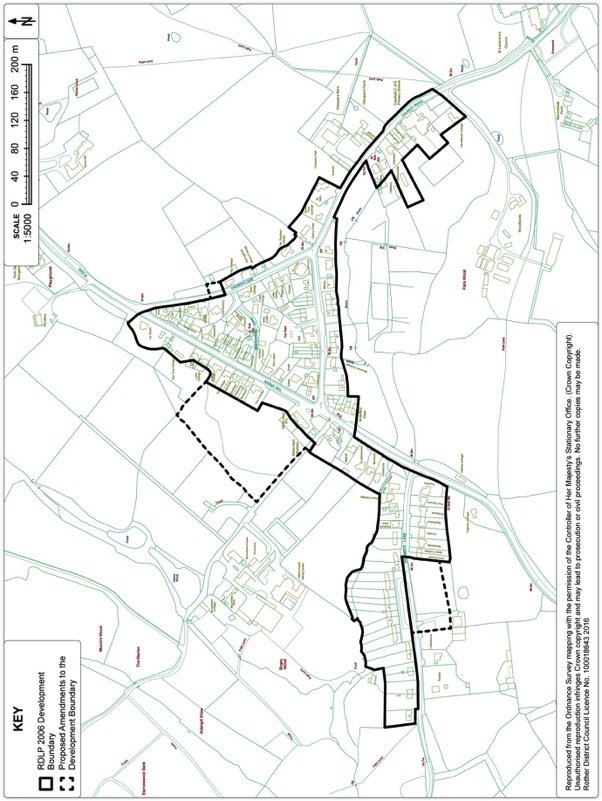
Hurst Green
Context
15.46. Hurst Green is centred around the junction of the A21 trunk road and the A265 and is one of the District's larger villages, with a population of well over a thousand. Today, the village still has a reasonable level of services and is classed as a 'local service village' within the adopted Core Strategy. Service provision has been improved in recent years via the provision of a new primary school building and a new shop/café.
15.47. The village is wholly within the High Weald AONB and set within the landscape of the Upper Rother Valley. There are a number of buildings listed for their special architectural or historic interest within the village, the majority of which are consolidated around the original core of the built form. More recent estates have developed on the northern side of the A265 and offer a mixture of house types. To the west of the village lies Burgh Hill, a ribbon form of development of mature dwellings which extends some way out of the village.
Development Provisions
15.48. The adopted Core Strategy identified a requirement for 75 dwellings in Hurst Green from new sites. Hurst Green did not have any allocations in the previous plan (2006 Local Plan) and has had relative few completions in the last few years, other than an exception site (10 units) at Dairy Close.
15.49. There is also some evidence of a need for a new facility for older children/teenagers in Hurst Green[45], although existing open spaces in the village appear to have capacity to accommodate this in the longer term if required.
Site Options
15.50. A number of sites have been considered (as seen on Figure 92 below) but there are environmental constraints on outward expansion. The northern side of the village is bounded by Burgh Wood, a large area of ancient woodland, and a Site of Nature Conservation Importance (SNCI). The broad valley of the River Rother is situated south west of the village and there are long distance views out of the village over the surrounding undulating countryside. Hurst Green Meadows and Woodlands is also an SNCI consisting of a collection of gently sloping meadows and pastures.
15.51. Several of the sites considered have access issues and/or are poorly related to the village core. A large area to the east of the village (HG18) is the main preferred site for development, since it has limited impact on the surrounding countryside, is accessible to key services and has an existing access road. A smaller site on the High Street (HG17), from which the existing occupier wishes to re-locate, is also a preferred site.
Figure 92. Hurst Green Options Map
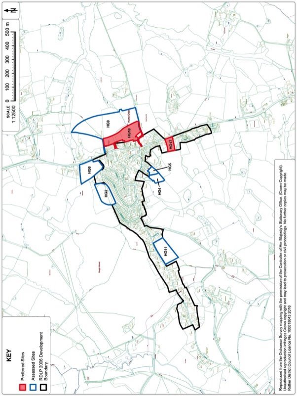
Preferred Site: Land off Foundry Close, Hurst Green (Ref: HG18)
|
Existing use(s) |
Vacant scrub. |
|
Size |
2.4ha |
|
Key constraints/ opportunities |
The site is suitable for residential development, relating well to existing services. There is capacity for approximately 60 dwellings subject to provision of parking, retention of important trees, hedges, historic field boundary and ecological features (including ditches). The site is relatively well contained, although a strong wooded edge would be required to contain new development from the wider countryside, particularly along the east boundary which is a historic field boundary. There is an existing vehicle access via Foundry Close that meets with the approval of both Highways England and ESCC Highways Authority. Additional pedestrian linkages are required for this site to ensure permeability, including direct access via a pedestrian crossing to village services, the school and shops, including: 1) a connection to the A21 and Station Road via the south west corner of the site (along existing footpath 31); 2) connections to Drewett Field to the south (also along existing footpath 31); 3) a connection north to footpath 33. The severance barrier of the A21 is an issue. S106 contributions are required from the development towards mitigating transport impacts in accordance with Core Strategy Policies TR3 and IM2. This would include the connection described in bullet 1 above. Signalling works at the junction of the A265 and A21 may be desirable, pending further investigation with the Highways Authorities. Local concerns about prevailing traffic speeds may also be addressed by mobile speed enforcement, a safe location for the camera van to park and/or a traffic safety camera, the locations of which are decided by the 'Camera/Safety Partnership'. A 'Local Area for Play' would be desirable to incorporate within the development to cater for locally generated need. The stream/ditch that sub-divides the two lower fields is a key character feature and also a High Weald AONB 'historic field boundary'. It should be retained for both heritage and ecological purposes (in accordance with Core Strategy Policies EN5, EN1 and EN2). There is an existing farm access gate on the western end that can be utilised to provide through access between the two lower fields. Parking is a particular concern for the Parish Council. The development should provide an additional unallocated car parking area close to the Foundry Close access, sufficient to replace on-street parking that is lost as a result of traffic management measures on Foundry Close. |
|
Proposed use(s) |
Residential. |
|
Developable area |
2.2ha |
|
Capacity |
Approximately 60. |
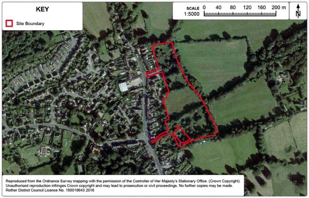
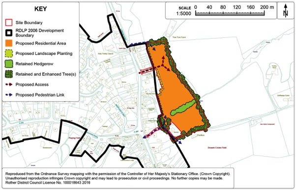
Policy HUR1: Land off Foundry Close, Hurst Green
Land to the east of Hurst Green is allocated for residential development. Proposals will be permitted where:
- approximately 60 dwellings are provided, of which 40% are affordable;
- vehicular access is provided off Foundry Close;
- the development provides additional unallocated car parking spaces adjacent to the Foundry Close access, sufficient to replace on-street parking that is lost as a result of traffic management measures on Foundry Close;
- a 'Local Area for Play' is provided within the development;
- a strong wooded edge screens new development from the wider countryside, particularly along the east boundary;
- direct pedestrian linkages are provided as follows;
- a connection to the A21 and Station Road via the south west corner of the site (along existing footpath 31);
- connections to the Public Open Space to the south (also along existing footpath 31); and
- a connection north to footpath 33.
- the stream/ditch historic field boundary that sub-divides the two lower fields is retained and incorporated within the layout; and
- developer's contributions are made towards highway safety improvements in the village, in order to make the development acceptable in planning terms.
Preferred Site: Caravan Tech, Hurst Green (Ref: HG17)
|
Existing use(s) |
Caravan sales. |
|
Size |
0.5ha |
|
Key constraints/ opportunities |
This is an existing retail/commercial site within the development boundary. The occupier wishes to expand by re-locating to alternative premises, in which case the site offers a residential opportunity. Continued commercial operation potentially impacts on local amenities in a congested location where residential is the prevailing character. The site is well located for residential development to access local services, including the primary school, local shops/services and village hall. The site is already reasonably well screened from the surrounding AONB countryside to the west by existing trees. Recent residential developments along this stretch of the A21 have not been restricted to frontage schemes. Therefore a 'courtyard' interior layout would not be out of keeping with prevailing character, although a frontage should also be maintained to the A21 for the benefit of the street-scene. However, layout would need to respect neighbouring amenities, particularly at the north-east boundary where buildings are at the site boundary. Access would necessarily be off the A21, although subject to further highways assessments there is no preference regarding specific access point at this stage. Since it is subject to relocation of the current occupier, development here could not be considered imminent. However, as the other proposed allocation is being actively pursued, growth of the village may reasonably be spread across the plan period. |
|
Proposed use(s) |
Residential. |
|
Developable area |
0.5ha |
|
Capacity |
Approximately 15. |
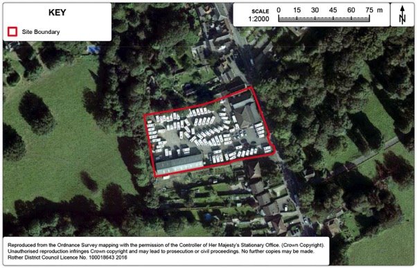
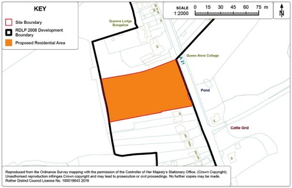
Policy HUR2: Caravan Tech premises, High Street, Hurst Green
Land at the existing Caravan Tech premises, Hurst Green is allocated for residential development. Proposals will be permitted where:
- approximately 15 dwellings are provided, of which 40% are affordable;
- vehicular access is provided off the A21;
- the scheme layout respects neighbouring amenities; and
- the scheme layout retains a frontage onto the A21.
Development Boundary
15.52. It is proposed to amend the development boundary to incorporate the allocation to the east of Hurst Green (HUR1), which is not currently within the development boundary. No other amendments are proposed.
15.53. The far western end of Burgh Hill, although within the Hurst Green development boundary and relating to Hurst Green village, is actually within Etchingham Parish. Therefore any review of the development boundary at this location will form part of the consideration of the Etchingham Neighbourhood Plan.
Figure 97. Hurst Green Development Boundary Map
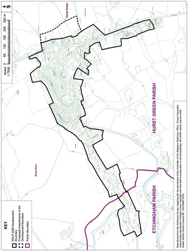
Iden
Context
15.54. Iden is a small village located near the East Sussex Kent border which is situated two miles north of Rye; Peasmarsh, the local service village, is located approximately two miles to the west of Iden. It overlooks the marshes with the Royal Military canal to the east. The village has a long history dating back to the Doomsday book. The village straddles the B2082 while the historic core of the village has grown around the crossroad in the centre of the village. Latterly, more modern development has grown along the roads leading out of the village: Wittersham Road, Grove Lane, Church Lane and along Main Street.
Development Provisions
15.55. Given the scale of the village, its setting and limited opportunities for any further development, the Local Plan Core Strategy only identifies a modest target for new housing over the Plan Period to 2028 of some 12 dwellings. No new sites has come forward recently, hence this remains the target.
Site Options
15.56. Eight sites in and around Iden have been considered in terms of their potential for housing sites. Three abut the existing development boundary and the remaining five sites are located to the north of the village along Wittersham Road. The five sites located to the north of the village range from agricultural holdings, paddocks and enclosed gardens and are considered detached from the main body of the village and relatively unsustainable. Development there would apply unwanted development pressure along Wittersham Road. Furthermore, it is considered that some of those sites not enclosed by strong boundaries had a negative impact on the wider AONB historic landscape, with medium to long views into a number of the sites.
15.57. Of the three sites abutting the existing settlement boundary of Iden, land south of Elmsmead (Ref. ID1a) is found to have the most potential. The other two sites under consideration were discounted on the grounds of impact on the wider medieval AONB landscape, inadequate access, loss of equestrian facilities and impact on the setting of the listed buildings. Further details of the assessment of individual sites can be found in Appendix 3.
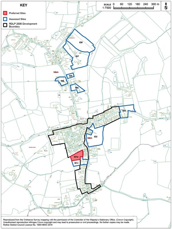
Preferred Site: Land south of Elmsmead (Ref: ID1a)
|
Existing use(s) |
Residential Paddock. |
|
Size |
0.94ha |
|
Key constraints/ opportunities |
The site is relatively enclosed in the built form of the village and is also well placed to access local amenities. The site is located on the western side of Main Street. The site lies to the rear of an existing residence known as 'Conkers' but was converted from a former public house. Conkers and East View to the immediate south of the site are both Grade II listed status. Views from Main Street through the site into the wider AONB landscape to the west are retained also safeguarding the setting of the both Conkers and East View. Access would be delivered off Elmsmead to the north of the site via third party land, to which there is an 'in principle' agreement. A pond is located on the eastern boundary of the site. Ponds are valuable in terms of the character of the High Weald AONB as well as potentially supporting many species including protected ones. It will be expected the applicant will undertake a detailed ecology appraisal to evaluate any significant species present in and around the pond and provide an appropriate link to the undeveloped paddock located to the south. Care should be taken to respect the amenity value and setting of adjoining properties on the northern and eastern boundary of the site. |
|
Proposed use(s) |
Housing. |
|
Developable area |
0.43ha |
|
Capacity |
Some 12 dwellings. |
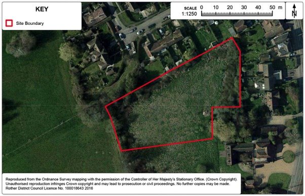
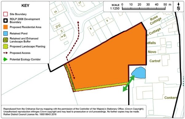
Policy IDE1: Land south of Elmsmead, Iden
Land south of Elmsmead, Iden (Ref: ID1a) on the west side of Iden, as shown on the Policies Map, is allocated for housing. Proposals will be permitted where:
- some 12 dwellings are provided within the identified residential area as shown on the Policies Map, of which 40% are affordable;
- a new access is achieved off Elmsmead;
- the existing landscaped boundaries around the site is maintained and reinforced; and
- the pond on the eastern boundary is retained, with an ecology assessment undertaken and any impact on protected species mitigated.
Development Boundary
15.58. The purpose of development boundaries is set out in Chapter 11.
15.59. It is proposed to amend the development boundary as set out on Figure 101 below.
15.60. The proposed amendment to the development boundary will reflect the new allocation in the village.
Figure 101. Iden Development Boundary Map
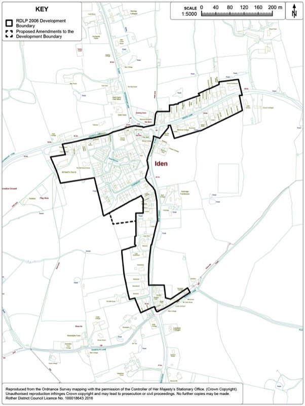
Northiam
Context
15.61. Northiam is one of the larger villages in the District and supports a wide range of services and facilities. In the adopted Core Strategy, Northiam is identified as Local Service Village. The village lies along a generally north to south running ridge, and is located approximately 12 miles north of Hastings and about eight miles south of Tenterden. The smaller villages of Beckley Four Oaks and Peasmarsh are both within a 5 to 10 minute drive time to the east.
15.62. The original form of the village mainly consisted of ribbon development along the A28 and the minor roads that connect to it. More recently, a number of small residential estates have grown up to the rear of the established frontages. There are a substantial number of buildings listed for their architectural or historic interest in the southern/central part of the village and this more historic area has been designated a Conservation Area. Notable buildings in the area include the 17th century Grade I Brickwall House and the Grade I Listed timber-framed Great Dixter dating from 1450.
15.63. Undulating countryside surrounds Northiam and there are a number of areas of ancient woodland. To the north lies the Lower Rother Valley that dominates the eastern end of the High Weald AONB. There is a small Site of Special Scientific Interest between Harlot's Wood and Ghyll Side Road. North west, there are also distant views out of the settlement in the proximity of Great Dixter. To the east, there are open fields and ghyll woodlands that are integral to the rural landscape. Given the location of the village within the High Weald AONB, allied with the many outstanding views out of and into the settlement, any growth needs to be considered sensitively.
Development Provisions
15.64. The Core Strategy identifies 142 total new dwellings for Northiam between 2011 and 2028, of which 123 were from larger (6+ dwellings) sites. There has already been a subsequent permission at Donsmead, Station Road for 65 dwellings (RR/2015/545), reducing the target for larger sites to 58 dwellings.
15.65. While it would appear that this number of homes coincides with that for which permission also exists at Goddens Gill (RR/2013/1490/P), the developers advise that it is no longer viable and it is to put back to the market. A similar scheme is unlikely to be implemented as it was specialised with a limited market. However, it remains that this site is appropriate for housing for the elderly. Reference is made to an earlier sheltered housing scheme of 52 dwellings (RR/2010/1634/P - 9/9/10), which is regarded as a more realistic expectation on the site. Taking this into account, the remaining housing target is for 6 more dwellings.
Site Options
15.66. There are over 20 sites of varying sizes in and around Northiam that have been assessed for their suitability as housing sites – see Figure 102: 'Options Map' below.
15.67. The majority of the sites offered for consideration are located on the eastern and north eastern fringe of Northiam and to the north of Dixter Lane. While development on the upper open slopes of the Lower Rother Valley should be robustly resisted, there are opportunities in enclosed pockets which are further assessed. Sites located centrally and to the east of the village are considered to be inappropriate because of access constraints, impact on the Conservation Area and the wider impact on the AONB landscape. Further details of individual sites can be found in Appendix 3.
15.68. Land south of Northiam Church of England Primary School (Ref: NO15) is the preferred site to accommodate the outstanding requirement of 6 dwellings for Northiam. It is an enclosed site and within walking distance of many of the village's amenities. The tree belt on the frontage should be retained as far as possible, preserving the setting of the village as you approach from the south via the A28.
Figure 102. Northiam Options Map
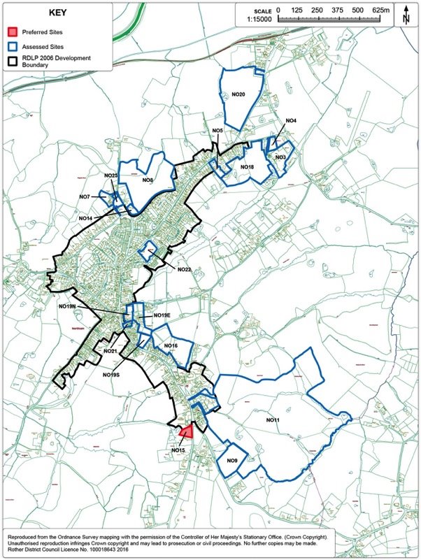
Preferred Site: Land south of Northiam Church of England Primary School
(Ref: NO15)
|
Existing use(s) |
Open meadow. |
|
Size |
0.36ha |
|
Key constraints/ opportunities |
The site has a frontage to the A28 on the southern fringe of the village and abuts the settlement boundary. The frontage of the site is characterised by a tree belt with 3 notable Oak specimens with all three benefiting from TPO status. This should be retained as it contributes to the setting of the rural approach to this part of the village. Similarly, there are two Oak trees to the rear of the site which also benefit from protected status, which should also be retained. A suitable buffer zone would be required to protect the tree roots of all protected trees within the site. Any site layout should be informed by a comprehensive tree survey and should avoid undue overshadowing from the trees. A new single access point onto the A28 at the northern end of the eastern boundary will serve some 6 units. Given its close proximity to the school to the north and nearby junction there is a requirement to undertake a satisfactory safety audit and to ensure suitable sight lines are achieved. |
|
Proposed use(s) |
Housing. |
|
Developable area |
0.36ha |
|
Capacity |
Some 6 dwellings. |
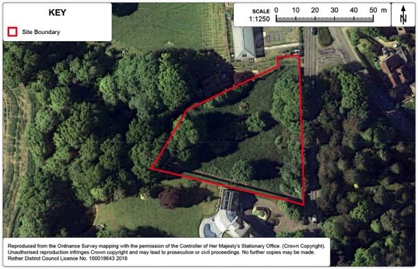
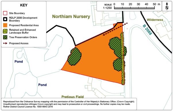
Policy NOR1: Land south of Northiam Church of England Primary School
Land south of Northiam Church of England Primary School (Ref: NO15), as shown on the Policies Map, is allocated for housing. Proposals will be permitted where:
- some 6 dwellings are provide within the identified residential area;
- access is provided at the northern end of the eastern boundary of the site fronting onto the A28;
- financial contributions are sought for affordable housing in lieu of onsite provision; and
- existing trees on the eastern boundary and western boundaries, protected by Tree Preservation Orders, should be retained.
Development Boundary
15.69. The purpose of development boundaries is set out in Chapter 11.
15.70. It is proposed to amend the development boundary as set out on Figure 105 below.
15.71. The proposed amendment to the development boundary will reflect the new allocation in the village, together with the recent permission for 66 dwellings (net 65) at Donsmead, Station Road.
Figure 105. Northiam Development Boundary Map
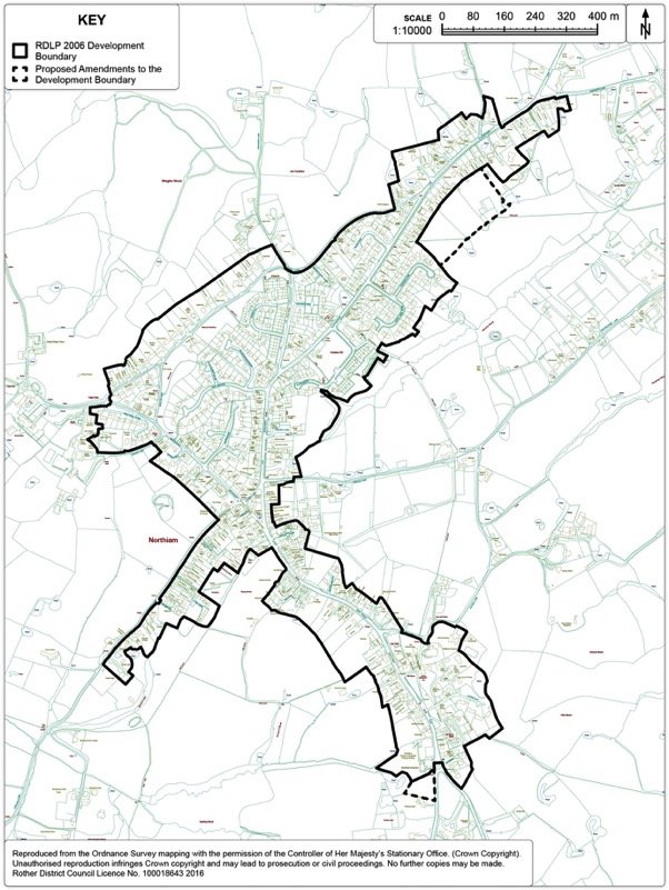
Peasmarsh
Context
15.72. Peasmarsh is situated on the A268 four miles north-west of Rye, with a number of other small villages and hamlets located within close proximity, including Beckley Four Oaks, Iden and Playden. The immediate surrounding High Weald AONB 'Lower Rother Valley' landscape is gently undulating with large swathes of ancient woodland and a legacy of traditional orchards.
15.73. Although its ancient origins were centred upon the church to the south, the current village developed in a linear form, with dwellings abutting the A268 that runs through the centre and School Lane that branches from it. More recent estate developments have grown up to the north and south of the main road.
15.74. Today, the village has a population of just over one thousand. It has a good range of local services and, uniquely amongst Rother villages it hosts a supermarket which is on the west side of the village. Whilst Peasmarsh is classified in the Core Strategy as a 'local service village', it lacks a defined centre. The primary school is located to the south on School Lane, the village memorial hall to the north, while the recreation ground is situated on the north-east side of the village.
15.75. The village is flanked to both north and south by the Rother, Brede and Tillingham Woods Biodiversity Opportunity Area (BOA) which identifies opportunities for wetland habitat management, restoration and creation. The Lower Rother Valley Landscape Character Area Assessment includes landscape action priorities of conservation and restoration of coppice woodlands and traditional orchards, improvement of footpath access along the valleys, restoration of hedgerow and tree pattern in arable areas.
Development Provisions
15.76. The Local Plan Core Strategy identified a target for new housing of some 50 dwellings over the plan period up to 2028 (excluding small sites of 5 or less dwellings). The recent Maltings scheme has resulted in a windfall net gain of 10 which can be taken into consideration.
15.77. Background evidence shows a shortage of accessible public open space, with a new play area being a specific recommendation[46].
Site Options
15.78. As shown on the Options Map below, a number of sites have been considered. The preferred option (Ref. PS24) is to locate development in the centre-west part of the village, an area that is relatively accessible to the dispersed services. The supermarket is about 400m to the west and the primary school about 700m to the south east. A bus stop and the village hall are about 100m away to the north.
15.79. Although the recreation ground and children's play are further afield at The Maltings, the site is of sufficient scale to accommodate play and open space alongside enough residential land to meet Peasmarsh's housing target. It has the additional advantages of being relatively free of wider landscape impact since it is enclosed from view, either by the contour of the landform or by surrounding woodland. Flood risk and biodiversity impacts are negligible.
15.80. In comparison, areas to the far west of the village are more visually exposed and typified by a close network of historic field boundaries typical of the High Weald AONB. Areas to the north, although enclosed from view, lack pedestrian accessibility, while areas to the east are further from key services and more exposed to the wider landscape.
15.81. The assessment of all sites is contained at Appendix 3.
Figure 106. Peasmarsh Options Map
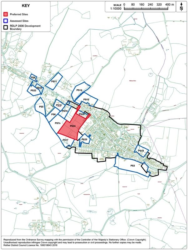
Preferred Site: Land south of Main Street (Ref: PS24)
|
Existing use(s) |
Paddock/equestrian (non-commercial private use by landowners). |
|
Size |
3.2ha |
|
Key constraints/ opportunities |
The site provides a relatively accessible and sustainable opportunity for some 45 dwellings plus open space provision. In addition, this area has scope to increase pedestrian linkages and ensure the preservation of High Weald AONB character features. Northern sections of the site, adjacent to the existing development boundary lend themselves to residential provision, being particularly well screened from the wider High Weald AONB countryside. In terms of vehicular access, the Highways Authority has accepted it is achievable 'in principle' via 'Pippins', although this will require a priority solution for a short distance at the rear of the curtilage. Given the shortfall against open space standards, provision of an area of open space and children's play area is required. In addition, the main feature of the land to the south, a traditional orchard (which is both a Biodiversity Action Plan Priority Habitat and also a character feature of the High Weald AONB) no longer serves as its original function and is deteriorating in quality. The inclusion of this land within the open space will have a considerable benefit in terms of landscape character, ecology, village amenity and potentially as an educational resource (benefiting from a close proximity to the local primary school). Bringing the area back into active management (e.g. as a community orchard accessible to the public) would bring wider community benefits. However, in the absence of any such community management proposal emerging, the area can function as an accessible green space, with the orchard trees retained on-site (which are protected by TPO). This provision is also in accordance with the recommendations of the Lower Rother Valley Landscape Character Area Assessment. The open space/orchard will need to be separated from the residential area by provision of native species hedgerows. The site should prioritise permeability for pedestrians via connections to: 1) Main Street to the north east of the site, via a green corridor connecting down an existing track that extends to the southerly rear sections of the site. 2) The footpath network off-site to the south and west, to connect the site to the wider area. This will require third party land for which there are at least two options. Together, these connections will need to traverse the full length of the site. Regard should be given to realising ecological opportunities within the 'green corridor'. There is a gentle slope down towards eastern sections of the site to the proposed pedestrian through-route, where there is an existing pond. Surface water flow paths cross from the area proposed as orchard/open space and traverse the south east corner of the developable area. SuDS are likely to be required in these areas (subject to further advice of the Lead Local Flood Authority at application stage). There are opportunities here to create multi-functional SuDS alongside the pedestrian link in the form of a wetland habitat green corridor. This would be in accordance with the Rother, Brede and Tillingham Woods Biodiversity Opportunity Area (BOA) and the River Rother Catchment Flood Management Plan. The southern edges of the site are historic field boundaries that should be retained and enhanced. A large oak tree on the western side of the site should be incorporated within the layout. In addition, landscape planting would help screen the site from wider view at western edges. |
|
Proposed use(s) |
Residential, children's play area, accessible natural green space/community orchard. |
|
Developable area |
Approximately 1.5ha |
|
Capacity |
45 |
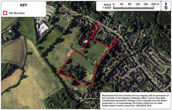
Policy PEA1: Land south of Main Street, Peasmarsh
Land south of Main Street, Peasmarsh, as shown on the Policies Map, is allocated for residential development and amenity open space in the form of a retained traditional orchard and children's play area. Proposals will be permitted where:
- some 45 dwellings-are provided as shown on the Policies Map, of which 40% are affordable;
- vehicle access is to Main Street to the satisfaction of the Highways Authority;
- additional pedestrian/cycle access:
- to the north-east of the site, connecting down the length of the eastern boundary via a green corridor;
- southward connecting to the footpath network.
- provision of a children's play area, which should be subject to passive surveillance from residential frontages;
- provision of open space to the south of the site, incorporating the traditional orchard within it, with funding arrangements for on-going management to maintain as open space and biodiversity interest;
- retention of other existing ecological and High Weald AONB character features so far as reasonably practicable, including historic field boundaries, boundary hedgerows, existing trees and existing pond; and
- maintenance and reinforcement existing landscaped boundaries around the site and creation of new ones on exposed western edges.
Development Boundary
15.82. The purpose of development boundaries is set out in Chapter 11.
15.83. It is proposed to amend the development boundary as set out on Figure 109 below.
15.84. The proposed amendment to the development boundary will reflect the new allocation in the village.
Figure 109. Peasmarsh Development Boundary Map
Rye Harbour
Context
15.85. Rye Harbour is located near the mouth of the River Rother and approximately one and a half miles to the south east of Cinque Port town of Rye. It is part of the civil parish of Icklesham. Rye Harbour has close economic links with Rye, but is considered distinctly separate. Furthermore, this distinction is consolidated by the designation of a Strategic Gap between Rye and Rye Harbour.
15.86. Rye Harbour has a village hall, village shop, public house, sailing club, and RNLI lifeboat station. Frenchman's Beach Holiday Park is a large holiday caravan site located on the south east fringe of the village.
15.87. Access to Rye Harbour is solely along Harbour Road, a long straight road which bisects a large industrial area. There is also local bus service (services 313 and 342) which runs a limited hourly service between Rye and Rye Harbour. In recent years, access by walking and cycling has improved with the introduction of a shared walking and cycling route along Harbour Road.
15.88. The countryside surrounding Rye Harbour is subject to a number of International and national environmental designations, signifying its landscape character and nature conservation importance. The European complex known as the Dungeness, Romney Marsh and Rye Bay complex was formally designated a Special Protection Area (SPA) and Ramsar site on 30 March 2016. Adjacent to the village to the west, Rye Harbour Nature Reserve is also part of the International sites as well as designated a Site of Special Scientific Interest. It attracts many visitors each year.
15.89. The whole of Rye Harbour lies within Flood Zone 3a. The main flood risk to Rye Harbour is from the tidal River Rother. The completion of the Rother Tidal Walls West together with the Winchelsea flood protection scheme (new groyne fields and shingle recharge) has significantly increased protection of the village from tidal flooding. Nevertheless habitable rooms on the ground floor should be avoided and flood resistance and resilience construction methods should be implemented for all new dwellings at Rye Harbour.
Development Provisions
15.90. The Local Plan Core Strategy presents an overall strategy for Rye and Rye Harbour and sets an overall target of between 355-400 dwellings up to 2028 for Rye and Rye Harbour. The 2013 SHLAA identified a potential for 40 dwellings on new sites in the village up to 2028; hence, this is taken to be its target as a contribution to the overall housing requirement for Rye and Rye Harbour.
15.91. The Core Strategy promotes in Policy RY1 of the adopted Core Strategy that at least 10,000 sqm floorspace of employment at Rye and Rye Harbour. Employment at Harbour Road will be dealt with in this section of the DaSA and will be discussed later in paragraphs 15.99 - 15.103.
15.92. Employment provision specifically for Rye will be dealt with through the Rye Neighbourhood Plan. The Council will work with the Rye Neighbourhood Plan steering group to review Rye's employment need.
Site Options
15.93. In total, there are 9 sites that have been considered as potential allocations - See 'Figure 110: Rye Harbour Options Map' below. The majority of sites are broadly located to the west of the village with only two abutting the existing settlement boundary. Greenfield sites were discounted because of flood risk. Two sites (Ref: RH4 and RH6) were not considered suitable as they lie in the SSSI designation. RH2, RH3 and RH5 were also rejected as potential housing sites as they are sited primarily in employment areas. For further details regarding individual sites please refer to Appendix 3.
15.94. Land at Stonework Cottages was previously designated in 2006 Local Plan for housing (for at least 16 dwellings within the existing settlement boundary. It is a brownfield site and is currently in low-key employment use for the storage of old motor vehicles. Land to the rear of this site is also brownfield was submitted for consideration but lies outside the settlement boundary. The two parcels of land coming forward together will improve viability and advance the probability of implementation in a challenging economic and environmental location.
15.95. Together, both areas form the preferred site to come forward comprehensively for some 40 dwellings (Site Ref: RH10).
Figure 110. Rye Harbour Options Map
Preferred Site: Land at Stonework Cottages, Rye Harbour (Ref: RH10)
|
Existing use(s) |
Low key employment land. |
|
Size |
1.65ha |
|
Key constraints/ opportunities |
RH10 comprises of two parcels of land should be bought forward as a comprehensive development. RH10 lies within Flood Zone 3a and habitable rooms should not be implemented on the ground floor. Dwellings should be flood resilient/resistant. Furthermore, essential infrastructure should be designed and constructed to remain operational and safe in times of flood. Given the commercial history of the site there may be contamination in the ground. The water table is particularly shallow beneath the surface of the site (within 1-2 metres) and could be leeching of contaminants from other areas of the estate. A proposal would have to undertake a land contamination assessment with the planning application that demonstrated any risks could be managed appropriately through the re-development process. Regard should be given to the setting of the Grade II listed School House and the Grade II Church of the Holy Spirits located west of the site. RH10 abuts the Rye Harbour SSSI on the southern boundary. Development would not adversely impact upon the Rye Harbour SSSI. |
|
Proposed use(s) |
Housing. |
|
Developable area |
1.39ha |
|
Capacity |
Some 40 dwellings. |
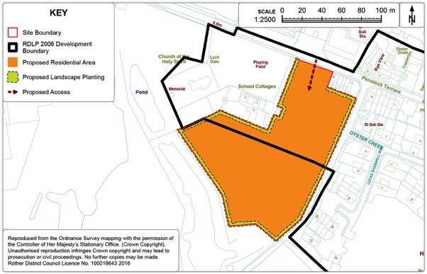
Policy RHA1: Land at the Stonework Cottages, Rye Harbour
Land at the Stonework Cottages, Rye Harbour (Ref: RH10) as shown on the Policies Map, is allocated for housing. Proposals will be permitted where:
- some 40 dwellings will be provided within the identified residential area as shown on the Policies Map, of which 30% should be affordable;
- a new access is achieved off Harbour Road;
- screen tree and hedgerow planting employing native species is provided on the boundaries of the site; and
- development of RH10 does not adversely impact upon the Rye Harbour SSSI.
Development Boundary
15.96. The purpose of development boundaries is set out in Chapter 11.
15.97. It is proposed to amend the development boundary as set out on Figure 113 below.
15.98. The proposed amendment to the development boundary will reflect the new allocation in the village, together with the recent permission for 66 dwellings (net 65) at Donsmead, Station Road.
15.99. The proposed amendment to the development boundary will exclude both Pound Field and Coronation Field from the settlement boundary. Given the village lies in Flood Zone 3a, it is reasonable to exclude these greenfield areas from the settlement boundary. This would not be incompatible with their current use.
Figure 113. Rye Harbour Development Boundary Map
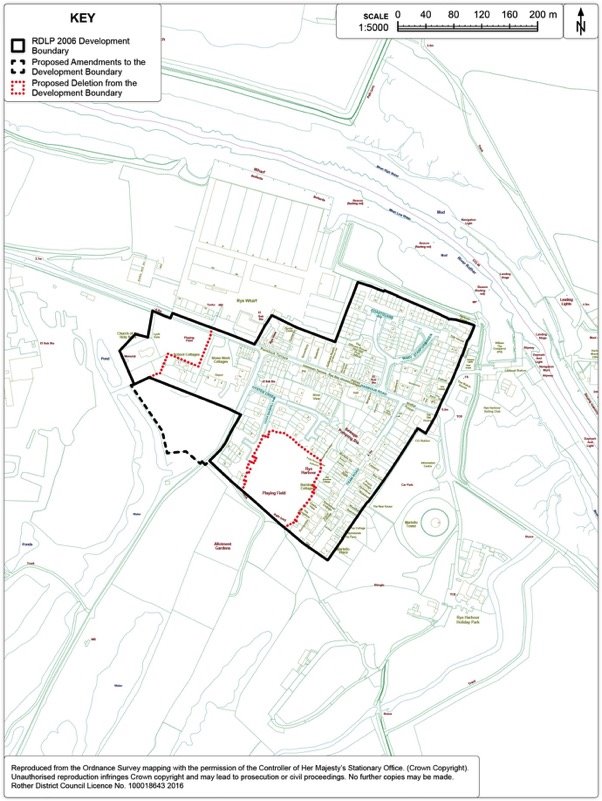
Employment
15.100. Harbour Road Industrial Estate is a long-established concentration of industrial uses and is the main employment area that serves the eastern half of Rother. The Estate measures approximately 37.7ha in size and is bisected by Harbour Road, which links both the Estate and Rye Harbour Village to the A259. Much of the existing employment land along Harbour Road has a very stark industrial appearance with many buildings close to and prominent from the road.
15.101. Harbour Road Industrial Estate can be described as being an elongated employment area and contains a long-established concentration of industrial uses. It incorporates Rye Wharf, the District's only commercial wharf for sea-going ships, with imports of aggregates and exports of grain to mainland Europe. While some uses still relate to its wharf-side origins, the area now accommodates a broad range of businesses and provides the main industrial area serving the eastern part of the District. Former uses for chemical manufacture and heavy industrial activities have resulted in concerns of contamination of a number of areas.
15.102. Harbour Road Industrial Estate also lies in Flood Zone 3a and is vulnerable to Tidal Flood Risk from the River Rother. The completion of the Rother Tidal Walls West together with the Winchelsea flood protection scheme (new groyne fields and shingle recharge) has significantly increased protection of the Industrial Estate from tidal flooding with the residual risk from a breach is considered low. Essential infrastructure should be designed and constructed to remain operational and safe in times of flood.
15.103. There are several opportunities for potential intensification of business activity within the existing employment policy area RHA2. Further intensification of employment uses on brownfield sites at Harbour Road is considered appropriate as it does not increase the footprint of the estate nor does intensification encroach onto the International Sites. As Harbour Road Estate lies within Flood Zone 3a, intensification uses on brownfield sites is also considered appropriate and considered to less vulnerable relative to housing sites. Please refer to the Employment Sites Review: Background Paper for the Development and Site Allocations Local Plan (Sept 2016) for further details.
15.104. A recent permission to expand Wharf activity at the Saltings (RR/2013/1538/P) will bring an additional 13,550sqm of (B1, B2 and B8 Uses) floorspace. As a result, an amendment to the employment policy boundary is proposed, which is reflected in Figure 114 Harbour Road Industrial Estate Boundary Map. Furthermore, opportunities remain at Weslake Industrial Estate and Churchfield Industrial Estate for intensification.
Figure 114. Harbour Road Industrial Estate Boundary Map
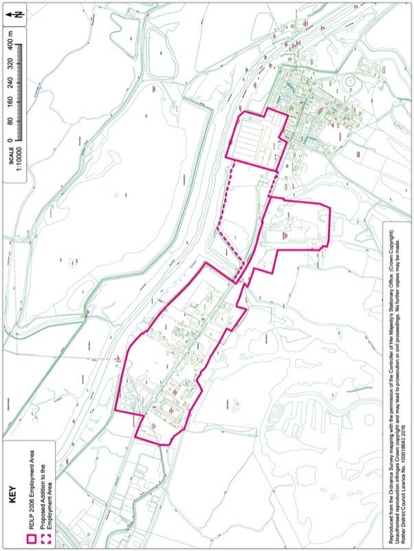
Policy RHA2: Harbour Road Employment Area
Within the Harbour Road Policy Area, as defined on the Policies Map, business development (Use Classes B1, B2 and B8) will be permitted where the following criteria are met:
- proposals which result in a significant increase in vehicle, especially HGV, movements along Harbour Road adjoining the A259 will only be permitted with the satisfactory consent of the Highway Authority;
- it is demonstrated that proper account has been taken of any contamination by a competent person, including in relation to surface water drainage;
- proposals with frontages to Harbour Road must submit a comprehensive landscaping strategy to improve overall appearance of development;
- there is no adverse impact on the adjacent sites of national and international nature conservation importance; and
- development shall not commence until measures to alleviate the potential risk from flooding have been put in place.
Westfield
Context
15.105. The former iron-smelting village of Westfield straddles the A28 some three miles north of Hastings. Dating from Saxon times, the village grew up around the convergence of several small settlements. Westfield has experienced a relatively high level of post-war development and is now one of the larger villages in the District, with a population of just under 1,500.
15.106. The village has a reasonable range of local facilities and services, including a shop, doctor's surgery, primary school, church, community hall, several recreational facilities and some local employment. Supporting evidence also suggests a shortfall of a facility for older children/teenagers, although Westfield is well served in terms of children's play areas.
15.107. Westfield is wholly within the High Weald AONB and is surrounded by undulating farmland, woods and streams with a network of public footpaths, including the 1066 Country Walk. The floodplain of the River Brede and its tributaries lie to the north-west, although the village itself is relatively free from the threat of flooding.
Development Provisions
15.108. Westfield is classified as a Local Service Village within the Core Strategy. The village is required to deliver 89 dwellings from large sites. This includes the current planning permission for 39 dwellings at Westfield Down.
Site Options
15.109. A number of sites have been considered (as seen on Figure 115 below) but there are topographical landscape constraints on outward expansion. The position of the village on a north-south elevated plateau is evident when approaching the village from the west, where there are also biodiversity constraints including ancient woodlands and wildflower meadows. The elevated far northern and north-western parts of the village enjoy distant views across the High Weald AONB. The southern edge of the village is generally well-defined and the land beyond existing limits is integral to the wider countryside setting.
15.110. Areas on the north-eastern side of the village appear to have the most potential for development to meet the identified needs, being relatively contained within wider landscape, relatively free of wider environmental impacts and reasonably connected to existing services. These include the southern end of Westfield Down (Ref. WF26) and the former Care Home at Moorhurst (Ref WF23).
15.111. In addition, one site at the southern end of the village – Land off Gould's Drive (Ref. WF6E), which was part of a previous Local Plan allocation (VL9), still offers a suitable opportunity for a smaller area of residential development.
15.112. The assessment of all the housing sites identified on Figure 115 is contained in Appendix 3.
15.113. A further site (Ref. WF27) is proposed, not as a residential development, but as a green corridor pedestrian/cycle link to improve connectivity for sustainable modes of transport.
Figure 115. Westfield Options Map
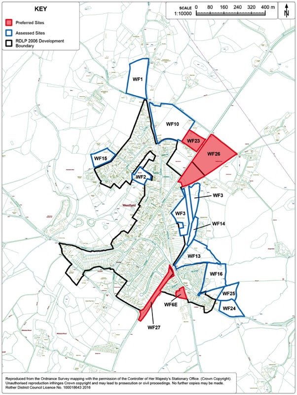
Preferred Site: Land at Westfield Down (Ref: WF26)
|
Existing use(s) |
Vacant greenfield (rough grassland). |
|
Size |
4.03ha |
|
Key constraints/ opportunities |
Land at Westfield Down is an unimplemented allocation from the Local Plan 2006 (Policy VL11). The site comprises rising ground extending out of the village on the east side of the A28. The lower section of the site to the south-west is more visually contained in terms of wider landscape setting and is within reasonable walking distance of all key local services. It is therefore suited to housing development. The higher ground to the north-east is more sensitive to building development, but could satisfactorily accommodate sports and recreational uses, for which there is a recognised need within the village, particularly pitches. In future, there may also be scope to provide an older children's/youth play facility/MUGA on the recreational land, as well as enhanced pedestrian links across the site. Vehicular access is currently proposed via a new joint access off the A28. An enhanced footway provision along the A28 would be advantageous. There may still be an option of upgrading the existing access to the Surgery, but this would also require a footway from the main road and a further highways assessment, taking into account impact on surgery parking. Because of the sloping nature of the land, some re-grading would be necessary, while screen planting would also help minimise its impact. SuDS are likely to be required at the southern and eastern boundaries of both residential and recreational areas. There appears to be an existing surface water flow path centrally down the site, connecting to an off-site tertiary river system. This will need careful management and incorporation into the scheme design to avoid off-site run-off issues. The provision of a tree belt across the northern boundary of the site would provide valuable screening from the wider High Weald AONB. In accordance with the advice of the Ecological Appraisal accompanying the previous application, bird and bat boxes should be installed along site boundaries to ensure the development can demonstrate a net biodiversity gain. As there is no physical division within the site, and because of the need for recreational facilities to serve the community, the housing development and recreational element should proceed in tandem. |
|
Proposed use(s) |
Residential and recreation (including pitches). |
|
Developable area |
1.2ha |
|
Capacity |
Approximately 39 dwellings, plus recreational uses and facilities. |
Policy WES1: Land at Westfield Down, Westfield
Land at Westfield Down, Westfield (Ref. WF26), as shown on the Policies Map, is allocated for housing and recreation purposes. Proposals will be permitted where:
- comprehensive proposals for both housing and recreational elements are put forward in tandem and the recreational land is secured;
- some 39 dwellings are provided at the southern end of the site, of which 40% are affordable;
- screen tree planting is provided on the northern boundary; comprising native species;
- recreation land includes pitches (at least one senior football pitch);
- a new joint access is provided off the A28; or alternatively via an upgraded existing access to the Surgery; and
- sustainable drainage (SuDS) is provided to the satisfaction of the local planning authority.
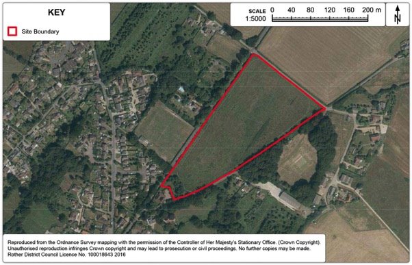
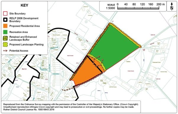
Preferred Site: Former Care Home, Moorhurst, A28, Westfield (Ref: WF23)
|
Existing use(s) |
Brownfield site, interspersed with overgrown scrub and redundant and degraded formal gardens. |
|
Size |
0.88ha |
|
Key constraints/ opportunities |
Now a brownfield site that is cleared of buildings, the site had a previous function (and established use) as a residential care home. In addition, it has had a more recent permission (2009) for a 48 bed residential care unit with day therapy suite, outreach and consulting rooms (RR/2552/CC). However the latter was never implemented and has now expired. As a consequence, the site has remained vacant for many years. Although somewhat removed from the development boundary at present, the area will become more integrated within the village in the event of the Westfield Down site opposite being developed, the access of which may be just 60m south of the site boundary. The site is reasonably well screened from the surrounding AONB countryside by virtue of both topography and mature boundary trees (which will be important to maintain as far as possible, subject to access requirements). It is also free of flood risk, environmental designations or notable High Weald AONB character features. However, highways are a potential constraint to more intensive development along this stretch of the A28, which has a 40mph speed limit, rising to the national speed limit (60mph) just 50m north of the site boundary. A future use which generates trips in line with, or less than, the established use would not be problematic from a highways authority perspective, subject to mitigation measures prioritising sustainable forms of transport. The trip generation of the previous unimplemented permission provides a further benchmark of what can be considered reasonably likely to be acceptable, subject to further assessment. In respect of trip generation, particularly at peak times, retirement living/sheltered housing is broadly comparable to a care home and generates much less traffic than standard residential development. Retirement living/sheltered housing would be more in keeping with the established use in terms of catering for older persons housing needs. It would also be a re-use of the site that is supported by the parish council which would like to provide opportunities for local older persons to downsize, thus freeing up housing for families. These reasons, together with the recognised need to provide more housing suitable for older people in response to demographic projections, lead to the preferred option of an allocation for 'Retirement Living/Sheltered Housing'. For vehicles, utilisation of the existing northern access onto the A28 would be preferred, since this would minimise loss of trees/vegetation. However, this will require further investigation, including a highways safety audit. In order to make the development acceptable in planning terms, there are a number of measures that will be necessary to prioritise safe pedestrian access and sustainable forms of transport. A standard footway will need to be provided along the A28 connecting to the village core. This may require a traffic island and pedestrian refuge alongside the site. Pedestrian links westwards along footpath 27 connecting to Cottage Lane should also be enhanced to a safe standard and directly accessed from the site. In addition provision of pedestrian links across the Down site to the east would be advantageous. In addition, the Highways Authority recommends a bus stop should be provided immediately adjacent. The development should incorporate reinforced and enhanced native species landscape planting screening to fill in any gaps, particularly notable along the north-eastern boundary, to limit wider landscape impact. It is expected that communal gardens/amenity open space will be provided on-site at a level of 25sqm per dwelling unit. This provision, together with allowance for garden space for individual units and other constraints identified above, should allow for some 40 units to be provided. |
|
Proposed use(s) |
Retirement Living/Sheltered Housing for older persons. |
|
Developable area |
0.8ha |
|
Capacity |
Approximately 40 units |
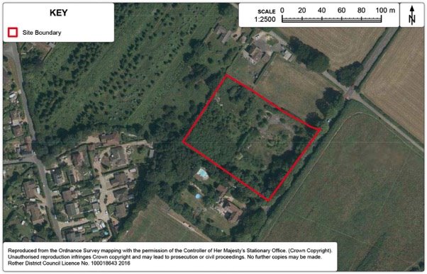
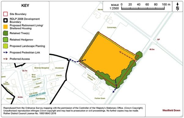
Policy WES2: Land at the former Moorhurst Care Home, Westfield
Land at the former Moorhurst Care Home, Westfield (Ref. WF23), as shown on the Policies Map, is allocated for Retirement Living/Sheltered Housing. Proposals will be permitted where:
- some 40 dwelling units are provided, of which 40% are affordable;
- a safe access to the A28 is demonstrated, with preference to utilising the previously established access;
- boundary trees and vegetation are retained and enhanced, with new native species landscape planting is provided to fill in gaps;
- communal gardens/amenity open space should be provided on-site to a minimum of 25sqm per dwelling unit; and
- provision is made for:
- an upgraded footway along the A28 connecting to the village core, together with safe means of accessing it from the site;
- enhanced pedestrian links westwards along footpath 27 connecting to Cottage Lane; and
- a bus stop adjacent to the site.
Preferred Site: Land off Goulds Drive, Westfield (Ref: WF6e)
|
Existing use(s) |
Vacant Greenfield (rough grassland). |
|
Size |
0.27ha |
|
Key constraints/ opportunities |
The site represents an opportunity to complete the neighbouring estate development by accessing from Goulds Drive and is the last remaining unimplemented section from the 2006 Local Plan Policy VL9. As such, it requires re-assessment as part of the current plan process. Adjacent development is of a relatively high density and this development should reflect the same character. A public footpath (number 44) runs along the southern boundary of the site and connecting to this will increase permeability of the wider area. The southern section of the site is within the Hastings Fringes Biodiversity Opportunity Area. Maintenance of ecological networks is particularly important in this area. Existing trees and hedges already provide a good degree of screening from the surrounding AONB countryside and should be retained, with any gaps reinforced by native species planting. The southern boundary appears to be an existing surface water flow-path, although the site appears to have a gentle slope to the east and north. SuDS will need carefully considered to avoid surface water run-off to surround areas. |
|
Proposed use(s) |
Residential. |
|
Developable area |
0.27ha |
|
Capacity |
Approximately 10 dwellings. |
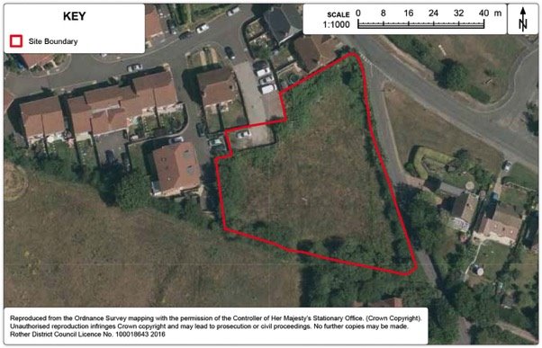
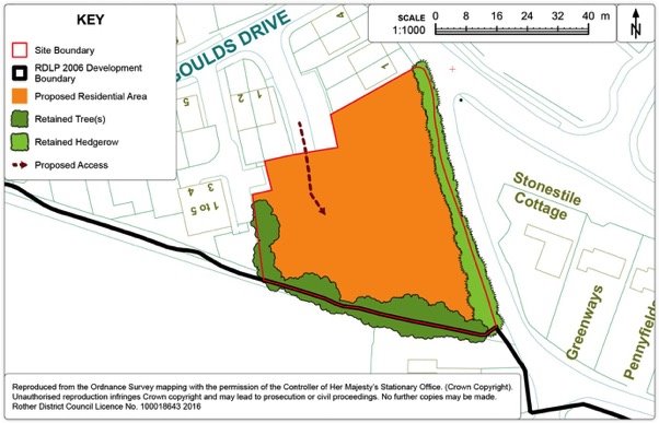
Policy WES3: Land off Goulds Drive, Westfield
Land off Goulds Drive, Westfield, as shown on the Policies Map, is allocated for residential development. Proposals will be permitted where:
- some 10 dwellings are provided including provision for affordable housing;
- vehicle access will be achieved off Goulds Drive;
- pedestrian access to footpath 44 on the southern boundary should be secured;
- existing landscaped boundaries around the site will be maintained and reinforced to minimise landscape and enhance ecological networks;
- care should be taken to respect the amenity value and setting of adjoining properties on the northern and western boundaries; and
- incorporation of sustainable drainage (SuDS) to the satisfaction of the local planning authority.
Preferred Site: Green Corridor and Pedestrian/Cycle Link, Moor Lane to the A28, Westfield (Ref: WF27)
|
Existing use(s) |
Vacant, partially overgrown with vegetation. Southern section has an existing public footpath. |
|
Size |
0.77ha |
|
Key constraints/ opportunities |
This connection was a requirement of Policy VL9 from the 2006 Local Plan but has not been implemented. It offers a sustainable alternative link for pedestrians and cyclists by connecting a notable gap in the footpath network and providing a green transport corridor that extends almost the length of the village, connecting to the GP surgery and Westfield Down recreation development. Within the immediate vicinity, the link should connect directly to Goulds Drive and Greenacres. The allocation is also an ecological opportunity. The southern section of the allocation is within the Hastings Fringes Biodiversity Opportunity Area, which identifies opportunities for ecological networks, access improvements, urban biodiversity, and woodland management and restoration. Locally present protected species include the grass snake, common toad and the common dormouse. The link would benefit from planting of native species trees (subject to pedestrian safety security and surveillance) and habitat creation. Advice for encouraging reptiles, amphibians and small mammals via habitat creation can be found in Table 1 of the Green Infrastructure Study Addendum. |
|
Proposed use(s) |
Green corridor and public footpath/cycle-route. |
|
Developable area |
Zero |
|
Capacity |
0 dwellings. |
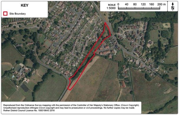
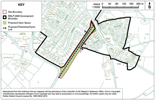
Policy WES4: Land connecting Moor Lane and the A28
Land connecting Moor Lane and the A28 is allocated as a green corridor and pedestrian/cycle Link. Proposals will be permitted where:
- the link will connect directly to Gould's Drive and Greenacres;
- the link will also connect to footpath 44 along the southern edge of the Gould's Drive development boundary; and
- ecological improvements are implemented in accordance with the Hastings Fringes Biodiversity Opportunity Area and the Rother Green Infrastructure Study.
Development Boundary
15.114. It is proposed to expand the development boundary to incorporate the proposed development allocations. This entails a large expansion to subsume WES2, as well as a smaller expansion of an area of WES1 that was not previously within the development boundary.
15.115. In order to incorporate the developable area of WES2, other intervening land will necessarily also be included within the expanded development boundary. However, this should not be interpreted as an indication that these areas are necessarily also suitable for development, or more intensive development. The expansion includes a football pitch, but as a general principle public open spaces are not incompatible with a location within the development boundary and remain subject to the protection of Core Strategy Policy CO3.
15.116. Smaller scale expansion of the development boundary has also been requested on Cottage Lane, but is not considered appropriate due to the impact on the rural area.
Figure 124. Westfield Development Boundary Map
16. Other Villages with Other Villages with Development Boundaries in the 2006 Local Plan
Context
16.1. The 'Use of Development Boundaries' was covered by Core Strategy Policy OSS2 and Policy DI2 within this document. In addition to the reviews undertaken within the sections on individual settlements, it is necessary to review the development boundaries of other, typically smaller, settlements which don't have a housing number apportioned to them, including:
- Brede and Cackle Street
- Guestling Green
- Icklesham
- Norman's Bay
- Pett and Friar's Hill
- Pett Level
- Staplecross
- Three Oaks
- Winchelsea
- Winchelsea Beach
16.2. Other settlements which didn't have a development boundary in the previous Local Plan (2006) have also been reviewed. None are considered suitable for the application of a development boundary in the current plan. By implication, sites submitted for development in such settlements have also been rejected.
Brede and Cackle Street (Figure 125.)
16.3. Brede and Cackle Street are strongly linked with the neighbouring village of Broad Oak located within one mile to the north. The three villages form a relatively compact cluster of settlements running north-south along the A28 Northiam Road. Brede and Cackle Street are situated on the south facing slopes of the Brede valley and both villages are located within the High Weald AONB. Broad Oak is the larger settlement and contains a range of services.
16.4. There is a regular bus service to Hastings, Northiam and Tenterden. Both Brede and Cackle Street themselves have modest levels of service provision. Brede has a church and a public house. Cackle Street has a community hall which serves the wider area.
16.5. The development boundary is still regarded as appropriate, properly reflecting the more built up areas of the villages, whilst also maintaining the valuable open countryside gap between them.
16.6. One minor amendment to the development boundary is proposed to incorporate the full extent of the garden at the property, Hilltop on the main road at the southern end of Brede. This would be a logical 'rounding off', consistent with other adjacent properties to north and south of Hilltop. There would be no significant negative impact on the wider AONB landscape, subject to the retention of the belt of native Scots Pines.
Guestling Green (Figure 126.)
16.7. Policy OSS2 of the Core Strategy establishes the principle of development boundaries within Rother District but did not define their boundaries. The 2006 Local Plan 'saved Policy' DS3 defines the physical development boundaries on the relevant 'Inset Maps'. It is therefore the role of this document to review these development boundaries. The existing development boundary is shown in Figure 126 below.
16.8. The preferred site for development in Guestling Green is physically separate from the development boundary of the main village and it is not considered appropriate to extend the development boundary to include all the ribbon development along Chapel Lane specifically to include this site within the development boundary. Therefore, it is considered most appropriate to not include the site within any development boundary.
16.9. The development boundary has been reviewed to see if there is any scope for small-scale development boundary amendments, where there may be development opportunities. As part of this review, consideration was made to whether sites are surrounded by development which have well-defined natural boundaries or topographical features, thereby creating a new defensible edge to the area. The function of the land and its relationship to the settlement are also important factors.
16.10. In reviewing the potential for small-scale development boundaries amendments in Guestling Green, it is considered that there is little scope to provide infill and rounding off opportunities that are physically, functionally and visually well related to the existing urban area, taking account of any environmental development constraints. Typically, those areas which are adjacent to the existing development boundaries are open areas which visually relate to the open countryside rather than the village and their inclusion would harm the structure, form and character of the adjacent countryside. Therefore no development boundary amendments are proposed for Guestling Green.
Icklesham (Figure 127.)
16.11. Icklesham is situated approximately two miles west of Winchelsea, five miles north-west of Hastings. A linear village, much of the original settlement fronted the A259, but more recent development has taken place in depth, to the north of the A259. Icklesham lies with the High Weald AONB is relatively well served by a peak time bus service to Rye and Hastings Conquest Hospital (Bus number 100). The village has a primary school, village hall, a recreation ground, a pub, and a church but has seen its main village store close recently but a local farm shop remains open in the village. There is also some employment provision at the Little Sherwood Industry Park. Icklesham has a well-defined built up area, set against open landscape with few opportunities for extensions of the settlement boundary. The continued application of the development boundary to the village is considered appropriate.
Norman's Bay (Figure 128.)
16.12. Norman's Bay is a quiet and isolated settlement situated on the shingle banks of the Pevensey Levels coast. A notable heritage feature is the Martello Tower which was part of the Napoleonic defences of England in the early 1800's. The village is dominated by two large caravan/camping sites, highlighting the importance of this area of largely undeveloped coast for tourism and leisure purposes. The village has a train station, but no bus service. The eastern caravan site has a small shop, but services are generally extremely limited in this location.
16.13. The village had two separate areas within the 2006 Local Plan development boundary, both abutting the shingle beach. At present time, these are entirely within the high probability flood zone (Flood Zone 3) based primarily on tidal models. The vast majority of the surrounding area, including all access points to the village is also Flood Zone 3, based on both fluvial and tidal models. Within this zone, national guidance stipulates that 'more vulnerable' forms of development, including residential, be subject to the exception test. This requires development to demonstrate wider sustainability benefits to the community that outweigh flood risk. Whilst the Shoreline Management Plan proposes to 'Hold the line' in this area until at least until the year 2105, the Strategic Flood Risk Assessment (SFRA) makes special reference to Normans Bay and the development constraints imposed. SFRA analysis indicates the main access road to the village would be at risk of particularly deep flooding in the event of a breach.
16.14. The main village is surrounded by marshland to the North, which is internationally protected, both as Ramsar and Special Area of Conservation, the latter designated in March 2016. The shingle beach at Norman's Bay is a designated Site of Nature Conservation Importance (SNCI). The Habitats Regulations Assessment (HRA) process has highlighted concerns with water quality within the Pevensey Levels international sites, for which cumulative run-off from development within the wider hydrological catchment area can be a contributory factor.
16.15. Core Strategy policies RA2 and EC6 facilitate tourism development in appropriate circumstances, while Policy RA3 allows for the one-for-one replacement of existing dwellings. However, given the very limited services and considerable environmental constraints, particularly flood risk, Normans Bay is not considered an appropriate or sustainable location to promote more intensive development, particularly residential. Therefore, the continued application of a development boundary to Normans Bay is not considered appropriate in this plan.
Pett and Friar's Hill (Figures 129. and 130.)
16.16. Pett is a linear village about four miles from Hastings and is the main settlement within the parish of the same name. The village is washed over by the High Weald AONB and the surrounding area is a mix of agriculture and woodland, much of it ancient. Within the 2006 Local Plan, Pett and Friar's Hill have two separate areas of unequal size within the development boundary – the main (and larger) area of Pett to the east and a much smaller outlying area of Friar's Hill to the west.
16.17. The smaller area is situated on the Pett Road (C23) between the Hastings fringes (Bachelor's Bump), Pett village and Guestling Green, but physically divorced from all three. It consists of about 25 dwellings of a mix of ages and styles, including a handful of Grade II listed cottages. There are no services at all at this location and as a consequence it is not an appropriate or sustainable location to promote more intensive development. Therefore, the continued application of a development boundary to this outlying area is not considered appropriate in this plan.
16.18. The larger main section of Pett village has a reasonable range of services including a village hall, two public houses, a play area, sports pitch and a church. However, there is no primary school, no convenience shop and no village centre as such, with services dotted across the extent of the village. Nonetheless, it is considered Pett is a settlement of sufficient stature to warrant retention of the main section of its development boundary. Just one minor amendment is proposed to this main area, in order to remove an area of ancient woodland. By implication, sites that have been submitted for consideration to be allocated (and hence extend the development boundary) have been rejected.
Pett Level (Figure 131.)
16.19. Pett Level is situated on a stretch of marshland which leads to Winchelsea in the East and rises to Fairlight Cliffs in the west. In summer months the village is popular with tourists. A distinctive local feature is that Pett Level marks the western end of both the 1940s sea defence wall and the Royal Military Canal, which was built in 1804 to protect against invasion from Napoleon. The Saxon Shore Way passes through Pett Level.
16.20. The village has a relatively small population and a limited range of services, which largely cater for visitors, notably the Smugglers Inn and the new Beach Club, both of which sit in the busier coastal section of the village.
16.21. In the 2006 Local Plan, Pett Level had three separate areas within the development boundary, each with a distinct character, as set out below.
16.22. The 'hub' of the village, the eastern coastal stretch, is also the most environmentally constrained. It is now being almost entirely surrounded by internationally protected Ramsar and Special Protection Area (SPA), both of which directly abut the development boundary. In addition, this section is entirely within the high probability flood zone (Flood Zone 3) based primarily on tidal models. Within this zone, national guidance stipulates that 'more vulnerable' forms of development, including residential, be subject to the exception test. This requires development to demonstrate wider sustainability benefits to the community that outweigh flood risk. Whilst the Shoreline Management Plan proposes to 'Hold the line' in this area until at least until the year 2105, the analysis within Strategic Flood Risk Assessment (SFRA) indicates a risk of particularly deep flooding in the event of a breach.
16.23. The western and northern sections of Pett Level's development boundary have a notably different character. The intervening and lower lying sections, including Canal Bank and the southern end of Chick Hill, are within Flood Zone 3 based on tidal modelling. Rising to the west is an area of lower density housing, sometimes referred to as Cliff End. There are serious constraints on vehicular access here, the roads are narrow and unadopted roads, while visibility is constrained at access points. Both western and northern sections of the village are more visually exposed, well treed, lack pedestrian footways, have virtually no services combined with a sense of rural seclusion and tranquillity. The prevailing character and constraints do not lend themselves to intensification.
16.24. The overall conclusion of these various considerations is that the continued application of a development boundary is not appropriate to any of the three distinct sections of Pett Level.
Staplecross (Figure 132.)
16.25. Located on a ridge above the Lower Rother Valley, Staplecross is situated between Northiam to the east, Robertsbridge to the west and Sedlescombe to the south. It is the largest settlement in the parish of Ewhurst. Staplecross is a reasonably compact village within its 2006 Local Plan defined development boundary centred upon a junction of the B2165. The village has a number of services and amenities available to local residents including a pub, a village shop, children's play area, village hall and a primary school.
16.26. The Local Plan Core Strategy identified a relatively modest target for new housing over the Plan Period to 2028 of some 25 dwellings in addition to a recently built affordable housing Exception Site, on the eastern edge of the village, along Northiam Road (B2165) which provides 8 new local needs affordable dwellings given approval in 2011 (RR/2011/2393/P).
16.27. This housing requirement of 25 dwellings has already been accommodated by the outline permission (RR/2014/1256/P) of a scheme for 25 dwellings on land east of Cricketers Field with vehicular access from the B2165 Northiam Road. It was granted permission on 25 August 2016 (RR/2016/647/P).
16.28. It follows that the development boundary at Staplecross should be amended to reflect the extent of both the above schemes. However, given the absence of opportunities for expansion into the very rural and distinct countryside setting, no other development boundary amendments proposed.
Three Oaks (Figure 133.)
16.29. Three Oaks is a small village bisected by the Hastings to Rye railway. It is principally linear in form and has a limited range of local services, including a pub, a village hall, a church and a play area. There is a limited rail service (approx. every 2 hours in each direction) and no bus service. The settlement is located approximately one mile off the A259 trunk road, and the local service village of Westfield is located to the north-west of the village. The village also lies in the AONB, Flood Zone 3 lies to the west of the village and there are clusters of Ancient Woodland to be found to the southern and northern edge of the village. While there is limited provision of services to be found in the village, the presence of a rail station, together with its well-consolidated nature to warrant the continued application of a development boundary for no changes are proposed to the existing development boundary, which properly reflects the ribbon nature of the settlement.
Winchelsea (Figure 134.)
16.30. Winchelsea is officially a town, albeit the smallest in the country with a population of just fewer than 600. It is of immense historic and archaeological interest and value, and is an outstanding and rare example of medieval town planning. The settlement was planned by Edward 1 in the 13th Century as a 'bastide town'[47], and the formal grid structure of the historic street pattern is still clearly visible today and is a crucial element in defining its character. The citadel dominates the surrounding landscape. The grid layout of weatherboard and tile cottages, stone church and windmill, stands above steep wooded bluffs on which medieval gates are conspicuous.
16.31. Winchelsea has a good range of services including a primary school and convenience shop. The development boundary established by the 2006 Local Plan serves to define the existing form and pattern of the town. Given the town's status, the development boundary is worthy of retention, although in reality there is extremely limited scope for more intensive development due to the considerable heritage constraints.
16.32. However, it is not considered appropriate to extend the town boundary any further. Most options for expansion would entail encroachment onto surrounding wooded bluffs, thus detracting from the historic formal grid structure established by the historic hilltop settlement.
Winchelsea Beach (Figure 135.)
16.33. Winchelsea Beach is situated on low lying land behind the sea wall between the mouth of the River Rother to the east and Fairlight Cliffs to the west. The northern section along Sea Road is essentially linear ribbon development connecting as far north as the A259. At the southern coastal section of the village, a static caravan park and more in depth development is located.
16.34. Winchelsea Beach has grown in an ad-hoc fashion and today has a population of just fewer than 600 which swells considerably in the summer months due to tourism. Local services, which serve both visitors and permanent residents, include a post office, convenience shop, pub, village hall, sports pitch, play area and church. However there is no primary school.
16.35. Much of the surrounding area is undeveloped coast which is protected internationally as Ramsar wetlands and also nationally as Site of Special Scientific Interest (SSSI). Indeed, parts of the SSSI actually overlap with the development boundary established by the 2006 Local Plan.
16.36. Flood risk represents a serious issue in Winchelsea Beach. The settlement is almost entirely within the high probability flood zone (Flood Zone 3) based primarily on tidal models. Within this zone, national guidance stipulates that 'more vulnerable' forms of development, including residential, be subject to the exception test. This requires development to demonstrate wider sustainability benefits to the community that outweigh flood risk. The Shoreline Management Plan proposes to 'Hold the line' in this area until at least the year 2105. However, the Strategic Flood Risk Assessment analysis indicates a potentially high level of flood hazard in the event of a future sea wall breach.
16.37. Given the considerable environmental constraints, particularly flood risk, Winchelsea Beach is not considered an appropriate or sustainable location to retain a development boundary. In accordance with the provisions of the national 'exception test' for flood risk, it is considered that there are other locations within the District where it is more appropriate to promote more intensive development and no over-riding sustainability benefits to the community in doing so in Winchelsea Beach.
16.38. The 2006 Local Plan included a policy (VL12) addressing 'Land at Victoria Way and south of Harbour Farm' in Winchelsea Beach. The Environment Agency subsequently indicated they would not support the continuation of Local Plan Policy VL12 into a future plan. This is on the basis that allocating the sites for permanent dwelling houses would also put the occupiers at an unacceptable risk in the event of flood defences in this location being breached and this risk would be made worse by the effects of climate change. In any event, VL12 required a comprehensive scheme offering significant environmental improvements including an orderly improvement of access and there seems little prospect of a comprehensive scheme with these improvements coming forward.
16.39. Local Plan Core Strategy 'countryside' policies are sufficiently flexible so as to allow Winchelsea Beach to continue as a vibrant settlement. Notably, policies RA2 and EC6 facilitate tourism development in appropriate circumstances, while Policy RA3 allows for the one-for-one replacement of existing dwellings.
Figure 125. Brede and Cackle Street Development Boundary Map
Figure 126. Guestling Green Development Boundary Map
Figure 127. Icklesham Development Boundary Map
Figure 128. Norman's Bay Development Boundary Map
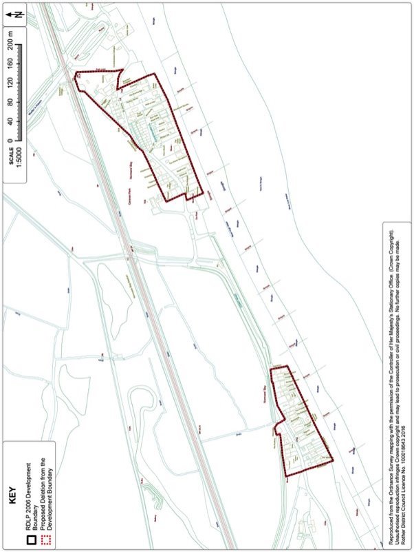
Figure 129. Friar's Hill Development Boundary Map
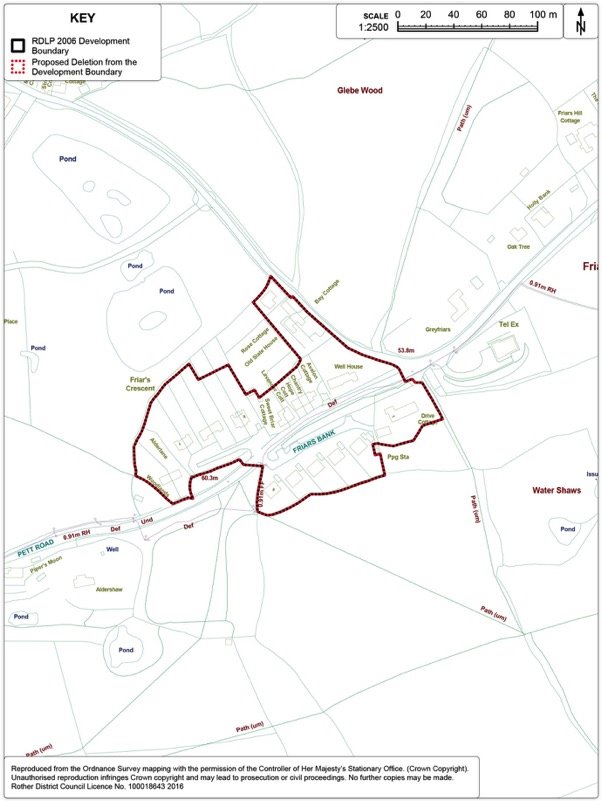
Figure 130. Pett Development Boundary Map
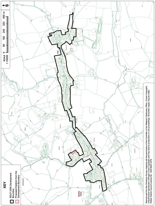
Figure 131. Pett Level Development Boundary Map
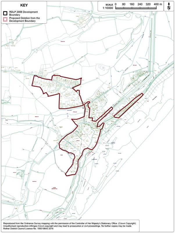
Figure 132. Staplecross Development Boundary Map
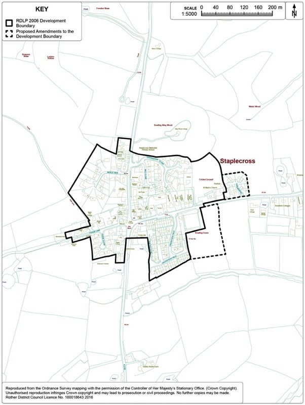
Figure 133. Three Oaks Development Boundary Map
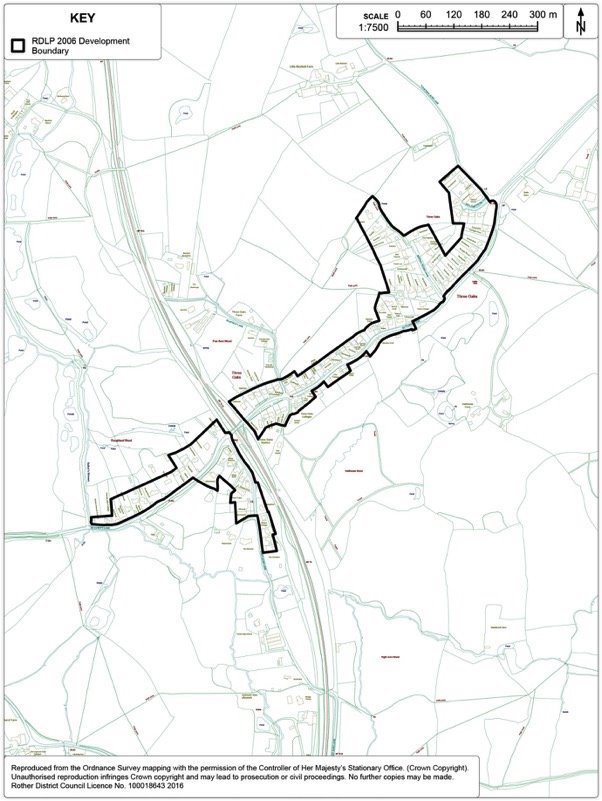
Figure 134. Winchelsea Development Boundary Map
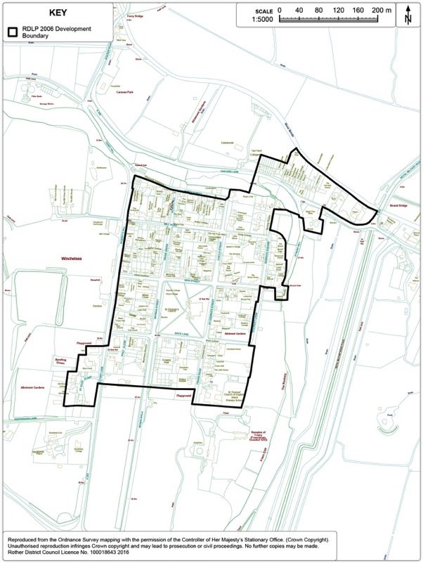
Figure 135. Winchelsea Beach Development Boundary Map
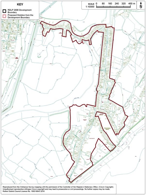
17. Other Policies
Gypsies and Travellers
Context
17.1. The Government's overarching aim is to ensure fair and equal treatment for travellers in a way that facilitates the traditional and nomadic way of life while respecting the interests of the settled community.
17.2. The Government's Planning Policy for Traveller Sites (PPTS) sets out the approach which Local Authorities should follow, firstly determining the level of need within the local area and then planning to meet that need.
17.3. The Core Strategy sets out the need for pitches over the plan period (2011-2028) through Policy LHN5 - Sites for the needs of Gypsies and Travellers, which states that:
"Provision will be made for 5 permanent pitches within Rother for Gypsies and Travellers over the period 2011-2016, and a further 6 pitches between 2016 and 2028.
Sites will be allocated in the Development and Site Allocations Plan, taking into account any sites granted permission in the interim.
Site selection will take into account the Strategy objectives, the future needs of occupiers and the likely availability of sites for its intended occupiers. Sites should meet the criteria set in Policy LHN6".
17.4. Between 2011- 2016[48], 5 pitches[49] have been granted permanent planning permission, leaving a remaining requirement of 6 pitches up to 2028[50]. Just like "bricks and mortar" housing, the Council is required to demonstrate how it will meet the targets for the provision of sites for Gypsies and Travellers. Therefore, sites should be identified through the Development and Site Allocations (DaSA) Local Plan to meet the outstanding requirement over the plan period.
Site Options
17.5. The Core Strategy also sets out the policy criteria for site selection through the DaSA and for determining planning applications for Gypsy, Traveller and Travelling Showpeople sites within the District through Policy LHN6:
Policy LHN6: Gypsies, Travellers and Travelling Showpeople Criteria
"Site allocations will be made and/or planning permission granted for Gypsy, Traveller and Travelling Showpeople sites, when all of the following criteria are met:
- The site is not located in a nature conservation designated area, in an area at risk from flooding (Flood Zones 3a & 3b or a functional floodplain), in close proximity to a Source Protection Zone or significantly contaminated land;
- The site should not result in an unacceptable visual or landscape impact, especially in the High Weald AONB taking account of proposed landscaping or screening;
- The site is located within or close to an existing settlement and is accessible to local services by foot, by cycle or by public transport;
- The site can be adequately accessed by vehicles towing caravans and provides adequate provision for parking, turning, and access for emergency vehicles;
- The site is not disproportionate in scale to the existing settlement;
- Mixed use sites should not unreasonably harm the amenity of adjoining properties;
- In the case of sites for Travelling Showpeople, the site must also be suitable for the storage of large items of mobile equipment;
Where planning permission is granted, appropriate conditions or planning obligations will be imposed to ensure occupation of the site is restricted to those persons genuinely falling into the definition of Gypsies, Travellers and Travelling Showpeople".
17.6. Evidence from the local Gypsy and Traveller community suggests that families have a preference for small, family plots rather than larger sites housing a number of families.
17.7. In terms of bringing sites forward for Gypsy and Traveller pitches through the DaSA, the Council must be able to demonstrate that the pitches are deliverable, i.e. the owner wishes to bring forward the land or is willing to sell the land for the identified purpose. Therefore, the most likely source of sites coming forward for Gypsies and Travellers are from:
- Sites already owned by a Traveller
- Publicly-owned sites
- Willing landowners
- Part of a comprehensive scheme
17.8. Eighteen sites have been considered as reasonable potential options for Gypsy and Traveller sites within the District. The sites considered are spread throughout the District.
Figure 136. Gypsy and Traveller Permanent Site Options Map
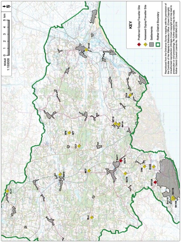
Sites considered (as shown in Figure 136):
1) BA76: Land north-west of Beeches Brook, Telham Lane, Battle
2) BA77: Land adjacent to High Views, Loose Farm Lane, Battle
3) BA78: Land off Loose Farm Lane, Battle
4) BX88: Actons Farm, Buckholt Lane.
5) BX108: Land south east of Cooden Wood
6) BX115: Lower Barnhorn Farm and Caravan Park
7) BX116: Land off Spindlewood Drive
8) BX124: North Bexhill
9) BL4: Coldharbour Farm estate, Battle Road, Dallington
10) CC1: Cripps Corner highway depot, Cripps Corner
11) CR8: Land south of Catsfield Road, Crowhurst
12) FL17: Land at Cherry Tree Nursery, The Mount, Flimwell
13) GU4: Guestling Green highway depot, Chapel Lane, Guestling Green
14) RB19: Land adjacent to Robertsbridge Traveller Site, Redlands Lane, Robertsbridge
15) RY45: Chippings Depot, Rye
16) SP6: Land north of Bramble Farm, Ewhurst
17) SP7: Land to the rear of Bramble Farm, Ewhurst
18) WF18: Land to east of Down Edge, Main Road, Westfield
19) WF19: Land south west of Moor Lane, Westfield
20) MO7: Land adjacent to Mountfield household waste site, Mountfield
17.9. Individual site conclusions can be found in Appendix 3.
17.10. The two preferred sites are:
1) BA77: Land adjacent to High Views, Loose Farm Lane, Battle (1 pitch)
2) BX124: North Bexhill strategic allocation (5 pitches)
17.11. Land adjacent to High Views, Loose Farm Lane[51] is located adjacent to the 2006 Local Plan Development Boundary, to the west of an existing Gypsy and Traveller site which consists of two pitches and is within the High Weald AONB. The site forms part of disused small holding which itself is an area of poor quality despoiled land which adjoins rolling open countryside to the south. The site is in the ownership of a Gypsy/Traveller household. It has been accepted by a Planning Inspector that the adjacent site is not considered to cause material harm to the existing landscape character of the AONB or compromise the objectives of its designation. The site is also considered to be acceptable in terms of access by vehicles, impact on the local environment and the amenity of residential neighbours and in terms of its proximity to services and relationship and scale with the settled community.
17.12. This site and the adjacent two Gypsy/Traveller pitches are considered to be located on the most discrete part of the wider Loose Farm Lane small-holding (BA78) and further pitches in this locality, over and above the additional pitch identified here (BA77) is likely to have an adverse impact on the landscape character of the High Weald AONB.
17.13. Provision for five further pitches will be made for in the North Bexhill strategic allocation. The detailed policy can be found in the Bexhill Chapter at Policy BEX3.
17.14. It is considered that these sites are preferable over other options within the District. Individual site conclusions can be found in Appendix 3. These preferred sites together yield 6 pitches from a remaining target of 6 of Gypsy and Traveller pitches within the District.
Preferred Site: Land adjacent to High Views, Loose Farm Lane, Battle
(Ref: BA77)
|
Existing use(s) |
This site forms part of a larger, currently unused; small-holding which is adjacent to a current gypsy site consisting of 2 pitches which has permanent planning permission. |
|
Size |
0.05ha |
|
Key constraints/ opportunities |
The proposed site is part of a smallholding located on the urban edge of Battle. It is an area of poor quality despoiled land which adjoins residential dwellings in ribbon development to the north and to the south it is rolling open countryside. The site is accessed via a single track off Loose Farm Lane – a narrow lane which connects the small complex of buildings at Loose Farm with the A2100 (Hastings Road). Immediately adjoining to the west are two existing pitches which a Planning Inspector accepted did not result in any material harm to the landscape character of this part of the AONB. The Inspector also concluded that the development only poses a limited risk to highway safety. This site is similarly not prominent when viewed from the adjacent countryside to the south and appears to be well screened by existing fencing, although would benefit from some soft landscaping along the boundary. This area is most acceptable in landscape terms compared to the rest of the wider small-holding. Care should be taken to respect the amenity of adjoining properties on the northern boundary. The site is relatively screened in the wider landscape, although the site would benefit from further native species screening on the southern and western boundaries. The site is considered to be well located in terms of access to services. Given the adjacent Gypsy/Traveller site and the likely negative impact on the AONB as a result of a larger scale of provision of pitches here, it is considered that the area west of the existing pitches is most suitable for one additional pitch. |
|
Proposed use(s) |
Site for Gypsies and Travellers. |
|
Developable area |
0.05ha |
|
Capacity |
1 pitch for Gypsies and Travellers. |
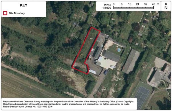
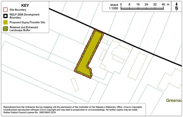
Policy GYP1: Land adjacent to High Views, Loose Farm Lane, Battle
Land adjacent to High Views, Loose Farm Lane, Battle as shown on the Policies Map is allocated for one permanent pitch for Gypsies and Travellers. Proposals will be permitted where:
- the applicant has adequately demonstrated that they meet the definition of Gypsies and Travellers in the Government's Planning Policy for Traveller Sites;
- the scheme proposes no more than one pitch; and
- the scheme is accompanied with an appropriate native planting scheme to ensure appropriate boundary screening in line with the provisions set out on the Policies Map.
Preferred Site: Land at North Bexhill (Ref: BX124)
17.15. Provision for five further pitches will be made for in the North Bexhill strategic allocation as part of a comprehensive development for the site.
17.16. The detailed policy, maps and consultation question/s can be found in the Bexhill Chapter at Policy BEX3.
|
Existing use(s) |
Most agricultural, some woodland, equestrian uses, residential. |
|
Size |
c50ha (0.2ha identified for provision for 5 pitches for Gypsies and Travellers). |
|
Key constraints/ opportunities |
The North Bexhill site, as identified in Figure 23, makes provision for housing, public open space, semi-natural green space and supporting community facilities, together with a small travellers site and access improvements. It is likely that the Gypsy and Traveller site of 5 pitches at the eastern end of the development area east of Watermill Lane. This area is relatively contained in the landscape and would contribute to the outstanding district-wide need for such pitches. The site should be planned in a comprehensive way alongside the other development provisions made within Policy BEX3, to ensure integration with the surrounding development. As well integrated provision of housing and infrastructure, the green infrastructure and mitigation and/or compensation for any biodiversity losses. Further details on the overall site considerations can be found in the Bexhill Chapter. |
|
Proposed use(s) |
Housing, public open space, semi-natural green space and supporting community facilities, together with a small travellers site and access improvements. |
|
Developable area |
0.2ha |
|
Capacity |
5x pitches for Gypsies and Travellers. |
Transit[52] site provision
17.17. East Sussex County Council owns and manages a transit site for short-term occupation on behalf of all the authorities in East Sussex - a nine pitch transit site with a resident site manager just outside Lewes, called Bridie's Tan. The site is one of only a few in the region, and was completely rebuilt in 2009.
17.18. In 2014, the Council worked in partnership with the other local authorities in East Sussex to produce a Gypsy, Traveller and Travelling Showpeople Accommodation Needs Assessment. The Assessment looked at the need for further Transit provision across the county, evidence showed that although the formal transit provision at Bridie's Tan appears to be in consistent use, there are regular vacancies on the site (pitches on Bridies Tan, on average, are only occupied 39% of the time). Analysis of unauthorised encampments across the county show that unauthorised sites occur in all local authority areas, which could indicate that the existing site may not be suited to all Gypsies and Travellers who travel through the County.
17.19. The Assessment considered "a provisional need for an additional eight transit pitches across the study area…. However, there is a need for all authorities to undertake more robust and consistent monitoring of households stopping on the existing transit provision and on unauthorised encampments in order to be able to more accurately assess future transit requirements". As such, the Local Authorities have revised the monitoring practices of unauthorised encampments to provide consistency of recording and a central point of collection (East Sussex County Council Traveller Team) , therefore being able to more accurately assess future transit requirements across the County. Given the high level of vacancies at Bridie's Tan and the need for more robust monitoring, the need for transit provision is currently under review.
17.20. It is considered that at the present time, there is no current unmet short-term need for further transit pitches. However, the Council will continue to work with other Local Authorities across East Sussex to allocate land to meet the county-wide transit needs, particularly through collaborative working using the existing policy framework (Policy LHN6) should a need arise in the future.
Guestling Green - Land at former highway depot
Context
17.21. Guestling Green is a small village located between Hastings and Icklesham and has direct access onto the A259. Guestling Green is rural in character despite the impact of the A259. The village and the surrounding countryside is located within the High Weald AONB. A number of the dwellings in the settlement are listed for their historical interest. It has a limited range of local services, including a primary school, although there is no shop. It is on a local bus route giving access to Rye and Hastings and is around one mile from Three Oaks Station which runs a partial service to Hastings and Rye. Given the limited range of services Guestling Green is not considered a particularly sustainable location for development.
Development Provisions
17.22. The Core Strategy does not identify any development targets for Guestling Green, given the scale of the village, its setting and limited opportunities for any further development.
17.23. Since the Core Strategy was adopted in 2014, the County Council Highways Depot, Chapel Lane has been confirmed as surplus to requirements. This site, although detached from the development boundary of Guestling Green, is located along the ribbon development of Chapel Lane, close to the existing doctor's surgery. Given the Government's focus on prioritising on the re-use of brownfield sites, it is considered that a positive approach is taken for an alternative use on this site.
17.24. In the consideration of alternative uses for the depot, Core Strategy Policy EC3 assumes that the site should continue in employment use unless it can be demonstrated that the site is unsuitable. Chapel Lane is narrow and suffers from informal on-street parking, particularly at school drop-off times for people accessing Guestling Bradshaw CE Primary School. This means that larger vehicles often find it difficult to manoeuvre along Chapel Lane, particularly where the Lane meets the A259, therefore it is considered that a continued business use, which would most likely be more intensive than the existing highway depot, is undesirable in this location.
17.25. In 2016, the existing doctor's surgery premises at Guestling Green have been identified by the Care Quality Commission as in need of modernisation. In response to this, the surgery has been looking for an alternative site for a relocated and expanded facility within the village. Guestling Green Highway Depot is considered as a suitable site for such a facility. The surgery has also identified the possibility for a 'intermediate care facility' adjacent to the site to provide care for those patients who no longer require hospital care but are unable to immediately care for themselves at home. This approach reduces the need for a stay in a residential care home. These proposed uses are considered appropriate for this brownfield site.
17.26. Further details of the assessment of individual sites can be found in Appendix 3.
Figure 139. Guestling Green Options Map
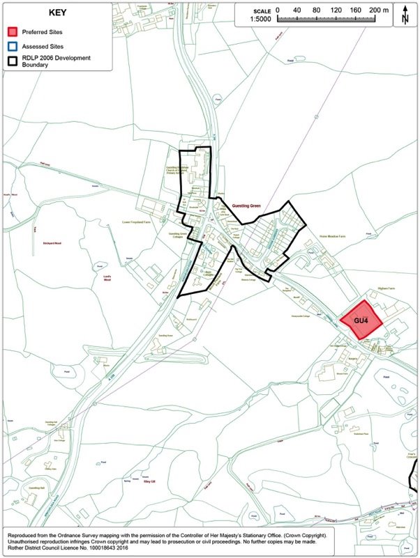
Preferred Site: Land at former highway depot, Chapel Lane (Ref: GU4)
|
Existing use(s) |
Highways depot. |
|
Size |
0.35ha |
|
Key constraints/ opportunities |
The site is an existing highways depot owned by East Sussex County Council, but identified as surplus to requirements. This brownfield site is level and well screened from public view by the existing hedging. Although the site is physically separate from the built-up area boundary of the village, it is visually well contained within the ribbon development along Chapel Lane. However, the site would benefit from some additional screening to its eastern boundary (there are some views to the north and east). The site is located within the High Weald AONB. There would be limited impact on neighbouring amenities and the site is located relatively close to an existing bus route on the A259 (although there is no footway along Chapel Lane to the site). Whilst Guestling Green is not identified as a particularly sustainable location for development (the site is not particularly well located for access to many key services) Government policy focuses on the re-use of brownfield sites for alternative uses. There is an existing suitable access point off Chapel Lane. Chapel Lane is narrow and on-street parking, especially at school drop-off and pick-up times, makes it difficult for vehicles to manoeuvre along the road, particularly for larger vehicles. |
|
Proposed use(s) |
Doctors surgery and associated complementary medical uses - intermediate care beds (short-term care for people who no longer need to be in hospital but may need extra support to help them recover). |
|
Developable area |
0.35ha |
|
Capacity |
200sqm doctors surgery plus intermediate care beds (this proposal for the intermediate care beds is subject to confirmation from the relevant health bodies). |
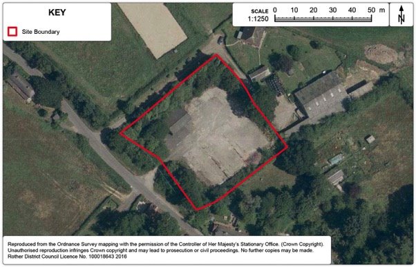
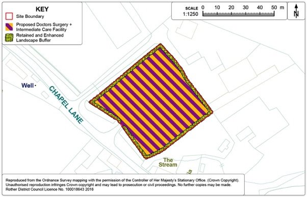
Policy GUE1: Land at former highway depot, Guestling Green
Land at Guestling Green Depot, Guestling Green, as shown on the Policies Map, is allocated for a doctor's surgery and an intermediate care beds facility. Proposals will be permitted where:
- a doctors surgery of around 200sqm is provided;
- a small scale intermediate care beds facility is provided;
- adequate on-site parking is provided; and
- provision is made for the retention and enhancement of boundary planting on the site.
Marley Lane - Land at Felon's Field
17.27. This site on the south side of Marley Lane adjoins the highways depot site near the junction with the A21. It was allocated in the 2006 Local Plan under Policy EM5 for industrial/storage purposes. Planning permission was granted in 2014 for a highways depot but it is understood that this will not be implemented. In view of this, further consideration has been given to the merits of reallocating the site.
Preferred Site: Land at Felon's Field, Marley Lane
|
Existing use(s) |
Brownfield site (overgrown hardstanding with surrounding woodland |
|
Size |
2.27ha |
|
Key constraints/ opportunities |
Any development would need to respect the number of constraints impinging on the site. Not only is it within the High Weald AONB, but is fringed by Semi-Natural Ancient Woodland and tree belts on the site are subject to a Tree Preservation Order. A buffer between development and the TPO trees would be appropriate. Part of the site lies within a ground water source protection zone. Ecology work in connection with a recent planning application (RR/2014/473/C) identified dormice on site, and a mitigation strategy. Whilst the site is poorly sited in terms of public transport and is not accessible by walking, this site still represents a very rare opportunity for uses that would benefit from good access to the adjacent A21. A Travel Plan would be an appropriate means of minimising traffic generation. The A21 junction has been improved since the earlier allocation; hence, this need no longer be a requirement. Therefore, subject to strict controls to ensure that the environmental constraints, including its habitat value, are fully and sensitively addressed, it is still regarded as an acceptable site for industrial/warehousing purposes, especially for distribution-oriented uses. |
|
Proposed use(s) |
Industry/warehousing |
|
Developable area |
1.02ha |
|
Capacity |
3000sqm |
Figure 142. Marley Lane Aerial Map
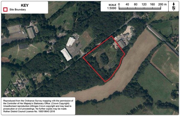
Figure 143. Marley Lane Detail Map
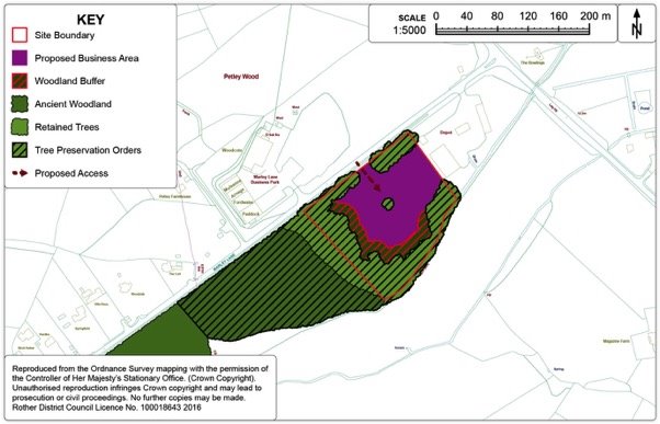
Policy MAR1: Land at Felon's Field, Marley Lane
Land at Felon's Field, Marley Lane, as shown on the Policies Map, is allocated for industrial/storage purposes. Development proposals should:
- provide for the retention and strengthening of boundary tree belts, new woodland planting to the south and west and its subsequent management;
- be subject to an ecological survey;
- ensure that it does not prejudice ground water;
- minimises the risk of increased flooding due to surface water run-off; and
- be accompanied by travel plan to show how the traffic to be generated is to be minimised.
Rother Valley Railway
Context
17.28. Saved Policy EM8 of the Rother District Local Plan 2006 provides for an extension of the Kent & East Sussex Railway westwards from Bodiam to Robertsbridge. The safeguarded route follows the original track of the railway.
17.29. Since 2006 planning permission has been granted to the Rother Valley Railway Ltd to redevelop facilities and buildings alongside Robertsbridge Station which also included a track connection to the main line itself and the reinstatement of the track from the station as far as Northbridge Street. The track work is now substantially in place and other works are on-going. In addition, a separate planning application was submitted in 2014 by the Rother Valley Railway for the continuation of the track bed across Northbridge Street and onward to Bodiam.
17.30. The tourism advantages of reinstating the former route continue to be recognised, which are seen as building on the success of the Kent & East Sussex Railway from Tenterden as far as Bodiam as well as giving the opportunity to provide a connection to the main line rail services at Robertsbridge. At the same time, the line of the route along the high quality and distinctive landscape of the Lower Rother Valley, which is part of the attraction of the railway route, requires that this character and its tranquil nature is maintained.
17.31. The current application by the Rother Valley Railway is yet to be determined, but it has sought to address the major issues acknowledged in the 2006 Plan, including crossing Northbridge Street, the A21 Robertsbridge Bypass and the B2244 Junction Road at Udiam, as well as environmental issues and flood risk, particular in respect of the flood defences at Robertsbridge. In this respect, there has been considerable negotiation with Highways England, the County Highway Authority and the Environment Agency. The large majority of the former track bed beyond Robertsbridge remains, however, in private ownership.
17.32. Given that the current planning application remains to be determined, a further policy is required in this Plan, if the proposal is still deemed appropriate.
Figure 144. Rother Valley Railway Map
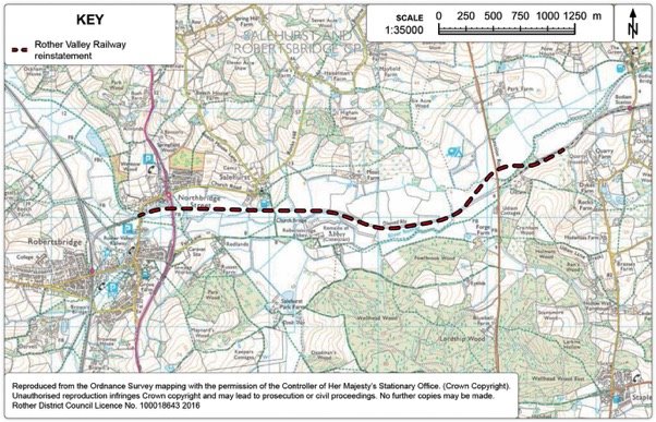
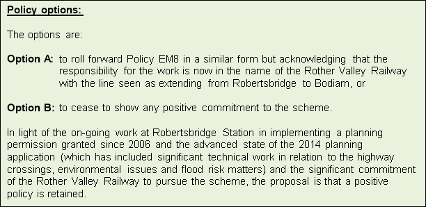
Policy RVR1: Rother Valley Railway
The proposal to re-instate the former railway line from Robertsbridge to Bodiam along the route identified on the Policies Map, will be supported, subject to a proposal meeting the following criteria:
- it does not compromise the integrity of the floodplain and the flood protection measures at Robertsbridge;
- it has an acceptable impact on the High Weald Area of Outstanding Natural Beauty; and
- it incorporates appropriate arrangements for crossing the A21(T) Robertsbridge bypass, the B2244 at Udiam, Northbridge Street and the River Rother.
And finally...
[40] As detailed in supporting evidence, including the 'Strategic Housing Land Availability Assessment' (SHLAA) 2013 (paragraphs 3.2 to 3.10), as well as the Employment Land Review process and liaison with Parish Councils.
[41] Planning application reference RR/2015/2260/P
[42] Based on 30 dwellings per hectare of net developable area on the basis that some ancillary amenity and recreation provision is within the adjacent green space.
[43] Defined area where retail development is concentrated – NPPF, March 2012
[44] The site off Breadsell Lane was considered previously as part of large sustainable mixed use urban extension jointly with Hastings Borough Council. However, the site was considered by the Hastings Inspector as part of their Core Strategy Examination and robustly concluded that the site should be omitted from their Plan on both sustainability and environmental grounds.
[45] Rother District Councils 'Open Space, Sport and Recreation Study'
[46] RDC Open Space, Sport & Recreation Study
[47] Bastides were originally walled towns, centred around a market square, with the houses set in narrow streets, often to a grid layout. The bastides were fortified to protect the inhabitants from outside attack.
[48] 01/04/2011 – 31/03/2016
[49] 2 pitches at Loose Farm Lane, Battle and 3 pitches at Beeches Brook, Battle. A further pitch has been granted permanent planning permission at Loose Farm Lane after the base date of this document (1st April 2016).
[50] There are two sites within the District which currently have temporary planning permission – 1 pitch at Bramble Farm, Ewhurst and 1 pitch at Coldharbour Farm, Dallington
[51] This site has received planning permission for one pitch in April 2016 application RR/2015/2242/P refers
[52] These are permanent sites that allow Travellers to stay for short periods (up to 12 weeks) when they are passing through an area.