Development and Site Allocations (DaSA) Local Plan - Options and Preferred Options
Part B: Development Policies
6. Resource management
Water efficiency
6.1. The Council's adopted Local Plan Core Strategy Policy SRM2 states:
'Effective management of water resources will be supported by:
(v) Ensuring that all development incorporates water efficiency measures appropriate to the scale and nature of the use proposed.'
This section considers how this broad policy commitment may be taken forward.
6.2. Water is recognised as being a finite resource and, in common with the rest of south-east England, Rother is identified as an area of 'serious' water stress[4]. This takes account of both existing and future demand.
6.3. While both water suppliers in the area, Southern Water and South East Water, have indicated that they can accommodate the level of planned development in the district, it is acknowledged that there will inevitably be pressure to manage existing water resources more effectively, not least because of restrictions on abstraction, notably on the Pevensey Levels, and the cumulative effects of development across the wider area.
6.4. Both suppliers have business objectives to sustain the existing water reserves by implementing efficiency measures, reflecting a clear legislative steer. Central to water efficiency is the programme of both local water suppliers for the installation of water meters. The Government has also said that Councils can play a part through their local plans by applying an optional standard for water efficiency in new homes as provided for by the Building Regulations where there is a clear need and does not prejudice the viability of development and housing delivery.
6.5. The mandatory default Building Regulations standard is 125 litres/person/day, while the higher optional standard of 110 l/d/p. To meet the relevant regulatory requirements[5], it will be necessary to demonstrate compliance via a calculation of the water usage (from mains supply) of sanitary appliances and white goods provided and installed. All products supply datasheets which outline the water consumption based on output of litres/ minute. Applicants can calculate the estimated use with the methodology in the Water Efficiency Calculator[6] or use Table 2.2 in Building Regulations Part G 2015 which sets out the maximum fittings consumption levels.
6.6. The level of water stress is clear evidence that water efficiency measures are needed in this area. This is consistent with the overarching South East River Basin Management Plan: Water for life and livelihoods Part 1: South East River Basin District Management Plan (2015). This specifies key actions for the catchment basins to meet the objectives of the Water Framework Directive including regulating the amount of water extraction and states:
'Dealing with unsustainable abstraction and implementing water efficiency measures is essential to prepare and be able to adapt to climate change and increased water demand in future'.[7]
6.7. Amongst other recommendations, it encourages that: 'Local government sets out local plan policies requiring new homes to meet the tighter water efficiency standard of 110 litres per person per day as described in Part G of Schedule 1 to the Building Regulations 2010.'[8]
6.8. Furthermore, the Environment Agency's Rother Abstraction Licensing Strategy (2013) states "Water efficiency and the reduction in household water demand are crucial elements of good water resource management planning especially as the South East is under increased pressure from climate change and population growth".
6.9. Having regard to the marginal additional costs of adopting the higher standard, as advised by the Government[9], it is evident that this is an achievable standard for house builders to implement. It will also benefit new home-buyers in terms of reducing their water usage, and associated costs.
New development should plan positively to minimise its impact on water resources. All new dwellings are required to achieve water consumption of no more than 110 litres per person per day.
6.10. This policy will be implemented through the Building Regulations, while planning applications for new homes will be expected to be accompanied by a 'letter of intent' confirming the dwellings will adhere to the standard 110 litres/per day/per person.
Renewable and low carbon energy
6.11. The Government's National Planning Policy Framework expects local planning authorities to have a positive strategy to promote energy from renewable and low carbon sources. In response, the Core Strategy has, through Policy SRM1: 'Towards a Low Carbon Future', a strategy to mitigate and adapt to the impacts of climate change.
6.12. The Core Strategy was supported by a 'Low Carbon & Renewable Potential Study' (2010). A further Background Paper has been prepared to provide further evidence on opportunities for 'Energy from Renewable and Low Carbon Sources'. Both of these are published on the Council's website.
Low carbon energy generation schemes
6.13. This Core Strategy Policy includes support in principle for renewable and low carbon energy generation schemes, particularly those utilising solar, biomass and wind energy technologies, that: (a) do not have a significant adverse impact on local amenities, ecological and heritage assets or landscape character, and (b) in respect of locations in or adjacent to the High Weald AONB and other sensitive landscapes, are generally small in scale.
6.14. Government guidance advises that when drawing up a Local Plan, local planning authorities should first consider what the local potential is for renewable and low carbon energy generation and consider:
- the range of technologies that could be accommodated and the policies needed to encourage their development in the right places; and
- the impacts of different technologies and how they may vary by place.
6.15. Therefore, there remains the opportunity to put forward more spatially specific policies identifying appropriate locations for, and approaches to, different potentials. In fact, in respect of wind energy development, the Government[10] advises that such developments should be in an area identified as suitable for wind energy development in a local or neighbourhood plan, and that communities concerns are addressed.
6.16. The recent Background Paper indicates the potential for wind turbines, based on prevailing wind speeds. Areas outside of the High Weald AONB and international nature conservation areas include the west/north-west of Bexhill and western edges of Hastings. There are also areas of wind energy potential within the High Weald AONB, earlier reports have indicated that these should not automatically be ruled out, suggesting that there may be scope in particular localised areas for a smaller (1.5-2MW capacity) single turbine or small clusters of up to three turbines.
6.17. The use of biomass as a fuel offers significant benefits, both in encouraging sustainable woodland management as well as in generating energy from a renewable resource. However, large-scale biomass plants do not appear to be likely to be viable, notwithstanding the scale of the potential resource, due to its highly fragmented nature. Nevertheless, small-scale biomass plants (particularly those using local wood fuel) may be viable.
6.18. The considerations that will inform the determination of planning applications will substantially depend upon the scale of the biomass burner. It is most likely that it would serve a single user, which may be relatively large, such as a school or commercial building, or a single dwelling.
6.19. Consideration may be given to encouraging suitable commercial buildings to be heated by biomass boilers and for residential properties to be designed to accommodate them, or wood burners, which essentially means providing working chimneys or flues.
6.20. Solar energy is another potential source of heat. Much solar equipment falls within planning control. Where permission is required for a proposal in the High Weald AONB, on a Listed Building or in a Conservation Area, existing policies would require that the objectives of those designations should always be respected.
Energy options in new development
6.21. Core Strategy Policy SRM1(i) promotes renewable and low carbon energy through its requirements for an energy strategy for residential developments of 10 or more dwellings and non-residential schemes of at least 1,000sqm of floorspace. Also, larger schemes, of 100 dwellings (or 50 flats) are required to consider the potential for combined heat and power generation (CHP).
6.22. The Core Strategy recognised that these thresholds may need to be reviewed and evidence to date is that the requirement for an energy strategy appears to be at least perceived as an unduly onerous expectation from smaller developments and has not been secured. Also, the threshold for CHP is also too low and could not be secured even at North East Bexhill. A higher threshold for an energy strategy, or 'statement', may be more reasonable for developments of more than 50 dwellings or non-residential developments of 5,000sqm or more floorspace.
6.23. Whichever threshold is applied, it is proposed to issue practice guidance advising on the nature of such an energy statement. Also, it is considered reasonable to clarify that, at any scale of development, a scheme that positively embraces options for renewable and low carbon energy will be a factor weighing in the favour of a proposed development.
7. Communities
Retention of sites of social or economic value
7.1. Community facilities, shops, tourism accommodation and business premises all play an important social and economic role within the District, making a positive contribution to maintaining and developing sustainable communities.
7.2. At the same time, commercial pressure for such sites and premises to change to alternative higher-value uses, notably housing, is strong. This often leads to local objections about the loss of facilities, notably shops and public houses, and the lack of sufficient job opportunities, especially for young people, when proposals come forward to convert or redevelop such sites for other purposes. Erosion of "sustainable communities" is at the heart of concerns.
7.3. It follows that it is vital to provide a clear policy framework to ensure that such uses, of social and economic value are normally retained, and their loss resisted unless it is evident that they cannot be maintained or that their continued use would perpetuate real harm to local amenities in some way.
7.4. This general approach is already established through the Local Plan Core Strategy; Policy CO1 sets the principles for retaining sites and premises currently or last in community use, as does Policy EC3 for employment space and Policy EC6 in respect of tourism accommodation. The Core Strategy's spatial policies are also relevant, notably Policy RA1, which looks to retain local shops, services and public houses in villages.
7.5. However, while laying down basic principles, these policies do not go so far as to detail the requisite marketing and viability evidence required to properly consider a proposal that would result in the loss of such a valued use or facility.
7.6. To satisfy the policy test regarding whether there is a reasonable prospect of continued use, marketing will normally be required. A comprehensive, sustained campaign must be undertaken, offering the premises for sale as a going concern or for rent, at a realistic valuation of the premises for the permitted use. Ordinarily, the marketing campaign should run for a period of at least 18 months before the planning application is submitted; the premises should be offered for sale locally and regionally, in appropriate publications including through appropriate trade agents. Details should accompany relevant planning applications.
7.7. Sites should be advertised with the option for use as an alternative commercial or community facility, or restaurant or other use falling within the 'A' or 'C1' use classes, subject to suitability in line with other policies in the Local Plan. Where applications relate to a public house, the property should be advertised free of tie and restrictive covenant. Applications should also have full regard to the provisions set out in the CAMRA Public House Viability Test.
7.8. Where ongoing financial viability is at issue, the Council will require submission of trading accounts, normally for the last three full years in which the business was operating on a full-time basis. In schemes affecting tourism uses, consideration will also be given to the adequacy of marketing measures to attract holiday lettings. Where viability evidence is submitted, the Council would normally obtain independent verification, to be undertaken at the developers expense.
7.9. Amenity spaces attached to public houses and community facilities in particular can be subject to similar pressures for residential redevelopment. In order that the sustainability of the particular social or economic use is not prejudiced, the policy embraces consideration of the need to retain adequate amenity space (internal and external) and parking. Therefore, it also identifies a need to resist the loss of features such as gardens, car parks and function rooms, where this would threaten to undermine retention of a community or economic use.
Policy DCO1: Retention of Sites of Social or Economic Value
In accordance with the presumptions set in the Local Plan Core Strategy, where developments are proposed that involve the loss or diminution of sites of social or economic value, including those currently or last in use as a community facility, public house, shop, tourist accommodation or business premises, in order to demonstrate that there is no reasonable prospect of a continued use, proposals must be supported by either:
- evidence of a comprehensive and sustained marketing campaign, which clearly indicates a lack of demand for the existing use (or as an alternative commercial or community facility, where appropriate), based on marketing, normally at least 18 months, that offers the land or unit/s for sale as a going concern, or rental, at a realistic valuation of the site/premises for that use; or
- clear evidence that demonstrates that the unit is not financially viable.
Proposals should not result in the loss of facilities or features which may undermine the viability of its use, including, but not limited to, car parks, gardens and function rooms.
Equestrian developments
7.10. The Rother area continues to be a popular area for equestrian activities. Its countryside provides an attractive context for horse riders and there is a good network of bridleways throughout the District.
7.11. While there are a limited number of larger commercial centres in the District, it is small-scale facilities for individual and private pursuit that predominantly come forward as planning applications. Typically, proposals for stables will include a tack room as well as external hard-standings and manure bays, but may also include sand schools, fencing and jumps, as well as new accesses from the highway.
7.12. Core Strategy Policy RA2 is supportive of recreation and leisure facilities in the countryside where they are compatible with the rural character of the area.
7.13. A balance needs to be struck between meeting the desires of the equestrian community and at the same time safeguarding the intrinsic value and locally distinctive rural character and landscape features of the countryside. This is especially the case in the High Weald AONB, the conservation and enhancement of which is afforded great weight.
7.14. The High Weald landscape is particularly vulnerable to development, including on the fringes of settlements. New buildings and hard surfaces – access roads or sand schools – are not always easily accommodated without some impact on the fields, small woodlands and farmstead meadows which make up the essential character of the AONB. Much of the rural area beyond the AONB is sensitive for other reasons; notably, the lower and open levels extending eastwards towards the Romney Marsh, are ecologically sensitive and subject to national and international protection.
7.15. The keeping of horses is recognised as a countryside pursuit but associated development must be carefully controlled, primarily for landscape reasons. This is particularly the case to manage the increasing pressures from proposals for new isolated stables and, at the other extreme, from a cumulative impact of stabling and equestrian facilities in a concentrated area.
7.16. Other than the possibility of utilising former farm or other commercial buildings for new uses, there is limited scope within the countryside to accommodate further commercial equestrian enterprises. However, there is scope for equestrian development in the countryside that is limited in scale.
7.17. Ideally, new development should be sited close to existing built development, close to the bridleway system and should preferably utilise mobile field shelters, although this is not always practicable. Where applications come forward in more remote locations and permanent buildings are required, new development will be expected to meet a number of criteria aimed at protecting the character of the countryside and the amenities of both local residents and users of the countryside. Particular control is necessary over the location of any new development and over the size, siting and design of all new buildings and associated facilities. Floodlighting is not appropriate in the countryside, neither are extensive access roads, or excavations other than of a minor nature to enable the formation of a sand school (or manège).
7.18. In assessing applications adequate provision should also be made for the safety and comfort of horses in terms of land for grazing and exercising. Such provision will help to address the issue of the excessive sub-division of fields and over grazing/loss of soil structure. While there is not a common standard applicable throughout the plan area, depending on how the horses are kept and the nature of the land, a desirable guideline would suggest stocking at a density of one hectare per horse[11].
Policy DCO2: Equestrian Developments
Proposals for equestrian developments should, individually and cumulatively, safeguard the intrinsic and locally distinctive character and amenities of the countryside, with particular regard to the conservation of the High Weald AONB.
In addition, proposals should accord with the following criteria, as applicable:
- the siting, scale and design, including materials and boundary treatment, of any new buildings or facilities should be appropriate to their rural setting;
- proposals should not be sited in prominent or isolated locations;
- all proposals and especially sand schools and commercial riding schools, livery stables and related facilities, should be satisfactorily integrated with existing buildings;
- any associated floodlighting, earthworks, new access routes or ancillary structures, including storage facilities, manure bays hard-standings, fencing and jumps, should not have an adverse impact on the surrounding countryside and local residential amenities; and
- adequate provision should be made for the safety and comfort of horses in terms of the land for grazing and exercising, notably in the consideration of stabling proposals; commercial riding schools, livery stables and other commercial facilities should have satisfactory access to the public bridleway network without the use of unsuitable roads and in all cases not adversely impact on road safety.
In some circumstances, conditions (such as the removal of permitted development rights for fencing and external storage) may be applied where it is considered that there is the need to control potential adverse landscape impacts which can arise from the poor management of sites. Permission may also be subject to the removal of excessive or inappropriate fencing which has already taken place.
8. Housing
Affordable housing
8.1. The requirement for affordable housing to be a part of new developments is a recognised means whereby the planning system can contribute to improving access to housing for households not able to purchase or rent on the open market. In this way it promotes balanced and inclusive communities.
Core Strategy provisions
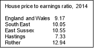
8.2. In light of the relatively high median house price/earnings affordability ratio in Rother – see table below - the Local Plan Core Strategy regards affordable housing as a strategic policy issue and requires between 30-40% affordable housing, depending on location, on new developments above certain size thresholds in the District. These requirements are set out in Core Strategy Policy LHN2:
- Bexhill - 30%
- Hastings Fringes - 30%
- Rye - 30%
- Battle - 35%
- Rural Areas - 40%
8.3. The size of sites which trigger the requirement also vary, with a threshold of 15 dwellings for Bexhill and the Hastings Fringes, 10 dwellings at Rye and Battle, and 5 dwellings in the Rural Areas. Also, in rural areas, the policy seeks a financial contribution from schemes of less than 5 dwellings towards affordable housing.
8.4. The reasons for the different requirements reflected the levels of affordable housing need relative to planned supply, as well as the anticipated contribution to supply from different sizes of sites in the respective areas and local factors. In effect, as smaller sites predominate in the rural areas, a higher requirement and lower threshold are appropriate. The impacts of these requirements on viability were duly considered and it found that, for the vast majority of schemes, they would not prejudice viability.
National Planning Practice Guidance (PPG)
8.5. The PPG has recently been updated following the order of the Court of Appeal in May 2016, which gave effect to the policy set out in the Written Ministerial Statement of 28 November 2014. This sets a national approach whereby affordable housing or tariff-style contributions should not be sought from developments of 10 units or less (and have a maximum combined gross floorspace of no more than 1,000sqm) but does allow local planning authorities to seek affordable housing contributions from developments of between 6 and 10 units in the form of cash payments (commuted until after completion of units within the development) in designated rural areas, which includes Areas of Outstanding Natural Beauty.
Review of Options
8.6. As can be seen, the current Core Strategy affordable housing thresholds and financial contributions requirements are no longer consistent with national policy guidance. Hence, it is necessary to review the thresholds in the Core Strategy policy.
8.7. There have been no planning application appeals locally that have examined this issue and, while cases elsewhere have variously found for the new national position and the local policy, they turn on local circumstances, with clear evidence needed to justify a departure from the national thresholds.
8.8. Further assessment of the most appropriate position is regarded as necessary, as the Core Strategy pre-dated the PPG. Three distinct options are outlined below.
|
Option |
Description |
Overview |
|
A |
Retain existing Core Strategy thresholds for on-site requirements and for financial contributions in Rural Areas |
This option is part of the extant development plan and has been through examination post-NPPF. Also, it maximises affordable housing provision. However, the Core Strategy pre-dates the PPG and does not align with it. Also, financial contributions have not been sought to date for very small schemes in rural areas. |
|
B |
Amend existing thresholds to be in line with the PPG (i.e. not seek any on-site provision for affordable housing from sites of 10 or less) and also not seek financial contributions on smaller schemes in the AONB from schemes of 6-10 dwellings |
This would be consistent with the PPG in that the financial contributions element is discretionary and needs local justification. However, it would reduce the number of affordable homes coming forward in rural areas, with no on-site contribution from schemes of 6-10 dwellings (or 5-10 under the Core Strategy) or financial contributions from smaller schemes. |
|
C |
Amend existing thresholds to be in line with the PPG and also seek financial contributions from schemes of 6-10 dwellings in the AONB |
This would be consistent with the PPG and would draw on the fact that the case for affordable housing from schemes of 5 and above has been accepted through the Core Strategy. It would yield less affordable homes than Option A but more than Option B, the main differences being the lack of contributions from schemes of 1-5 dwellings. Also, opportunities to use financial contributions to increase supply are less certain than on-site provision. |
8.9. Views are sought on these options – as reflected by the question below.
8.10. In the interim, the Council's position is that Option C will be followed. An exception to this is that financial contributions will not be sought from sites of 6-10 dwellings in Battle pending further viability assessment, as the Core Strategy does not require any provision, either on-site or financial contributions, from sites of less than 10 dwellings at present.
8.11. At this point, if the Council were to insist on Core Strategy thresholds, there would be a high risk of successful appeals; also, it is recognised that most very small schemes are likely to be exempt from providing affordable housing, as 'custom or self-build' homes in any event, as well as the need to support the delivery of small sites as an important contributor to overall housing supply.
8.12. As the PPG thresholds are higher than those in the Core Strategy and the contributions required will be less or the same as would have been required under Policy LHN2, then this interim position cannot have any prejudicial effect on the viability of developments and, in some cases, will increase it.
8.13. At the same time, the Council will further consider the merits of the different approaches before the final version of the plan is finalised, which will take into account comments made on the above options and further work on viability of a number of proposed policy requirements aside from affordable housing, such as residential space and access standards, water efficiency standards and provisions to support biodiversity.
8.14. Separate guidelines to advise developers on the financial contributions that will be sought, with immediate effect, from housing schemes of 6-10 net additional dwellings within the High Weald AONB, outside of Battle town, are published alongside this Options and Preferred Options Plan.
Access to housing and housing standards
8.15. It is vital that new homes meet the needs of their occupiers, and future occupiers, in terms of the both the internal and external space available. Also, having regard to the generally ageing population, it is important to build homes that are capable of meeting the needs of people who are less mobile or who may become less mobile.
8.16. This Section is made of three complementary parts to help ensure widespread access to housing, covering (a) internal space standards, (b) accessible and adaptable housing and (c) housing for older people.
8.17. National policy expects councils to plan for a mix of housing based on current and future demographic trends, market trends and the needs of different groups in the community (such as families with children, older people, people with disabilities, and people wishing to build their own homes), including through the delivery affordable housing. (NPPF, paragraph 50).
8.18. In March 2015, the Government set out in a Written Ministerial Statement[12] its new national planning policy on the setting of technical standards for new dwellings. These provide for 'optional' standards above the basic minimum set out in the Building Regulations 2010 to be applied in relation to water efficiency and access, and gives local councils the ability to "opt in", through their local plan, to these, as well as to a nationally described internal space standard for residential dwellings. Planning Practice Guidance (PPG) adds that the introduction of the 'Optional Technical Standards' requires the gathering of evidence to determine whether there is a local basis for setting them, as well as consideration of how the of setting of optional standards affects viability and delivery of development.
8.19. The Council's adopted Core Strategy looks for a housing mix to meet the needs of all households (through Policy LHN1), while Policy CO5 promotes initiatives and developments which enable older people to live independently in their own home, as well as increase the range of available housing options with care and support services in accessible locations.
Internal Space Standards
8.20. The Government's internal space standards[13] sets out requirements for the Gross Internal (floor) Area of new dwellings at a defined level of occupancy as well as floor areas and dimensions for key parts of the home, notably bedrooms, storage and floor to ceiling height. Figure 2 below shows the minimum gross internal floor areas and storage.
Figure 2. Minimum gross internal floor areas and storage (sqm)
|
No. of Bedrooms (b)* |
No. of Bed Spaces (p) |
1 Storey Dwelling (sqm) |
2 Storey Dwelling (sqm) |
3 Storey Dwelling (sqm) |
Built-in Storage (sqm) |
|
1 |
1 |
39 |
1 |
||
|
2 |
50 |
58 |
1.5 |
||
|
2 |
3 |
61 |
70 |
||
|
4 |
70 |
79 |
2 |
||
|
3 |
4 |
74 |
84 |
90 |
2.5 |
|
5 |
86 |
93 |
99 |
||
|
6 |
95 |
102 |
108 |
||
|
4 |
5 |
90 |
97 |
103 |
3 |
|
6 |
99 |
106 |
112 |
||
|
7 |
108 |
115 |
121 |
||
|
8 |
117 |
124 |
130 |
||
|
5 |
6 |
103 |
110 |
116 |
3.5 |
|
7 |
112 |
119 |
125 |
||
|
8 |
121 |
128 |
134 |
||
|
6 |
7 |
116 |
123 |
129 |
4 |
|
8 |
125 |
132 |
138 |
8.21. The PPG is explicit that space standards should be justified, taking account of need, viability and timing. An 'Access to Housing and Housing Standards' Background Paper has been prepared that reviews the requirements (together those for accessible and adaptable homes – see next sub-section) and gather evidence in terms of current building sizes and costs.
8.22. Analysis of recently built and approved schemes existing of varying sizes, in terms of their gross internal floor area, bedroom floor areas, bedroom widths, built-in storage and ceiling heights, suggests that some 44% of dwellings would not meet the minimum requirements for the gross internal area (GIA), being on average 9sqm too small, more so in larger schemes and for private housing.
8.23. However, these figures do not fully explain the results of the research. Although a relatively small amount complied wholly, the majority of schemes have potential to meet the standards with minor adjustments to the internal layout to improve bedroom sizes and built-in storage. For example, if smaller second bedrooms identified as double rooms were denoted as single rooms, this would reduce the minimum requirement for the GIA, as it would have fewer bed spaces. Essentially, second bedrooms may be either enlarged to better function as such or be more reasonably identified as single rooms.
8.24. Overall, the research indicates although the figures show there is a low compliance, every one of the measurements are close to the standards and would not have required major adjustments to become compliant with the space standards.
8.25. In terms of viability, the Government's own impact assessment details the likely cost impacts to development in adopting the optional standards. These are relatively low and, also considering the consequential impact on sale values, should not detract from the overall viability of developments. This will be further tested prior to the submission version of the Plan alongside other planning-related costs.
8.26. It should be stressed that these are minimum standards and that greater floor areas are not discouraged. In fact, greater areas may well be appropriate to support home working.
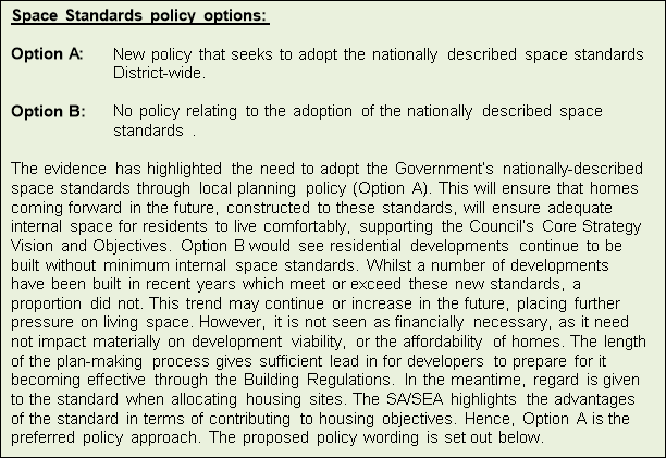
Policy DHG1: Residential Internal Space Standards
The Council adopts the Government's nationally-described space standard.
All new dwellings (including converted flats) should
provide adequate minimum internal space in line with the
standard.
Access Standards
8.27. The Government has introduced, through amendments to the Building Act 1984[14], a three tier standard for accessibility in Part M (access to and use of buildings) of Schedule 1 of the Building Regulations, involving a mandatory baseline (i.e. minimum) requirement and two optional standards:
- Mandatory baseline - M4(1) – visitable dwellings
- Optional Standard - M4(2) – accessible and adaptable dwellings
- Optional Standard - M4(3) – wheelchair user dwellings
Figure 3. Main differences between Part M 'Building Regulations' M4(2) and M4(3).
|
M4(2) Accessible and adaptable dwellings |
M4(3) Wheelchair adaptable dwellings |
|
In addition to all the baseline requirements –M4(1), dwellings built to M4(2) must comply with the following:
|
In addition to all the M4(2) requirements – M4(3), dwellings must also comply with the following:
|
8.28. Part M4(3) of the Building Regulations distinguishes between (3a) wheelchair accessible (a home readily useable by a wheelchair user, including step-free access) and (3b) wheelchair adaptable (a home that can be easily adapted to meet the needs of a household including wheelchair users) dwellings. Local Plan policies for wheelchair accessible homes (M4(3)(a) should be applied only to those dwellings where the local authority is responsible for allocating or nominating a person to live in that dwelling.
8.29. Having regard to PPG advice about relevant data and factors, available evidence suggests that the introduction of the optional accessibility standard M4(2) could be justified within the District due to its ageing population and forecasted increase in the number of people with mobility issues and limiting illnesses. For comparison, it is noted that similar provision was made by Housing Associations under former 'lifetime homes' standards.
8.30. Consideration is also given as to whether it would be appropriate to apply this requirement to all new housing or a certain proportion. It may be seen as "future-proofing", but is difficult to justify this across the board based on forecast needs and the potential negative impact on overall delivery of unit numbers. However, given the proportion of the district's population projected to have mobility issues or limiting illnesses and older people/households (over 25% of the population by 2030) and that, by 2032, 29% of all households will have a household representative aged 75 or over (with almost 15,000 over 75s living alone by 2030), this suggests that a requirement of at least 25% of new homes to meet the optional Building Regulation for accessible and adaptable homes would be appropriate.
8.31. In terms of viability, the Government's Impact Assessment estimated that the typical additional cost to a three bedroom house in adopting the M4(2) access standard would be £521. In terms of the cost impact in constructing a three bedroom dwelling to the M4(3a) – wheelchair accessible, would be £22,791. It also indicates that there will be cost savings over time as more dwellings get built to these accessibility standards.
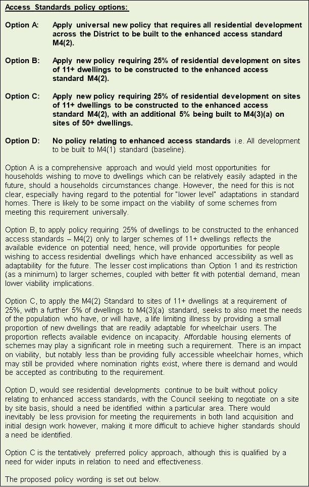
Policy DHG2: Accessible and Adaptable Homes
The Council adopts the Optional Buildings Regulations for Accessible and Adaptable Homes.
Sites of 11 or more dwellings are required to provide at least 25% of dwellings to meet M4(2): Category 2 – Accessible and Adaptable Dwellings.
Sites of 50 or more dwellings are also required to provide a further 5% to meet M4(3)(a): Category 3 - Wheelchair Adaptable Dwellings.
Only in circumstances where it can be robustly demonstrated by the applicant that it is not practicable or financially viable to deliver the provisions above, new development will be exempt from either or both of these policy requirements.
Specialist housing for older people
8.32. Population estimates show that 22% of the population of Rother are currently over 65 years old, with 32.4% of the population in Bexhill over 65 at the last Census. In 2027, households whose head is over 65 years old will equate to almost 50% of all households within Rother, up from 45% in 2014. This equates to an extra 4,229 over 65s in 2027, while it is also forecast that the number of households where the representative is 75+ will increase by more than a third over this period and that there will be a significant increase in the number of over 75s living alone by 2030, by almost 50%.
8.33. These proportions, coupled with large forecast increases in the number of people with limited mobility and limiting long term illnesses, will inevitably lead to an increase in the need for suitable housing that can be adapted to allow people to stay in their own homes for longer – as covered in the preceding sub-section – but also a need for more supported, care housing.
8.34. There is already a range of housing options in the District, including sheltered, supported and extra care housing, in addition to residential and nursing care homes. However, this provision will need supplementing to meet the increasing level of demand, as the "bulge" of 45-74 baby-boomers in 2015, moves through age cohorts.
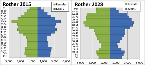
8.35. Evidence from East Sussex County Council (ESCC) is that between 2010/11 and 2014/15 the numbers of people receiving 10-15 hours' support increased by 43% to 425 and those receiving over 15 hours' support per week have increased by 73% to 291. Bexhill has significantly more older people in receipt of high levels of care than anywhere else in the district. Other areas with noticeable demand are: Rye (56% increase from 2010-11 to 2014-15), Battle (57% increase), Ewhurst (143% increase) and Northiam (109% increase).
8.36. Currently there is not a wide choice of options in all parts of the District, although Bexhill has several retirement housing schemes and a new extra care housing scheme in Sidley. There is also a good supply of residential care homes, followed by Battle. In fact, residential care placements have remained broadly unchanged over the last five years and nursing home placements have slightly fluctuated (peaking at its highest during 2014/15).
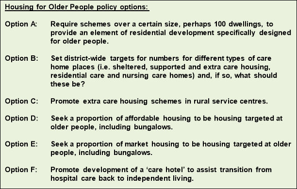
8.37. Further evidence on the range of housing needed over the plan period to meet the needs of people who are unable, or prefer not to continue to live at home for either health or other quality of life reasons, is required. This will be developed in conjunction with the relevant agencies and in consultation with service providers as this Plan progresses.
8.38. In particular, views are sought on the following tentative options, which should be seen as complementary to the existing Core Strategy policy requiring 30% 1 and 2-bed homes in rural areas and to the above proposed policy on accessible and adaptable housing.
QUESTION 9: Do you agree with the policy approaches to:
(22) a) adoption of the national internal space standard?
(17) b) adoption of the optional Building Regulations standards for accessible and adaptable housing?
(21) c) housing for older persons, and the specific policy options highlighted?
If not, what changes would you wish to see?
Self-build and custom housebuilding
8.39. 'Self-build' is where an individual, or a group of individuals, purchases a plot of land and design and build a house to live in. They do most or all of the build themselves. 'Custom-build' is where an individual, or a group of individuals, purchases a plot or plots of land and employs/commissions a builder, architect and, in some cases, a project manager to oversee the build.
8.40. Councils are required to plan for all types of housing, while the Self-build and Custom Housebuilding Act 2015[15] places a duty on local councils in England to keep and have regard to a register of people who are interested in self-build or custom build projects in their area.
8.41. The Council's Register[16] was set up in April 2016, as required by the Regulations. This will be the primary source of data about the demand for plots for self-build and custom housebuilding and will inform the policy approach for the number, location, size and type of self-build and custom-build plots to be planned for across the District. At this point though, it is difficult to determine what level of demand will be generated for self-build and custom housebuilding, as data has only been collected over a relatively short time period.
8.42. Interest shown to date, as at 1st September 2016, amounts to a total of 43 individuals on Rother's self-build and custom housebuilding Register, with 26 individuals indicating a preference in self-build and 17 individuals indicating a preference in custom-build. Figure 4 below shows a breakdown of the type of interest that the Council has received in terms of type of plot and property required, local connection and location preference for both self-build and custom housebuilding.
Figure 4. Breakdown of data from Rother self and custom-build register
|
Type of Plot required |
Type of Property |
Local Connection |
Location Preference |
||||
|
Individual Plot |
26 |
Detached |
24 |
Work in Rother |
5 |
Bexhill |
4 |
|
Individual plot with group of other |
1 |
Specialist housing |
2 |
Live in Rother |
24 |
Hastings Fringes |
2 |
|
No explicit preference |
16 |
No preference |
17 |
No local |
14 |
Battle |
0 |
|
Rural east |
1 |
||||||
|
Rural west |
5 |
||||||
|
No explicit preference |
31 |
||||||
8.43. In the context of the overall housing target of at least 5,700 homes over the plan period, at present this demand, as identified through the Register, is seen as very small (i.e. less than 1% of the overall housing target). It is difficult to determine whether the initial 'rush' of applicants to the Register in the first few months will continue at a similar rate in the future or will not increase much further. This will be kept under review as this Plan progresses, but views are sought on the likely level of need is for self-build and custom housebuilding.
8.44. Once an overall target for new self and custom-build
housing has been identified, consideration needs to be made
in respect of how this housing should be delivered. The
Council presents the following potential options.
External residential areas
8.45. In planning new residential developments, it is important to appreciate that schemes will provide the living environment for people for decades to come. Therefore, all new residential development should be capable of accommodating the reasonable expectations of likely occupiers, in accordance with Local Plan Core Strategy Policy OSS4. This applies to the external areas, which should provide not only sufficient outdoor amenity space but also cater for practical needs, such as parking and refuse/recycling facilities.
8.46. The provision, layout and treatment of external areas should be seen as an integral part of the wider design approach to residential developments, which respects the character of its setting, whether urban or rural, and makes a positive contribution to reinforcing local distinctiveness. Key design principles are set out in Policy EN3 and Appendix 4 of the Local Plan Core Strategy.
8.47. Gardens should be of an appropriate size to provide sufficient, useable amenity space. For family dwellings, this will normally mean a minimum rear garden depth of 10 metres. Garden space for apartment complexes may benefit from individual design solutions to the provision of external amenity space, such as providing courtyards or communal spaces of appropriate and usable size.
8.48. In practice, a number of considerations may affect garden size, including the relationship with adjacent properties and land uses. Where the usability of external space is constrained, such as by sloping ground, orientation or the presence of large trees, or where there is a strong, well-established spacious character, larger gardens will be more appropriate. Overlooking of and from neighbouring properties must also be considered.
8.49. East Sussex County Council's 'Guidance for Parking at New Residential Development' and 'Guidance for Parking at Non Residential Development' has been adopted for use by the Council in the assessment of parking provision in new development proposals. It is expected that parking provision accords with prevailing adopted standards. Moreover, it should be wholly integrated into the layout and design of the proposed scheme and respect and be informed by the character of the locality. Developments should not be dominated by hardstandings or verge parking. The visual impact of parking on the character of the locality and on residential amenities may be mitigated by appropriate use of soft landscaping.
8.50. Refuse and recycling storage and collection facilities should be considered at the beginning of the design process in new development to ensure that:
- Adequate refuse and recycling facilities are provided to serve the development.
- Storage of wheelie bins, communal waste bins and refuse sacks do not detract from the street-scene, obstruct access or detract from residential amenity.
- There is convenient access, both for occupiers of the properties and for the collection vehicles and workers.
8.51. Useful operational guidance has been produced on behalf the East Sussex Waste Management Partnership and should be referred to. It is available to view or download at: http://www.rother.gov.uk/article/4961/Overview-of-the-service
Policy DHG3: External Residential Areas
An integrated approach to the provision, layout and treatment of external areas of dwellings should be taken in accordance with relevant Core Strategy policies and with specific regard to the following:
- Private External Space. Appropriate and proportionate levels of private usable external space will be expected. For dwellings with three or more bedrooms, private rear garden spaces of at least 10 metres in length will normally be expected. In relation to flat developments and complexes, an appropriate level of usable communal amenity space should be provided.
- Car Parking. Car parking provision should be made in accordance with Core Strategy Policy TR4 and should be appropriate to the location, layout and design approach of the development.
- Waste and Recycling. Sufficient bin storage and collection points must be provided on all new residential developments and changes of use. Their siting and design should be considered at the outset, be integral to the development, respect the visual amenities and streetscape character of the dwelling and the area, and be fully accessible for collection vehicles/operatives as well as occupants.
Extensions to residential gardens
8.52. Some householders and other property owners, particularly in countryside locations, seek to enlarge the extent of land in residential use surrounding their dwelling either to accommodate outbuildings, parking or for use as garden.
8.53. While such extensions can be acceptable, a prime objective in rural areas is to conserve the intrinsic value and locally distinctive character of the countryside. In the High Weald Area of Outstanding Natural Beauty, great weight will be given to the conservation of its landscape and scenic beauty. The erosion of countryside character, albeit incremental, and the potential suburbanising effect caused by the enlargement of garden areas should be avoided.
8.54. Hence, any extensions to gardens should be modest in scale (such as to provide sufficient outside area for the reasonable enjoyment of the dwelling or to accommodate essential services) and create a logical new boundary to a natural feature such as a hedgerow, watercourse or woodland or otherwise constitute a "rounding off", which is acceptable in its impact on the rural character of the area.
8.55. Where a garden extension is acceptable, conditions will normally be attached to mitigate the visual impacts including, soft landscaping and where the dwelling's curtilage is extended, removal of permitted development rights for the erection of outbuildings and provision of hard surfaces.
Policy DHG4: Extensions to Residential Gardens
Extensions to the gardens of existing dwellings in the countryside will not be permitted unless the extension:
- is modest in area and the change of use and associated domestic paraphernalia does not harm the rural character of the area; and
- is to a natural boundary or is a logical rounding off.
Extensions, annexes, alterations and outbuildings
8.56. Extensions and alterations to dwellings, including annexes and outbuildings, are often means of enabling people to better meet their housing needs without moving.
8.57. Smaller proposals often don't need planning permission (although generally require approval under the Building Regulations), but more significant proposals generally do require permission and will be considered in terms of:
- impact on the amenities of neighbouring properties;
- relationship with the character and appearance of the principal building; and
- compatibility with the general character of the locality.
8.58. The overall approach to these considerations is set out in the Local Plan Core Strategy, notably Policy OSS4, which requires all development to not unreasonably harm the amenities of adjoining properties and respect the character and appearance of the locality, and Policy EN3 (supplemented by Appendix 4), which requires high quality design.
8.59. Extensions, alterations or new outbuildings can, through their height, size and location, impact on adjoining properties in terms of:
- a loss of sunlight or daylight through overshadowing of habitable rooms or gardens;
- having an overbearing presence through their size and position (generally referred to as its "massing"); and
- result in overlooking or loss of privacy.
8.60. In considering these factors, regard should be given to whether there is a significant change in level between properties, as this may increase the impact of an extension on the amenity of neighbours' homes.
8.61. In assessing proposals, the Council uses the Building Research Establishment's principles in 'Site Planning for Daylight and Sunlight: A Guide to Good Practice'.
8.62. In relation to whether there is an overbearing massing, this tends to arise most commonly where two-storey rear extensions are proposed, particularly on narrow-width terraced properties or closely-sited semi-detached properties.
8.63. Overlooking is most commonly an issue where windows to habitable rooms would directly face those in a neighbouring property, particularly when considering first floor side extensions, and should be avoided. In exceptional cases, obscured glazing may be considered where potential overlooking problems cannot be overcome, or window(s) should be set at an angle to avoid direct overlooking.
8.64. To ensure that an extension or other building relates appropriately to the principal dwelling and its locality, the design approach should draw on an analysis of local character and distinctiveness undertaken in line with Core Strategy Policy EN4.
8.65. Also, in order to demonstrate that a proposal will contribute positively to the character of the site and the surroundings and that due regard is given to how it will relate to both the dwelling and neighbouring development, drawings (elevations and sections) should show proposals in the context of adjacent buildings.
8.66. Either traditional or contemporary design approaches can be appropriate in a particular context; their success dependent on how well they are thought out and detailed. Traditional designs will be expected to follow the distinctive vernacular characteristics of the host building - for example, simple building forms with relatively narrow roof spans, matching storey heights, a materials palette of brick, clay tile (including handmade clay tile in historic areas), timber weatherboarding, steeply pitched roofs, open eaves, small module windows, and traditional joinery styles. Meanwhile contemporary designs will be expected to demonstrate design flair, a skilled handling of materials and crisp detailing.
8.67. In all cases, even where the existing building is architecturally unremarkable, proposals should demonstrate basic design principles of scale, form, massing, height and proportion in relation to the existing dwelling and the wider area.
8.68. A good general principle is to ensure that extensions, especially side extensions, do not dominate the existing dwelling but, rather, are "visually subservient", such that they do not detract from the property's architectural integrity or the character of the street or lane. This can often be achieved by a combination of an appropriate elevational width and scale in relation to the existing dwelling, the setting back of the extension from the front wall of the house, and stepping down of the roof ridge height. Particular care needs to be taken if an extension is proposed to only one side of a property to ensure that a visually balanced front elevation is created. Side extensions should normally seek to maintain external access to rear gardens.
8.69. Retaining sufficient external private space to meet the continuing requirements of the dwelling is an important consideration in proposals for extensions and outbuildings, including the retention of usable and meaningful amenity/garden space and sufficient space for off-street parking and refuse/recycling facilities. This is covered specifically by Policy DHG3.
8.70. Detailing and materials can be critical to a successful extension or other ancillary building. Every effort should be made to retain and, where appropriate, repeat any distinctive architectural features and materials that contribute positively to the character of the building.
8.71. In relation to side extensions, particular care should be taken to avoid infilling the gaps between detached or semi-detached houses where these are an important characteristic of the locality, creating a visual rhythm and density to the street, as it may result in a cramped, 'terracing effect' and detract from the character of the dwelling and the street scene.
8.72. Alterations to roofs to create attic-level accommodation require careful design. Some roofs may not be suitable for conversion if their pitch is too shallow and sufficient headroom cannot not be achieved without protruding above the ridgeline.
8.73. Successful dormer windows are achieved where they are appropriately located within the slope of the roof (and not on the hipped part of a roof) and have due regard to the arrangement and proportions of existing windows. This normally means aligning them over, or set slightly in from windows in the elevations below, and being smaller sized than those below. Overly large or box-like dormers are inappropriate for the majority of domestic properties, as they give the house a top-heavy appearance. Too many dormer windows in a roof slope may also be harmful.
8.74. For historic and other vernacular buildings, and in historic areas, the design and details of extensions and alterations will be carefully scrutinised to ensure that they are consistent with the specific architectural character and form of the existing dwelling and the character and appearance of the area. Converted traditional farm buildings, including barns and oasthouses, are particularly vulnerable to inappropriate extensions, garages, sheds and other outbuildings that undermine the intrinsic character of the building as an example of a particular building typology or would domesticate and detract from the character of the countryside setting.
8.75. Modest single storey outbuildings which are ancillary to the main dwelling and reflect its character and materials can contribute to the character of a locality. The siting of outbuildings, including garages, needs careful consideration in terms of both the relationship with the main house - particularly if it is of heritage value – and the wider street-scene – avoiding cramping or cluttering the site or adversely affecting the amenities of neighbouring properties. Discreet siting is generally preferred, as siting buildings in front of the main house often dominates the plot frontage, detracting from the appearance of the dwelling in the street scene. In rural areas, especially within the High Weald AONB, it is important that outbuildings conserve landscape character and qualities and do not 'suburbanise' this sensitive countryside.
Policy DHG5: Extensions, Alterations and Outbuildings
Extensions, alterations and outbuildings to existing dwellings will be permitted where:
- they do not unreasonably harm the amenities of adjoining properties in terms of loss of light, massing or overlooking;
- they respect and respond positively to the scale, form, proportions, materials, details and the overall design, character and appearance of the dwelling;
- they do not detract from the character and appearance of the wider street-scene, settlement or countryside location, as appropriate, in terms of built density, form and scale;
- they leave sufficient usable external private space for the occupiers of the dwelling in accordance with Policy DHG3;
- where appropriate, they fully respect and are consistent with the character and qualities of historic buildings and areas;
- in the case of extensions and alterations, they are physically and visually subservient to the building, including its roof form, taking into account its original form and function and the cumulative impact of extensions; and
- in the case of outbuildings, through their siting, scale and massing, design and appearance and materials, they respect and respond positively to the character, appearance and setting of the main dwelling within its plot and the wider street-scene or general locality.
Annexes
8.76. A residential annexe is defined as accommodation ancillary to the main dwelling within the residential curtilage that provides additional semi-independent accommodation for members of the same family, often older family members who may need assistance with health care. There are an increasing number of people who, although capable of living relatively independently, would benefit from living close to relatives or carers on whom they can rely for help and support. While this may sometimes be met through the purchase of a nearby property, in other situations residential annexes provide for the carer or relative to be on hand at short notice to provide care and support, including through shared facilities.
8.77. The general principle is to support such accommodation where it is needed in a way that enables it to be most effectively incorporated into the dwelling and site.
8.78. Annexes can be provided in the form of an extension to the dwelling, the conversion of an existing outbuilding or in some cases a new detached building. An extension to the dwelling is normally most appropriate, as this better integrates the annexe into the dwelling for use of shared facilities and providing ready access, normally also minimise the impact on neighbours, and provides advantages for the longer-term use of the annexe, reducing pressure for future, inappropriate development.
8.79. For this reason, a sequential approach is taken for proposals for annexes by firstly looking at whether the required accommodation can be provided in the form of an extension to the dwelling; if not, then, seeing whether an existing outbuilding within the residential curtilage could be converted; if not, then considering the potential for a new separate annexe building located in close proximity to the existing dwelling. Exceptions to this approach may be where the extension of an existing dwelling would not be appropriate, for example in some cases that relate to listed buildings, non-designated heritage assets or historic agricultural buildings.
8.80. In all locations annexe accommodation should respect the character, scale and design of the existing dwelling and not adversely affect the living conditions of occupiers of neighbouring properties, in the same way as set out in the policy for extensions, alterations and outbuildings above. The size of the annexe will need to be demonstrated to be that necessary to meet the intended purpose, normally with one bedroom, and demonstrate that it will be capable of being incorporated into the use of the dwelling in the longer-term.
Policy DHG6: Residential Annexes
The creation of residential annexes will be permitted normally in accordance with a sequential approach that considers, in order:
- an extension to the dwelling;
- the conversion of an existing outbuilding within the residential curtilage that is located in close proximity to the dwelling; and
- a new building that is located within the residential curtilage in close proximity to the existing dwelling and has a demonstrable link to the main dwelling, such as shared access (including both vehicular access and doorways), communal parking and amenity spaces, where appropriate.
The suitability of proposals will also be considered against the criteria of Policy DHG5 above to ensure that they are appropriate in terms of the existing dwelling, surrounding area and amenities of occupants of nearby properties.
In all cases, the occupation of the annexe shall be managed by planning condition or legal agreement to ensure that the accommodation is tied to the main dwelling, cannot be used as a separate dwelling and cannot be sold separately.
Boundary treatments, accesses and drives
8.81. Boundary treatments, accesses and drives play a significant role in defining the character and appearance of a locality; they can make a positive contribution to the successful integration of new development and to reinforcing local distinctiveness.
8.82. The height of boundary treatments, as well as any gates or gate piers, needs careful consideration. It is normally expected that where a development involves boundary treatments, these should be similar in height to the prevailing height of existing boundaries in the area. Also, where there is a repeated style of boundary treatments, for example low walls, railings or an open plan, boundary-free approach, then the Council will normally expect any development proposal to follow the predominant style in the vicinity and to maintain and strengthen the existing character of the street scene.
8.83. In terms of the forms of enclosure, close-boarded fencing provides screening for privacy and has less impact when used to enclose rear gardens not subject to public view, but is not always appropriate.
8.84. Open post-and-rail fencing on frontages has the advantage of maintaining the natural and open character, while estate railing can also be an appropriate boundary treatment in certain rural areas. However, the predominant boundary type in the rural areas consists of mature trees, hedges and ditches, which are in keeping with the rural scene and provide a continuity of characteristic landscape.
8.85. In contrast, the construction of close boarded fences and walls along road frontages can punctuate and detract from the more natural and open character of rural areas and lanes, particularly in the High Weald AONB. The same may apply in urban areas where hedges predominate.
8.86. If solid enclosure is necessary, a fence may be set back from the boundary with sufficient space for planting of a hedge in front, with sufficient room that, when mature, it will sit 'in-line' with any existing adjoining hedging or other boundary line.
8.87. Occasionally, there may be a stretch of historic brick or stone walling denoting an historic estate boundary; such boundary treatments should be retained and conserved.
8.88. More generally, hedges and trees that define historic field boundaries, especially within the High Weald AONB, are regarded as important components of landscape character, as noted in the Environment Chapter; hence, their retention is normally expected.
8.89. To reinforce local character, in specifying any new hedging, where a particular type of hedging or tree species is predominant, new planting should be of the same species. In the AONB and other rural areas, native species of planting, such as a traditional mixed hedge of hawthorn, field maple, beech, and hornbeam is characteristic, sometimes with trees such as oak, cherry or ash. Meanwhile, in suburban, village and town centre areas, the Council would normally seek species such as laurel, hazel, holly, yew, box, hornbeam and beech.
8.90. A particular issue can arise where a new access or driveway is sought in order to create a parking area at the front of a property which would result in the loss of boundaries, especially hedges, that contribute positively to the character of the street scene. This will require careful balancing of amenity, character and highway safety considerations. Careful siting is required to minimise the amount of any hedge loss and such loss would be expected to be mitigated by replanting with matching species behind the sight lines of the access.
8.91. Where a new access is to be created, care should also be taken in the design and materials choices to match the character of the locality, for example in the width of the access and corner radii (subject to highway safety requirements), surfacing materials, provision or not of any kerbing materials, and treatment of verges, particularly to ensure that the works would not suburbanise the character of the rural areas.
Policy DHG7: Boundary Treatments
Planning permission for new or altered boundary treatments, including fences, walls, gates and gate piers and hedges (where they are part of a wider layout plan) will be supported where:
- it does not involve the loss of existing boundary structures of historic or architectural interest;
- the proposed boundary treatment, by virtue of design, height, and materials or species, is consistent with the character of the locality;
- in the rural areas, it would not, by virtue of its siting or appearance, adversely impact on the undeveloped character of the countryside, nor, by virtue of its design and appearance, introduce a suburban or urban feature into the rural area; and
- it is considered acceptable in terms of highway safety.
Policy DHG8: Accesses and Drives
Proposals for new drives and accesses will be supported where:
- they are considered acceptable in terms of highway safety;
- in the rural areas, where they would, by virtue of their location and design and materials, maintain the rural character of the locality; and
- they involve the relocation of an existing access, if there are highway benefits of relocating the existing access, and the existing access will be stopped up.
9. Economy
Shopfronts and advertising
9.1. Shopfronts[17] and advertisements form an integral part of commercial streets and of town and village centres in the District. They play an important role in helping to create an attractive retail environment and, as such, contribute to economic vitality.
9.2. While advertising and signage generally convey important information and are valuable in promoting business activities, they can have a significant impact on the appearance of buildings and areas. Unduly prominent or poorly designed signage can detract from the character of a building, the townscape or village street scene or of the countryside within which it is located. Furthermore, if uncontrolled, it can lead to roadside clutter and distract drivers.
9.3. In order to protect the amenities of an area, it is important that all signs and advertisements, whether on a building or freestanding, are carefully designed and of an appropriate scale, detail, materials and colours.
9.4. Traditional shopfronts, such as the late Victorian/early Edwardian ones found in the planned shopping streets of Bexhill-on-Sea or those inserted into the medieval buildings of the market towns of Battle and Rye, are important because they provide active frontages and make a positive contribution to the character and appearance of those historic centres. Without careful attention though, it is easy to gradually erode the character of traditional shopfronts and historic street-frontages and to lose or obscure important building features.
9.5. It follows that there should be a general presumption that the original fabric and detailing of historic shopfronts, such as stallrisers, cornices and pilasters, windows and decorative tiling, should be retained and restored. More generally, any new shopfront should relate well to the building and to its overall setting in the street scene, in terms of its proportions, design, relationship to upper storeys, fascia height and width, mullion treatment, materials and colour. Most common issues relate to the introduction of unsympathetic deep fascias and internally illuminated signage.
9.6. Canopies and blinds may be successfully integrated into a traditional shopfront if carefully detailed and not unduly dominant. However, the use of modern materials such as acrylic sheeting, perspex, aluminium or plastic, is rarely appropriate for traditional shopfronts on historic buildings in a Conservation Area.
9.7. There is particular concern around the introduction of solid external roller shutters, which can have a "deadening", inhospitable effect on the street scene. Where security measures are essential, alternatives such as the use of an internal lattice shutter or laminated glass represent more sensitive approaches.
9.8. Fascia signs are the most common form of advertisement on a building and should be designed to appear as an integral part of it in terms of their positioning, height, size, design and materials. Similar considerations apply to hanging signs, while modern projecting, usually illuminated box signs, can be particularly cluttering and discordant features on shopfronts and in the street scene.
9.9. Where shops or other commercial premises lie within a Conservation Area, it is particularly vital that shopfronts, signage and advertisements are well designed and detailed, and relate to their surroundings. Projecting box signs are very unlikely to be appropriate within Conservation Areas.
9.10. The Council has adopted specific guidance for shopfronts and signage within Bexhill-on-Sea Town Centre Conservation Area[18], in recognition of the special architectural character of the shopping terraces that were constructed within a very short period of time at the end of the 19th century and beginning of the 20th century.
9.11. The illumination of all signs and advertisements needs sensitive consideration and be restrained in their quantity and brightness. Within the town centres of Bexhill, Battle and Rye, some night-time illumination of shops and other commercial premises helps to promote a vibrant and safe evening economy. Elsewhere, the illumination of signs on buildings, including hanging signs, is normally only justified where it relates to late-opening premises such as a public house, restaurant, chemist or similar. At the same time, consideration must be given to the amenity of residential properties.
9.12. In rural areas, advertisements, especially illuminated signage, need to be strictly controlled, in the interests of maintaining the generally undeveloped landscape character and amenities of the countryside, preventing "clutter", maintaining highway safety and dark skies. Hence, the general approach is to limit its amount and siting to locations close to the premises.
9.13. In view of the sensitivity of the District's historic town centre retail areas, villages and largely AONB countryside, it is intended that further guidance on signage and advertisements will be produced.
Policy DEC1: Shopfronts and Advertising
Any proposal for a new shopfront, alteration to existing shopfront (including external blinds) and signage on buildings will be permitted where it relates appropriately to the architectural and historic character and appearance of the building in which the shopfront is located, to its overall setting in the street scene, and impact on public safety, having regard to its proportions, size, design, visual relationship to upper storeys, materials, colour, height and width, and illumination.
Particularly within Conservation Areas, the loss of features or fabric of historic, architectural and/or socio-cultural merit or the installation of external roller shutters will not normally be acceptable.
Free-standing signage and advertisements will be
permitted where they have an acceptable impact on amenity,
including on the scenic, architectural and historic character
of the locality, having regard to the relevant features in
paragraph 1 above. They should have a close physical
relationship to the premises that they serve, have an
acceptable impact on highway safety and, in rural areas, not
detract from landscape character nor introduce unnecessary
"clutter" into the countryside.
Holiday Sites
9.14. Short stay holiday accommodation provided by chalets or lodges, caravans and camp sites contributes significantly to the local economy. However, its promotion has to be balanced against the protection of the countryside and coastal areas, which are the very assets that makes the District attractive to visitors.
9.15. The overarching policy approach in the Core Strategy is to support tourism activities and facilities, giving encouragement to increasing the supply of quality serviced and self-contained accommodation, including through upgrading older facilities, while ensuring compatibility with other policies, especially those that protect landscape character and rural amenities.
9.16. Caravan and camping holidays take different forms and leisure patterns change over time. Historically, a significant amount of tourist accommodation in the District has been provided on static sites and especially in caravans. Most sites are situated near the coast and laid out in traditional forms. However, they can impact adversely on the special character of the Rother countryside and particularly on an otherwise undeveloped coastline or the High Weald Area of Outstanding Natural Beauty (AONB). Coastal areas are also most often vulnerable to flood risk. Hence, the provision of any new holiday centres or large static caravan/chalet sites would be most unlikely to be appropriate in the countryside.
9.17. Many of the existing larger holiday sites are owned by national holiday companies and it is in the nature of the business for operators to look to upgrade facilities regularly to meet new demands on these sites. The upgrading of sites, for example replacing static caravans with chalet or lodge-style units, can be positive in terms of better meeting customer needs and where the impact on the wider landscape is unaffected. In some circumstances, in order to make the best use of land in upgrading facilities on a site, and where there are benefits to be achieved to the character of the area, a limited expansion of an existing site may be permitted if this represents a sensitive extension of that site.
9.18. In recent years, as the nature of caravan and camping holidays in this country has become more diverse, the trend nationally has been to move away from seasonal controls on permanent sites to allow all-year-round use.
9.19. It is essential that holiday sites remain available as tourist accommodation and do not develop, or become seen, as low cost homes to be purchased or occupied by persons without a permanent residence elsewhere. As well as the loss to the tourism economy, permanent residential occupation has further impacts, notably in terms of traffic and the demands on local service, including schools.
9.20. Hence, established practice is to impose conditions on any new permissions to the effect that any unit is only occupied for holiday purposes and not as any person's sole or main place of residence; also, that the owners/operators of the site should maintain an up-to-date register of the names and main home addresses of all occupiers of the holiday units and make this available to the local planning authority.
9.21. Changing leisure patterns bring other demands, often for short stay breaks in low key, high quality, self-catering accommodation. These may be accommodated in the natural countryside environment where the scheme involves limited ancillary facilities and generates minimal traffic.
9.22. In addition, accommodation serving other countryside uses, for example existing fishing lakes or equestrian facilities, may also be favourably considered where any new buildings can be incorporated in the landscape and the accommodation is wholly ancillary to and an integral part of the principal leisure use.
9.23. There is somewhat more scope for further seasonal touring caravan and camping pitches on temporary small-scale sites provided in the summer months where these can be visually contained within the rural landscape. In recent years new forms of camping – the rise of 'glamping' for example – have become more popular, often taking place on small areas of working farms as part of farm diversification. Again, additional seasonal sites will be limited to holiday use and the occupation period will be restricted to prevent use all year round (ordinarily allowing use between April and October).
9.24. In all cases, the protection of local landscapes will be paramount and proposals should not adversely impact on the particular characteristics of the High Weald AONB or other sensitive areas, such as those protected for nature conservation reasons.
9.25. Some significant areas of the District are at risk from both coastal and fluvial flooding. For both permanent and seasonal tourist accommodation, the provision of new sites or the extension of existing seasonal occupancy periods is unlikely to be agreed in undefended areas of high flood risk unless a Flood Risk Assessment has satisfactorily demonstrated that the appropriate minimum standard of flood defence will be provided and it would not impede flood flows or otherwise prejudice floodplain storage. Fluvial flooding from rivers can occur at any time of the year and therefore highly vulnerable uses such as touring and static caravans, tents should ideally be located outside the floodplain or be adequately defended, with any residual flood risk mitigated for on the site. Flood Risk Assessments will also be required for applications in defended areas to assess any residual flood risk to the site. These should include regard to the impact of hardstandings and other impermeable surface treatments. Restrictions on occupation will be imposed where there is a high risk of flooding.
9.26. Opportunities for other types of holiday accommodation are dealt with by other policies of the Plan.
In the countryside, camping, caravan and purpose-built holiday accommodation will only be acceptable in the following circumstances:
a) In all cases, the proposal:
- must have an acceptable environmental impact especially when viewed from public vantage points;
- must not significantly detract from the needs of agriculture;
- must not adversely affect the amenities of residents in nearby dwellings;
- must be accompanied by landscaping proposals appropriate to the local landscape character;
- must not be in an area that is not defended against the 1 in 100 year fluvial or 1 in 200 year tidal flood event;
- must not harm the rural character of the area where there is any increase in the site area or new structure; and
- must meet other policies of the Plan.
b) In relation to new permanent accommodation, is either:
- a proposal of a modest scale for low key, high quality self-catering accommodation that requires only limited ancillary facilities and can be accommodated within the natural environment, or
- a proposal that comprises a limited amount of accommodation to enhance another existing countryside recreational use and is wholly ancillary to that use.
c) In relation to static caravan, chalet or lodge accommodation within an existing site, is either:
- a proposal that would result in a significant improvement in the appearance and quality of accommodation of that site, or
- a proposal for the limited extension of that site to a natural boundary, and makes a significant improvement in the appearance and quality of accommodation.
d) In relation to a touring caravan or tented camping proposal, it is of a small scale appropriate to the area and, where the temporary use of land is permitted, any ancillary facilities necessary to serve the site will only be permitted on a similar temporary basis or, if they are of a permanent nature, are compatible with the local character of the area.
e) In order to prevent the residential use of permanent accommodation intended for solely for tourists, the occupation of holiday chalets, lodges static holiday caravans, touring caravans and camping sites will be restricted to holiday/leisure purposes only and will be subject to occupancy conditions relevant to the site.
Existing employment sites and premises
9.27. Planning for improved job opportunities is a fundamental part of the Council's overall development strategy as contained in its adopted Local Plan Core Strategy (2014). Hence, it sets targets for the amount of additional business floorspace on employment sites[19], alongside those for housing growth. The business floorspace targets are expressed as minima, reflecting the objectives of the strategy to increase overall prosperity, improve access to a wider range of jobs and increase economic activity at a realistically achievable level, but without setting a cap on economic growth.
9.28. Core Strategy policies EC2 – EC5 provide a strategic framework for how business floorspace targets are to be met. Policy EC2 identifies the need for a broad range of supply to be available. It looks for the majority of space to be on sites opened up by the construction of the Bexhill to Hastings Link Road (now open and called Combe Valley Way) and to an increase in the supply of high quality sites, as well as a spread of small and medium-sized sites and premises across the District, especially in settlements with good strategic access. This includes access to the sea, provided at the Port of Rye. It also sees mixed-use developments as a potentially valuable opportunity to deliver jobs growth in parallel with housing, including in relation to providing offices in central locations.
9.29. Core Strategy Policy EC3 recognises that existing employment sites will continue to provide the large majority of accommodation to meet the needs of businesses. On this basis, it puts forward a policy to make effective use of existing sites and premises in terms of:
- retaining land and premises currently (or last) in employment use in such use unless it is demonstrated that there is no reasonable prospect of its continued use for employment purposes or it would cause serious harm to local amenities;
- permitting intensification, conversion, redevelopment and/or extension having regard to other policies of the Plan;
- facilitating access/environmental improvements, where appropriate; and
- in circumstances where a continued purely employment use of a site/premises is demonstrated not to be viable, looking firstly at mixed-use schemes in order to make most effective use of the property for employment purposes; if a mixed use scheme is not viable, prioritise alternative community uses, affordable housing and then market housing, subject to local needs.
9.30. At the same time, this policy is made subject to a full review of existing and potential sites for employment use, in tandem with looking to allocate sites, to ensure that the requirements are secured in an effective way.
9.31. This Review has been completed and its findings form the basis of the further consideration of Policy EC3 – set out below - as well as the allocation of additional sites.
9.32. The Review also has regard to Core Strategy Policy EC4, which provides for:
- continuing to give priority to the re-use and adaptation of suitable buildings in the countryside for employment (including for tourism purposes), in accordance with the Rural Areas policies;
- incorporating an appropriate level of business development within residential allocations and developments to contribute to the overall development strategy, where such accommodation is otherwise appropriate in the site circumstances; and
- facilitating (where permission is required) business activities operating from residential properties wherever there is no adverse impact on local character and amenities, including by traffic generation.
9.33. Policy EC5 further requires particular regard to meeting the needs of key sectors, notably "enviro-industries", engineering, financial and business services and other growth and knowledge-based businesses, and those that are directly related to sensitive land management.
Employment Sites Review
9.34. The Employment Sites Review has been published and is available to view under 'Background Evidence Studies' in the Planning Policy section of the Council's website. It firstly identifies the national and local policy framework for the review, including the employment land requirements of the Core Strategy (which are adopted and not themselves being reviewed), then undertakes an assessment of the function and capacity of all the more significant estates and areas, supplemented by a sample of 13 smaller areas distributed across the District, as shown on Figure 5 overleaf. It then looks at potential of committed, allocated and vacant sites and, finally, at options for providing additional land. The distribution of the areas/estates is shown on Figure 5 below.
Figure 5. Employment Sites – Rother
9.35. The main findings of the review are:
1) of the 21 larger areas/estates (over 2ha in towns or 1ha in rural areas), there is a good distribution across the District, albeit the amount in Rural Areas is skewed by the size of the British Gypsum's operational area. Harbour Road, Rye is by far the largest estate, with Beeching Road, Bexhill being the only other estate over 10ha;
2) looking at the typologies of the areas, there is a severe lack of high quality office and business park sites capable of attracting inward investment of high-growth companies and/or headquarters;
3) there is a very high occupancy level across both the larger areas/estates and the sample of small business areas;
4) all of the identified sites perform valuable functions, a few of which have the potential for intensification of space within their current boundaries, but only a couple have scope for outward expansion;
5) of the 7 areas/estates with intensification potential, 3 of these are already recognised through planning permissions, with Harbour Road, Rye having by far the greatest potential, with over 15,000sqm of floorspace benefiting from an outstanding planning permission;
6) the main estates in Bexhill and Battle - Beeching Road, Bexhill and Station Approach, Battle – are both identified as having potential for redevelopment although the former may also meet an unmet retail requirement, so a net loss of B-class space is more likely;
7) for all the business areas that are the subject of Neighbourhood Plans, further consideration of both development needs, in terms of local business needs and market potential, should be undertaken as part of those plan-making processes;
8) for Bexhill, the earlier 2006 Local Plan (Policy BX3) allocation for 'land north of Sidley' will provide for enough further high quality space to meet the needs of the town and the wider area, but should be complemented by other provision for modern office and light manufacturing/workshop space via intensification at Elva Way and as part of the approved mixed-use development off Barnhorn Road;
9) also at Bexhill, the option of a high tech/R&D/office scheme in a "campus" setting at the former Northeye site a little to the west of the town is mooted;
10) for the Hastings Fringes, it finds that the Core Strategy business floorspace requirement may be appropriately met by the outstanding 2006 Local Plan allocation (Policy HF1) to the north of Burgess Road on the Ivyhouse Lane Estate, but supplemented by a further small extension to marry in with ones proposed by Hastings Borough Council on adjoining land;
11) existing sites are expected to meet some two-thirds of the 10,000sqm Core Strategy requirement for Battle (which embraces sites in Marley Lane, albeit some sites are in Sedlescombe parish), while a previously allocated site on the south side of Marley Lane is still expected to come forward to contribute to the balance;
12) there is found to be scope for intensification (and possibly expansion) at the Rutherfords Business Park, as well as at the Station Approach Business Area; hence, it is recommended that these are further investigated through the ongoing Battle Neighbourhood Plan;
13) for Rye and Harbour Road, it notes that the lower end of the minimum floorspace target is already provided for by outstanding planning permissions at Harbour Road Industrial Estate but adds that, given its strategic role, identified opportunities for further intensification would most appropriately be provided for by an enabling policy, which would also need to fully acknowledge the need to not adversely impact on the surrounding nature conservation designations;
14) at the same time, encouragement is given to Rye Town Council, through its Neighbourhood Plan, to consider the potential to promote higher density office-led schemes in more central locations;
15) the Rural Areas have seen most business development in recent years, as well as accounting for the greatest amount of floorspace with full planning permission, which together approximate to the minimum floorspace target;
16) these findings point to the role that rural areas are playing in meeting the accommodation requirements of businesses and, hence, to the economic growth of the District, and it is recommended this trend should not be frustrated;
17) there are obvious difficulties in identifying further sites in rural areas, due to both development economics and environmental constraints, compounded by the fact that supply is very fragmented and tends to be occupier-led; and
18) hence, for the Rural Areas, the most appropriate approach is regarded as taking a criteria-based approach to further business development, supported by continued application of the policy of resisting the loss of existing business sites and floorspace to other uses unless there is very clear evidence that it is not needed and the application of Core Strategy Policy EC4.
9.36. The finding in respect of drawing on the potential of existing sites and premises in rural areas is directly relevant to the Core Strategy Policy EC3. Indeed, it is clear from the assessment of the business estates and areas in the towns as well that the continued presumption to retain existing employment sites is justified across the District.
9.37. Notwithstanding this, there are a few instances where retaining employment sites are not found to be warranted. Alternative proposals are put forward in the relevant settlement sections in this Plan or can be expected to come through the relevant Neighbourhood Plan.
Policy DEC3: Existing Employment Sites and Premises
Effective use of existing employment sites will be secured by:
- land and premises currently (or last) in employment, including tourism, use being retained in such use unless it is demonstrated that there is no reasonable prospect of its continued use for employment purposes or it would cause serious harm to local amenities;
- permitting intensification, conversion, redevelopment and/or extension having regard to other policies of the Plan;
- facilitating access/environmental improvements, where appropriate; and
- where continued employment use of a site/premises is demonstrated not to be viable, permitting complementary enabling development as part of an overall scheme to make most effective use of the property for employment purposes; if a mixed use scheme is not viable, prioritising alternative community uses, affordable housing and then market housing, subject to local needs.
9.38. This policy will effectively supersede Core Policy EC3 as the strategic policy in respect of existing employment sites.
9.39. Cross-reference is made to Policy DCO1 in the Communities Chapter in relation to the marketing that would be expected in order to establish whether there is a reasonable prospect of continued business use of a site.
10. Environment
Landscape and the High Weald Area of Outstanding Natural Beauty
10.1. The importance attached to maintaining and reinforcing landscape character across Rother district is clearly set out in Chapter 17 - Environment of the Local Plan Core Strategy. Its 'landscape stewardship' Policy EN1, identifies the principal landscape assets and provides an over-arching framework to ensure that new development makes a positive contribution to the landscape character of the area in which it is to be located.
10.2. Landscape character varies across the district. At a national scale, much of Rother falls within the 'High Weald' national character area (NCA), with the south-eastern part in the 'Romney Marshes' area and a small swathe of land west of Bexhill in the 'Pevensey Levels' area. The boxes below summarises the key characteristics of each NCA in Rother district:
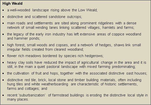
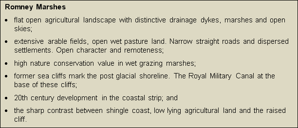
10.3. Within these unique regional areas with similar landscape character[20], the East Sussex Landscape Character Assessment (LCA) provides more detailed descriptions at a local level, reflecting the particular pattern of elements derived from geology, landform, topography, flora and fauna, physical features and settlement. The LCA Index Map, as it relates to Rother is reproduced below. The key features and "action priorities" for each character area are identified in the Assessment document.
Figure 6. Local landscape character areas in Rother
10.4. Due to their nature conservation status and consequent very limited development, the Pevensey Levels and Romney Marshes enjoy high degree of tranquility, at least for the most part. Even though never far from a farm, some small-scale scattered dwellings or settlement, the same is true of large swathes of the High Weald. East Sussex County Council published 'Remoteness at the Local Scale – An Application in East Sussex' some time ago; its identified 'areas of remote countryside' and areas of exceptional remoteness' are still helpful maintaining the peace and tranquility of remote rural areas.
10.5. One aspect of this rurality is the existence of "dark skies"; that is, the relatively limited amount of night glow from street lights and other sources. Characteristics of tranquility and dark skies are valued by local people. A separate policy in relation to lighting, put forward in the Environmental Pollution section, provides a policy basis, and associated guidelines to assist in maintaining these characteristics. Particular care will be taken, over and above the regard to the features of local landscape, to the feeling of remoteness that exists when a site is physically and visually separated from the noise and activity of urban areas, as well as from associated features and activities (such as busy roads, pylons, sport and leisure venues, etc.).
The High Weald Area of Outstanding Natural Beauty
10.6. The High Weald is of national as well as local landscape value, as reflected by its designation as an Area of Outstanding Natural Beauty (AONB). Also, its landscape is defined in the High Weald AONB Management Plan in terms of the interplay of the "components" that make it distinctive. These key features, which are mapped and published on the High Weald AONB website, are:
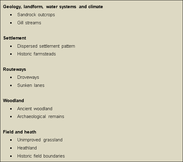
10.7. National policy (NPPF paragraphs 109, 113, 123 and 125) highlights the need to recognise the intrinsic value of landscape and countryside to local identity and sense of place, and the great weight attached to conserving and enhancing the landscape and scenic beauty of AONBs (paragraphs 115, 116).
10.8. It follows that a proper understanding of the local landscape, which will include its historic characteristics, is necessary in order to produce developments that meet these objectives.
10.9. In assessing landscape impact, the High Weald components and/or the characteristics of the relevant Landscape Character Area provide an appropriate assessment framework for evaluating the siting, layout and design (including materials) of development. For example, existing landscape features that are important to local character should normally be retained, with new features that are typical of the locality, fit naturally into the landscape and complement existing features also incorporated into developments.
10.10. The scale of development is also sensitive to its location. While new development is not ruled out, national policy seeks to restrict major development in AONBs. A certain level of development has already been accepted through the Local Plan process as being capable of being satisfactorily and sustainably accommodated in and around the towns and villages within the AONB. However, given that the High Weald is essentially a "small scale" landscape, further major development over and above that necessary to meet local housing and other needs will rarely be justified in the public interest.
10.11. The following policies elaborate on the relevant Core Strategy policies in respect of promoting landscape-led approaches to the consideration of the suitability of development proposals, both generally and with specific regard to the High Weald AONB. They should be read in conjunction with Core Strategy policies EN1-EN5 and RA2, as well as other policies in this Plan, notably those relating to sustainable drainage and biodiversity and green space. It is also noted that developments for housing, business, solar and wind farms, recreation and tourism uses are each the subject to separate policies in the Local Plan, with the emphasis on locations outside of environmentally sensitive areas and, where appropriate within them, on a small scale.
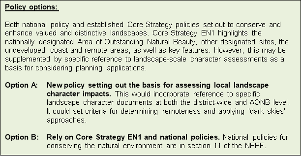
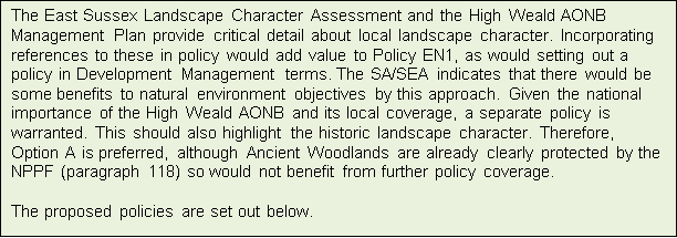
Policy DEN1: Maintaining Landscape Character
The siting, layout and design of development should maintain and reinforce the natural and built landscape character of the area in which it is to be located, based on a clear understanding of the distinctive local landscape characteristics (see Figure 6 above), in accordance with Core Strategy Policy EN1.
Particular care will be taken to maintain the sense of tranquility of more remote areas, including through maintaining 'dark skies' in accordance with Policy DEN6.
Policy DEN2: The High Weald Area of Outstanding Natural Beauty (AONB)
Development within or affecting the setting of the High Weald AONB shall conserve and seek to enhance its landscape and scenic beauty, having particular regard to the impacts on its character components, as set out in the High Weald AONB Management Plan.
Such development should be small-scale, in keeping with the landscape and settlement pattern. Except where necessary to meet strategic development requirements and demonstrated to have acceptable environmental impacts having regard to alternatives taking into account mitigation, major development will be resisted.
Strategic Gaps
10.12. Strategic Gaps are regarded to be of strategic importance in terms of guiding the location of development. The particular objectives of the Gaps are:
- To maintain the separate identity and distinctiveness between settlements.
- To maintain the strategic settlement pattern.
- To prevent the coalescence of settlements.
10.13. Their protection through local plans is an established policy tool. They were defined and protected in the Rother District Local Plan 2006 (Policy DS5 refers). Development within these Gaps has been strictly limited to maintain their openness, although does allow for agricultural buildings, conversions and the replacement of an existing building.
10.14. The principle of these Strategic Gaps has been carried forward in the Council's adopted Local Plan Core Strategy (2014) where policies HF1 and RY1 highlight the need to maintain the Gaps between:
- Bexhill and Hastings/St Leonards
- Battle and Hastings/St Leonards
- Crowhurst and Hastings/St Leonards
- Fairlight and Hastings/St Leonards
- Rye and Rye Harbour
10.15. Accordingly, there is a need to now review the actual extent of these Gaps as previously defined and redefine them through this Plan in line with the above objectives.
Review of the extent of the Strategic Gaps
10.16. East Sussex County Council County's Landscape Officer has undertaken a full assessment of the extent of the five identified Gaps within the District. The Assessment produced the following outputs:
- An assessment of the landscape of each Gap to review its current quality, value and condition. The sensitivity of the landscape to change and vulnerability to potential development pressure.
- A visual analysis of the Gaps, including an assessment of the visual characteristics of the urban edges, views and identification of visually intrusive elements of the Gaps.
- Analysis of the effectiveness of the physical and visual state of the current Gap boundaries.
- Guidelines for landscape management and enhancement which would strengthen the Gap landscapes.
10.17. Further details can be found in the Strategic Gaps Landscape Assessment, March 2016 which has been published as a Background Paper.
10.18. The findings for each Gap are summarised below. They should be read in conjunction with Figure 7 - in relation to the Strategic Gaps between Bexhill and Hastings/St Leonards, Crowhurst and Hastings/St Leonards, Battle and Hastings/St Leonards, Figure 8 - in respect of that between Fairlight and Hastings/St Leonards, and Figure 9 - for the Gap between and Rye and Rye Harbour.
Bexhill and Hastings/St Leonards
10.19. The Gap between the two towns is relatively small, being particularly narrow along the A259 corridor, and hence highly vulnerable to development pressures that would compromise the Gap objectives.
10.20. The perception of the Gap between Bexhill and Hastings has been subject to considerable change recently with the construction of Combe Valley Way, which opens up the countryside between Bexhill and Hastings/St Leonards.
10.21. Given the new views from Combe Valley Way and the Greenway which provides a pedestrian/cycle/bridleway route from Bexhill to St Leonards, it is recommended that the boundaries of the Gap are extended to encompass the Combe Haven valley and its tributary valleys in order to protect this open landscape between the two settlements. The small area of land within Glyne Gap which is in Rother District should also be included in the Gap boundary.
Crowhurst and Hastings/St Leonards
10.22. Whilst the Gap defined in the 2006 Local Plan still generally reflects the policy objectives, the omission of the area between the built up edge of Crowhurst and the Hastings to London railway line would leave this area vulnerable to development. From a landscape character and visual perspective, this land is an important part of the open area between the settlements and it is recommended that this is included in the Gap boundary.
Battle and Hastings/St Leonards
10.23. The Gap between Battle and Hastings/St Leonards, as defined in the 2006 Local Plan, still generally meets the policy objectives. However, the area to the west of Forewood Lane on the southern edge of Battle, behind existing frontage development along Hastings Road is found to not contribute to separation between the towns, even though it is valuable as part of the High Weald AONB setting of Battle and therefore still protected by countryside and AONB policies. It is recommended that the western boundary of the Gap is reviewed to follow an alignment along Forewood Lane as this would not compromise the effectiveness of the Gap between Battle and Hastings.
Fairlight and Hastings
10.24. The Gap between the Hastings Borough boundary and the edge of Fairlight Cove provides an important function in protecting the general openness of the area between the Hastings Country Park and the edge of the settlements of Fairlight and Fairlight Cove. While the 2006 Local Plan excluded developed land in this area, it is vulnerable to incremental change and infill development. It is recommended that these areas are included in the gap to conserve the open character of the gap between Fairlight and Fairlight Cove.
Rye and Rye Harbour
10.25. The Gap between Rye citadel and Harbour Road industrial area and Rye Harbour village does provides an important function in retaining the separate and distinct identity of the two settlements. The area is fragile and vulnerable to encroaching development and incremental changes in landscape management. The retention and protection of this Gap area is important to the conservation and enhancement of local landscape character and views especially with regard to the setting of the Citadel. A small extension to the Gap to also incorporate the sensitive riverside margin is recommended, as this is contiguous with and inseparable from the Gap landscape.
Conclusions
10.26. It is proposed that the Strategic Gaps be refined as recommended by the recent Strategic Gaps Landscape Assessment for the reasons set out above. This is supported by the Sustainability Appraisal, which found that, generally, the recommended boundaries somewhat better meet environmental objectives. In respect of the Hastings-Battle Strategic Gap, the revision is seen as more appropriate in terms of the specific function of the Gaps, as set out in the Core Strategy.
Figure 7. Strategic Gaps between Bexhill and Hastings/St Leonards, Crowhurst and Hastings/St Leonards, Battle and Hastings/St Leonards
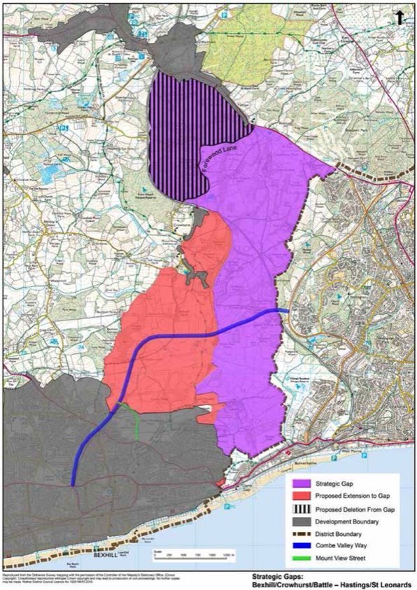
Figure 8. Strategic Gap between Fairlight and Hastings/St Leonards
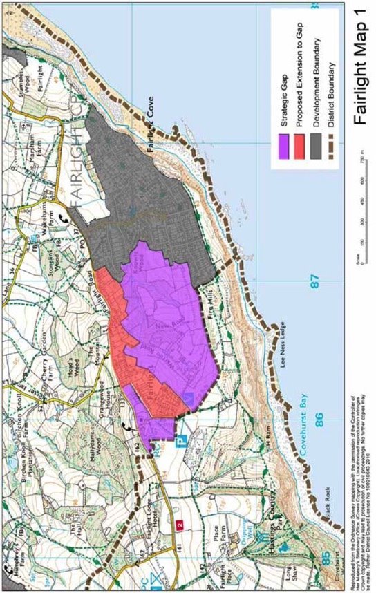
Figure 9. Strategic Gap between and Rye and Rye Harbour
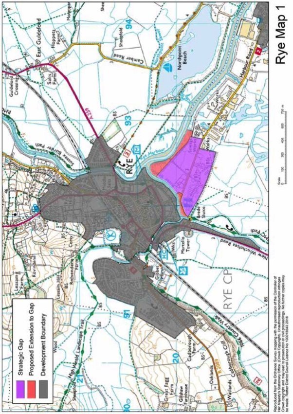
The Strategic Gaps are identified on the Policies Map between the following areas:
- Bexhill and Hastings/St Leonards;
- Crowhurst and Hastings/St Leonards;
- Battle and Hastings/St Leonards;
- Fairlight and Hastings/St Leonards; and
- Rye and Rye Harbour
Within these Gaps development will be carefully controlled and development will only be permitted in exceptional circumstances. Any development must be unobtrusive and not detract from the openness of the area.
Enhancement of the Gaps through effective landscape management which strengthens and reinforces their significance as protected landscape areas will be supported.
Biodiversity and green space
10.27. The biodiversity interest in Rother is substantial and wide-ranging. In the south-west of the district, the Pevensey Levels are designated as being of international importance as a wetland habitat, whilst the eastern side of the District (Rye Harbour, Winchelsea, Camber, Pett area) is extensively covered by several European designations reflecting their value for birds and as wetland habitats. There are many nationally-important Sites of Special Scientific Interest (SSSIs), covering about 9% of the district in total, as well as some 60 locally-designated wildlife sites[21]. Ancient woodlands, of which Rother has the highest concentration in the South-East, are also associated with biodiversity interest, while many nationally-defined 'Biodiversity Action Plan' (BAP) habitats and species are also present in the district, often beyond the internationally, nationally and locally designated sites.
10.28. Core Strategy Policy EN5 provides an over-arching policy commitment to protect and enhance the biodiversity, geodiversity and green space (or "green infrastructure") of the District. This relates not only to the statutory designations, but also to local sites of biodiversity value and the array of "multi-functional" green spaces that variously provide recreational opportunities, flood management, climate change mitigation and 'green transport' corridors, as well as nature conservation.
10.29. Policy EN5 highlights:
- developing a district-wide network where possible linking areas of natural green space;
- protecting and enhancing the international, national and locally designated sites;
- establishing the Combe Valley Countryside Park, between Bexhill and Hastings;
- enhancing the Romney Marsh Biodiversity Opportunity Area;
- supporting habitat opportunities in line with the Biodiversity Opportunity Areas and targets set out in the Sussex Biodiversity Action Plan;
- developing the wetland habitat at Bewl Water Reservoir;
- access to the countryside from urban areas, especially in the Hastings and Bexhill fringes;
- ensuring that development retains, protects and enhances habitats of ecological interest; and
- avoiding adverse impacts from development on biodiversity or, where wholly unavoidable, providing appropriate mitigation or compensation, as well as considering and promoting opportunities for the creation and/or restoration of habitats appropriate to local context.
10.30. It follows that proposals which are focused primarily on these objectives should be supported. This will include developments to increase public understanding and enjoyment of biodiversity and green spaces, such as through "green corridors" and interpretation facilities. This approach accords with paragraph 118 of the National Planning Policy Framework (NPPF), which sets out how biodiversity should be taken into account in determining a planning application.
10.31. In relation to the international wildlife sites, European regulations require that councils ensure that no significant harm comes to them. This is reflected in a requirement, when preparing development plans, to undertake 'Habitat Regulations Assessments' (HRA) for such sites. These were undertaken for the Core Strategy. One issue highlighted was the potential impact of tourism policies on the Dungeness complex. In response to this, the Council, in partnership with Shepway District Council, Natural England and other environmental bodies, is preparing a 'Sustainable Access Strategy' to manage future visitor access in and around the Dungeness complex to ensure that no adverse effect will occur.
10.32. Core Strategy Policy EN5 gives the overarching policy to '(iv) Enhance the nature conservation value and multi-functional nature of the Romney Marsh Biodiversity Opportunity Area.' It is envisaged that this will be elaborated upon in the Submission version of this Plan, with appropriate practical provisions, including for reducing trampling pressure on vegetated shingle, taking account of the recommendations of the Sustainable Access Strategy.
10.33. A further outcome of Core Strategy's HRA was a need to control the quantity and rate of run-off within the hydrological catchment of the Pevensey Levels. This is addressed by Core Strategy Policy SRM2 and the Drainage policy within this Plan.
10.34. Only in exceptional circumstances, would a proposal that would impact negatively on an international wildlife site be permitted, and only where there are no alternative solutions and the proposal is necessary for imperative reasons of over-riding public interest.
10.35. European Directives give protection to several species (generally referred to as 'European Protected Species'), the most commonly occurring in Rother including great crested newt and bats. It is an offence to damage or destroy breeding or resting places of protected species, such as may occur by in-filling of or earthworks near to a pond used by great crested newt, felling of trees or demolition of buildings used by bats or the clearance of woodland or hedgerows supporting dormice.
10.36. SSSIs and Ancient Woodland are highly protected, with any development that would have an adverse effect only allowed in exceptional circumstances where the benefits of the development clearly outweigh the nature conservation impacts.
10.37. In accordance with 'Section 41 of the Natural Environment and Rural Communities Act (2006), the UK Biodiversity Action Plan (BAP) identifies those habitats of principal importance for the purpose of conserving biodiversity in England. These priority habitats are recognised by national policy, while those found in Rother are identified in the Council's Green Infrastructure Study.
10.38. There is also varying degrees of protection under Wildlife and Countryside Act for certain rare plants and for bird nesting habitats, limiting their removal to outside of the bird breeding season. The Sussex Local Nature Partnership lists the species that can be found in Sussex. These include water vole, common lizard, grass snake, slow worm and Roman snail.
10.39. The presumption is that development should avoid impacts on protected species, but where this is not possible, mitigation or compensation will be necessary.
10.40. Table 1 in the Green Infrastructure Study Addendum gives helpful advice on biodiversity opportunities within the landscaping of a development scheme to enhance its biodiversity value and ensure net gains for nature. Development could impact on populations of farmland birds and bats in particular, by direct loss of habitat but also through increased recreational disturbance. Thought should be given to the impact of lighting on bats, with areas of no or low level lighting along bat foraging routes considered.
10.41. Table 3 in the Green Infrastructure Study Addendum indicates some actions that developers should consider incorporating within built fabric to help conserve species that rely on buildings and ancillary developments for nesting.
10.42. In recognition that a focus on protecting important sites will not alone sustain biodiversity in the long term, Biodiversity Opportunity Areas (BOAs) have been identified[22], being those areas that are seen as offering the greatest benefit to wildlife, taking into account existing concentrations of BAP habitat and important areas for priority species, often being buffers around existing reserves or linkages between existing sites. There are nine separate BOAs within, or partially within, Rother District, as set out and mapped in the Green Infrastructure background paper, each supported by a statement identifying the features of biodiversity importance and targets for habitat maintenance, enhancement, restoration and creation.
10.43. Whilst Areas of Outstanding Natural Beauty (AONB) are landscape designations for the purpose of conserving and enhancing the natural beauty, it is notable that the term 'natural beauty' includes the conservation of flora, fauna and geological and physiographical features of an area. Furthermore, the High Weald AONB some of the key High Weald character features are also priority habitats[23] (Ghyll woodland, sandstone outcrops, ancient woodland, heathland, wildflower meadows and ponds). Hence, particular consideration should be given to biodiversity gains that meet AONB objectives.
10.44. The connectivity of habitats is important to enable dispersal of species across the wider environment. Green spaces, including any proposed or enhanced as part of new developments, should, wherever practicable, be linked. River valleys provide particularly important wildlife corridors. Provision of habitats and landscaping within developments that allow wildlife to live within and move through built areas to the wider countryside are encouraged, including hedgerows, ponds, trees as set out in Table 1 of Green Infrastructure Study Addendum.
10.45. Within these areas, consideration should be given to whether development will affect habitat connectivity and integrity, either positively or negatively; and opportunities to achieve the aims of the BOAs, including enhanced habitats and linkages to off-site habitats via green corridors.
10.46. In addition, green spaces should be planned with regard to other "ecosystem services" such as flood protection, microclimate control, filtration of air pollutants and enabling biodiversity to adapt to climate change.
10.47. The National Planning Policy Framework (NPPF) looks to the planning system to not only minimise impacts on biodiversity but also to provide net gains in biodiversity wherever possible[24]. It also looks to planning policies to promote the protection and recovery of protected species populations linked to national and local targets[25]. Similarly, as noted above, Core Strategy Policy EN5 part (ix) promotes habitat restoration and creation.
10.48. There will be opportunities for supporting biodiversity in virtually all developments. This may range from retaining and enhancing existing biodiversity features including hedgerows and ponds, providing landscaping and amenity green spaces that support biodiversity, creating new habitats (including as part of SuDS), ensuring adequate "buffering" of, and management regimes for, existing priority habitats within or adjacent to a site and providing linkages to the wider environment via green corridors.
10.49. Provision for biodiversity will largely depend on the
particular local context and also have regard to the scale of
development. Larger developments will generally provide more
scope for biodiversity gains. In order that opportunities
specific to a particular site are properly considered and,
where appropriate, incorporated into the development planning
and design processes, larger developments (of more than 2
hectares (ha) or 50 dwellings) will be expected to produce a
"green infrastructure master-plan" as an integral part of
proposals. Such masterplans should include measures for the
ongoing management of habitats and other green spaces, which
will be the subject of planning control.
10.50. A number of key references are available to inform the formulation of appropriate proposals to support biodiversity. These include:
|
International Nature Conservation Sites and Sites of Special Scientific Interest (SSSI) |
Joint Nature Conservation Committee |
|
European Protected Species |
Habitats Directive |
|
Nationally Protected Species |
Joint Nature Conservation Committee |
|
Sites of Nature Conservation Importance (SNCI) and Regionally Important Geological Sites (RIGS) |
Sussex Wildlife Trust |
|
Biodiversity Action Plan (BAP) Priority Habitats |
Joint Nature Conservation Committee and |
|
Special to Sussex non-BAP Habitats |
Sussex Biodiversity Record Centre |
|
Ancient Woodland Inventory |
Rother District Council |
|
Local Biodiversity Opportunity Areas Reports |
Sussex Local Nature Partnership |
|
East Sussex Green Infrastructure Strategy |
East Sussex County Council |
|
Natural Character Areas map and East Sussex Landscape Character Assessment |
Natural England and East Sussex County Council |
|
High Weald AONB Management Plan |
High Weald AONB Partnership |
|
Rother Open Space, Sport and Recreation Study |
Rother District Council |
10.51. A further reference is the Council's own 'Green Infrastructure Study' incorporating its recent Addendum, which has drawn on a number of sources in summarising biodiversity opportunities by settlement. The Addendum provides, at Table 2, a helpful overview of the opportunities for each town and those villages with development requirements. It also provides useful tables listing potential means of incorporating biodiversity opportunities within landscaping, including bird nesting opportunities.
10.52. While the above sources of information are helpful, they cannot be exhaustive and should not be used as a substitute for site-specific ecological surveys. Where it is likely that a proposal will impact upon any protected species, designated site, priority habitat, or other biodiversity features on, or adjacent to, the application site, up-to-date survey information to determine their presence or absence should be provided with a planning application. The type of assessment needed will vary from an ecological survey and report, to an Environmental Impact Assessment (EIA) for a major site and an Appropriate Assessment if a European Site is involved. All ecological surveys need to be undertaken by a suitably qualified ecologist. It is important to bear in mind that the survey work needed to inform such assessments will be seasonally restricted.
10.53. As noted above, information on biodiversity impacts and opportunities should inform all stages of development, with an ecological assessment required where impacts are likely to be significant, where there is a reasonable likelihood of protected species being present and existing information is inadequate. Furthermore, proposals should be supported by a plan for their long term management.
10.54. The Council has already adopted open space standards through the 'Open Space, Sport and Recreation Study', as applied in Core Strategy Policy CO3. These standards, which include accessible natural or semi-natural green-space, apply in both urban and rural areas, where practicable and appropriate in the environmental context.
10.55. Separate policy consideration is given to landscapes, including the High Weald AONB, elsewhere in the Section. The Combe Valley Countryside Park is considered in the Hastings Fringes Chapter.
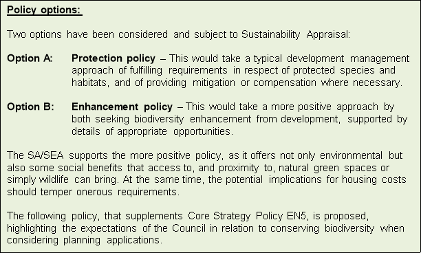
Policy DEN4: Biodiversity and Green Space
Development proposals should support the conservation of biodiversity and multi-functional green spaces in accordance with Core Strategy Policy EN5 and the following criteria, as applicable:
- Proposals where the principal objective is to conserve or enhance biodiversity or geodiversity will be supported in principle.
- Development proposals should avoid significant harm to the biodiversity value of international, national, regional and local designated sites of biodiversity and geological value, (including Biodiversity Action Plan (BAP) priority habitats and/or protected species). Depending on the status of habitats and species concerned, this may require locating development on alternative sites that would cause less or no harm, incorporating measures for prevention, mitigation and (in the last resort) compensation.
- In addition to (ii) above, all developments will be expected to retain and enhance biodiversity in a manner appropriate to the local context, having particular regard to locally present BAP priority habitats and species, defined 'Biodiversity Opportunity Areas' and further opportunities identified in the Council's Green Infrastructure Study.
- Larger developments of more than 2 hectares or 50 dwellings (whichever is the smaller) will be expected to produce a Green Infrastructure masterplan as part of their proposals.
In respect of the Dungeness and Rye Complex of International Sites, the Council will develop proposals in conjunction with Shepway District Council for managing access to reduce the potentially damaging impacts of recreation and visitor pressure.
Sustainable drainage
10.56. Nationally, there has been a heightened awareness in recent years of the risk of flooding following serious flood events and an increasing amount of more localised "flash floods". Effective drainage systems are clearly crucial, requiring their design to be considered from the beginning of the development process.
10.57. National planning policy directs development away from areas of highest flood risk and, when deciding planning applications, ensuring that flood risk is not increased elsewhere and taking opportunities to reduce the causes and impacts of flooding[26].
10.58. Planning Practice Guidance states that, when considering major development, sustainable drainage systems should be provided unless demonstrated to be inappropriate[27]. Generally, whether a sustainable drainage system should be considered will depend on the proposed development and its location. At the same time, it states that the general aim should be to discharge surface run-off as high up the following hierarchy of drainage options as reasonably practicable:
1) into the ground (infiltration);
2) to a surface water body;
3) to a surface water sewer, highway drain, or another drainage system; and
4) to a combined sewer[28].
This hierarchy supports a general presumption in favour of the use of sustainable drainage systems.
10.59. The Council's overarching Core Strategy policies on managing flood risk (Policy EN6) and on flood risk and development (Policy EN7) follows this approach. It is considered appropriate to elaborate on this policy approach particularly in relation to promoting the effective development of sustainable drainage systems (SuDS).
10.60. East Sussex County Council has the responsibility of being the 'Lead Local Flood Authority' (LLFA), with the Environment Agency retaining responsibilities for managing flood risk from 'main rivers' and the coast. The County Council's 'Local Flood Risk Management Strategy' sets out implications for drainage design based upon spatial characteristics which should complement site specific surveys undertaken as part of the drainage design process. This and related guidance are shown in the box below.
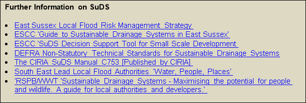
10.61. To meet the requirements of the national non-technical statutory standards for SuDS, peak runoff rates discharged from a development for the 1 in 1 year, 1 in 30 year and 1 in 100 year rainfall events must not exceed the peak greenfield runoff rate from the site for the same event. For brownfield sites, peak runoff rates must remain as close to greenfield runoff rates as possible, and not exceed the pre-development rate of discharge. The volume of surface water discharged from the development site must also be closely managed, and not exceed the greenfield runoff volume for the 1 in 100 year, 6 hour rainfall event.
10.62. SuDS are required regardless of pre-existing risk. The requirement is therefore in addition to the requirement to address existing areas of flood risk on-site, as set out in national guidance and Core Strategy policy.
10.63. As well as providing effective drainage solutions, SuDS can be designed and implemented in ways that deliver other Local Plan objectives, such as:
- the provision of habitats and support for biodiversity;
- reinforcing local landscape character and the design of the development itself;
- provision of open space/recreation;
- promotion of water use efficiency and quality; and
- reducing risks of land instability.
10.64. The type of SuDS approach that can be best utilised should have regard to all relevant factors (flood risk, compatibility for infiltration, groundwater, runoff characteristics, ground stability, topography, soils, geology, contamination issues, existing infrastructure, archaeology) as well as the potential for wider benefits. CIRIA's SuDS Manual C753, the latest guidance from the lead local flood authority, including any relevant Local Flood Risk Management Strategy and related guidance will be key references.
10.65. Ground conditions will often dictate the appropriateness of SuDS techniques and a ground investigation is likely to be required to assess the suitability of using infiltration measures and assessing the required volume of on-site storage required.
10.66. Where relevant, all watercourses, including 'ordinary watercourses', should be retained as an open feature within a designated corridor, where possible, ideally as open space, within any drainage strategy design. Developers should consider the potential flood risk arising from them, including in circumstances where no flood mapping currently exists. Any proposals to alter or divert an ordinary watercourse will require consent from the LLFA.
10.67. Applicants should submit sufficient information to enable proper consideration of drainage proposals. For major schemes, seeking pre-application advice from the LLFA is strongly recommended as is, for minor development, reference to its 'SuDS Decision Support Tool for Small Scale Development'. Proposals should also demonstrate that maintenance measures will be in place for the lifetime of the development. This may be secured by a legal agreement.
10.68. The Fairlight/Pett Level area has been recognised as an area of drainage concern. There are both issues of flooding in the Cliff End area and, in Fairlight Cove, issues of ground water affecting land stability and cliff erosion. A specific policy is put forward in the Land Stability section which restricts the use of soakaways in a zone near the cliff face, as well as limiting run-off in the wider catchment.
10.69. Core Strategy Policy SRM2 part (iii) requires SuDS for all development that creates impermeable surfaces in the Pevensey Levels hydrological catchment area – see Figure 3 below. This was derived from the Pevensey Levels Habitats Regulations Assessment which recommended further assessment work to include 'The identification of appropriate SuDS techniques to mitigate surface water and water quality concerns'. Further Habitats Regulations Assessment (HRA) work in support of the DASA recommends a minimum of two types/stages of SuDS treatment within the catchment, in order to address possible negative effects from surface run-off and hydrological pathways. As set out in the DASA HRA, SuDS selection should be in accordance with 'Water, People, Places'[29], which advises on appropriate techniques to prevent runoff from reducing the quality of a receiving body of water.
Figure 10. Pevensey Levels Hydrological Catchment Area
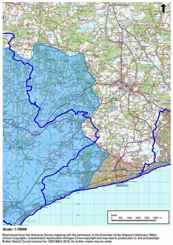
10.70. Analysis of the 'Review of Consents' for the Pevensey Levels suggests that the essential issue affecting water quality is insufficient water levels within the internationally protected wetland site under the Ramsar Convention (Ramsar) and consequent failure to replenish supporting ditches with negative impact on ecology. Therefore, rather the emphasis should be on implementing SuDS with several stages of the treatment train in order remove pollutants and sediments effectively. This approach is supported by both the Environment Agency and Natural England.
10.71. More generally, the East Sussex Local Flood Risk Management Strategy (LFRMS) subdivides the county into one of four 'Drainage Areas', each with their own characteristics based upon the different ground conditions present and their ability to drain surface water. Of particular note, 'Drainage Area 2' is characterised by areas of steep relief causing high velocities of surface water run-off and ponding in low points. The FRMS notes that for this spatial area, 'Improvement upon greenfield runoff rates from the site should be discussed with the LLFA, to minimise the downstream surface water flood risk.' The standing advice in the LFRMS, tailored to the characteristics of the area, which should be used to inform drainage strategies as part of new developments. However, it does not replace any site specific assessment.
10.72. The County Council has also produced Surface Water Management Plans for Bexhill, Battle and Rye, which identify flood risk that arises from local flooding from surface runoff, groundwater, and ordinary watercourses. Where development is proposed within or close to identified 'flooding priority areas' and 'hotspots' in these plans, consultation with the LLFA is recommended, which may advise on a case by case basis.
Policy DEN5: Sustainable Drainage
Drainage should be considered as an integral part of the development design process, with Sustainable Drainage Systems (SuDS) utilised unless demonstrated to be inappropriate. In particular:
- peak run-off rates from development should remain as close to greenfield runoff rates as possible, and not exceed the existing rate/volume of discharge as a minimum;
- new development should utilise opportunities to reduce the causes and impacts of all sources of flooding, ensuring flood risks are not be increased elsewhere and that surface water run-off is managed as close to its source as possible;
- drainage should be designed and implemented having regard to the latest East Sussex Local Flood Risk Management Strategy (LFRMS) and related guidance;
- SuDS should be designed and implemented to be 'multi-functional' and deliver other Local Plan policy objectives;
- applicants should demonstrate that arrangements are in place for on-going maintenance of SuDs over the lifetime of the development;
- within the Pevensey Levels Hydrological Catchment Area, SuDS designs should incorporate at least two stages of suitable treatment, unless demonstrably inappropriate; and
- within the Pett Level catchment, drainage proposals should accord with Policy DEN5 in the Land Stability section.
Land stability
10.73. Issues of land stability and subsidence have a raised profile in recent years, generally associated with increasing climate change. At the same time, they can be linked to local ground conditions, flood events and the legacy of former land filling or mining.
10.74. The National Planning Policy Framework (NPPF) looks to the planning system to play its part in ensuring that sites are suitable for their new use taking account of ground conditions and land instability[30] Supporting Planning Practice Guidance states that planning authorities may need to consider identifying areas where particular consideration of such risks is needed, potentially limiting development in those areas or ensuring that there is appropriate land remediation or mitigation. In specific circumstances may even warrant the removal of permitted development rights[31].
10.75. Core Strategy Policy OSS3 already requires that issues of land stability, along with contamination, air quality, agricultural land quality and coastal erosion, are considered in assessing both the suitability of land for development and in determining the details of schemes.
10.76. Useful information on 'natural ground stability', such as may be due to shrink-swell, landslides, running sands, soluble rocks, compressible ground or collapsible ground, can be obtained from the British Geological Survey[32].
10.77. Developers may be required to demonstrate they have investigated risks and where there is likelihood of instability, a full land instability risk assessment report is expected to be submitted with a planning application. This should be undertaken by a suitably qualified professional and should demonstrate the degree of instability, appropriate measures to mitigate those risks, and an implementation and future monitoring plan.
10.78. Consideration will be given to whether the proposed development, taking account of pre-existing land stability, should proceed. Regard will be given to the impact of proposed drainage on ground stability, as well as of any mitigation, such as retaining walls. All works should be both effective and environmentally acceptable. Building Regulations will address the detailed design of buildings and their foundations.
10.79. Locally, the greatest issues of land stability are at Fairlight, where there have been long-standing issues of coastal erosion. These are considered further below. Elsewhere, land stability issues have affected parts of South Undercliff and Military Road, Rye.
Coastal erosion – Fairlight
10.80. The District Council is the 'Coastal Risk Management Authority' and has long recognised the specific problems of coastal erosion at Fairlight Cove. Measures have been undertaken to manage this through the construction in 1990 of a rock bund at the sea edge below Sea Road and, in 2007, the construction of a Rock bund below Rockmead Road, together with slope grading and the installation of slope drainage and deep well pumps in 2007, designed to operate for 50 years, consistent with the 'Hold the Line' policy of the Shoreline Management Plan (SMP). A further bund linking these has been approved and is due to be in place later in 2016.
10.81. However, while these engineering works control erosion and land loss, they do not prevent it, which is also affected by the variable quality of the ground and the impact of ground water. Despite a number of studies of the source of water, the complexity of the geology makes it very difficult to come to clear conclusions.
10.82. At the time of the Local Plan 2006 it was found that 'Close to the cliff edge at Fairlight Cove, the land is likely to be affected by erosion or land instability. Where this is likely to occur during the lifetime of the building a precautionary policy is necessary.' Notwithstanding that there have been significant defence works since that time, which have clearly helped in terms of the rate of erosion and land stability, it still seems prudent to limit development that may have an effect on the loading near the cliff or on the flow of water in the ground near the cliff edge.
10.83. The situation is further complicated, if not aggravated, by the lack of a surface water drainage system at Fairlight. While there appears to be some scope to connect to the foul system (but not the highway system), care needs to be taken in relation to further discharge into the Lower Waites Lane sewer. There is also a wider concern about surface water drainage both in the village and downstream in the Pett Level.
10.84. A report by the East Kent Engineering Partnership in 2015[33] recommends that "sensible measures need to be put in place to restrict development near to the cliff top via set back lines and not permit soakaway drainage within 50m of the cliff face. The limit of development should be reviewed every 10 years or so and should be part of Planning Policy.'
10.85. Hence, it is regarded as good practice to define a coastal zone in line with the above-mentioned Report (which also approximates to the earlier SMP erosion line) within which neither soakaways nor development that would add to the loading will be permitted (see Figure 11 below). To complement this, it is also proposed to require the rate of run-off from sites in the catchment of Pett Level, including Fairlight, (see Figure 12 below) to the greenfield rate, in both flow and volume.
Figure 11: Fairlight Coastal Zone Buffer
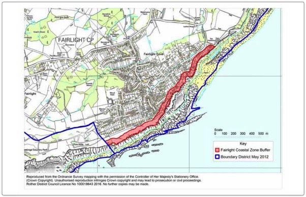
Figure 12: Pett Level Catchment Area
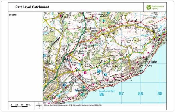
10.86. A structural engineer's survey and geo-technical report will be required for new development in the coastal zone to demonstrate that there would be no increase in ground loading.
10.87. The definition of the development boundary for Fairlight is now a matter for the Fairlight Neighbourhood Plan, but the Parish Council may also consider drawing it back to exclude the coastal zone shown on Figure 7.
Development will only be permitted on unstable or potentially unstable land, including former landfill sites and coastal margins, where:
- the nature of the instability has been properly assessed; and
- any remedial measures required to ensure that the development does not add to the instability of the site or surrounding land are environmentally acceptable and normally implemented prior to the commencement of building works.
In the Fairlight/Pett area:
- soakaway drains will not be permitted within a coastal zone within 50 metres of the cliff face at Fairlight Cove, as shown on Figure 11; and
- elsewhere within the catchment of Pett Level, as shown on Figure 12, surface water run-off from development shall be no more than the greenfield rate, in terms of volume and flow.
Environmental pollution
10.88. As noted earlier, Rother is a largely rural district with over 80% of the land lying within the High Weald Area of Outstanding Natural Beauty (AONB). As well as the three towns with their bustling town centres and employment areas, there are also large and small villages, quieter residential neighbourhoods and more tranquil countryside areas.
10.89. While environmental pollution issues will vary depending on the location and type of development involved, in all cases it will be appropriate to consider the effect of proposals in terms of their potential to create pollution through lighting, noise, odour, hazardous and non-hazardous substances and/or airborne particulates. The general approach is to ensure that such impacts of new development are properly assessed at an early stage to keep their effects to a minimum.
10.90. Other legislation, notably The Clean Neighbourhoods and Environment Act 2005 makes noise, odour and light nuisance the subject of criminal law. At the same time, planning can play a complementary role. Local Plan Core Strategy policies seek to protect amenity and the character of an area and also to support economic growth. In this context, it is important that all development has regard to their potential impacts on the noise environment, on dark skies, where these prevail and on air quality.
Noise
10.91. Many developments have the potential to affect the acoustic environment. They may involve the introduction of new noise sources, or new noise-sensitive developments near existing noise sources. It is necessary for the Council to carefully manage development to ensure that noise does not give rise to unacceptable adverse effects on health and quality of life, or on the character of areas.
10.92. The National Planning Policy Framework (NPPF), at paragraph 123, states that planning policies and decisions should aim to avoid noise from giving rise to significant adverse impacts[34] on health and quality of life as a result of new development and reduce impacts to a minimum. At the same time, development, including existing businesses, will often create some noise and should not have unreasonable restrictions put on them. Further details of possible mitigation measures are contained within the Government's Planning Practice Guidance.
10.93. Local noise guidance has been prepared by the Sussex Air Quality Partnership and adopted by councils in the county. This document, entitled Planning Noise Advice Document: Sussex, provides detailed guidance for developers on the preparation of noise reports and also mitigation measures. The Council normally require technical information to be provided with planning applications in the form of a 'Noise Impact Assessment'[35]. Where new noise-generating development or noise-sensitive development is proposed or for plant installation. These should be prepared by suitably qualified acousticians.
10.94. General guidance to local residents on issues of noise can be found on the Council's website at http://www.rother.gov.uk/article/195/noise
Lighting
10.95. Artificial light can be an essential aid to safety, can facilitate a thriving night-time economy and increase the period of the day and evening when sport and leisure facilities are available to use. Well-designed lighting can highlight architecturally or culturally significant buildings and features, creating visual interest and instil a sense of civic pride. However when poorly located, designed, maintained or otherwise used incorrectly, artificial light can impact on people's health, wildlife behaviours and safety, result is a waste of energy, distract road users and affect the character and amenities of places, both in built-up areas and the countryside.
10.96. The Campaign to Protect Rural England (CPRE) has estimated that between 1993 and 2000 alone the amount of light pollution across England increased by 24% and the amount of truly dark sky dropped from around one sixth of the country to just over one tenth. East Sussex has remained relatively dark in comparison with more developed areas, although the amount of general light pollution nevertheless increased significantly so that by 2000 only 13% of the sky fell within the two darkest categories compared with 29% in 1993. At a district level, dark night skies are a valued characteristic of the district's countryside and contribute in particular to the special landscape qualities and natural beauty of the High Weald Area of Outstanding Natural Beauty.
10.97. Common sources of potential light pollution include sports grounds (e.g. equestrian uses, golf driving ranges, tennis courts, football pitches, multi-use games areas), quarries and other industrial, commercial and retail areas, street lighting and illuminated signage. Nationally, approximately half of all complaints regarding light nuisance arise from domestic external security lighting. These are not subject to planning control, while operational lighting for roads, etc. benefits from permitted development rights. Illuminated advertisements, which generally require consent, are dealt with in Chapter 9.
10.98. The national objective to limit the impact of light pollution from artificial light is set out in the NPPF at paragraph 125. Applying those principles and related national guidance to local circumstances, proposals should consider:
- the need for the lighting, its duration, intensity and direction;
- the impact of light levels outside the development;
- the effect on the use or enjoyment of nearby buildings or open spaces;
- the impact on a protected site or species[36]; and
- whether the development is in an intrinsically dark landscape where it may be desirable to minimise new light sources.
10.99. The 2006 Local Plan sets out that, in respect of external lighting, regard is to be had to its impact on the character and appearance of the surroundings, to include the avoidance of unnecessary light spillage into the surrounding area and into the night sky. (Paragraph 5.19)
10.100. The 'Guidance Notes for the Reduction of obtrusive Light' GN01:2011 Institute of Lighting Professionals (ILP) 2011 provides a useful framework for considering the impact of lighting. It defines a typology of "environmental zones" that may be applied to Rother District as below:
- E1: the Pevensey Levels and the Dungeness Complex of international nature conservation sites, the High Weald AONB outside of towns and villages[37];
- E2: within settlements and elsewhere outside areas in E1 and E3; and
- E3: within Bexhill and the town centres of Battle and Rye
10.101. For larger developments involving outdoor lighting or those developments in or adjacent to sensitive locations, the Council may require a full lighting strategy to be submitted prepared by a qualified lighting engineer.
10.102. Where planning permission is granted, appropriate conditions will normally be attached to control the lighting scheme including for example: specification of lighting type, height, angle etc.; hours of operation; retention of screening vegetation; use of new planting or bunding; details of a future scheme of maintenance and post installation checks.
Air pollution/particulates
10.103. No part of Rother District is defined as an 'Air Quality Management Area'; hence, there is no expectation of focused planning policies to address air pollution. Also, there is a separate statutory framework for consideration of the level of airborne pollutants. Nonetheless, it may be appropriate for appropriate mitigation measures to be incorporated into planning permissions for certain developments.
Hazardous substances
10.104. Sometimes pre-existing sources of pollution or specific hazards need to be taken into account by development proposals. Key factors are the distance, risks and nature of the proposal. In these cases, the Health and Safety Executive (HSE) are able to advise potential applicants about these. The Council will use the advice of the HSE in its decision making process, including where applications are near "notifiable installations", such as high pressure gas mains and overhead power cables.
10.105. Any site that needs to use or store hazardous substances, requires hazardous substances consent (HSC) before it can operate. Further advice is available at: http://planningguidance.planningportal.gov.uk/blog/guidance/hazardous-substances/

Policy DEN7: Environmental Pollution
Planning permission for development will only be permitted where it is demonstrated that there will be no significant adverse impacts on health, local amenities or environmental character as a result of lighting, noise, odour, hazardous and non-hazardous substances and/or airborne particulates associated with development. In particular:
- in relation to noise, consideration will be also given to the character of the location, established land uses and any cumulative effects; also, in the case of new noise-sensitive development, users of the new development should not be likely to experience unacceptable adverse effects resulting from existing levels of noise; and
- in relation to lighting, is necessary and the minimum required, is designed to minimise light pollution, including light glare and sky glow, and to conserve energy, through the use of best available technology and has regard to the lighting levels recommended by the Institute of Lighting Professions (ILP) for the relevant environmental zone identified at paragraph 13.
11. Implementation
Comprehensive development
11.1. The NPPF (paragraphs 7, 8 and 152) underlines the three roles of the planning system, highlighting that in order to achieve sustainable development, economic, social and environmental gains should be sought jointly and simultaneously.
11.2. Securing such gains should draw upon the extensive evidence base that identifies local needs for different uses and services at the settlement and site level for the benefit of the community. Core Strategy Policy OSS4 states in part (iv) that development should be 'compatible with both the existing and planned use of adjacent land'.
11.3. This may involve bringing together land in different ownerships to ensure that the range of needs are met effectively within a logical overall area or it may involve bringing together a mix of uses for an appropriate and sustainable approach to site development (for example commercial, community or recreational uses in addition to residential development). Mixed use developments are promoted in the NPPF at paragraph 17 and reinforced in relation to character and quality of places at paragraphs 58 and 64.
11.4. Hence, where a site comprises separate land ownerships, the expectation is that developers and land owners should work positively together to achieve wider goals of sustainable development and the full benefits to the local community. The need to demonstrate that proposals will secure the provision of infrastructure to serve a whole site, which was formerly required by Policy GD2 of the 2006 Local Plan, is carried forward by this new policy. Reference is also made to the Core Strategy Policy LHN2 'Note' relating to treating a site as a whole for the purposes of delivering affordable housing.
11.5. The approach to land-use mix should ensure the overall viability of proposals, while also ensuring that socially, economically and/or environmentally important elements that will typically be less commercially attractive should not be considered separately or in isolation but effectively cross-funded by residential elements other uses to enable the delivery of development that is sustainable and acceptable in planning terms.
Policy DIM1: Comprehensive Development
Comprehensive proposals for the development of sites will normally be required, including where sites are in multiple ownerships.
In exceptional circumstances, proposals for part of a site may be permitted, but only where it demonstrably has regard to, and facilitates, an integrated scheme for development of the entire site. This will include the provision of appropriate uses, affordable housing, green space/open space and other infrastructure (including sustainable drainage), taking account of the site as a whole.
Development boundaries
11.6. Development boundaries differentiate between the substantially built-up areas of towns and villages, where further development, including redevelopment or intensification, would be acceptable in principle, and the countryside (i.e. outside development boundaries) where it would not. Development boundaries both positively focus growth on sustainable settlements and help to protect the surrounding countryside from unnecessary and intrusive development.
11.7. The principle of the continued use of 'development boundaries' around settlements, has been reaffirmed by Core Strategy Policy OSS2, as reproduced below:
Core Strategy Policy OSS2: Use of Development Boundaries
Development Boundaries around settlements will continue to differentiate between areas where most forms of new development would be acceptable and where they would not.
Existing development boundaries will be reviewed by the Development and Site Allocations DPD, having regard to the:
- existing pattern, form and function of settlements, including of closely 'linked' settlements and important 'gaps' of countryside between them;
- character and settings of individual towns and villages;
- sensitivity to further development both within the main built up confines and in more rural fringes;
- the amount of land needed to fulfil development needs and requirements;
- availability of local infrastructure and services;
- accessibility to facilities and services, and avoiding scattered and ribbon development;
- environmental considerations, including the need to conserve designated areas of national and local landscape, archaeological, geological, ecological or historical importance; and
- following physical features, unless this may suggest a potential for development that is inappropriate.
11.8. This policy also commits to review the development boundaries around settlements as currently defined in the Rother District Local Plan 2006, having regard to the factors set out. Proposed updated boundaries, which also take account of proposed new site allocations, are presented in Part C of this consultation document.
11.9. The supporting text to Policy OSS2 clarifies that 'within development boundaries there is a presumption that infilling, redevelopment and changes of use will be acceptable subject to other policies of the plan.' At the same time, proposals within development boundaries are still subject to a number of other policies to ensure that it does not adversely impact on other interests of acknowledged importance.
11.10. While land outside development boundaries is regarded as 'countryside' for planning policy purposes, this not is an absolute restriction on development. The potential for development outside development boundaries to support vital rural communities and also conserve or enhance its intrinsic qualities is recognised. There are specific policies to promote a sustainable rural economy, including farming, tourism and meet recognised local needs for facilities or affordable housing.
11.11. As the criteria in Policy OSS2 imply, development boundaries are policy lines; they do not seek to define settlements as such. As with existing development boundaries, there may be fringe areas of settlements, as well as some smaller settlements and enclaves of development in the countryside that are excluded in order to maintain the overall rural character of the locality. While they will normally follow physical boundaries, on occasion, the full depth of property curtilages may be excluded to make clear a policy statement that backland or in-depth development is unacceptable, often because of its additional visual or amenity impact.
11.12. It is proposed to carry forward the essence of the existing key 2006 Local Plan policies that cover the application of development boundaries, namely policies DS3 and DS4. Policy DS3 states that 'The existing settlement pattern will be maintained. The majority of all new development will take place within the development boundaries of existing towns and villages set out below, as defined on the Proposals Map.' while Policy DS4 sets out the limited circumstances in which development would be allowed outside development boundaries, with a requirement to demonstrate that a countryside location is necessary for a particular development that falls outside the specific exceptions.
11.13. Regard is also had to the NPPF which states (in paragraph 17) that planning should actively manage patterns of growth to make the fullest possible use of public transport, walking and cycling, and focus significant development in locations which are or can be made sustainable at the same time highlighting the need to recognise 'the intrinsic character and beauty of the countryside'. In relation to housing, paragraph 55 says 'Local planning authorities should avoid new isolated homes in the countryside unless there are special circumstances such as: …'
The substantial AONB coverage of the District is a further key justification for carefully managing development in the countryside.
Policy DIM2: Development Boundaries
The development boundaries of settlements, defined in accordance with Core Strategy Policy OSS2, are shown on the Policies Map[38].
New development shall be focused within defined settlement development boundaries, principally on already committed[39] and allocated sites, together with other sites where proposals accord with relevant Local Plan policies.
In the countryside (that is, outside of defined settlement development boundaries), development shall be normally limited to that which accords with specific Local Plan policies or that for which a countryside location is demonstrated to be necessary.
Figure 13. Settlements with Development Boundaries
|
Settlements with Development Boundaries in this Plan |
Settlements with Development Boundaries in Neighbourhood Plans |
|
Bexhill |
Battle |
|
Hastings Fringes |
Rye |
|
Beckley Four Oaks |
Burwash |
|
Brede and Cackle Street |
Burwash Common |
|
Broad Oak |
Burwash Weald |
|
Camber |
Crowhurst |
|
Catsfield |
Etchingham |
|
Guestling Green |
Fairlight Cove |
|
Hurst Green |
Flimwell |
|
Icklesham |
Netherfield |
|
Iden |
Robertsbridge |
|
Northiam |
Sedlescombe |
|
Peasmarsh |
Stonegate |
|
Pett and Friar's Hill |
Ticehurst |
|
Rye Harbour |
|
|
Staplecross |
|
|
Three Oaks |
|
|
Westfield |
|
|
Winchelsea |
[4] Environment Agency paper 'Water Stressed Areas - Final Classification' published in 2013.
[5] Part G of Schedule 1 and regulation 36 to the Building Regulations 2010, as amended.
[6] The Water Calculator is an online tool which can be used to assess the efficiency and water consumption of many products.
[7] South East river basin management plan - Part 1 (Water Resource Sustainability Measures p58)
[8] South East river basin management plan - Part 1 Changes to natural flow and levels of water (p44)
[9] Housing Standards Review Cost Impacts DCLG, September 2014
[10] Written ministerial statement on 18 June 2015
[11] Managing Land for Horses Kent Downs AONB (2011)
[12] Steps the government are taking to streamline the planning system, protect the environment, support economic growth and assist locally-led decision-making.
[14] Through the Deregulation Act 2015
[17] The term "shopfront" is taken to mean the built frontage of a variety of commercial premises, including shops, financial and professional services, restaurants/cafes, drinking establishments and hot food take-aways.
[18] Bexhill-on-Sea Town Centre Conservation Area: Shopfronts + Signage Guidance
[19] 'Employment sites' are defined as those providing for business uses falling with Class B of the Use Classes order together with similar 'sui generis' uses.
[20] See Countryside Character Volume 7: South East and London, The Countryside Agency, 1999
[21] Sites of Nature Conservation Importance (SNCIs)
[22] South East Biodiversity Partnership, 2008
[23] Including both BAP habitats and 'Special to Sussex' habitats
[24] Paragraph 109, NPPF, 2012
[25] Paragraph 117, NPPF, 2012
[26] NPPF paragraph 100
[27] PPG paragraph Reference ID: 7-079-20150415
[28] PPG paragraph Reference ID: 7-080-20150323
[29] South East Lead Local Flood Authorities 'Water, People, Places'
[30] NPPF, Paragraph 121
[31] PPG Paragraph 003 Reference ID: 45-003-20140306
[32] BGS can produce a site-specific 'Natural Ground Stability Report' which briefly describes any natural ground stability hazards if they are present.
[33] Study Report: 'Fairlight Cove Coast Protection Works Phase 3' (Quote from page 40)
[34] With reference to the Explanatory Note to the Noise Policy Statement for England (DEFRA)
[35] See the Council's Planning Validation Checklist
[36] See Defra and Natural England websites on handling the impact on wildlife – including from artificial light – where European protected sites or European protected species could be affected.
[37] As defined by settlement development boundaries
[38] Towns and villages with development boundaries are listed in Figure 13.
[39] That is, sites with planning permission (or resolution to grant permission subject to a legal agreement) as identified in the Local Plan Monitoring Report.